All posts by mickcosteondrums@aol.com

14th Entry: Recapturing The ADK Magic 9/5 – 9/8/2015

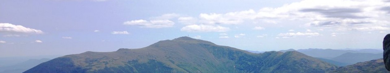
Great Range- High Peaks-Adirondacks

(Haystack, Basin, Saddleback, Gothics, Armstrong, Upper/Lower Wolfjaws: 1-7)

IMG_3353

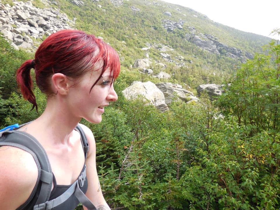
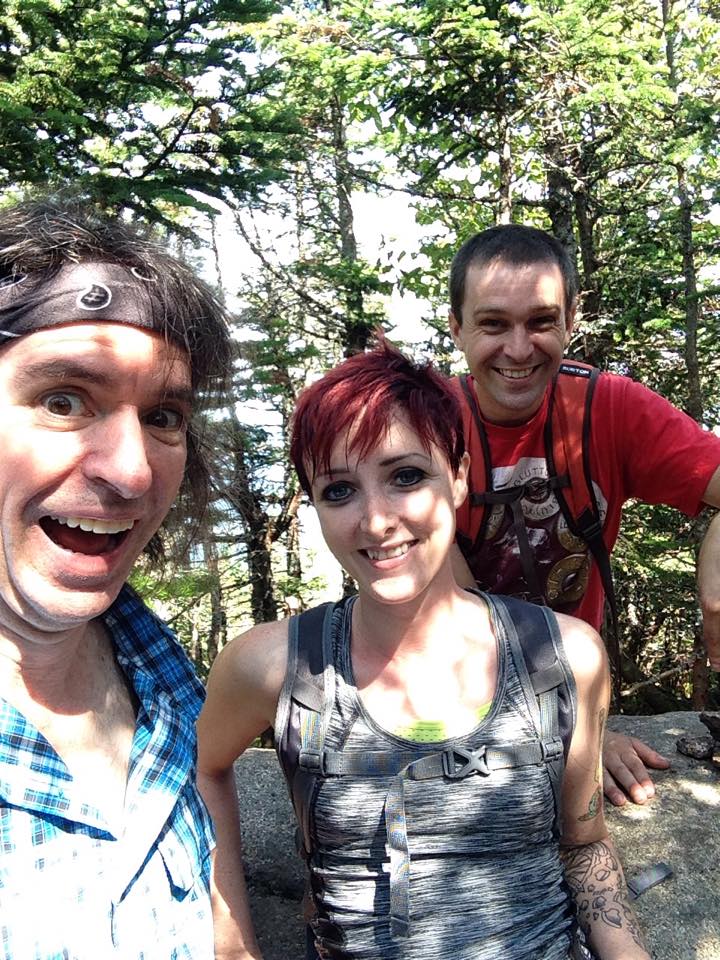
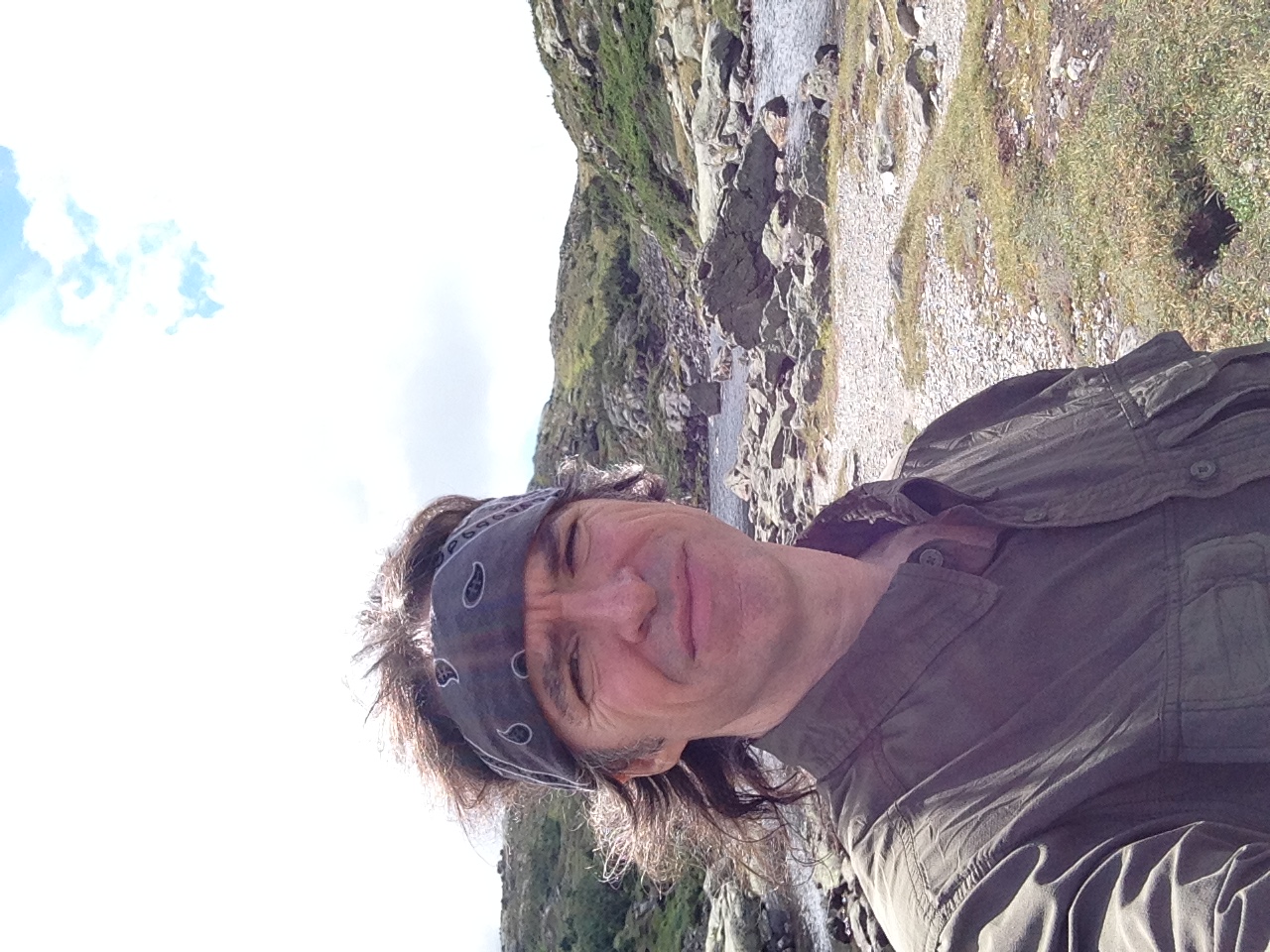
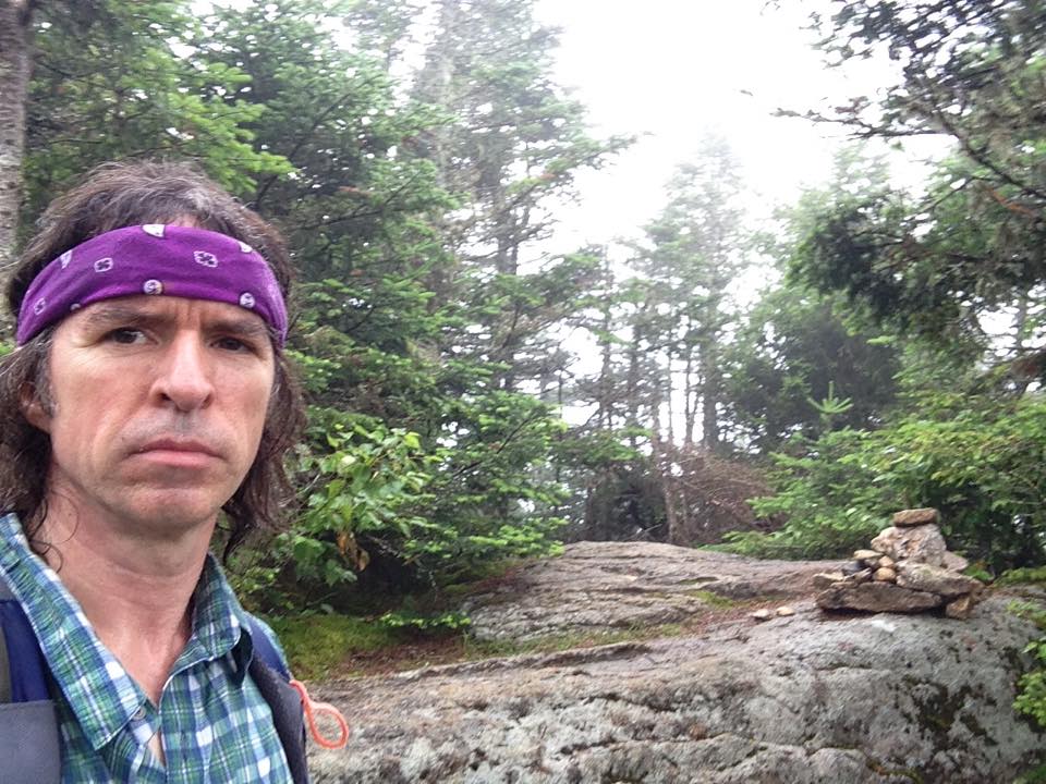
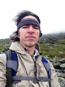
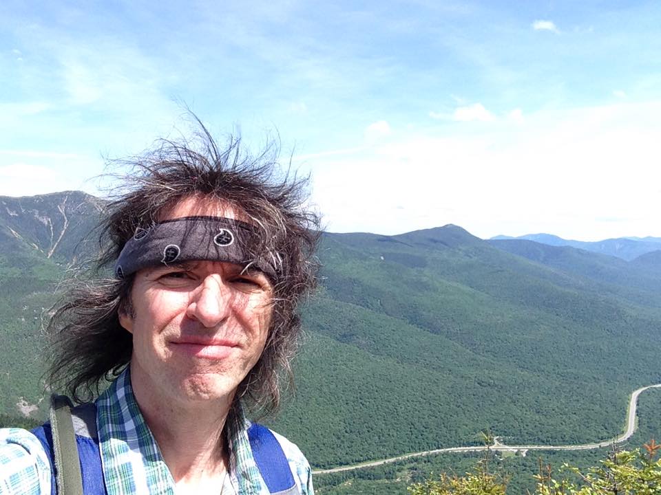
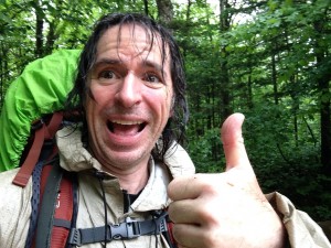
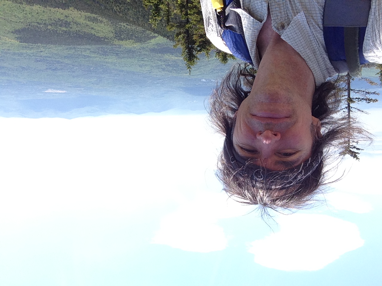
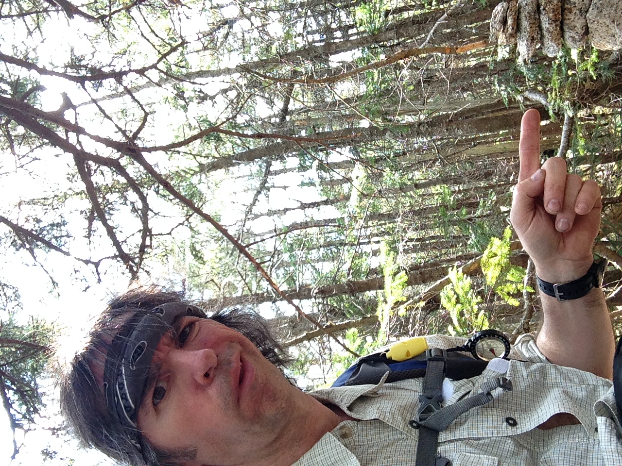
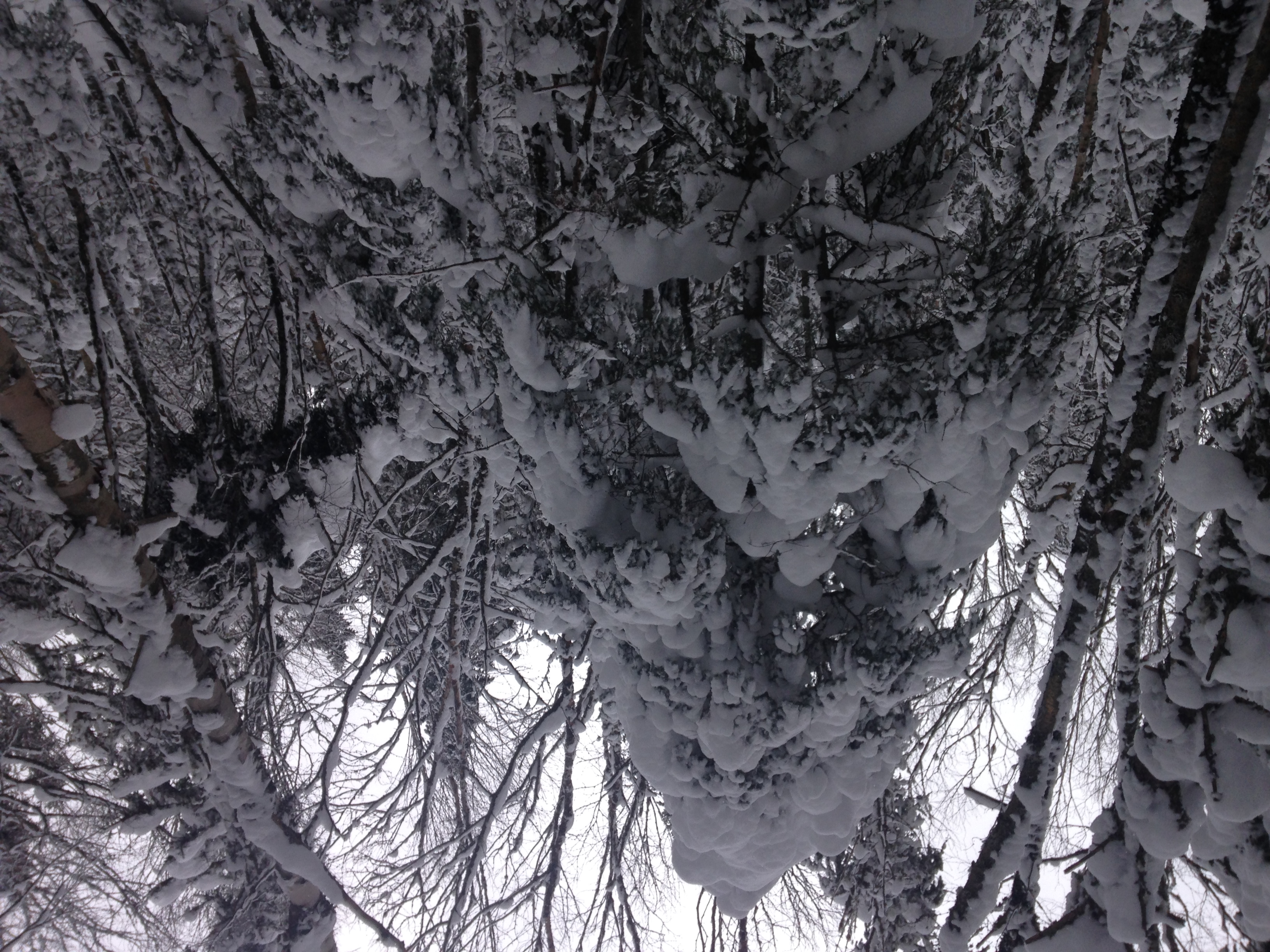
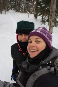
We are approaching Easter now, heading into Spring 2016 and looking back on possibly the best weekend of the whole summer 2015. This new chapter began Labor Day weekend. Therese and I found ourselves hiking into John’s Brook Lodge with fully loaded monster packs, and fully open minds and hearts for what was about to become the most perrrrfect bro/sis peak bagging, tree hugging, fantastic journey ever! This was my introduction to these mind blowing amazing mountains, and Therese’s renewed continued quest becoming a 46-er. My hiking quest was about to be kicked up to a new level, and my life change for the better while I, in the midst of my love affair with the Whites, was dropped smack-dab in the middle of a new enchanted land of splendor that is ADK. Now as I rewrite this entry for the SECOND TIME, and try to recall the details and recapture the magic 3 seasons later, I am so looking forward to once again immersing myself into these amazing mountains and the new journey of someday becoming a 46-er myself.46ers_logo

When I first put this trip into words in the days that followed, the experience was so fresh in my mind, the images so vivid, the sounds of laughter and silence so clear, the smells- both sweet and horrid still lingering, the aches and pains still throbbing, and the memories still overflowing into puddles of ink upon the page. Now, over a dozen White peaks later, as I start the countdown (“10-9-8-7…”) to the NH48 “finishing” milestone, I find myself longing for the journey to continue, and searching for what will be coming next. With just ten of a lengthy list left and having just shared my story of a day on ‘The Rockpile’ the clear front runner for the next chapter in my exploration led me back to this weekend with my sister.

So I am frantically fumbling through my disorganized pile of scribbles on note pads from past months for the record of this trip, tangible proof that the magic actually happened, so that I can finally share it all with the world (or at least the small part of the world that is following along with my steps). …Only it is not here!! I am frustrated beyond words! I have searched through every stack of books, through piles of bills, boxes of Christmas ornaments, sacks of camping gear, and somehow the writings are no more – vanished like a lost winter climber sent to his grave by the fierce rushing avalanche. So I will do the only thing I can do – dig deep into my own memory, tap into my sister’s recollections, gaze upon the trail maps, rummage through the photos and video clips, search websites and facebook pages of fellow hikers that have shared their own similar treks, and attempt to crack open a door to the archives that hold these precious memories and bring them back to life. The details may be somewhat muddled and hazy to start, but I hope that by the last words I will have brought the feel of this amazing weekend back into focus, as though it just happened yesterday. So here goes the revival…

DAY ONE:

…And so the journey begins.

IMG_4411IMG_4410

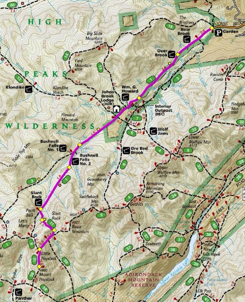
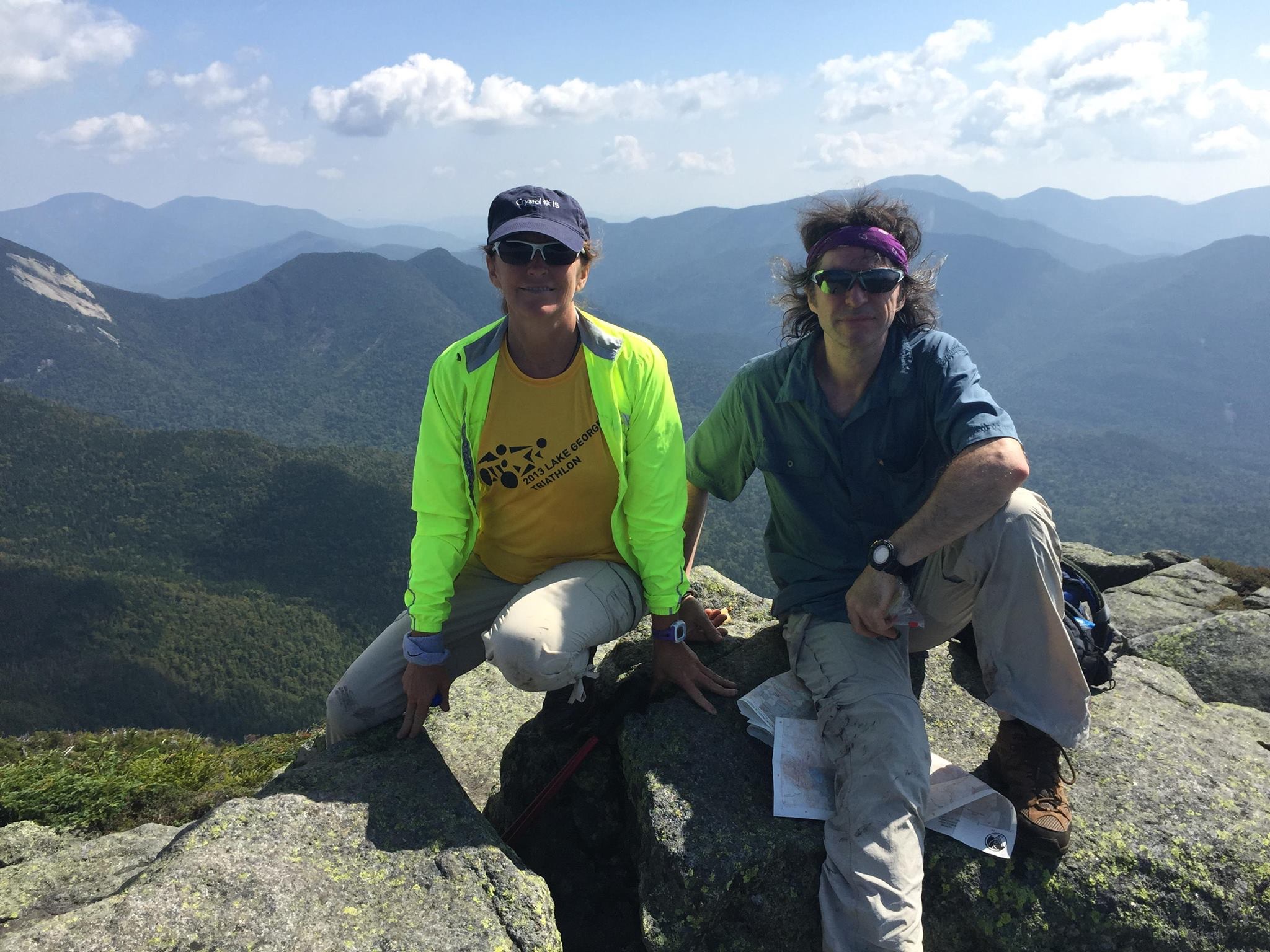
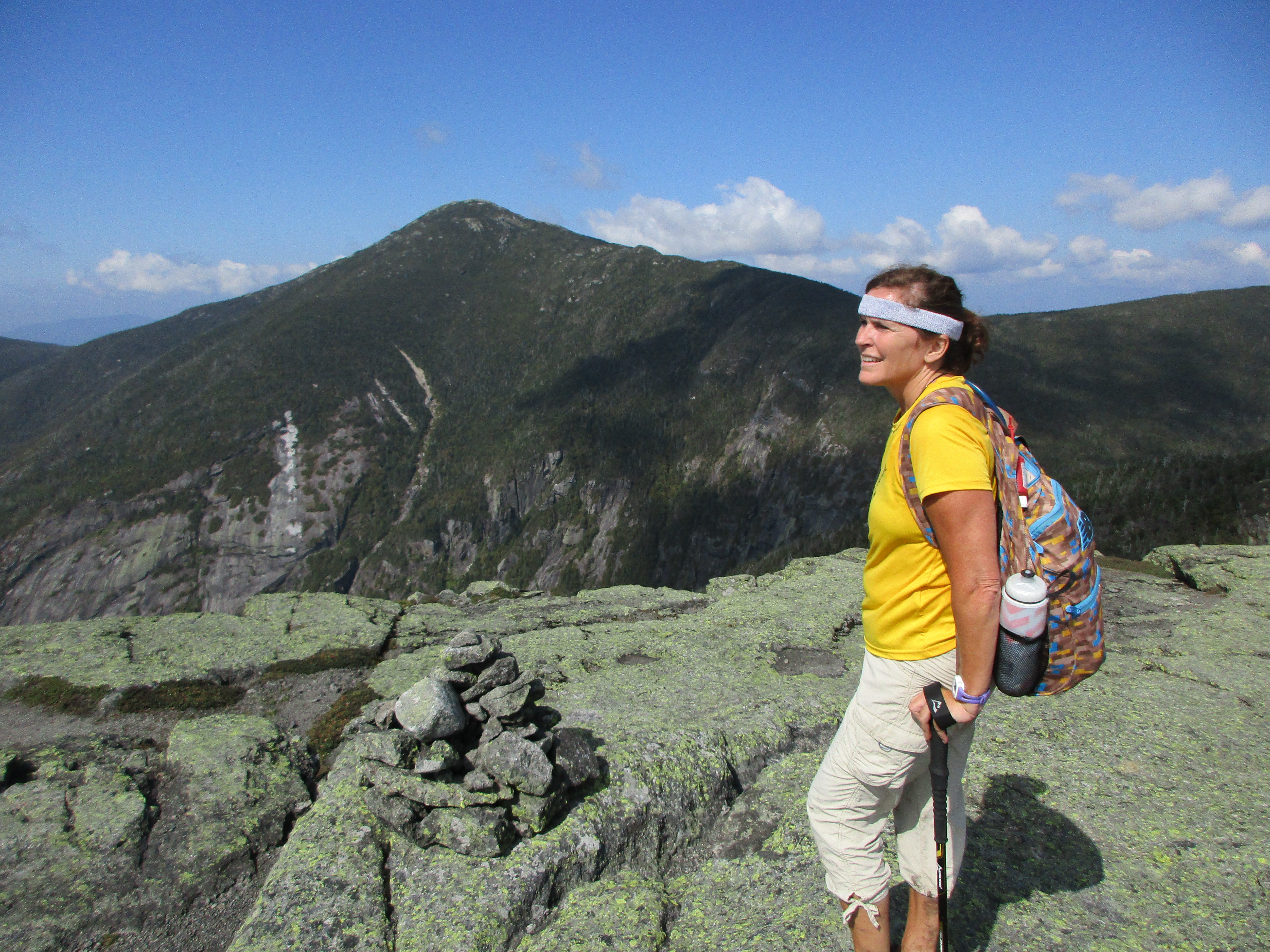
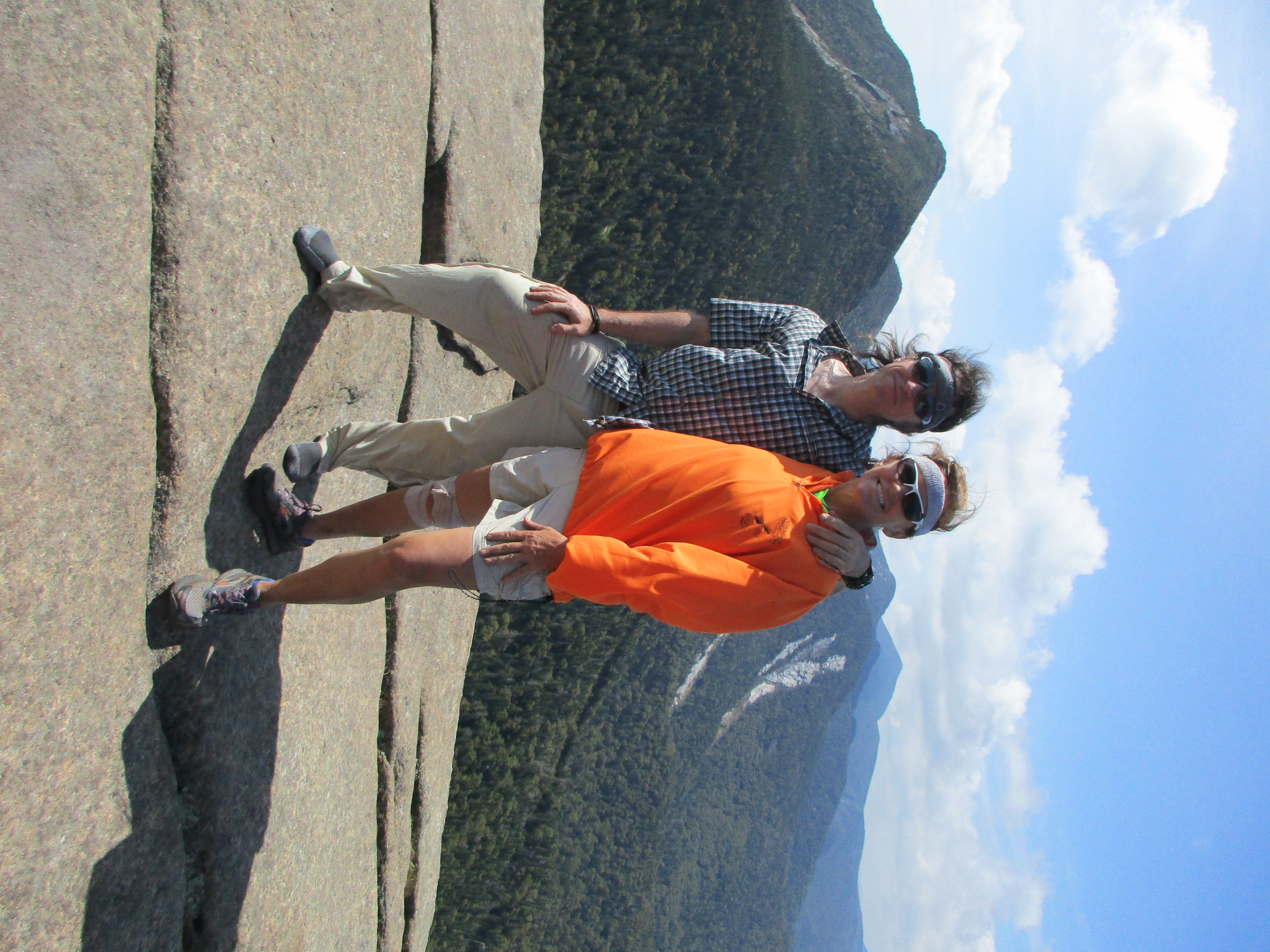
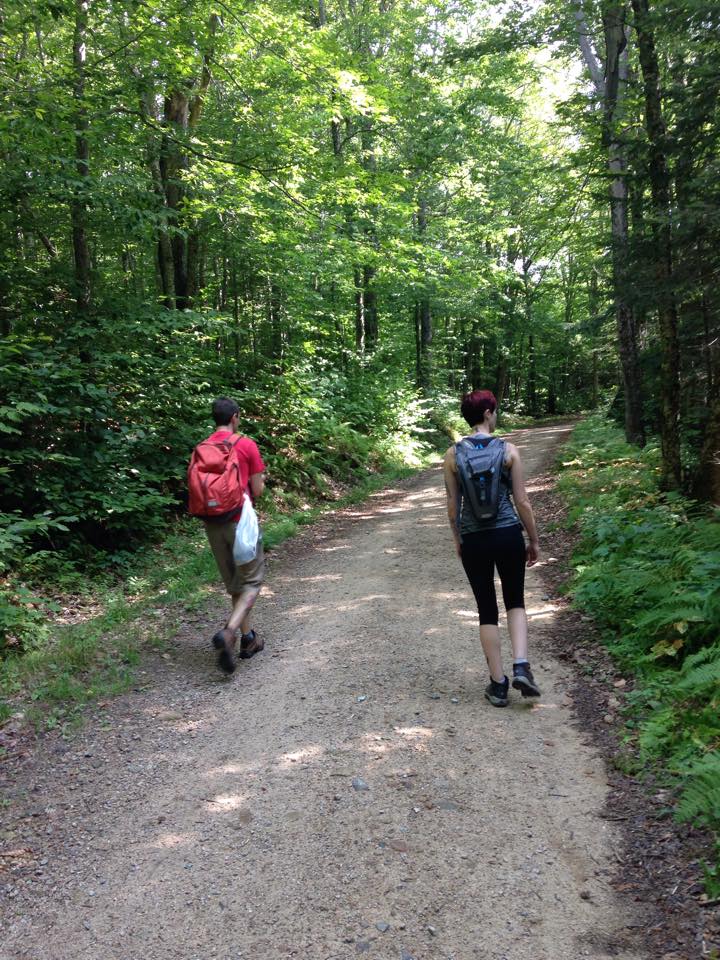
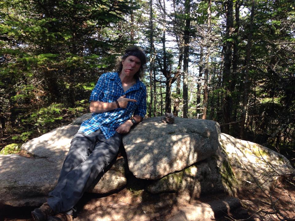
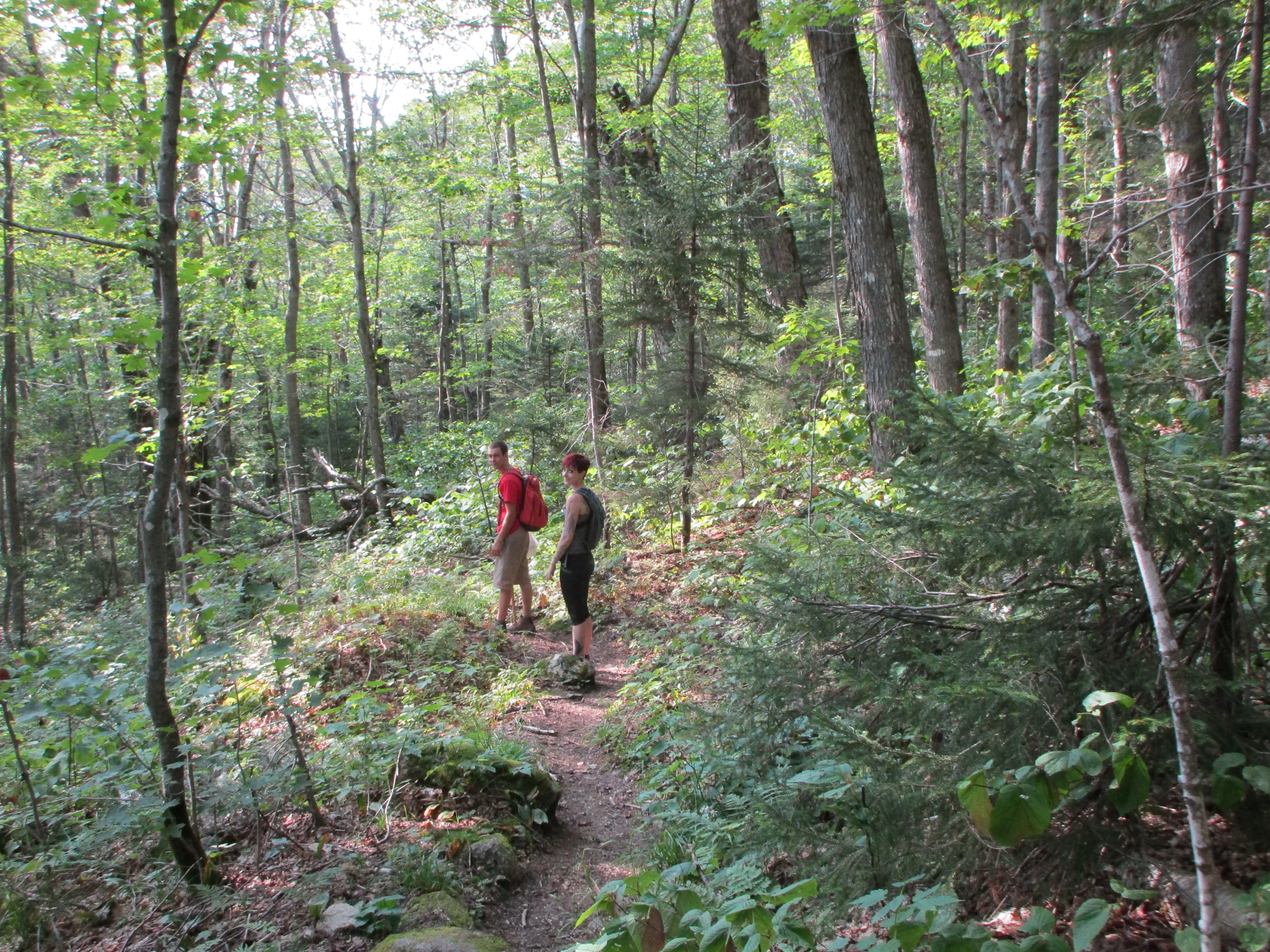
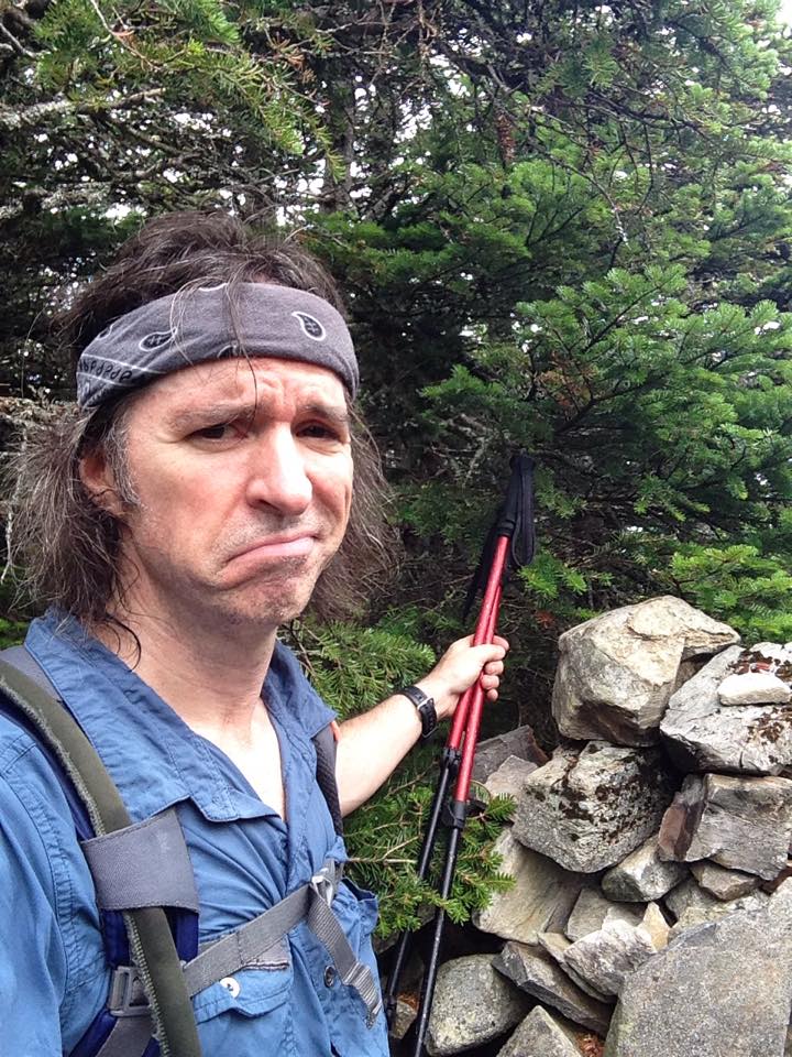
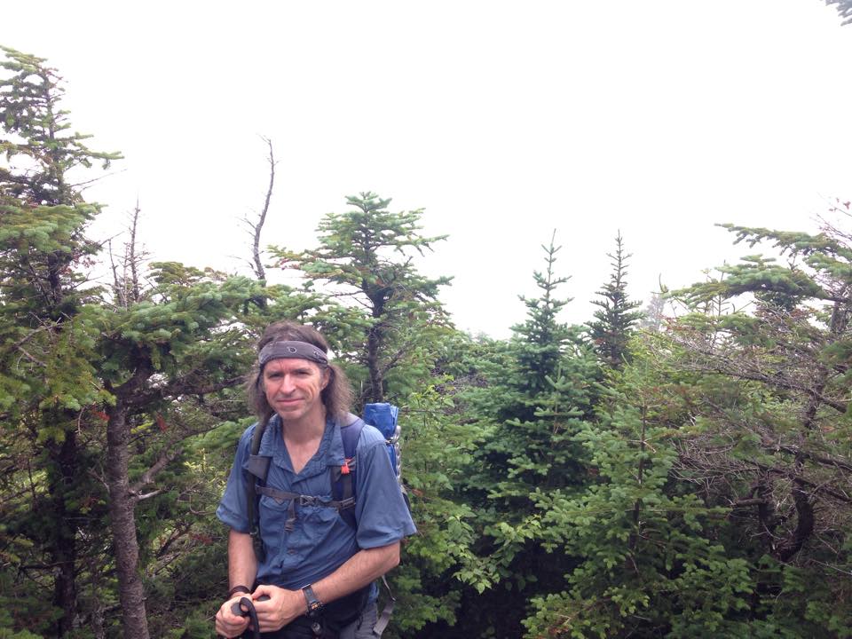
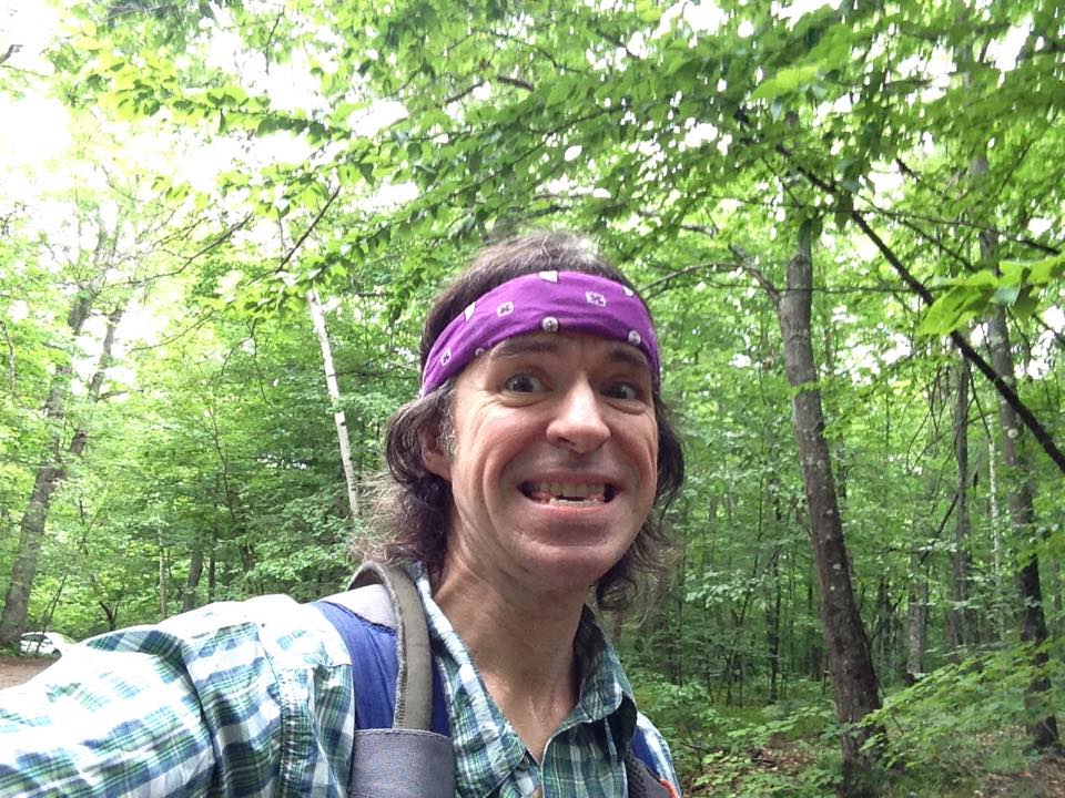
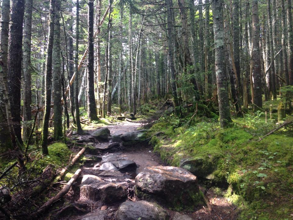
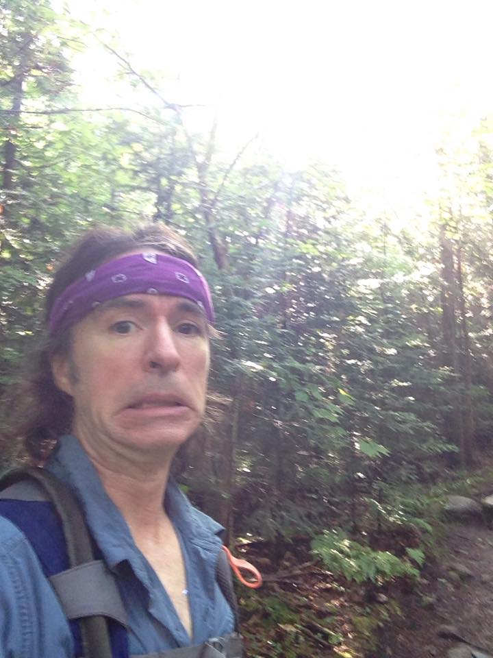
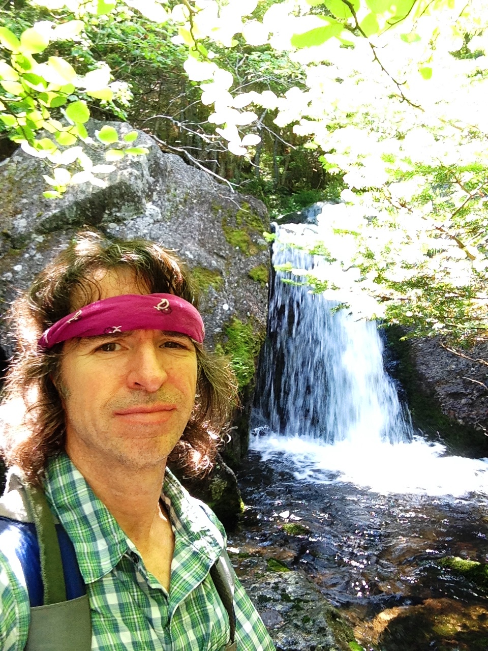
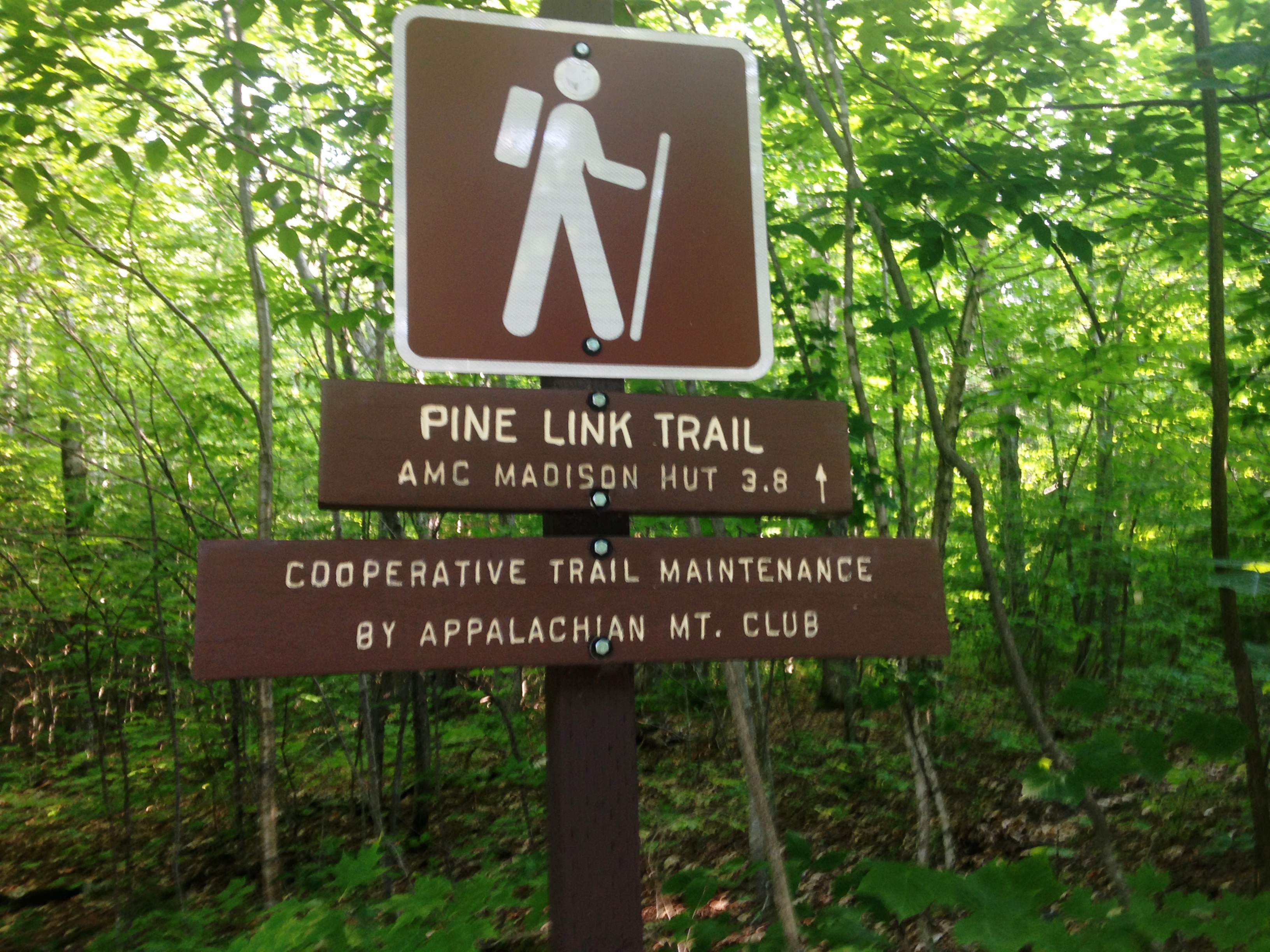
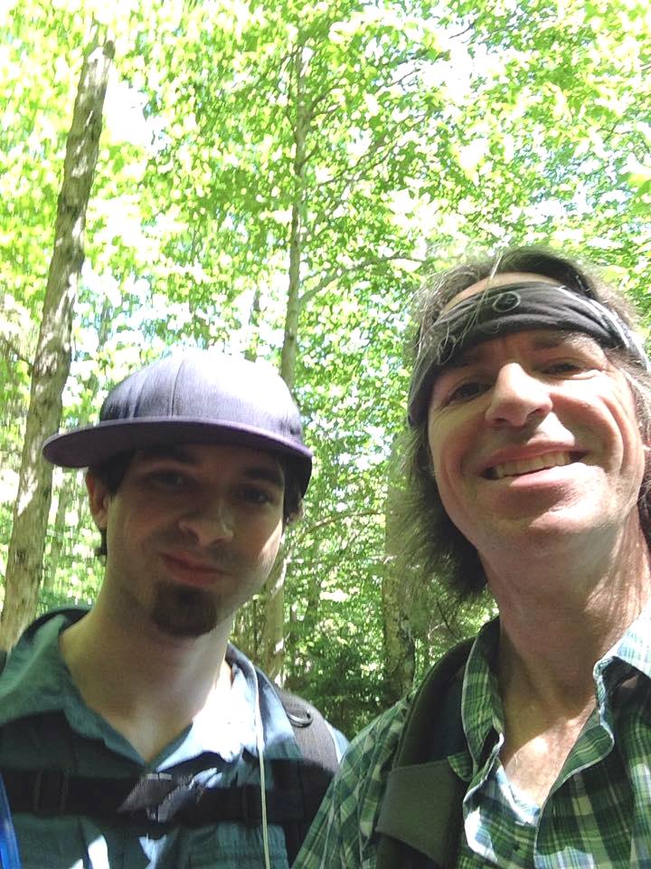
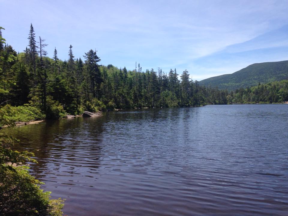
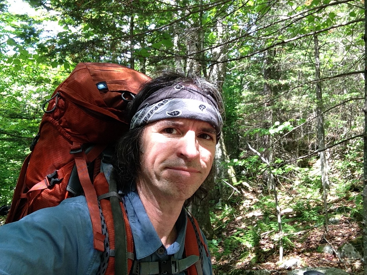
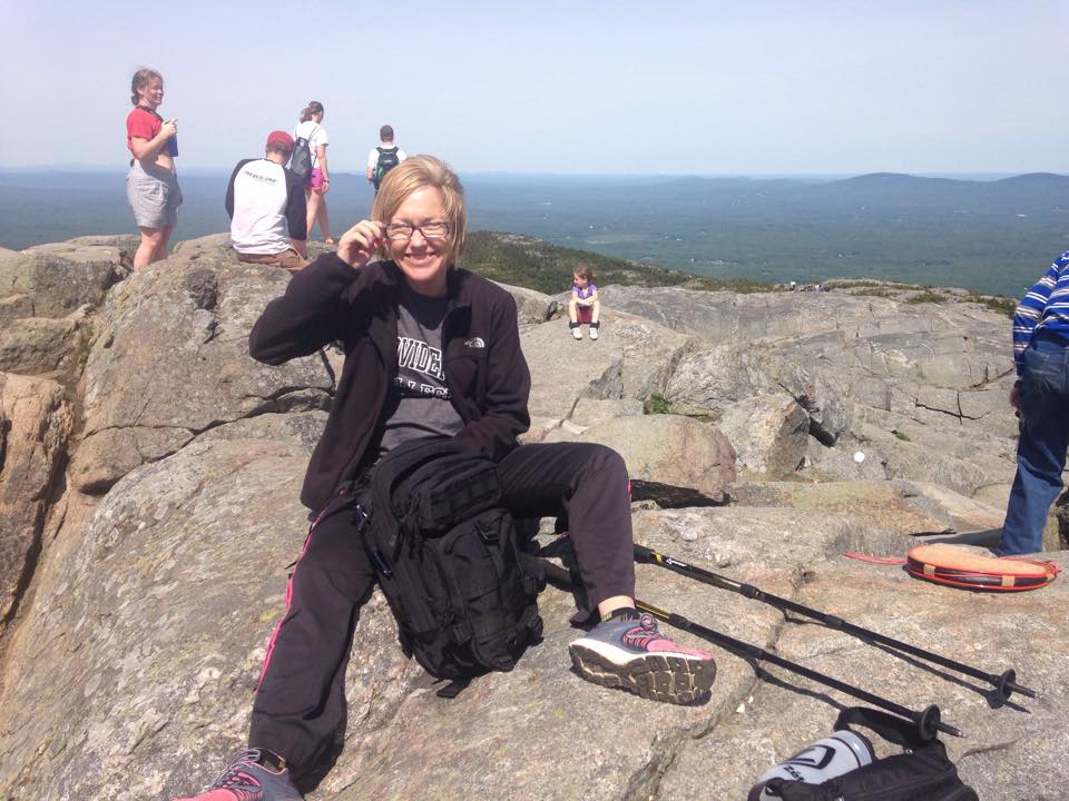
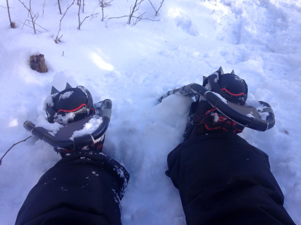
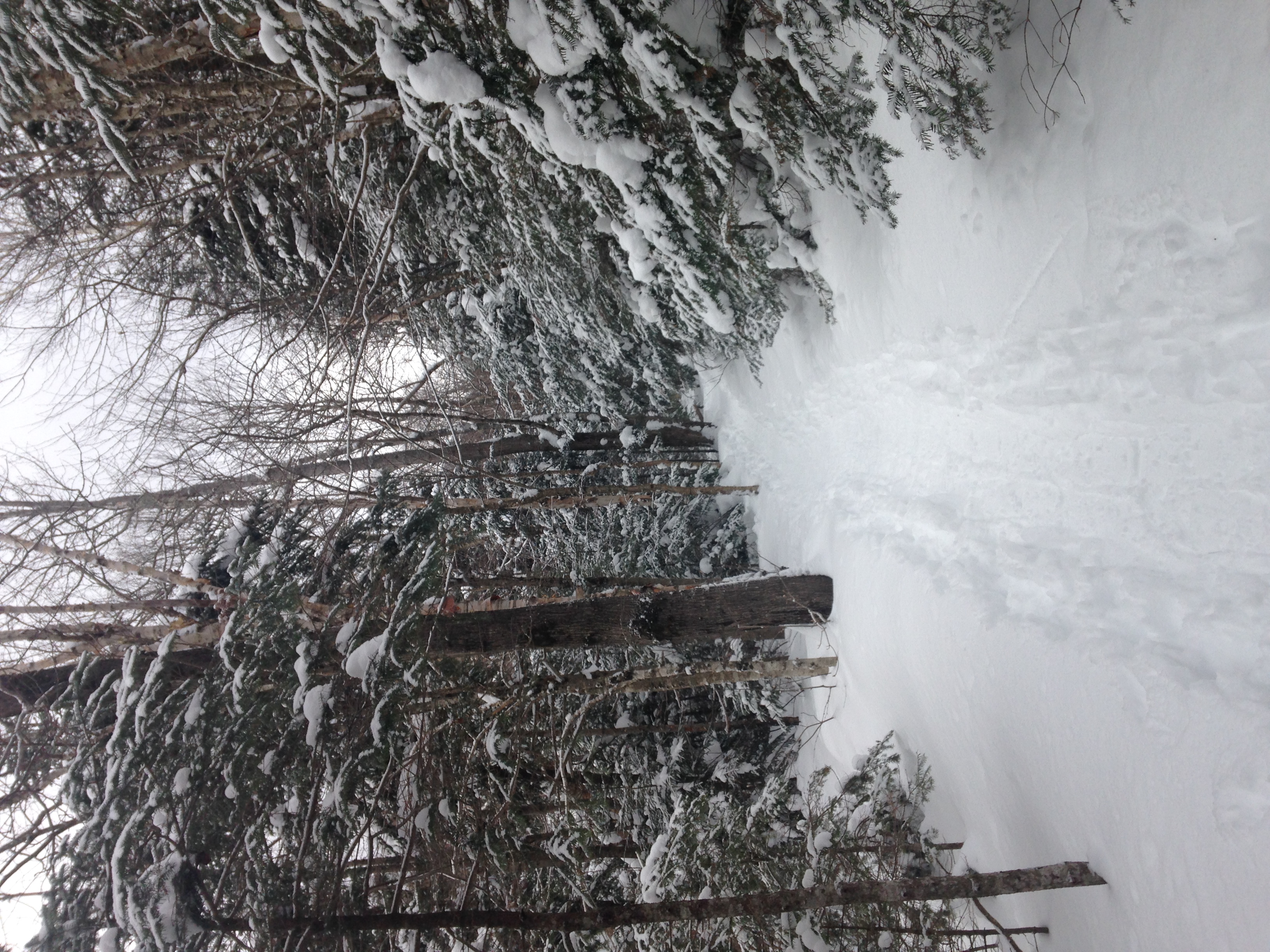
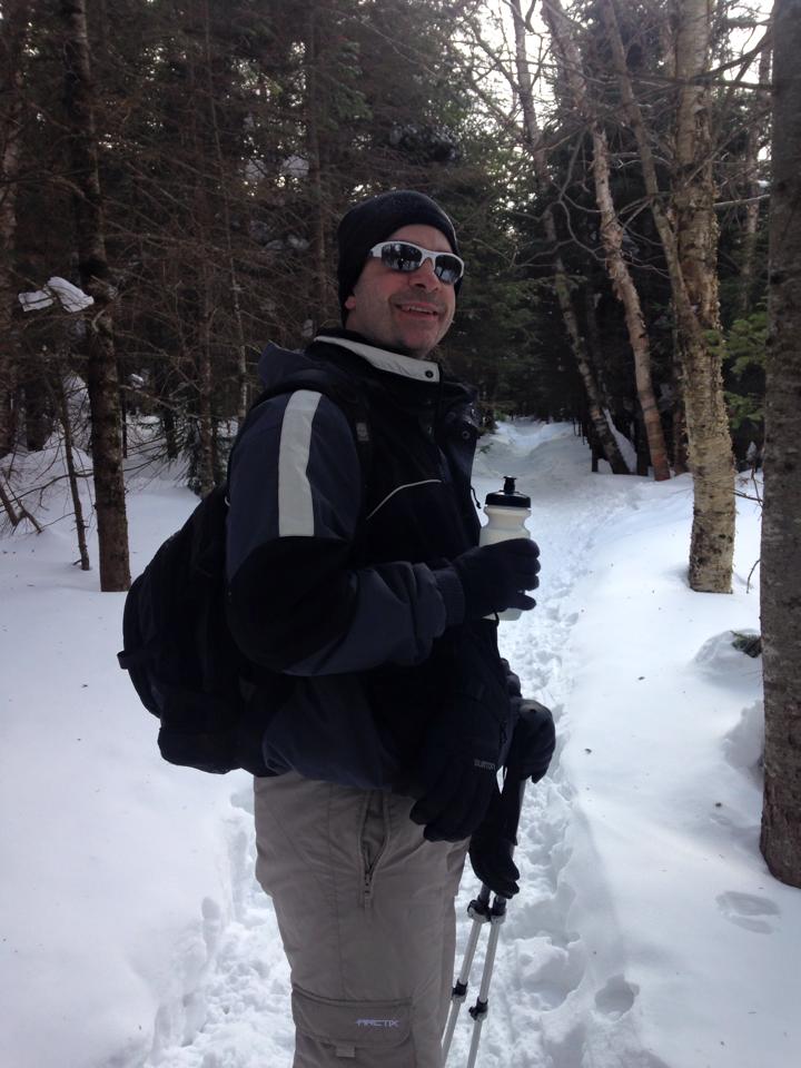
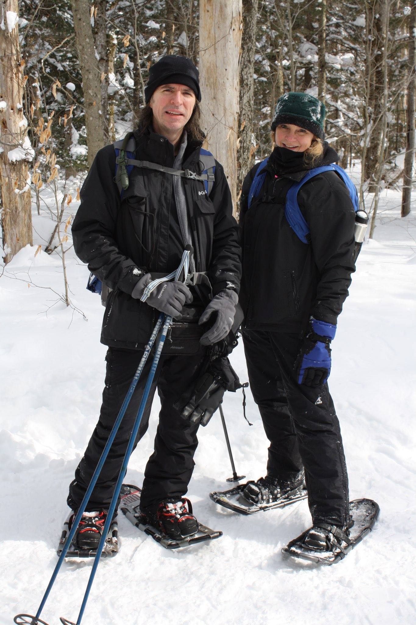
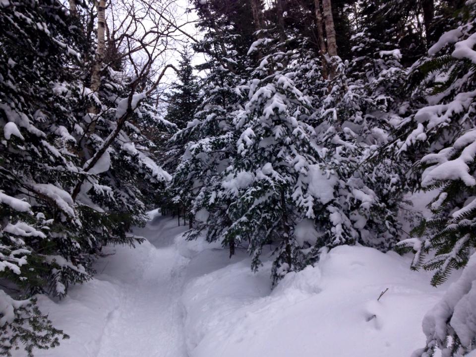
We’ve been planning this for a few months now. The original idea was to make this a backwoods camping trip, but it has morphed into a few nights stay at JBL with two pretty aggressive hikes that will take us to 7 of the high peaks in the Great Range. IMG_4412
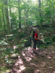
Actually scratch that. At this point, as we are hiking in with the big packs 3.5 miles to the Lodge, the plan is to spend two nights followed by a third overnight stealth campsite and a morning hike out, but as it turns out we would enjoy JBL so much that our stay would be extended by a night, making both of our peak seekers day hikes. I hadn’t hiked with Therese since our younger days in the Whites, so this was a fitting way to start off- the person that took me and my brother on that long hike in the Bonds, is now leading me into one of the most rugged and sought after stretches in the ADK’s. That’s how we roll: no easing in, just get right down to it.2924839537_b2b934bbe7
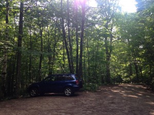
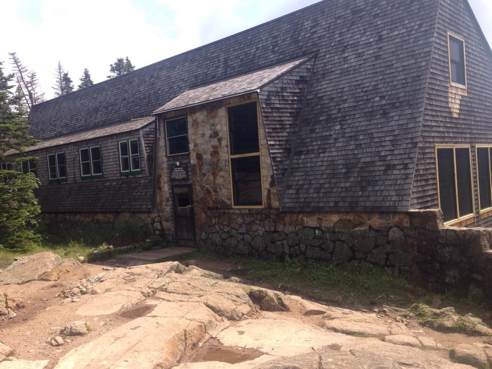
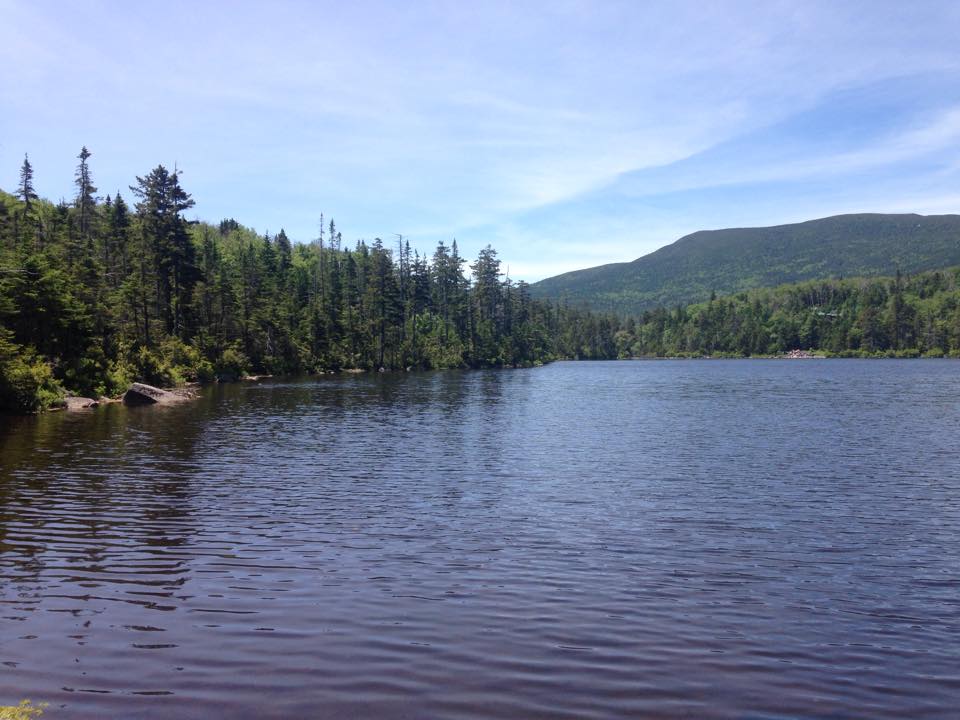
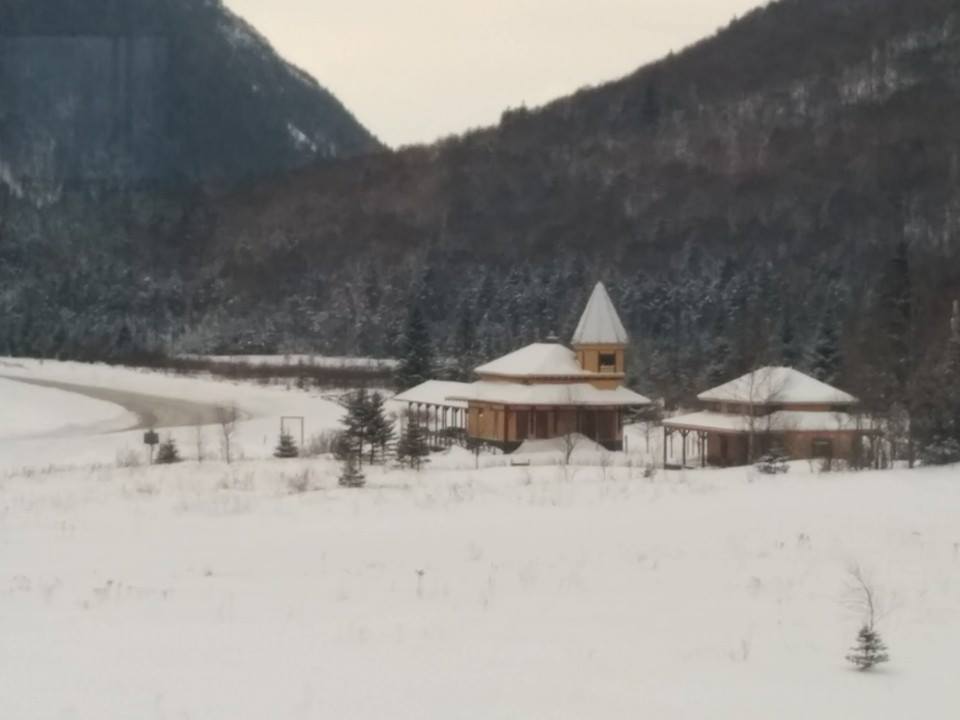
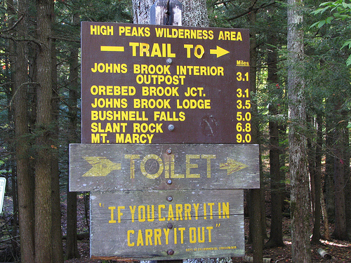
Having to park in the overflow lot down the road, we took the shuttle to the completely filled Garden lot and set our extra weighted feet onto Phelps Trail, following John’s Brook upstream to our home base for the next few days. We walk up the wooden steps that lead to a large wraparound deck of this 28-bunk lodge as the mid-afternoon hour arrives. IMG_4497IMG_4413
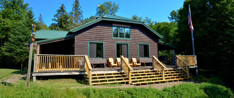
It is too late to start in on a peak but there is just enough time left in the day for a leisurely afternoon unpacking, and to settle in and get acquainted with our surroundings. We spend some quiet time by the brook, followed by a lazy lounge on the sun-drenched deck for a bit of reading and mapping out trails. Hikers start shuffling by us later in the afternoon/early evening, drenched in sweat and drained of energy from a long day on the trails. At first a feeling of guilt arrives, over our fairly easy, flat short hike in and our lazy afternoon, but we know we will be more than making up for this in the days that follow.

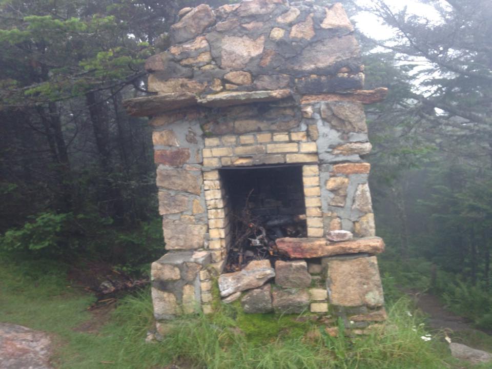
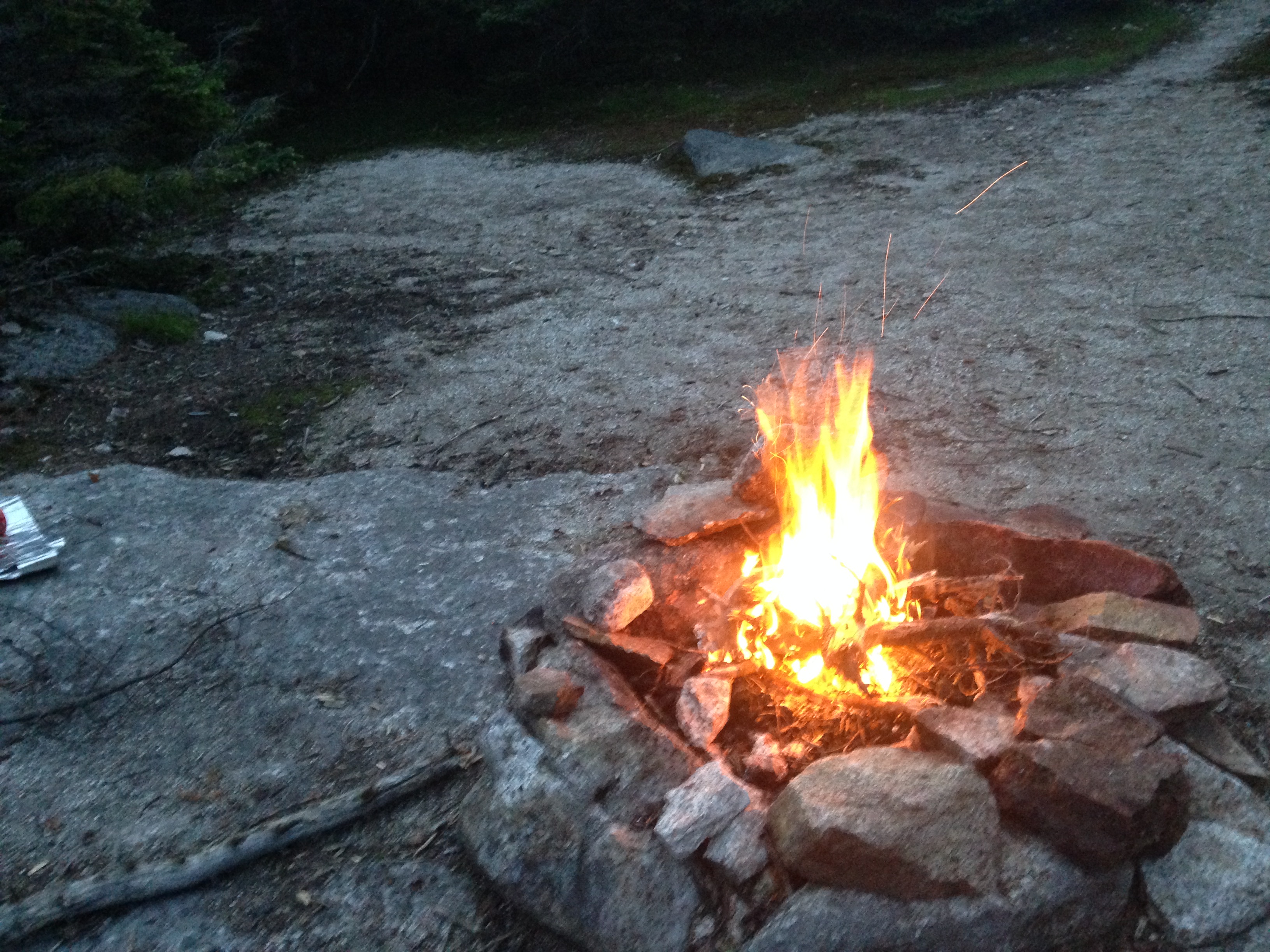
With dinnertime approaching we stroll into the large living area, which is filled with large wooden tables and benches and a raised stone fireplace. Off the main room is a kitchen, where the ADK staff is busy filling the place with yummy aromas, and 4 bunk rooms (2 large, 2 small). Dinner is served family style and I don’t recall what we ate but I know it was delicious. We sat and talked with the other guests – most conversations were standard friendly hiker length and content, but one guest in particular took talking to an art form. We finally found a chance to break away from the gabby woman and retreat to the deck once again to breathe the night air, before retiring to our bunks to rest up for a full day on the trails.
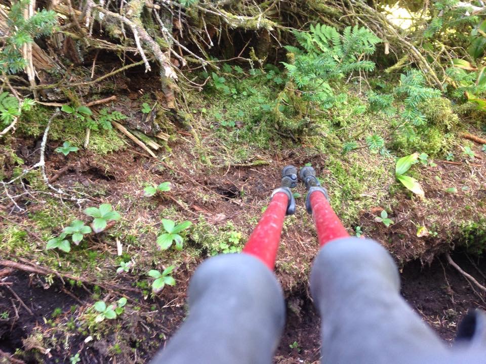
IMG_4434

DAY TWO:

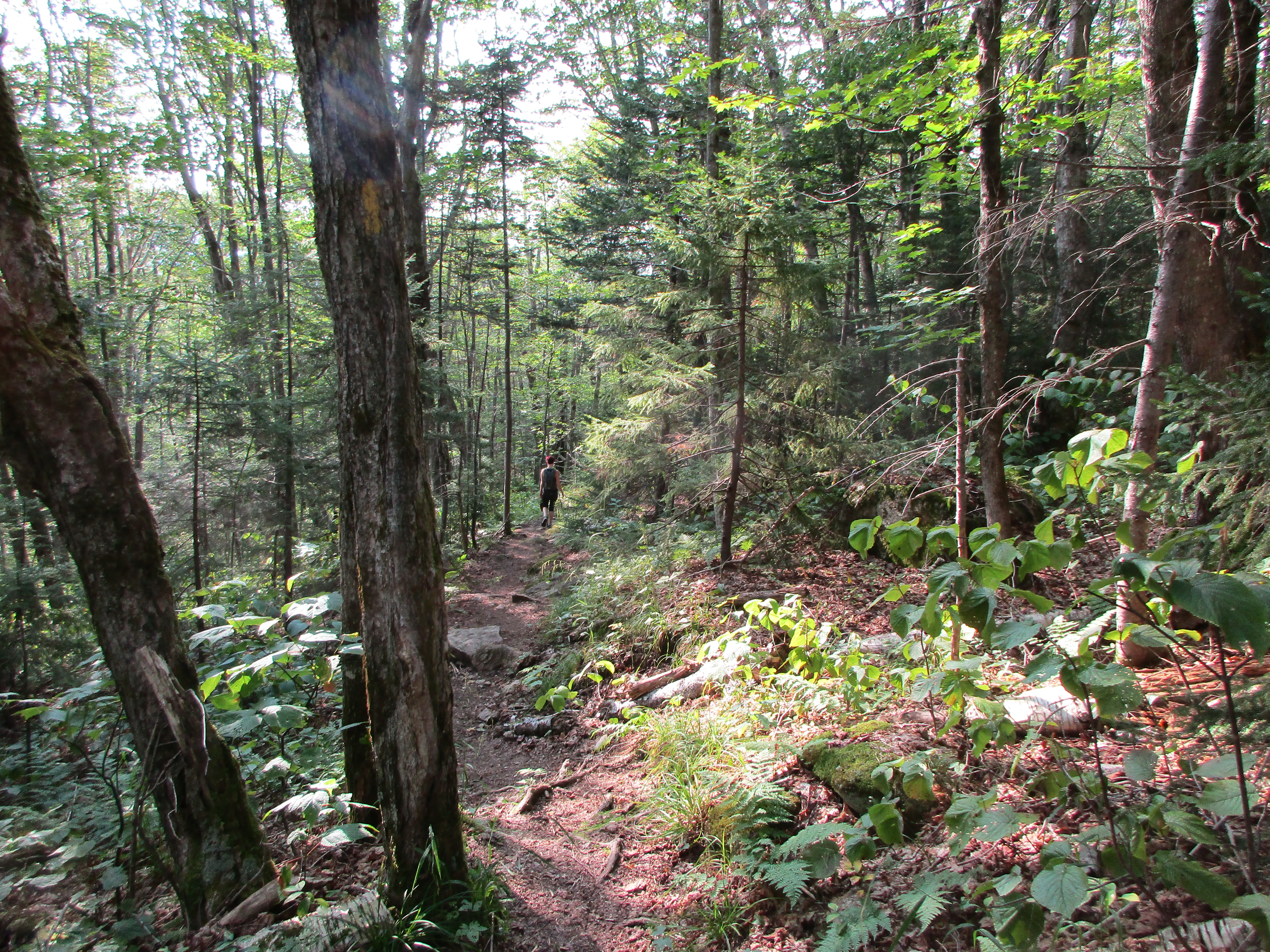
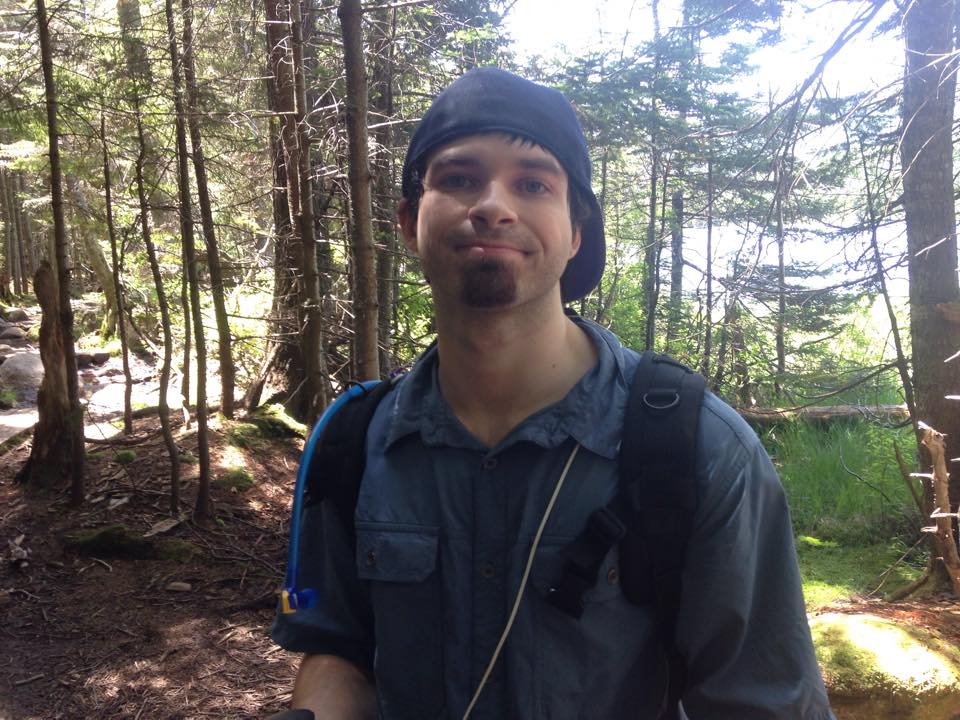
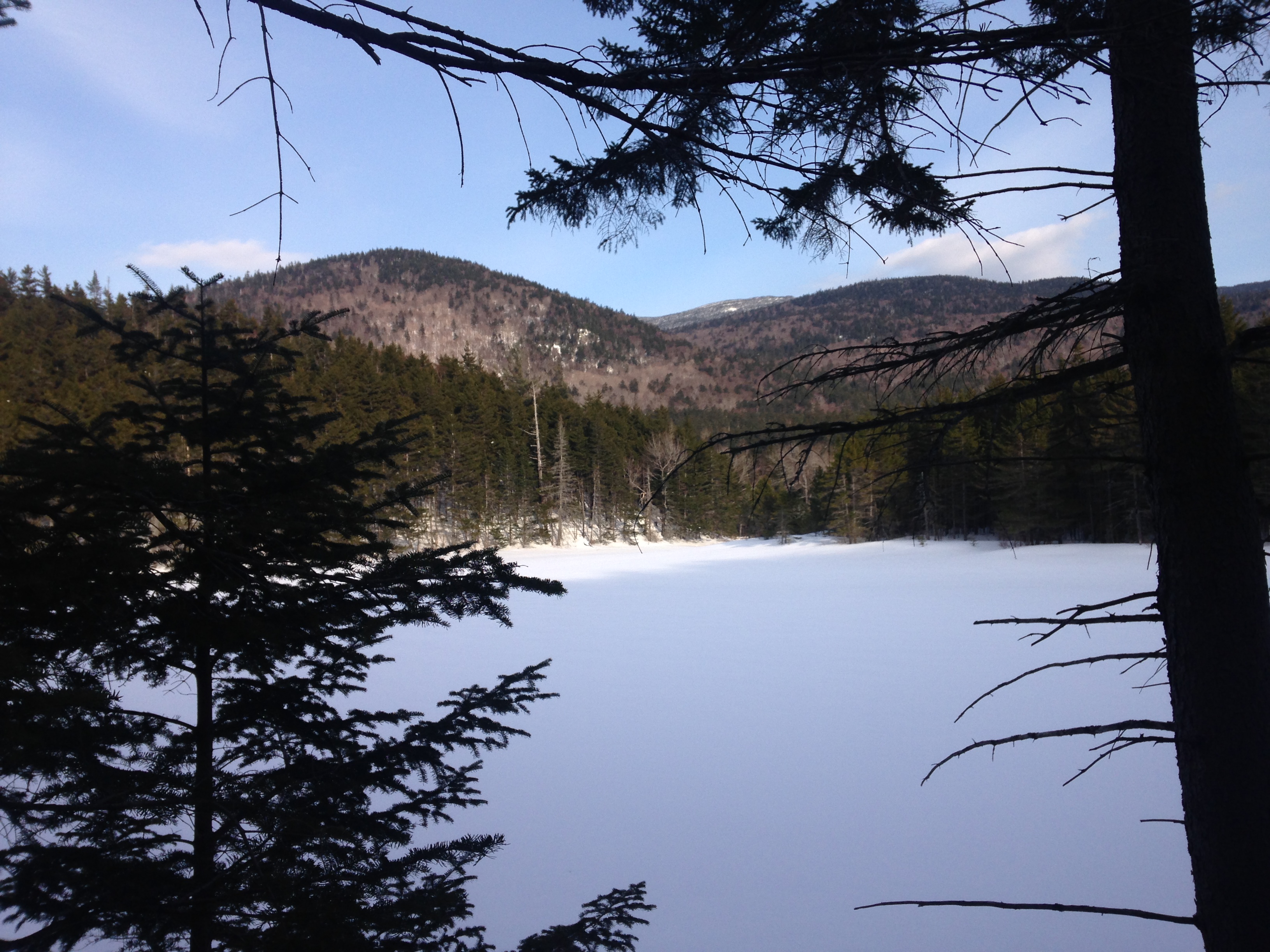
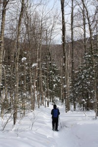
The next day started out a bit groggy from a night of enduring a monster snoring neighbor, but we are soon energized by a mountain sized breakfast and a cup of jo or two. We waist little time grabbing a few prepared lunches and hitting the trails to get an early start on the day with our much smaller day packs. Soon the Lodge guest chatter fades and it is just brother and sister heading southwest up the Phelps surrounded by things of green happiness. IMG_4424
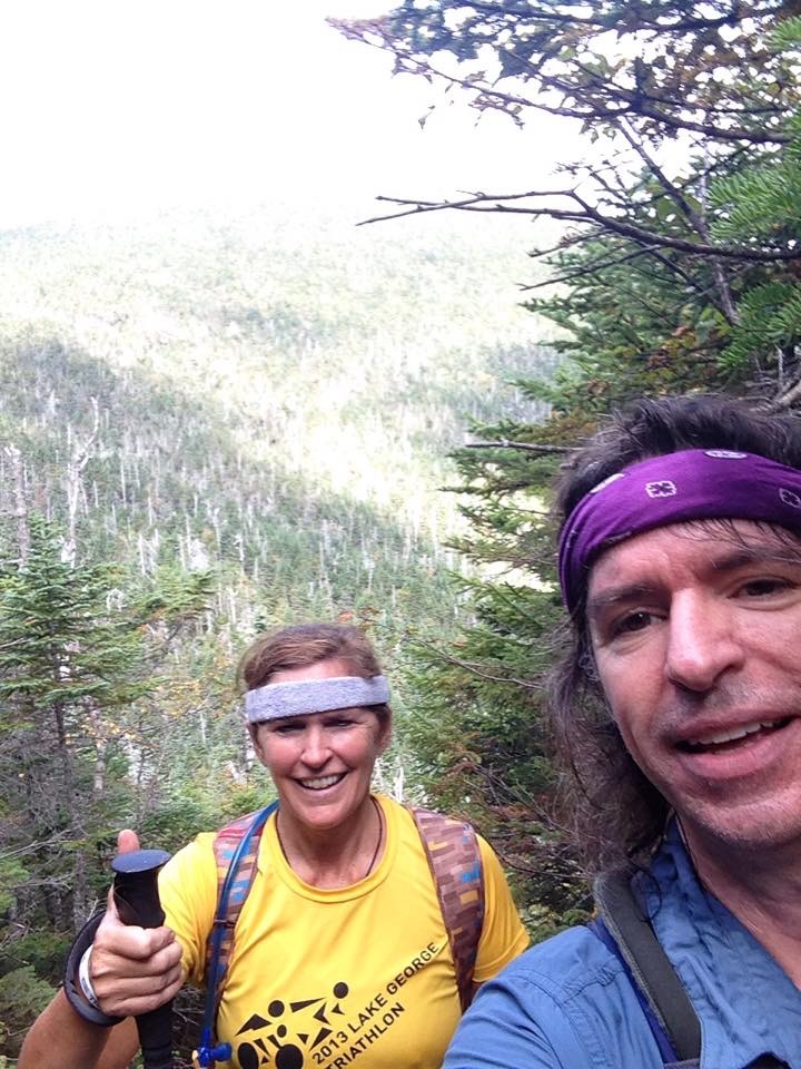
To quote Therese, “It felt so good to be in the rhythm of nature… walking, talking, joking… interspersed with periods of long silence.” We talked of childhood memories, hikes of yesteryear, things encountered in each of our family-building, career-constructing, life-shaping experiences. We joke at our siblings and parents expense and treasure the moments we all shared. We share quirky little stories of our jobs and coworkers… In the spirit of keeping an inside joke INSIDE, I will share some meaningless/ meaningful punchlines and key phrases: “Mmmm noodle soup”, and ”That’s a great story”, followed by “#coworker’s name” which led to “#pole uses” and “perrrrfect”…Maybe I’ll explain a few of these later… then again maybe not. IMG_4422
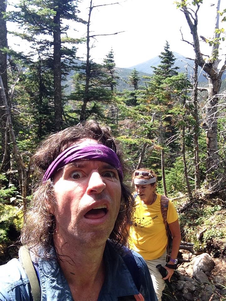
Then just like that, the words stop and the woods tell their story once again. This how it went throughout the weekend. I would tell a work anecdote or share something learned on the trail, she would recall memory from one of her kids key moments growing up, one of us would crack a joke or witty remark, we would laugh for a while and then nothing but footsteps, breathing, poles clicking and a dramatic pause to hear ma nature sing us her song of silence, calm breezes, animal calls, and water trickling downstream.IMG_4420IMG_4416

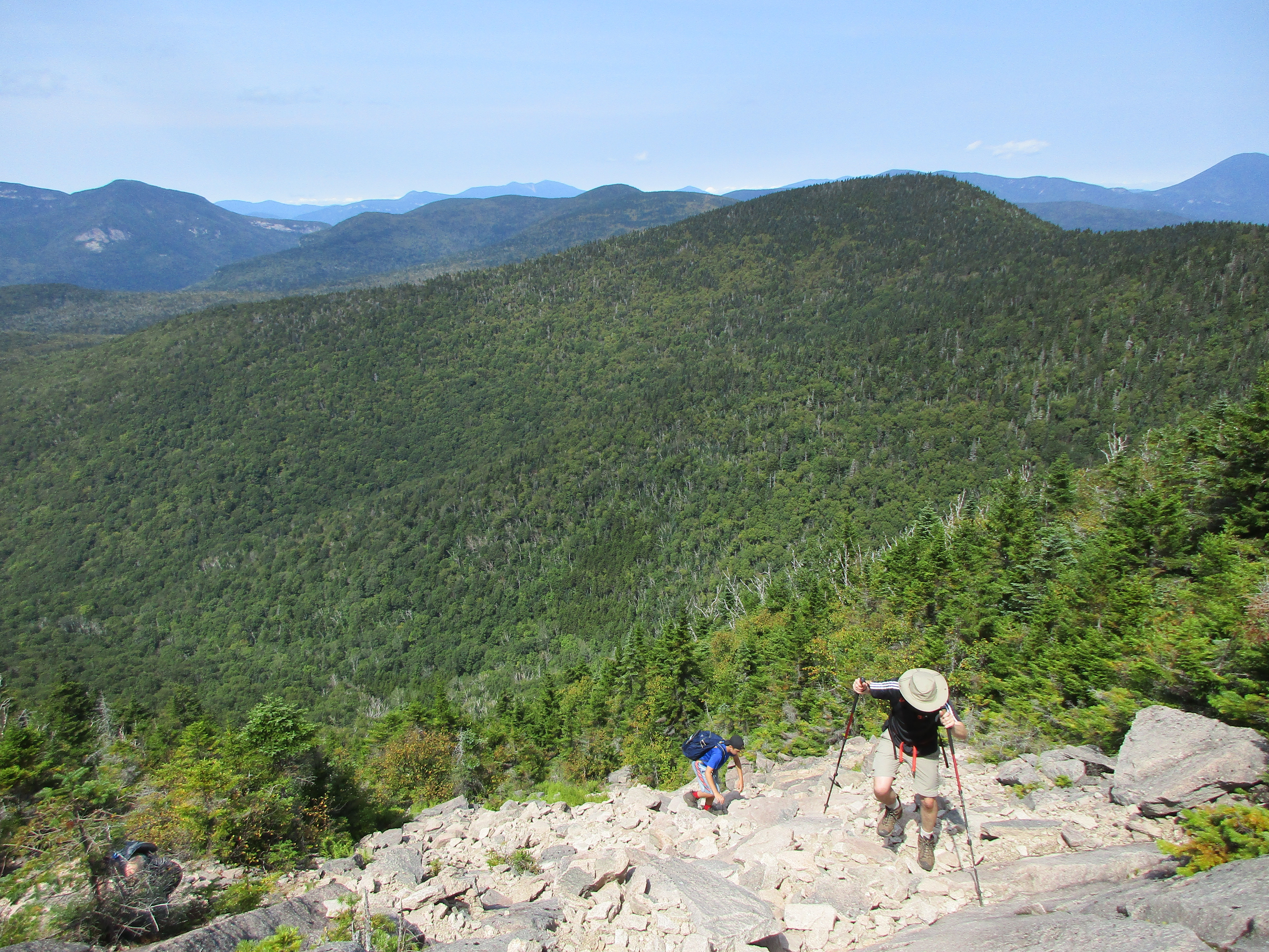
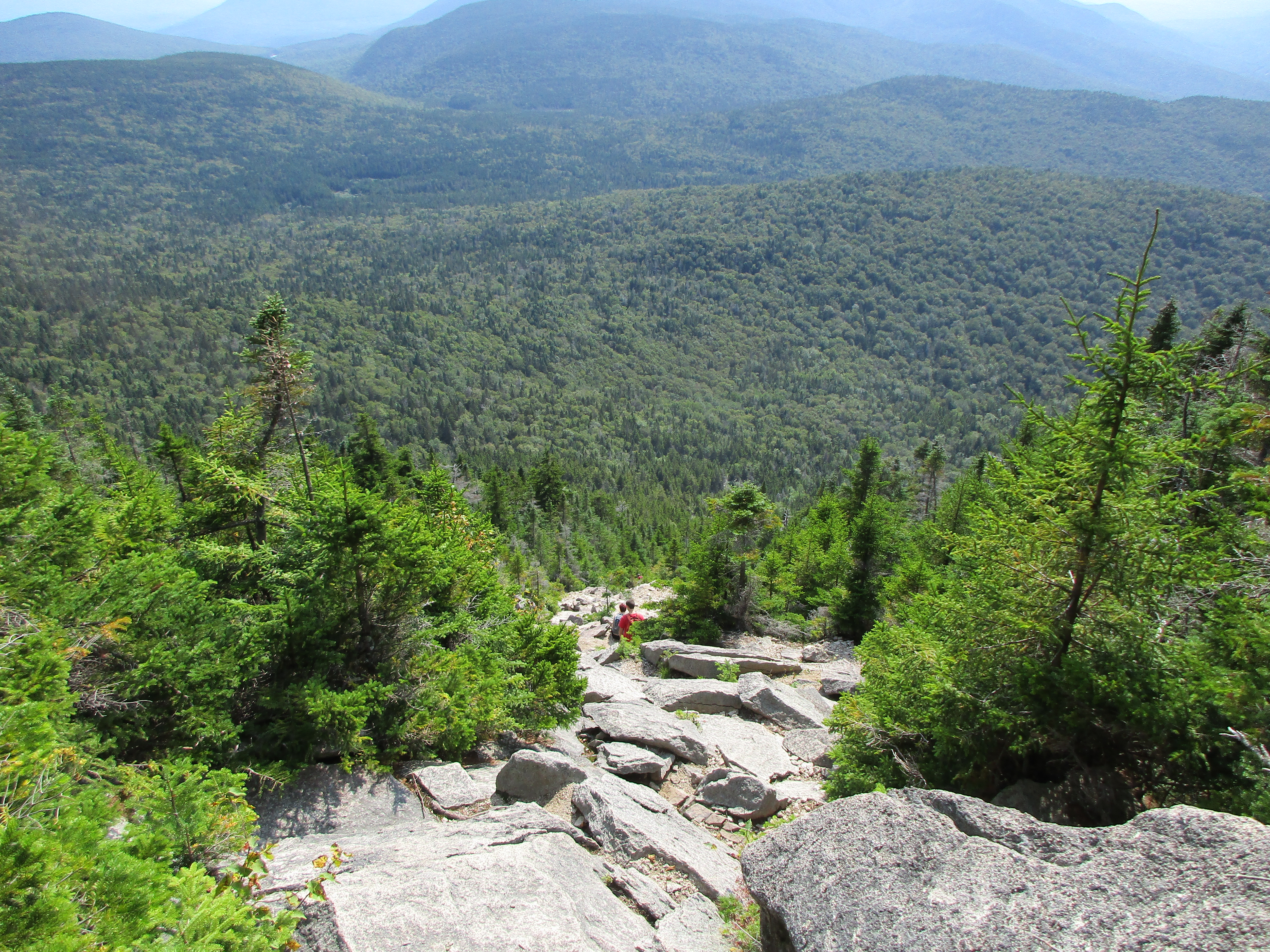
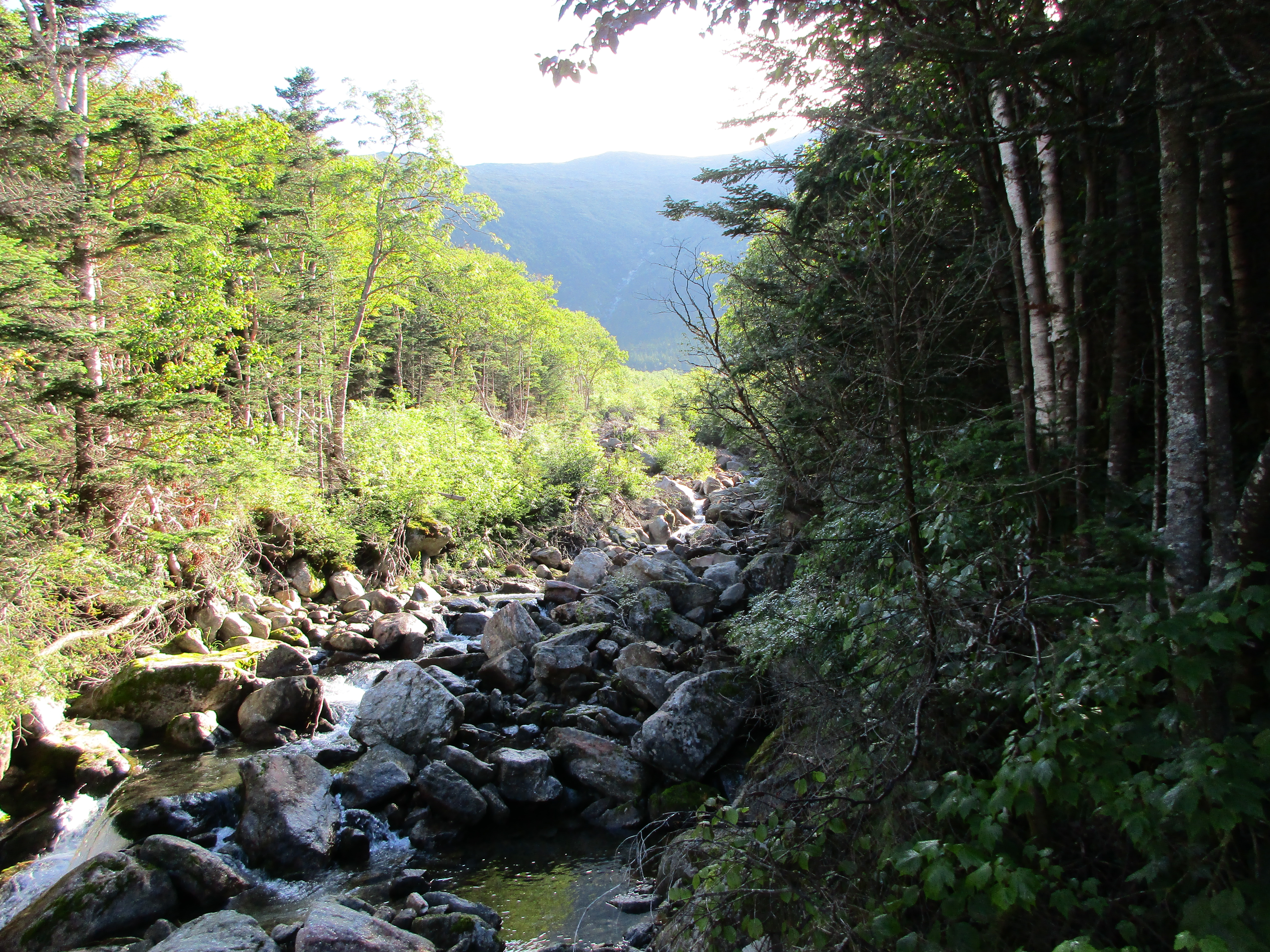
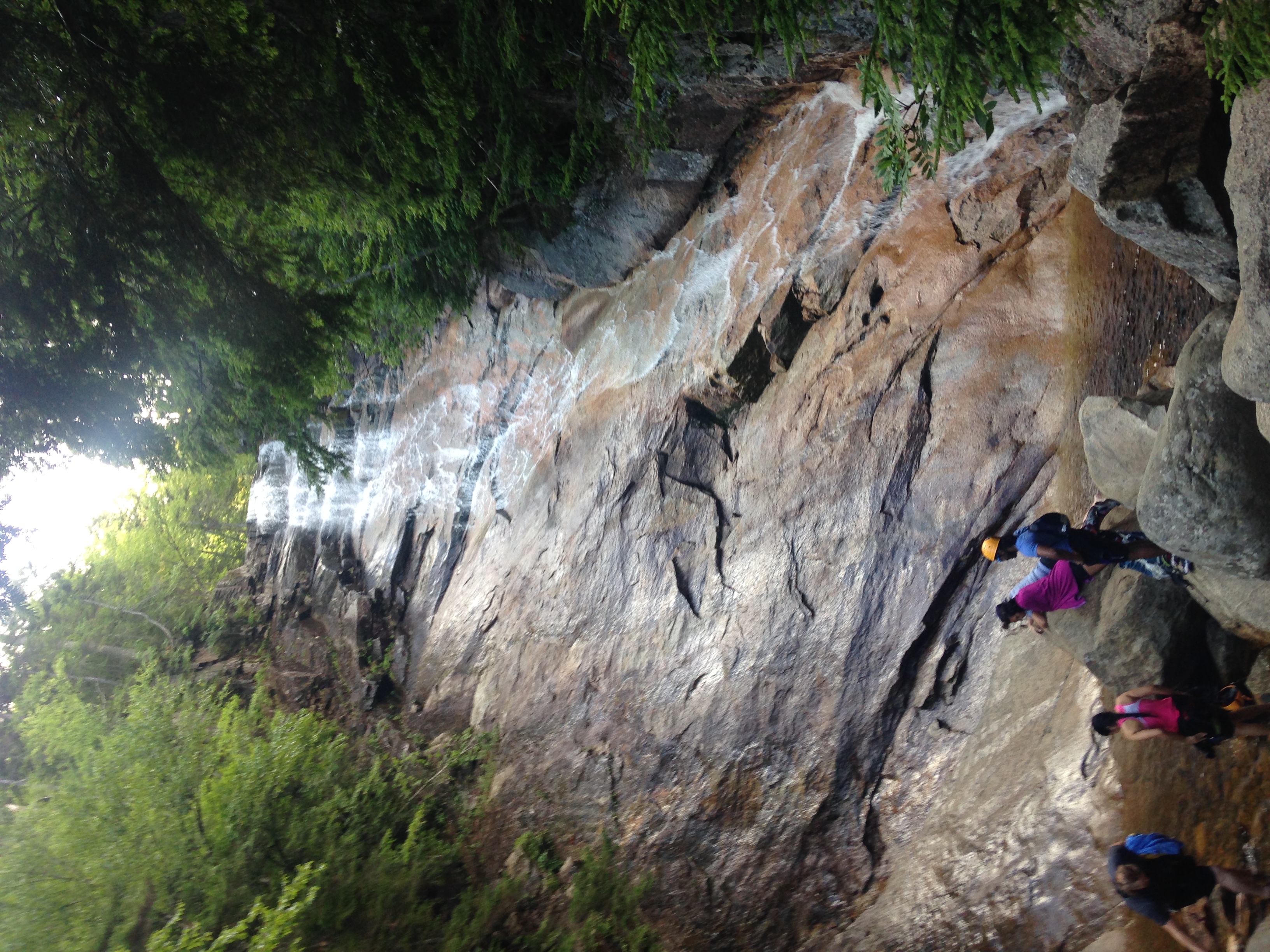
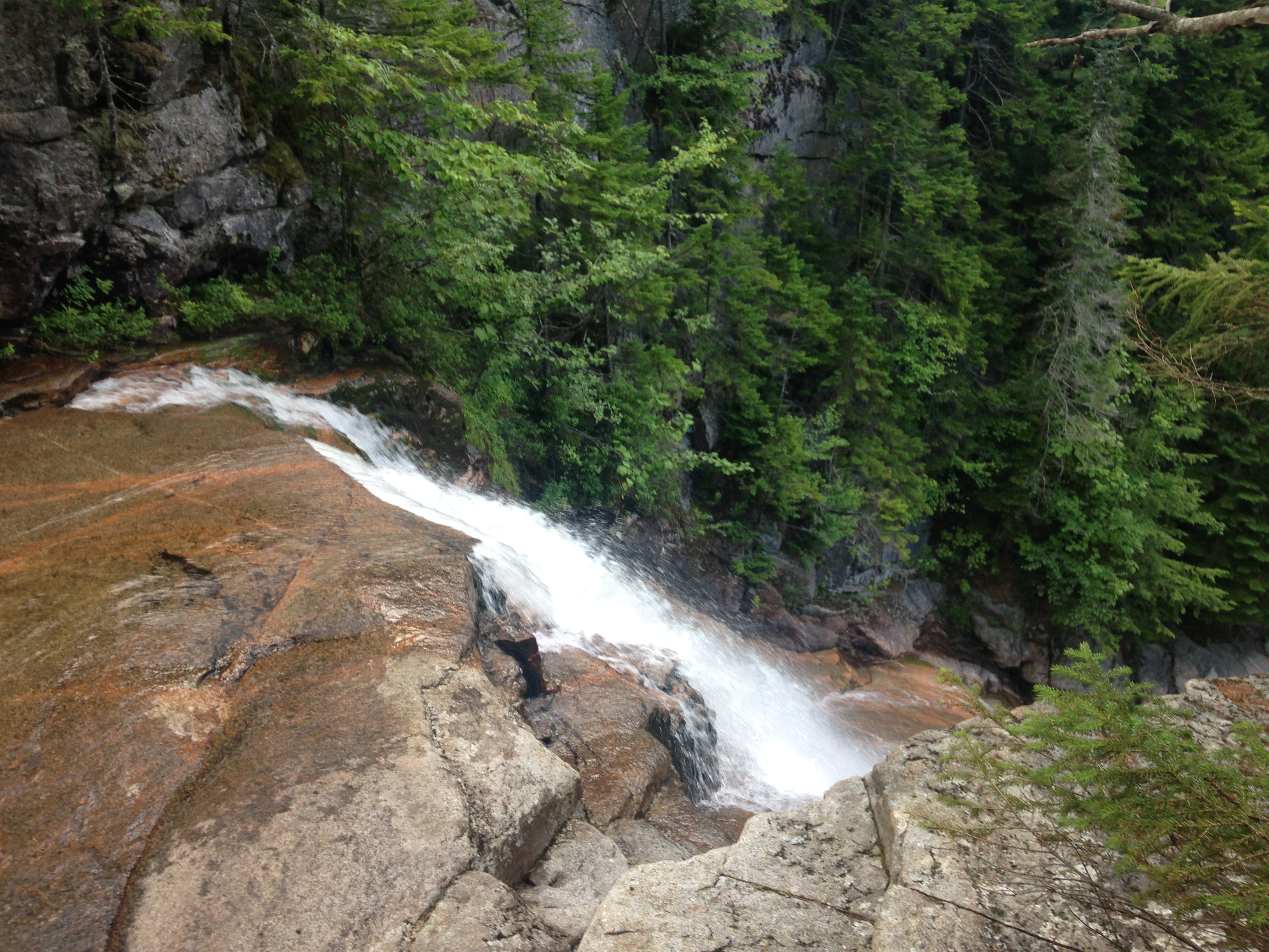
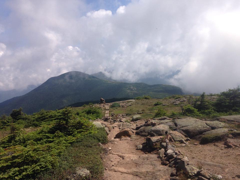
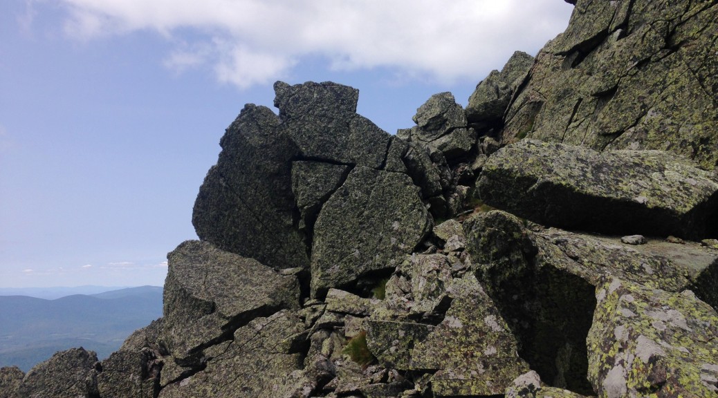
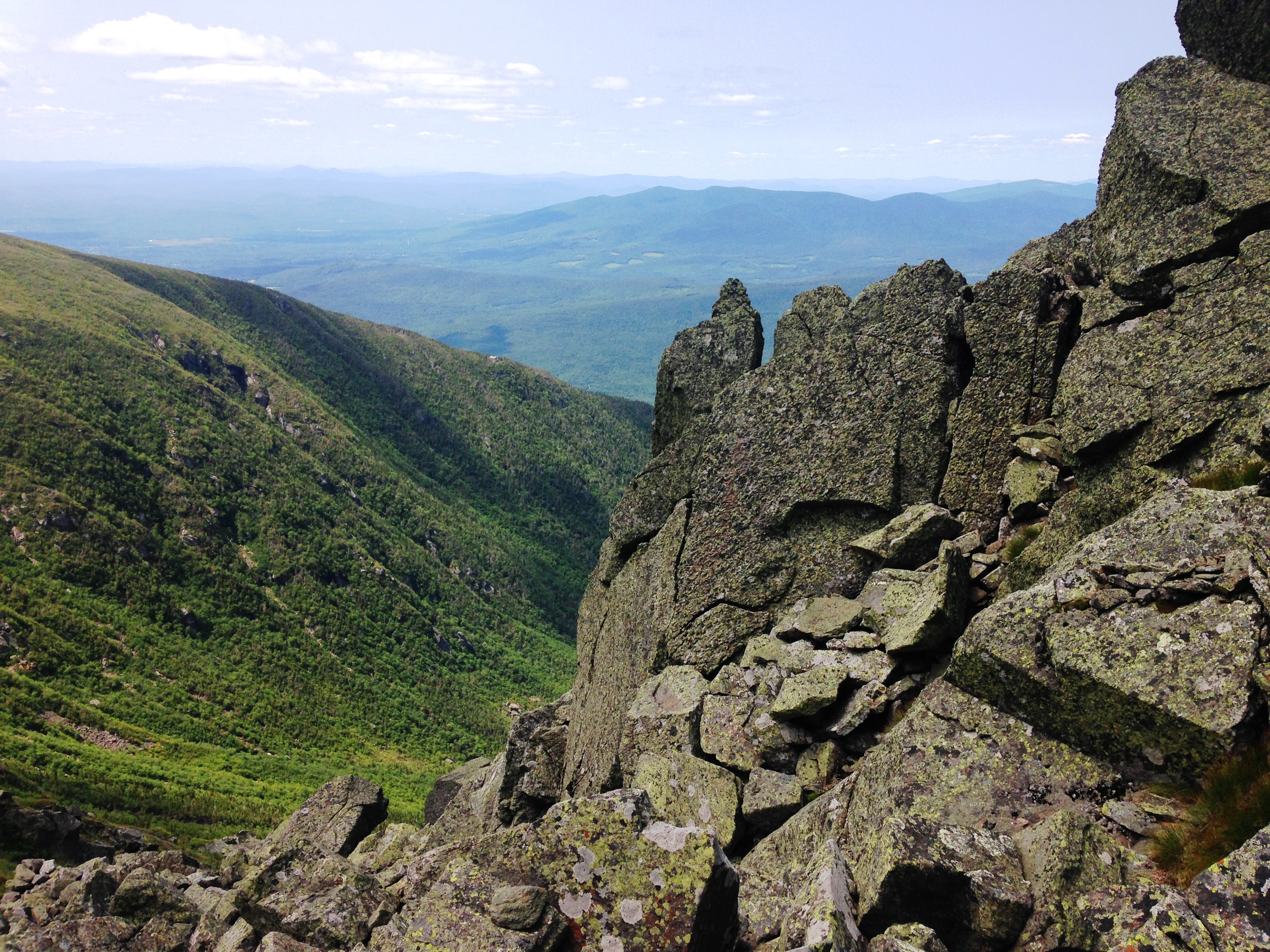
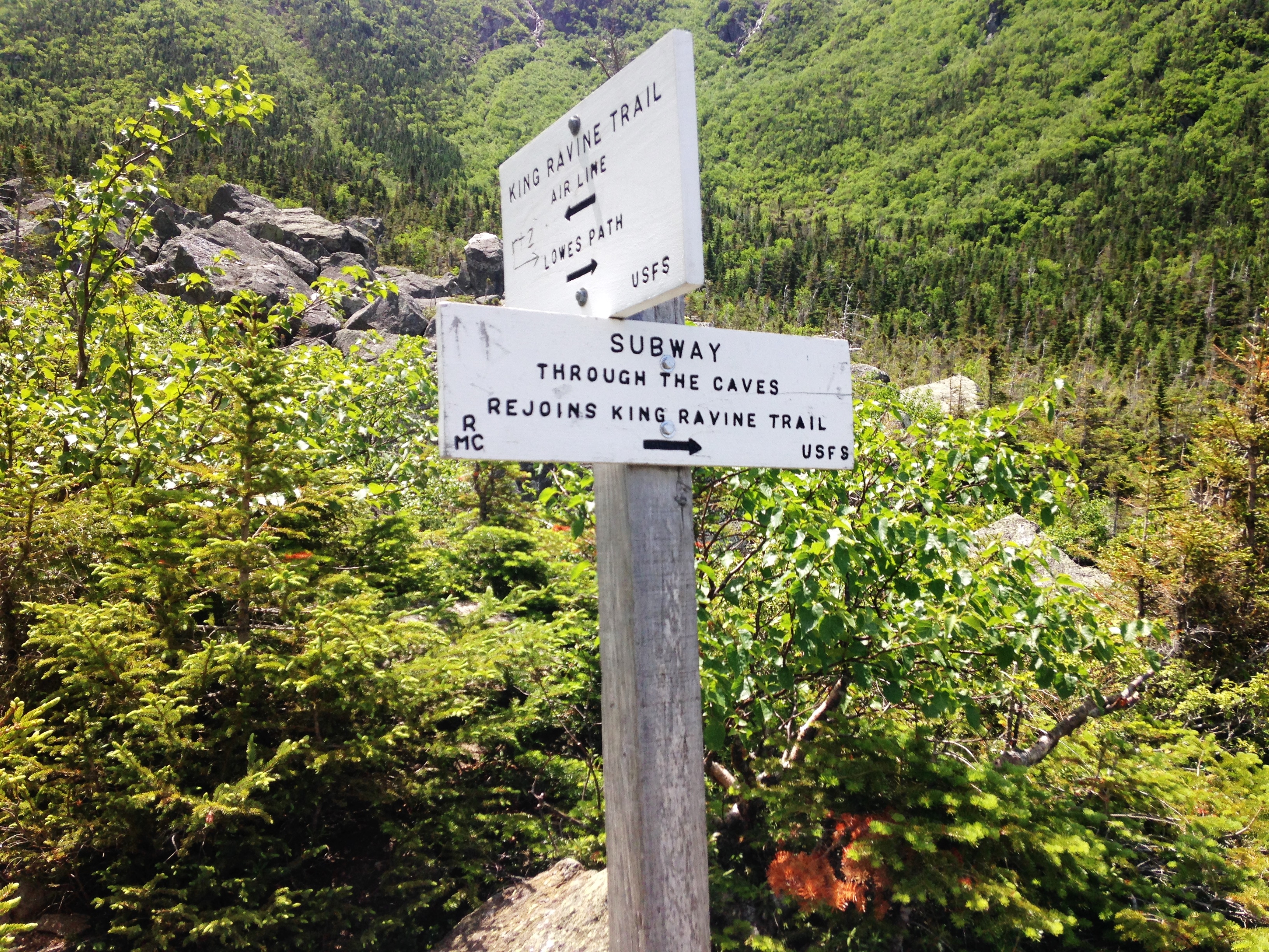
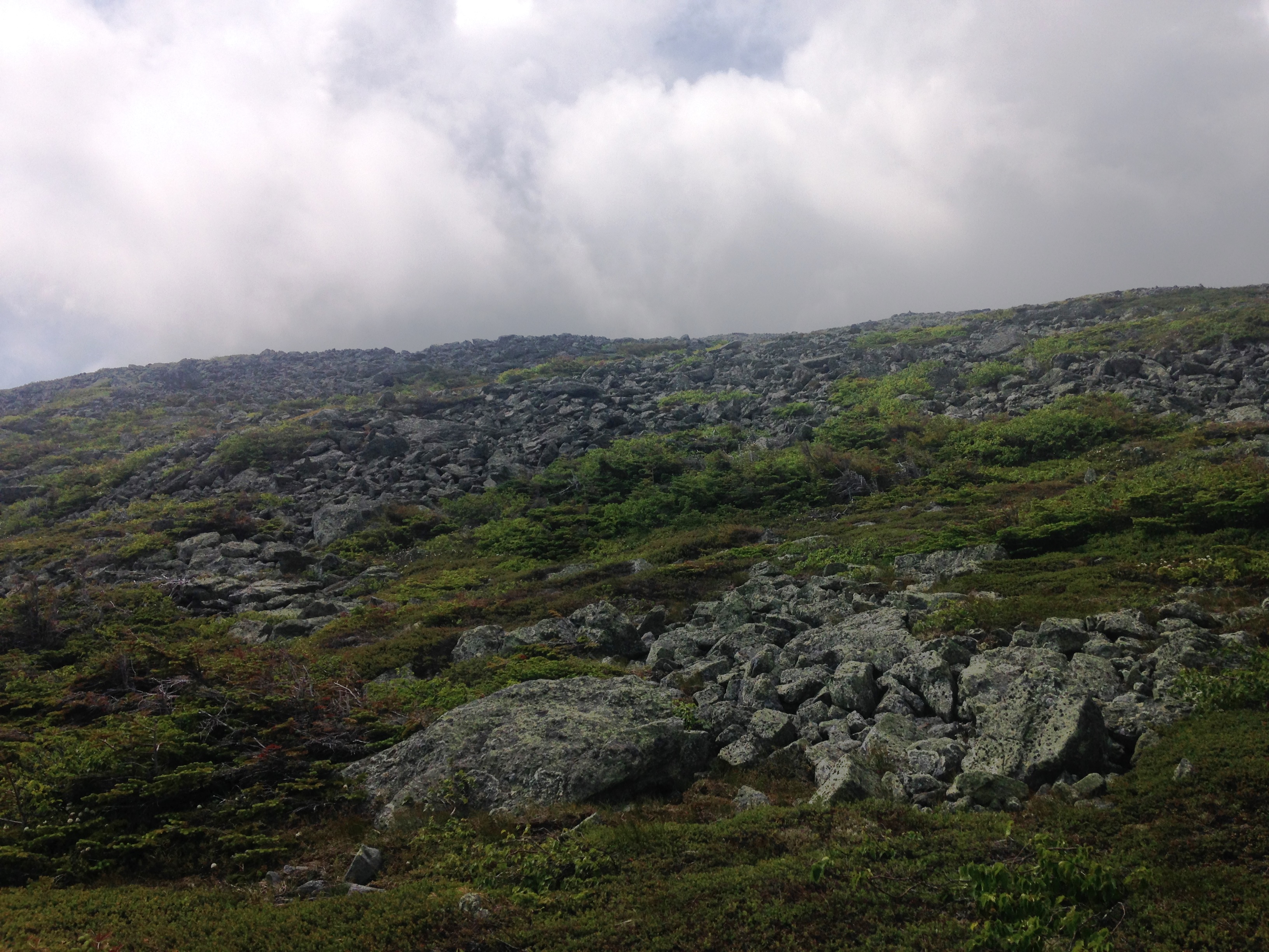
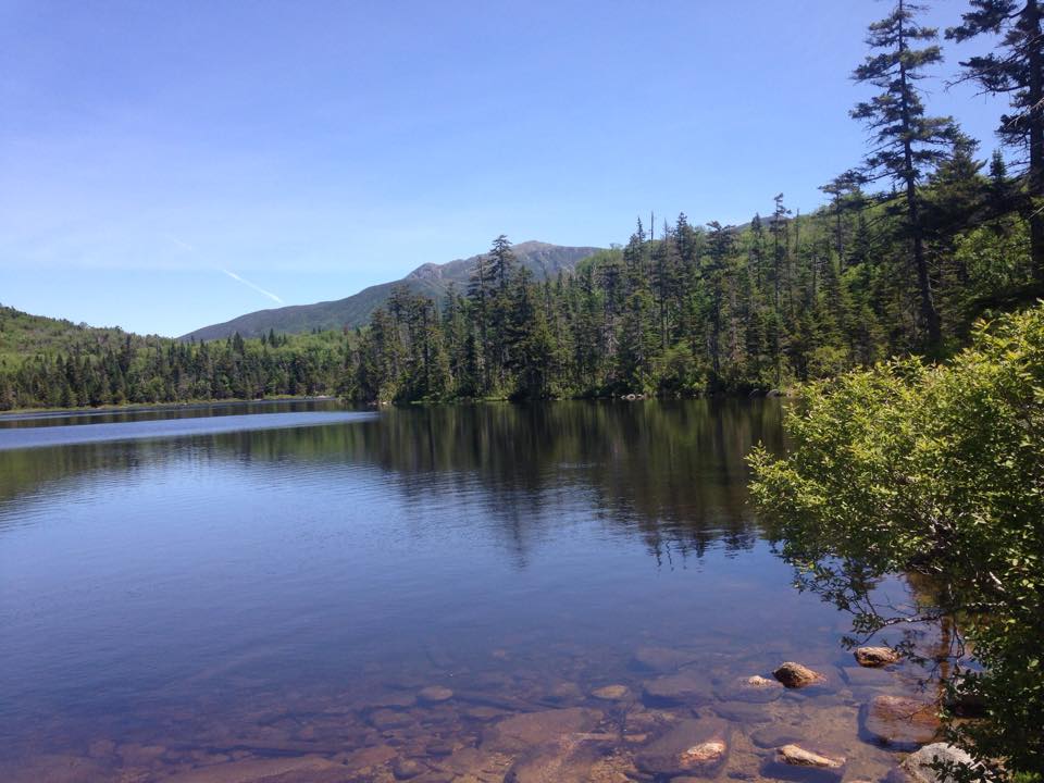
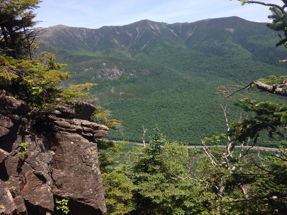
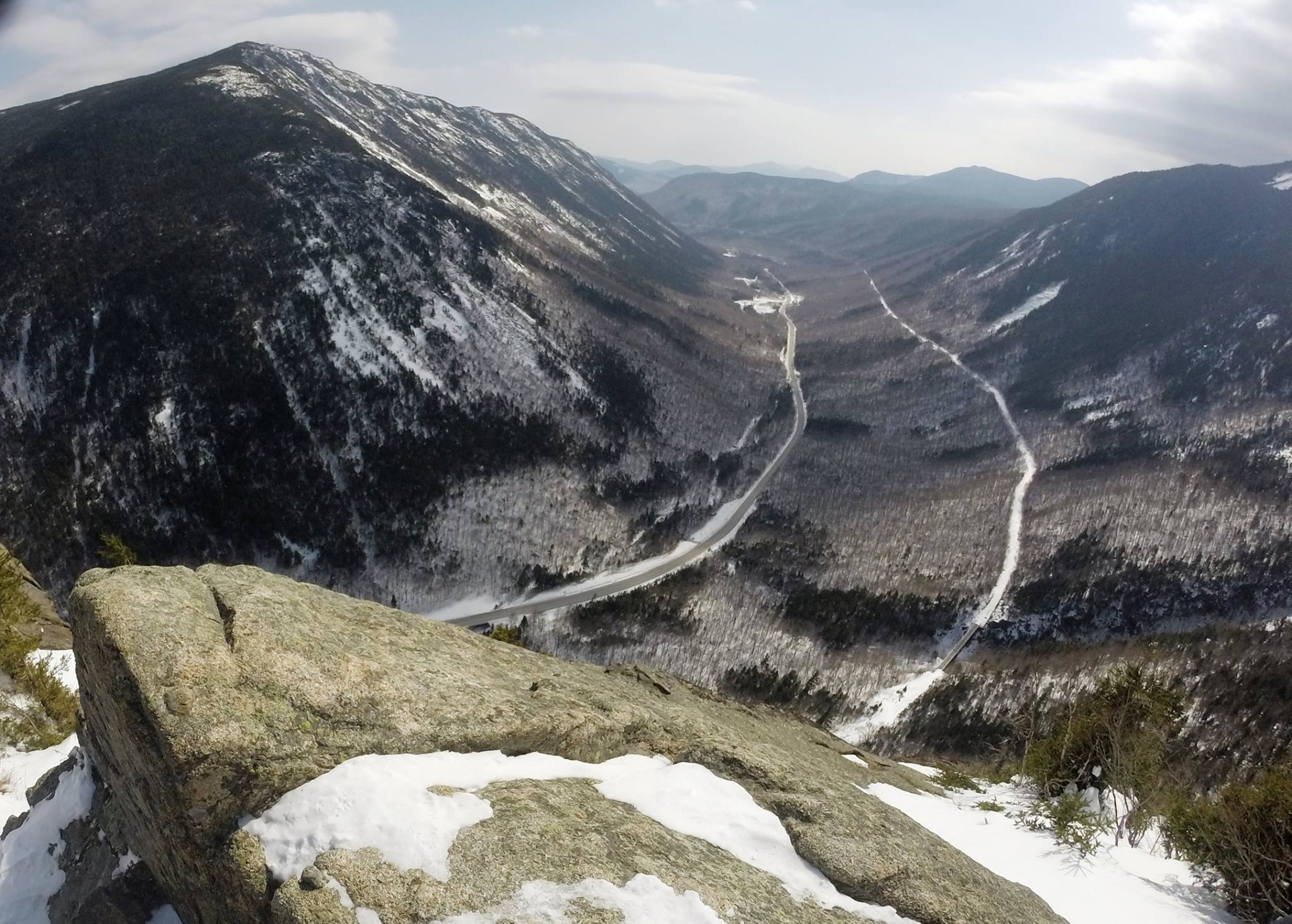
After a photo stop at Slant Rock, our first trail junction followed. I’m not sure now if we went left or stayed right at this spot, but I remember it started getting steeper. It had been fairly flat or easy slopes up to this point, and now we were starting the real climbing. We passed a few other groups along this stretch, one of which included a girl who was climbing her first mountain ever, and having a tough time of it as she labored her way up and across jagged rocky terrain, with others in her group helping her along. I remember thinking “Wow this is one hell of a first hike!” Indeed, there were those back at the lodge that were impressed that we picked these challenging peaks as my first 7 of the 46 despite the fact that I was a semi-seasoned hiker, and this girl was taking on Haystack as her first ever! You gotta respect that ambition. I certainly hope her experience affected her positively, and didn’t discourage her from future hikes. IMG_4495

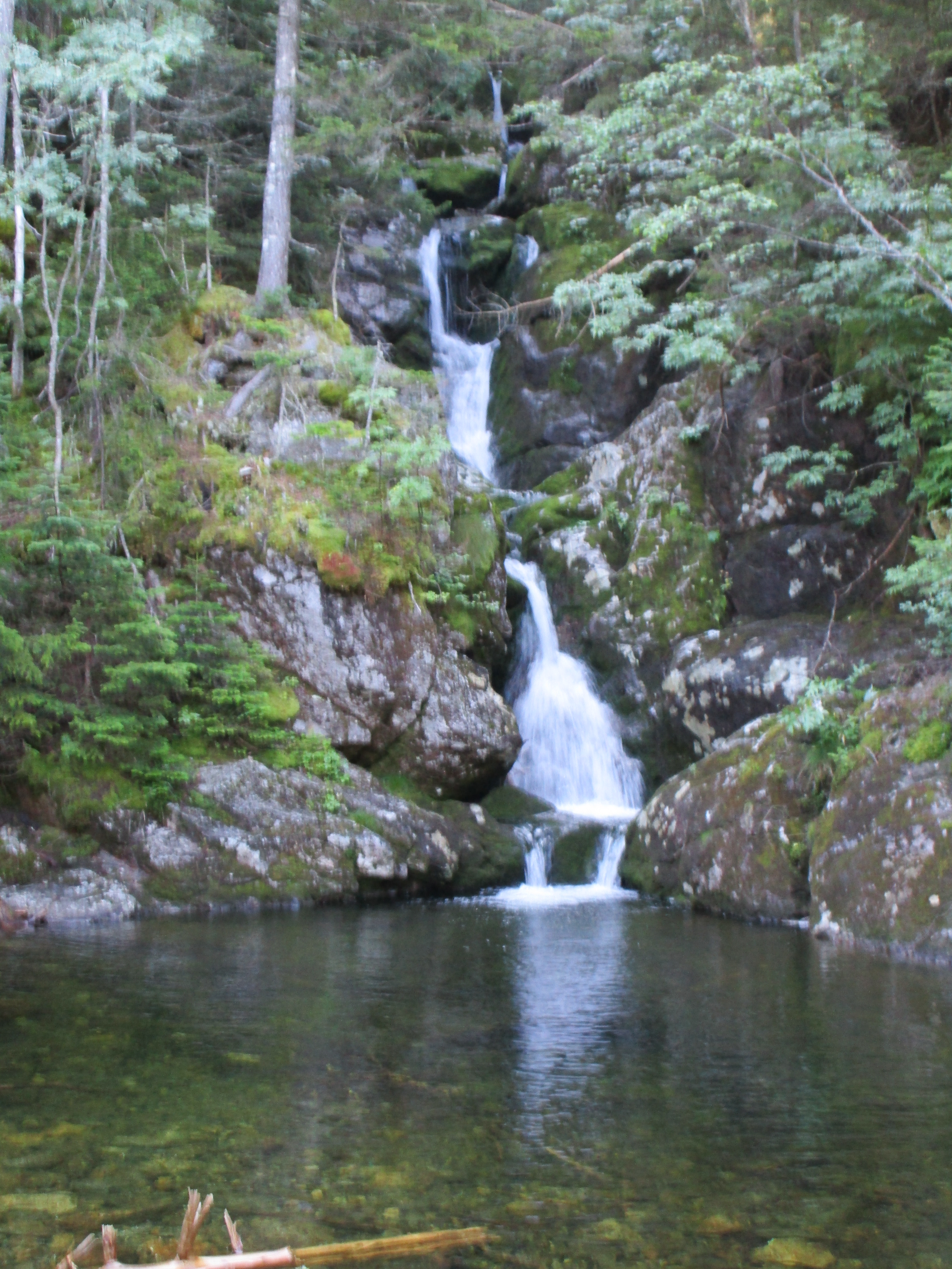
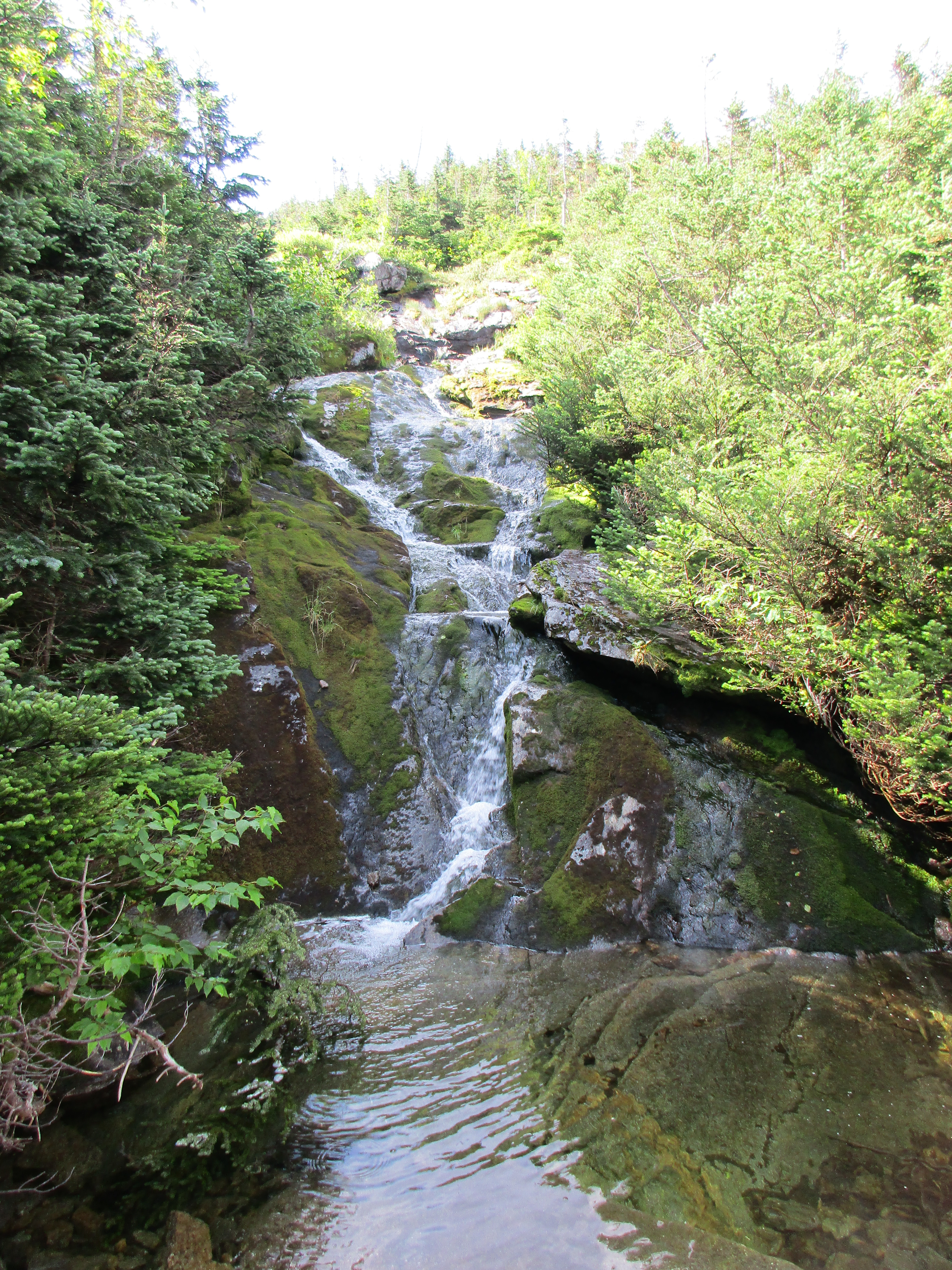
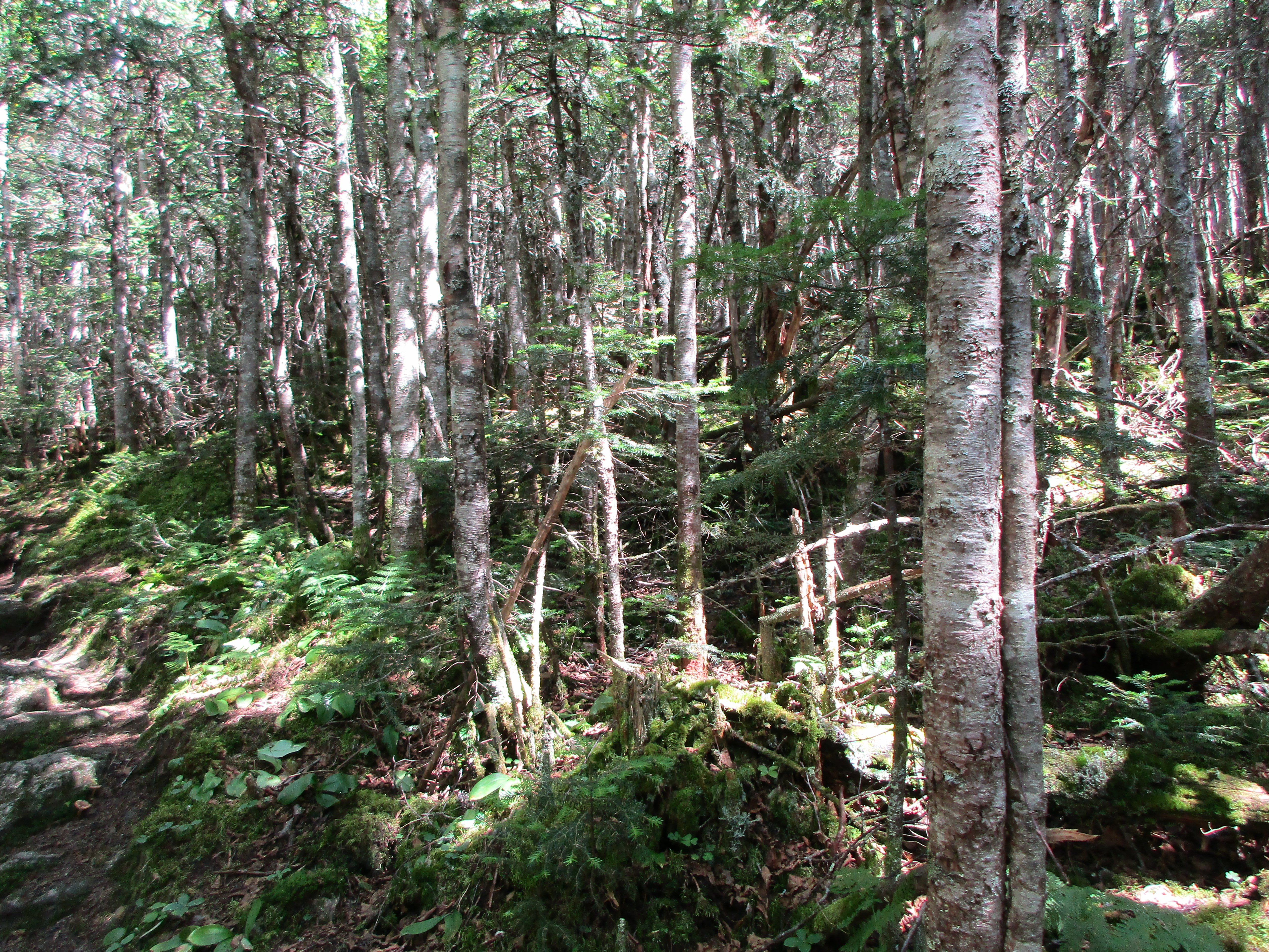
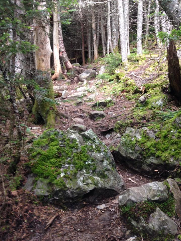
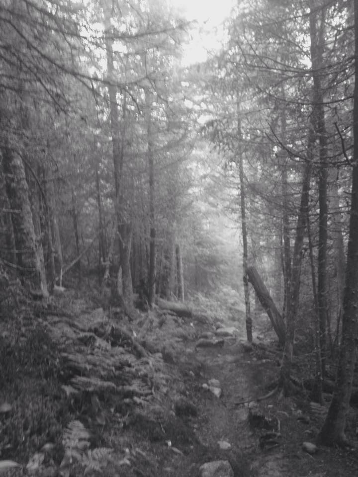
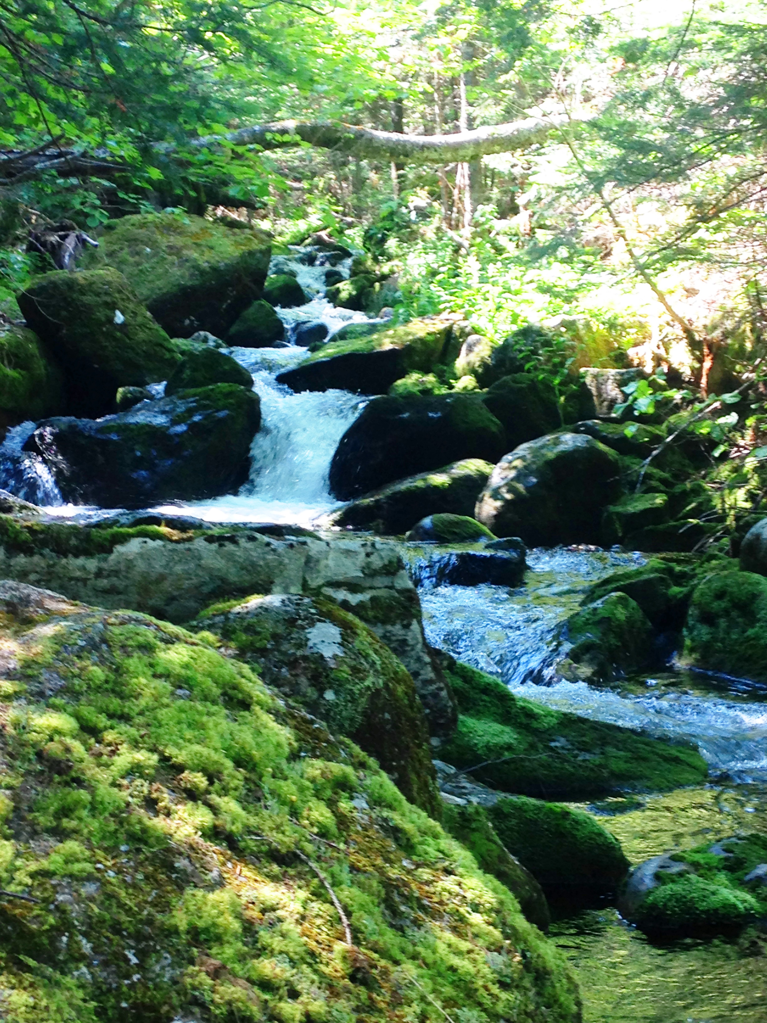
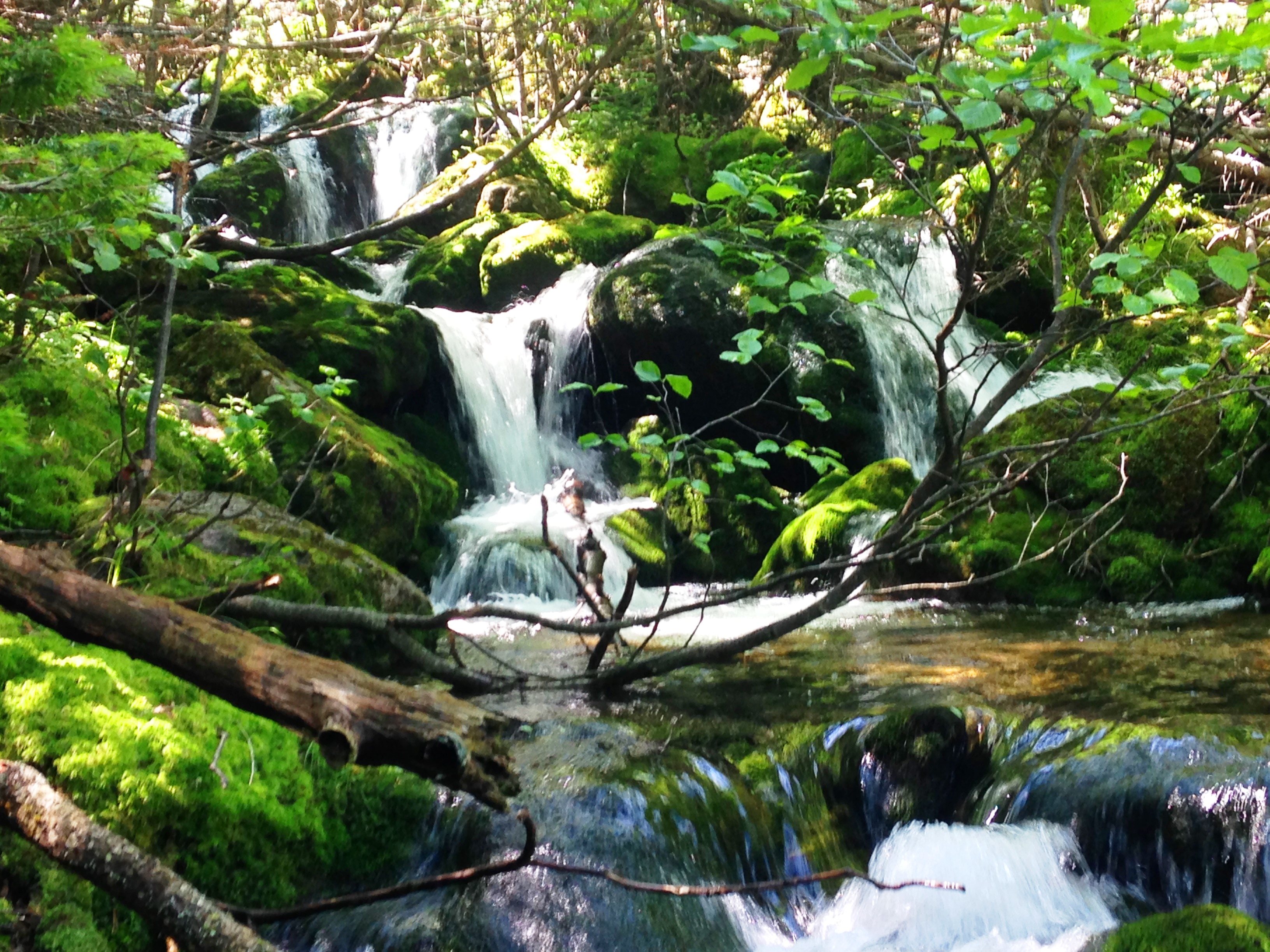
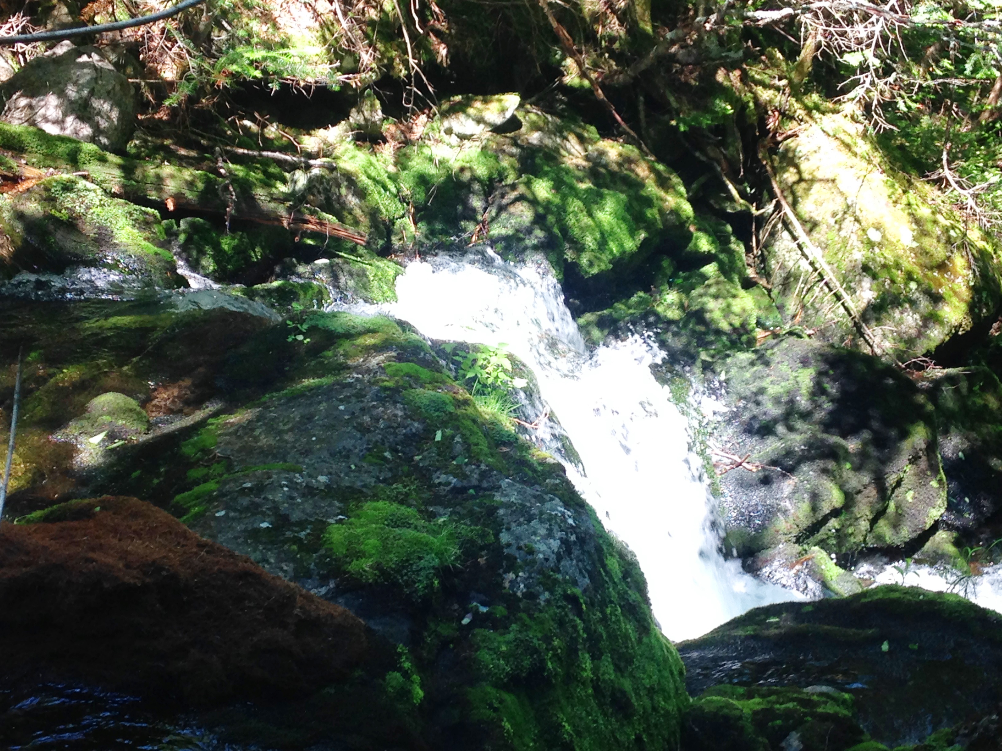
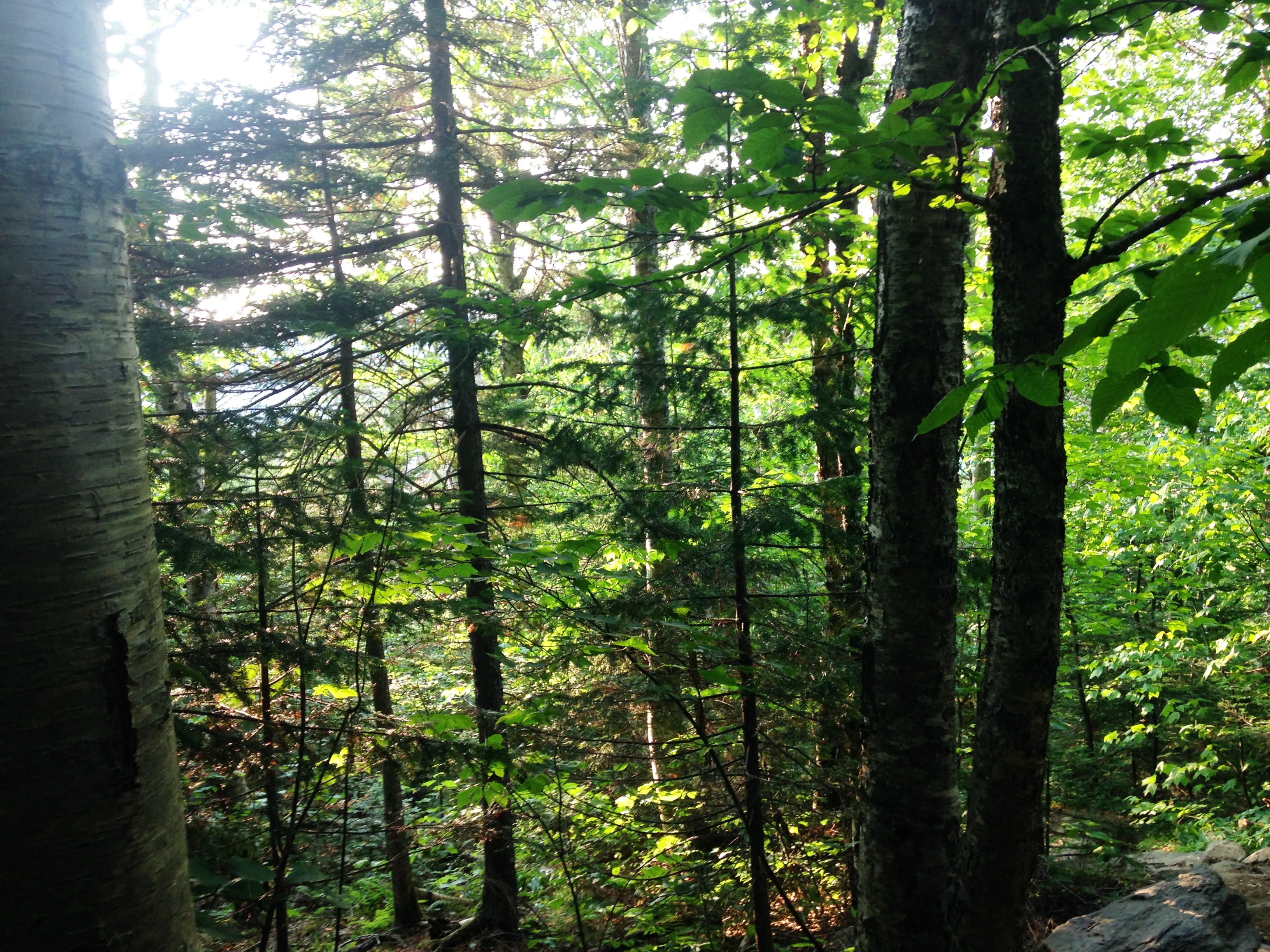
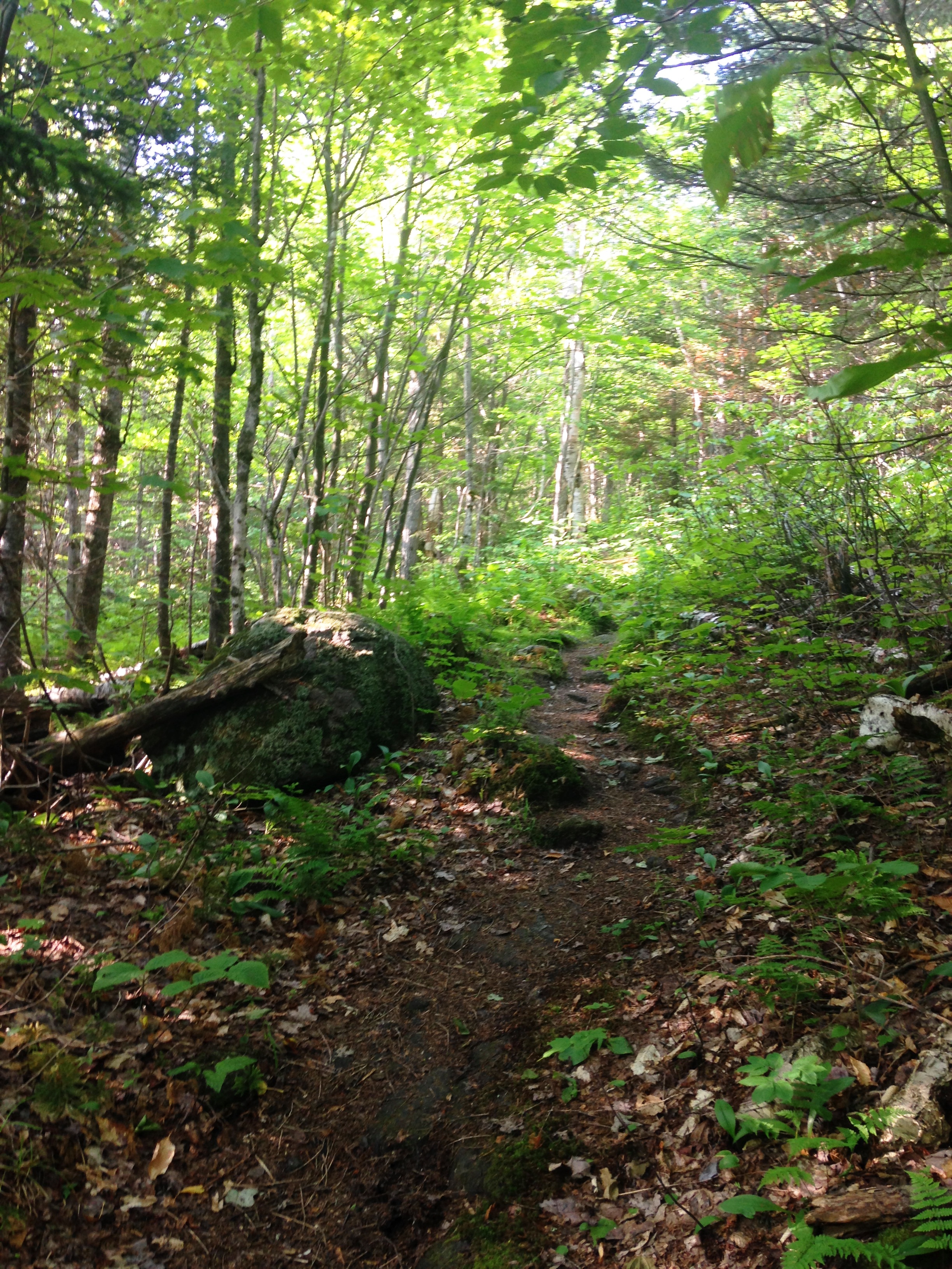
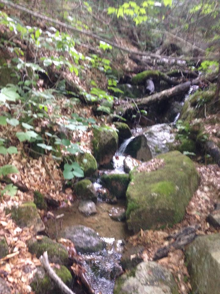
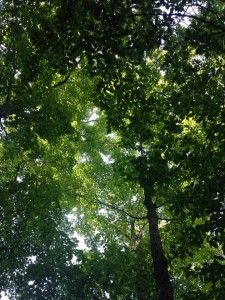
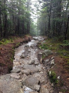
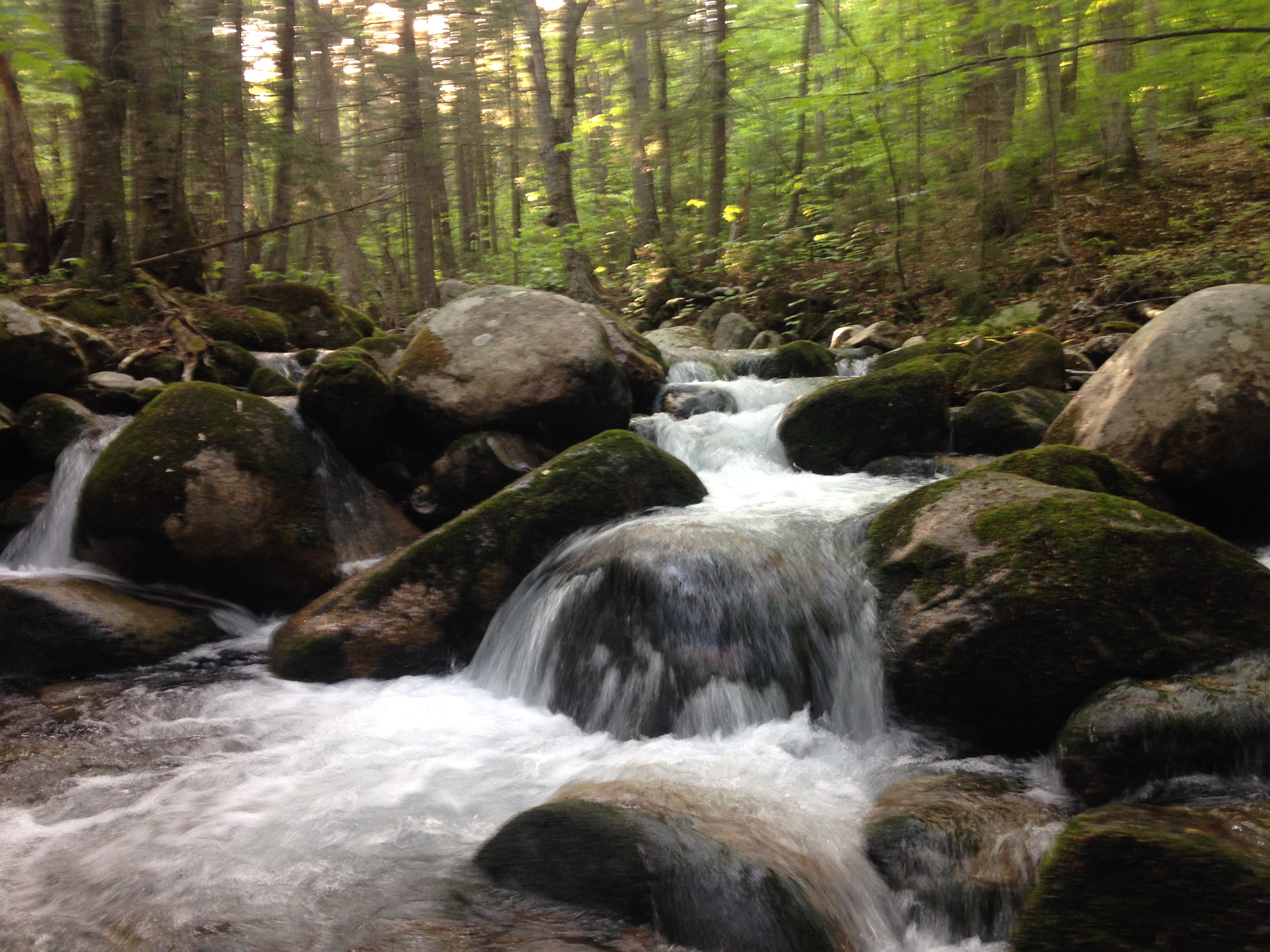
In any case, this place was having quite an effect on me already. It’s so beautiful here and different in many ways from the Whites, yet similar in a lot of ways too. The trail seems more neatly manicured and marked more consistently. They also seem to be used a bit less, showing less wear and tear and more spaciousness. This is by no means a knock on the fabulous trail crews of the Whites. They do an amazing job on the trails given their ever increasing use. That being said, there is no getting around the rustic look of a heavily trampled White Mountain trail. The Whites also seem to have way more options for trail routes to any given destination. They do both have their fair share of rocky steepness, rushing brooks and streams, thick forests, and of course mud.Muddy-Trail

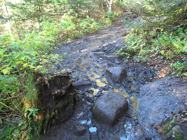
At some point Therese tripped clumsily over a downed tree while attempting to avoid a particularly nasty mud pit and ended up landing in it. Now that’s being truly connected to nature and becoming one with the trail. It was one of those classic slow motion falls too “Nooooooooooo!” – Of course we both had a good laugh but were otherwise unfazed and undeterred in our mission.IMG_4418

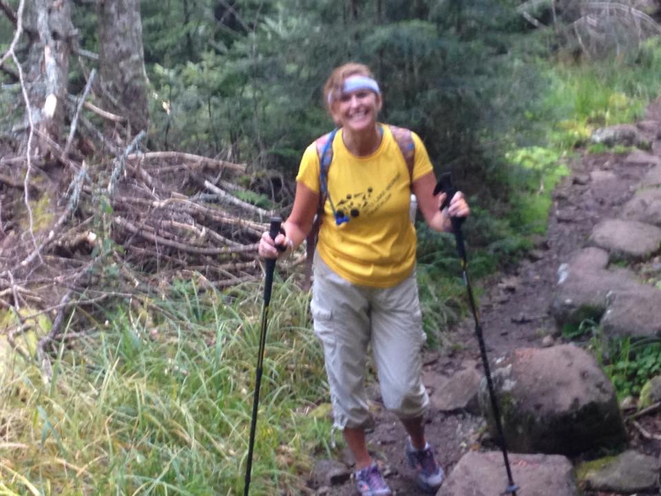
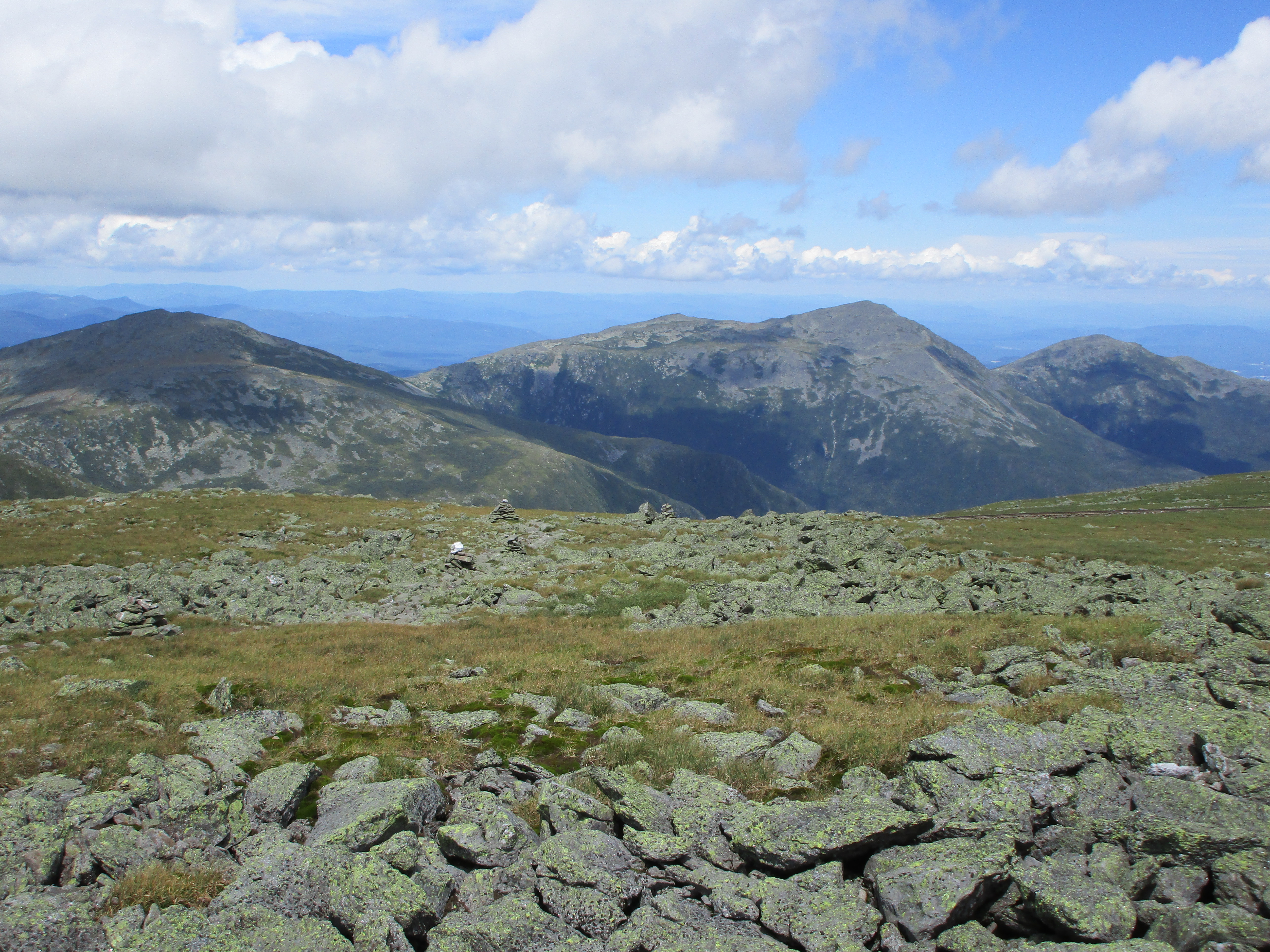
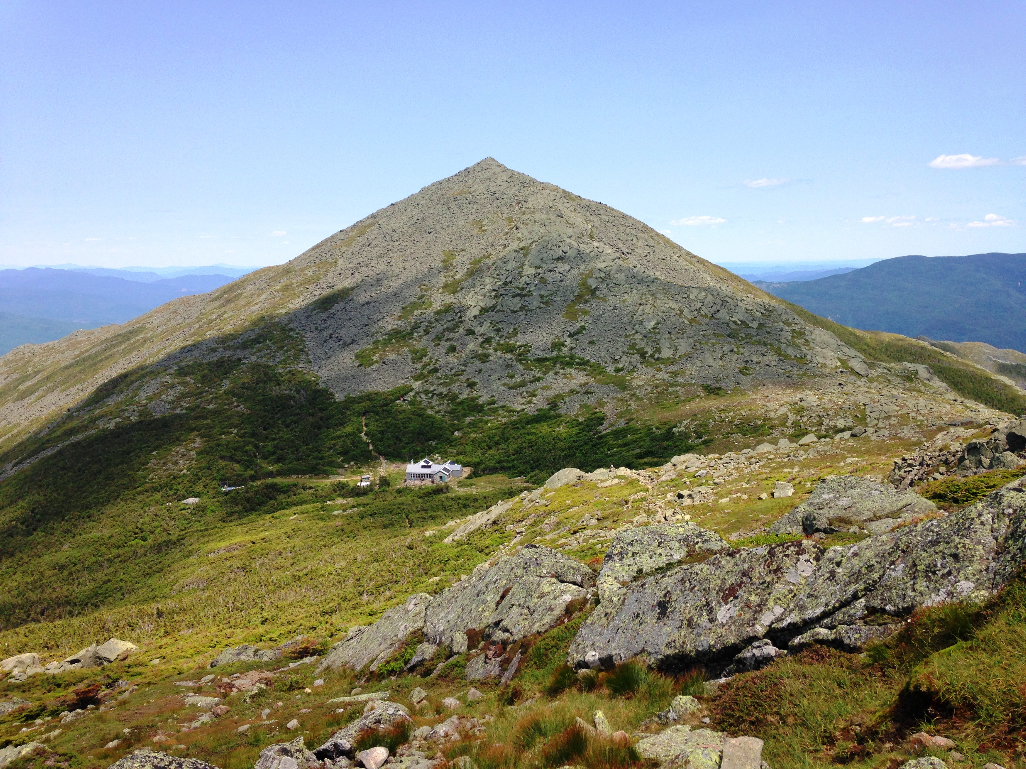
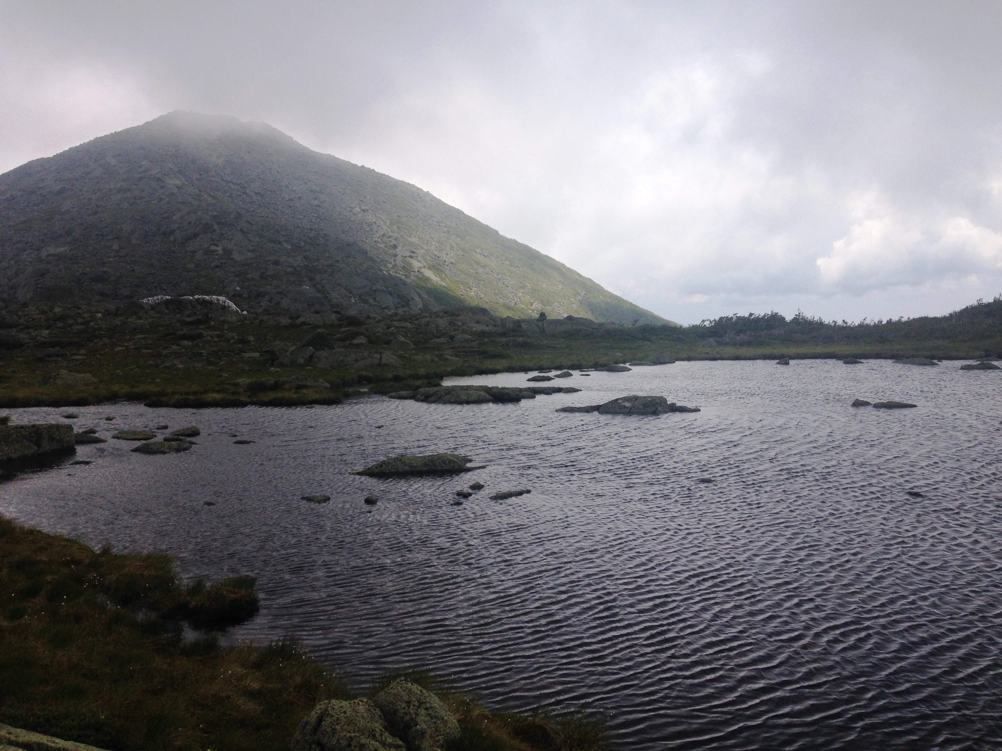
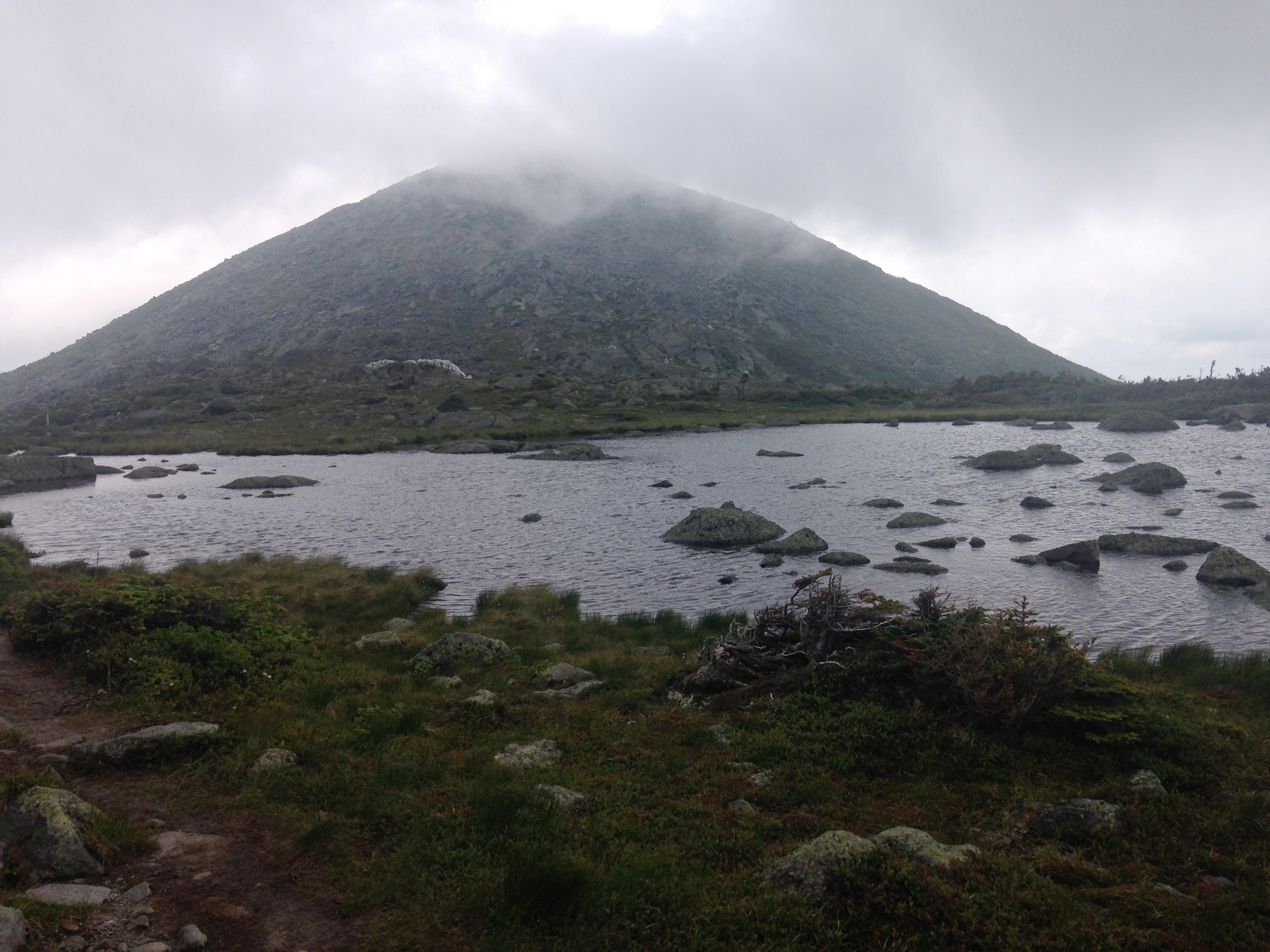
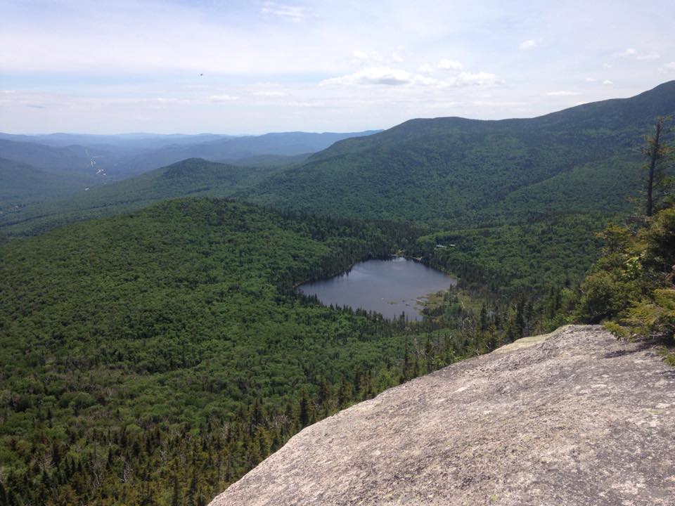
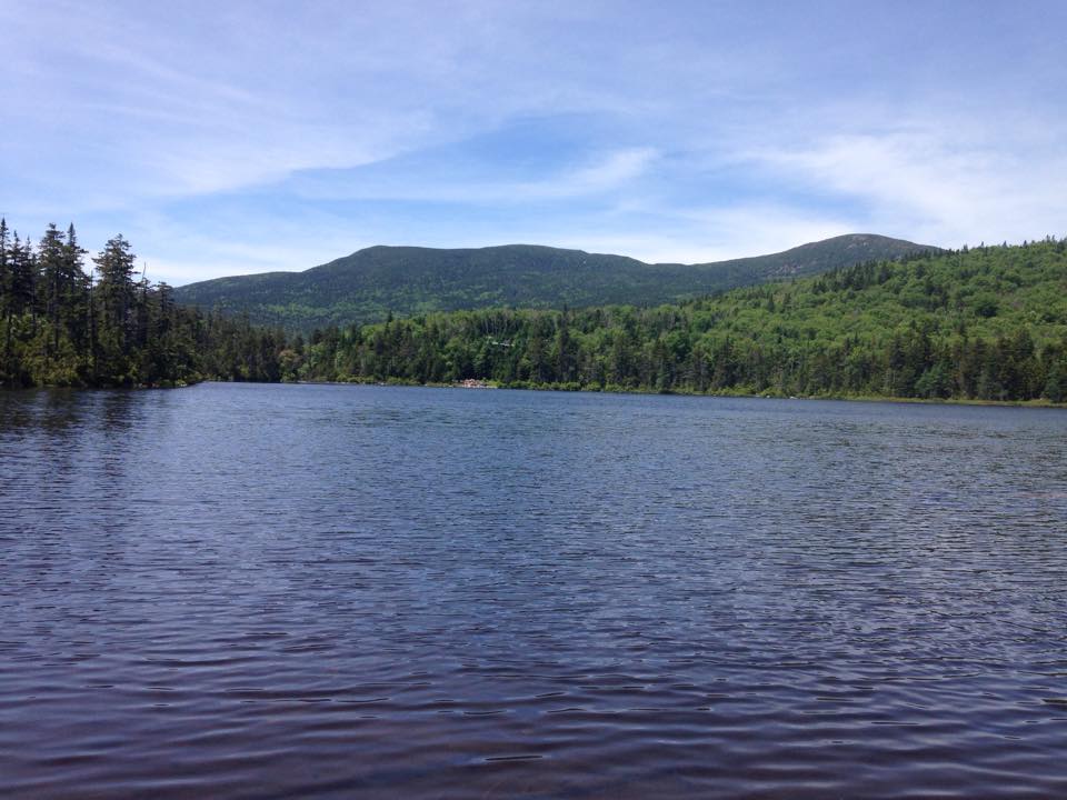
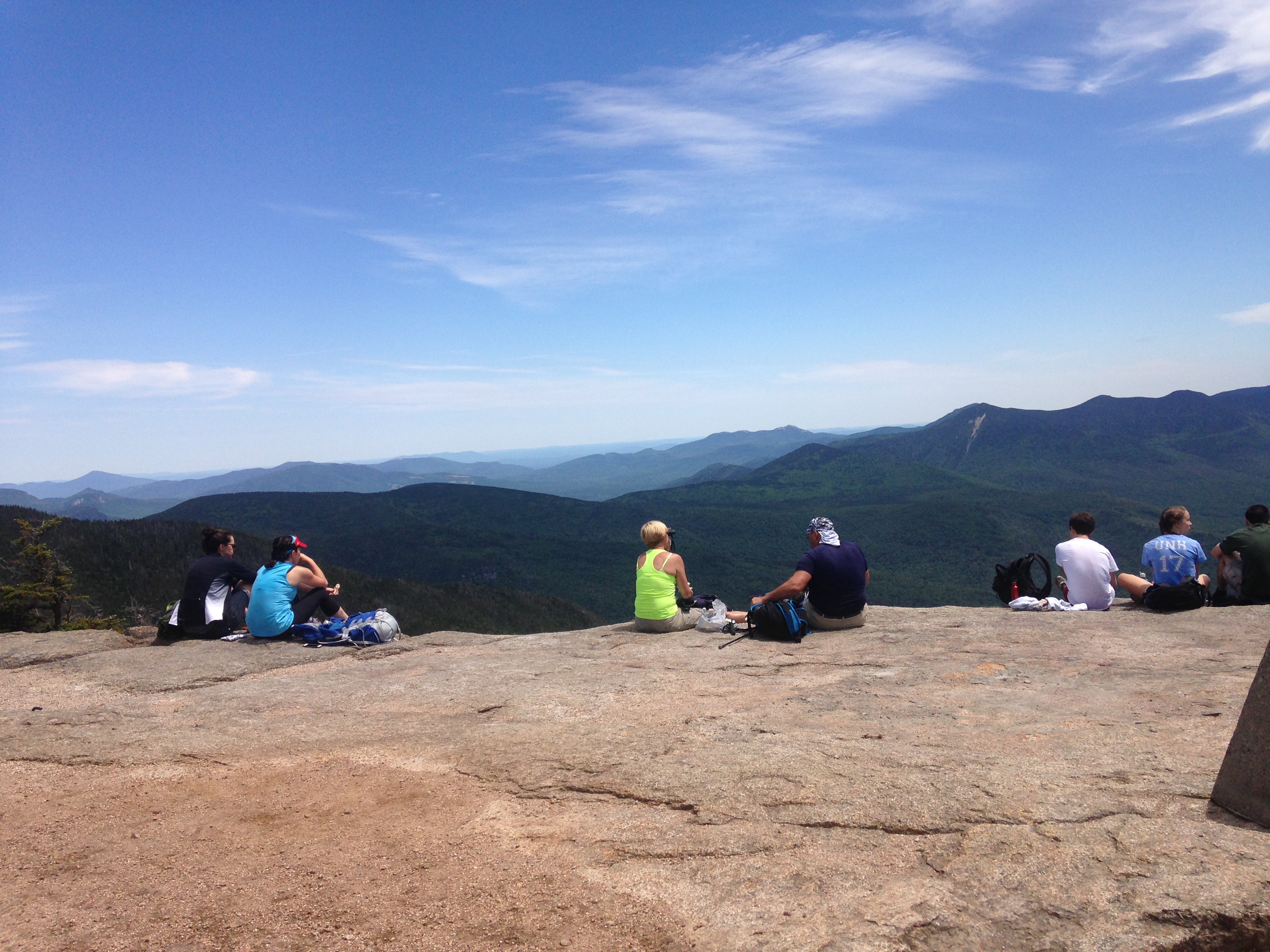
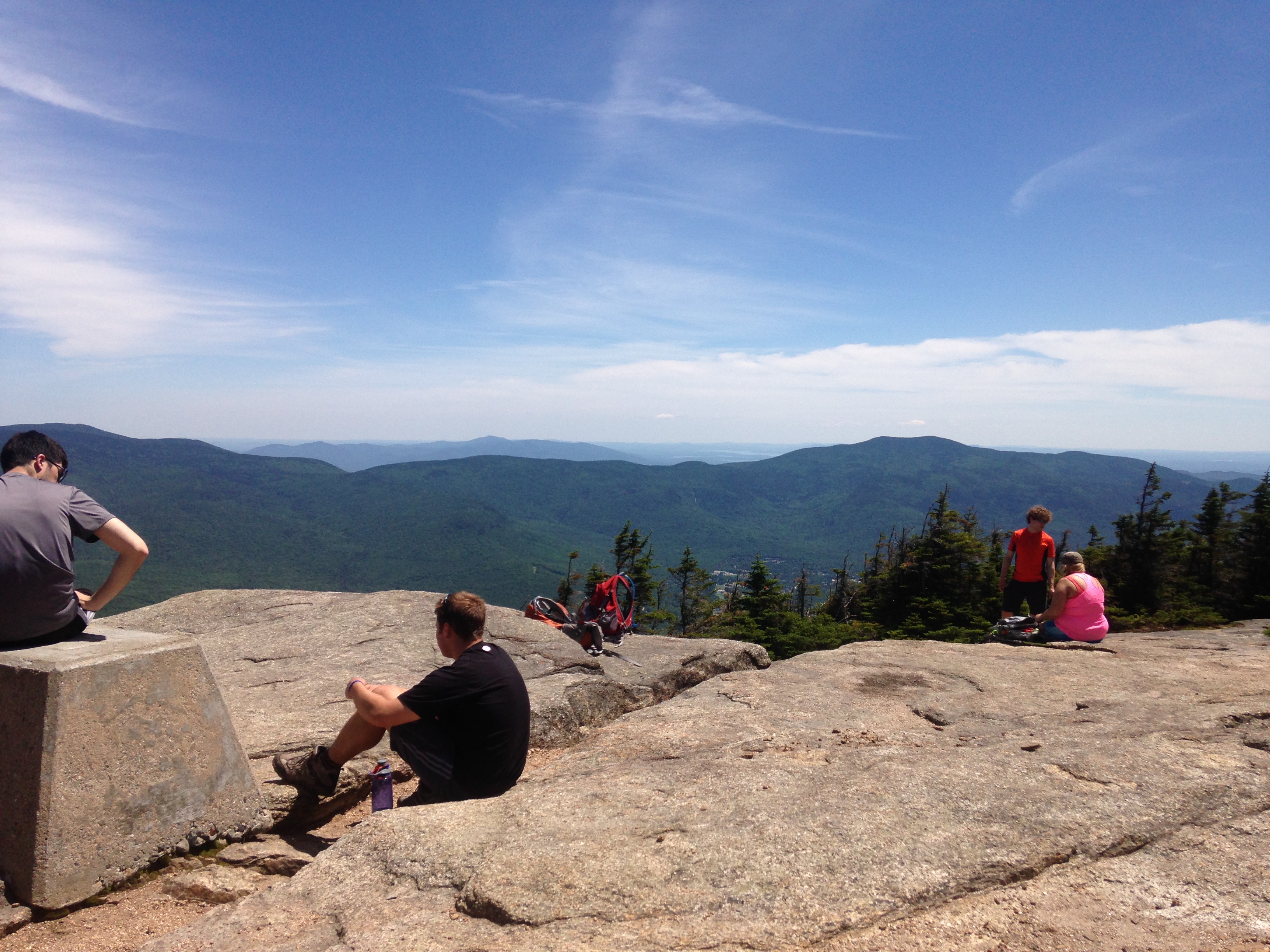
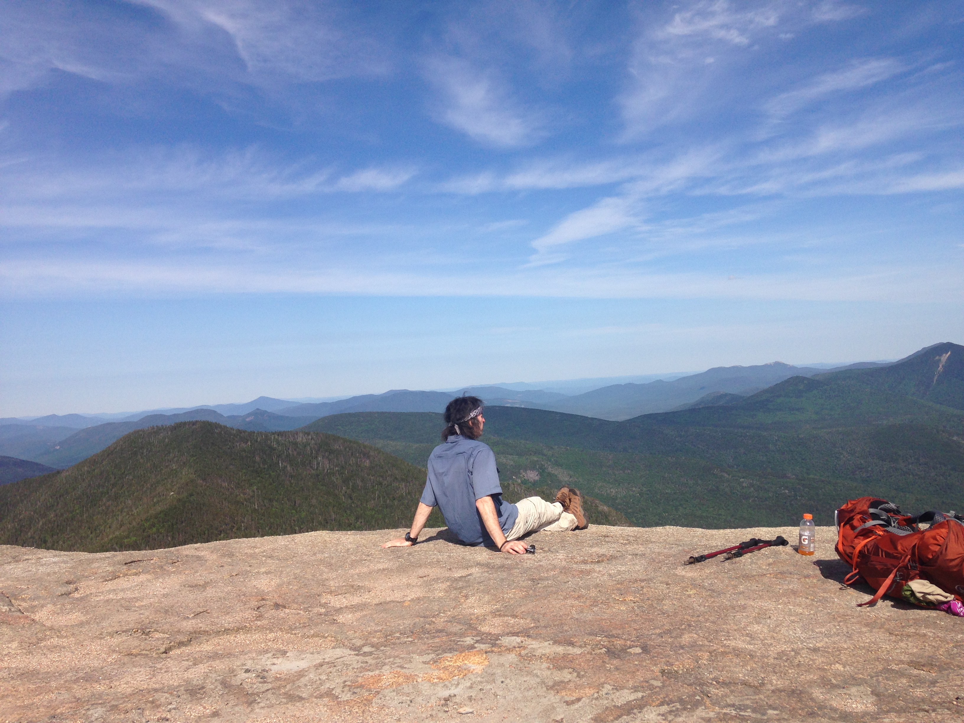
When we reached Little Haystack (a sub-peak of Haystack), our gabby friend was there with her group, part of which was the girl and her helpers that we had passed earlier and was still some ways back from joining the group I’m sure. Another of the group, if memory serves, was set to “finish” this weekend and become part the elite group of 46ers. We chatted for just a bit while we enjoyed the views, but broke away at the first pause to get ahead of the babble. After all, we still had many miles ahead of us. The final push to Haystack was a bit of a scramble, and then at last we arrived.IMG_0409

IMG_4464
from Haystack, a view of Marcy

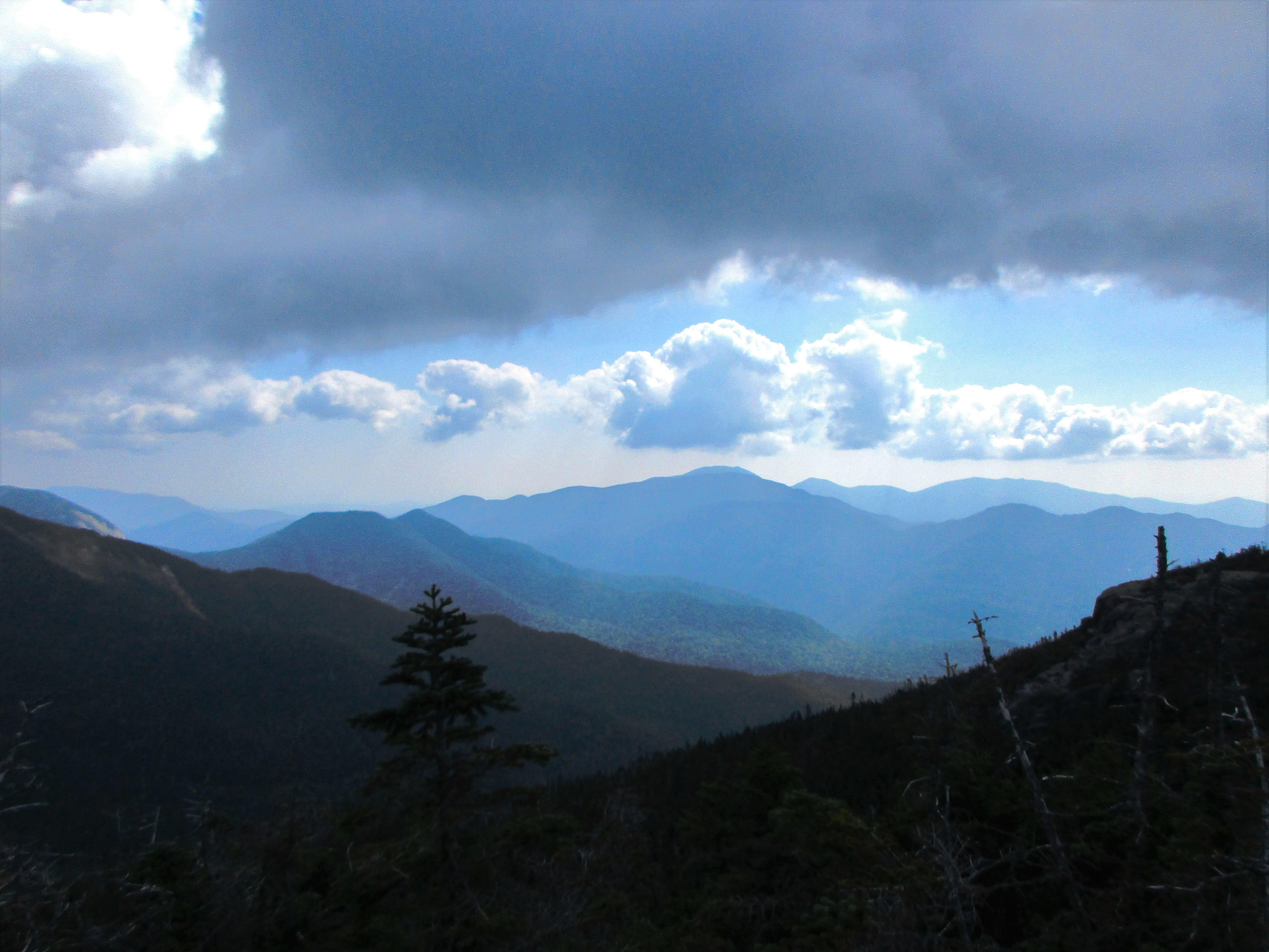
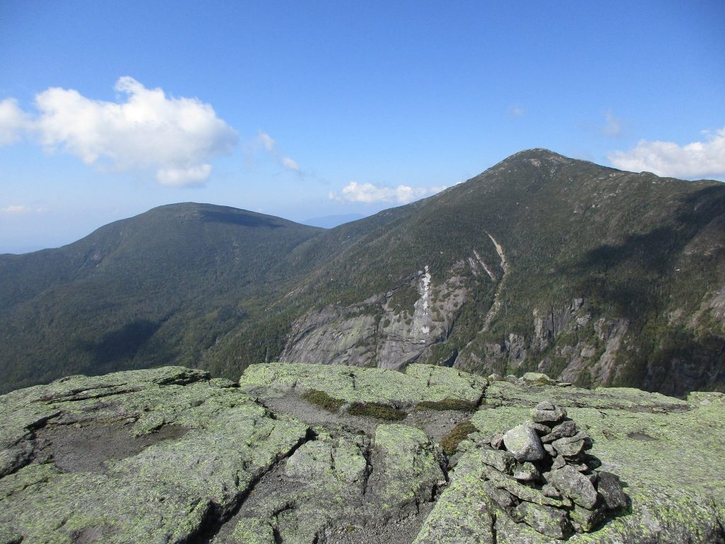
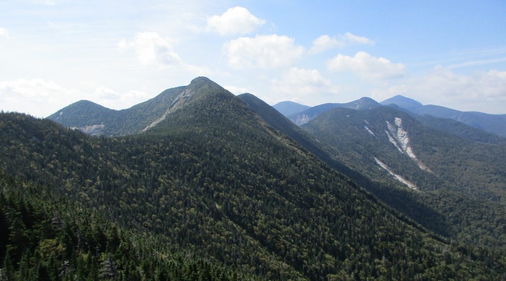
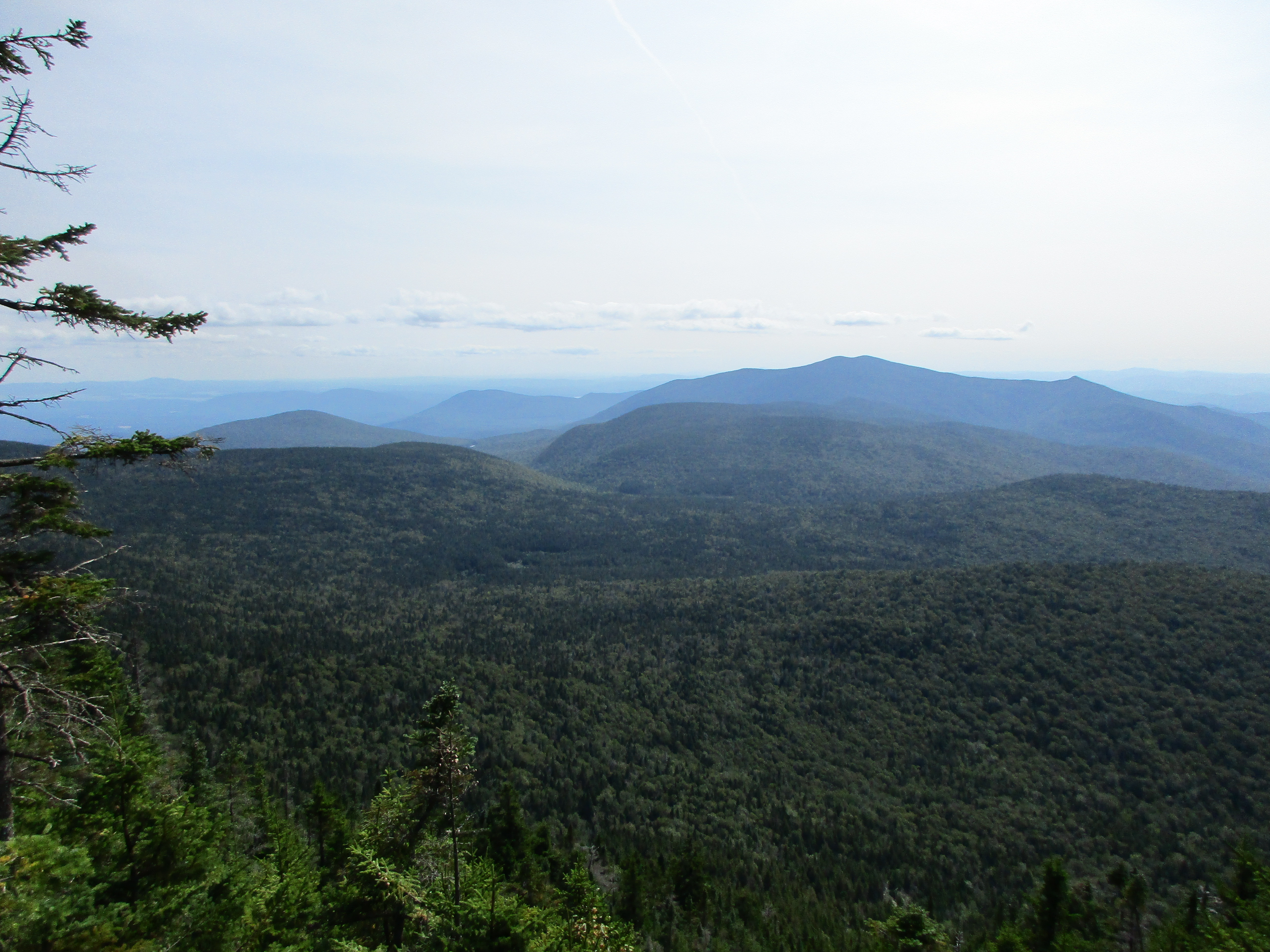
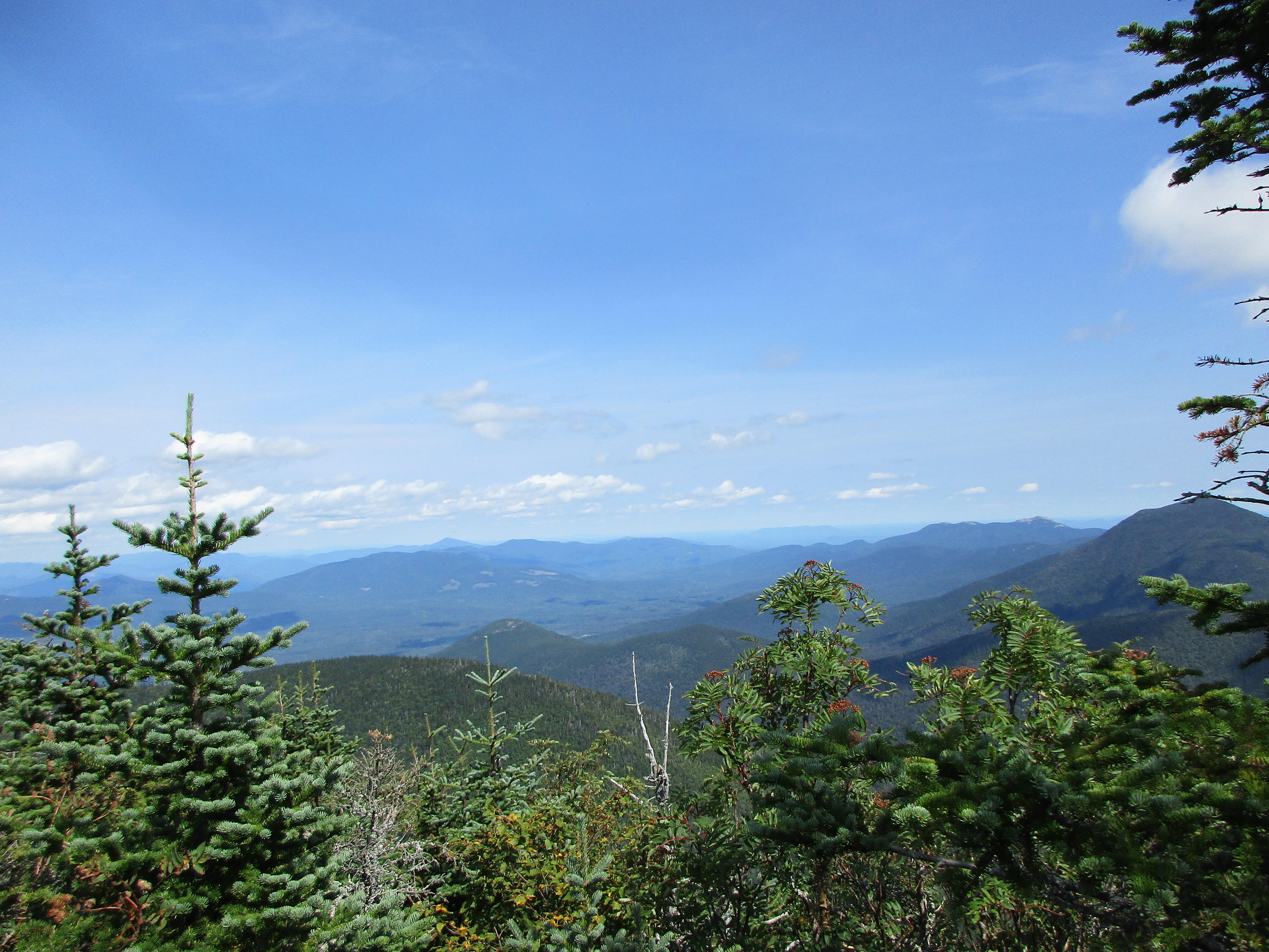
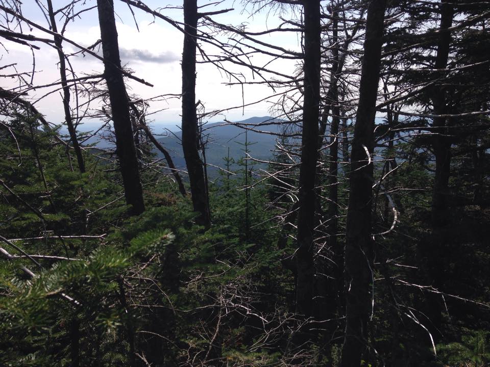
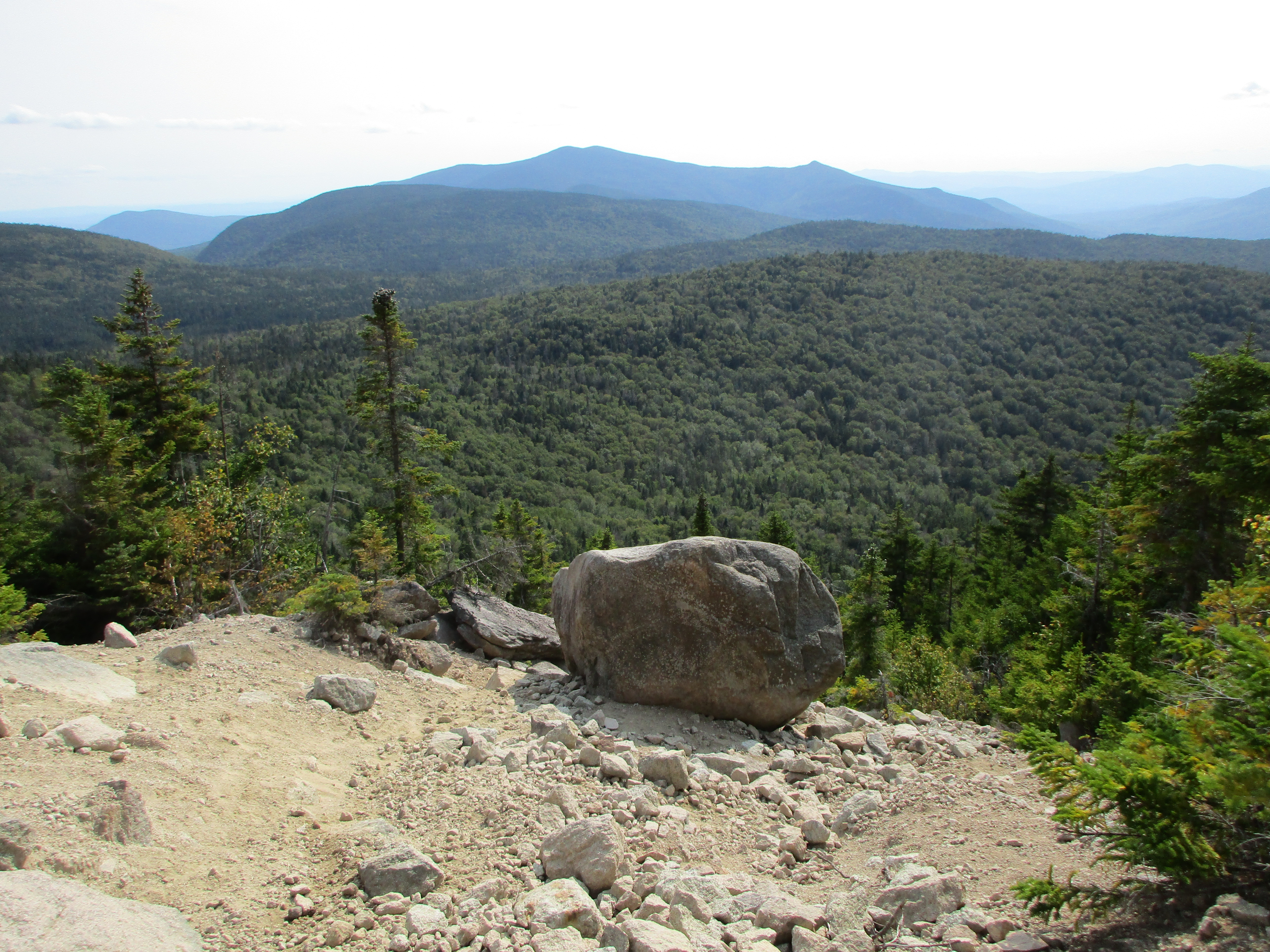
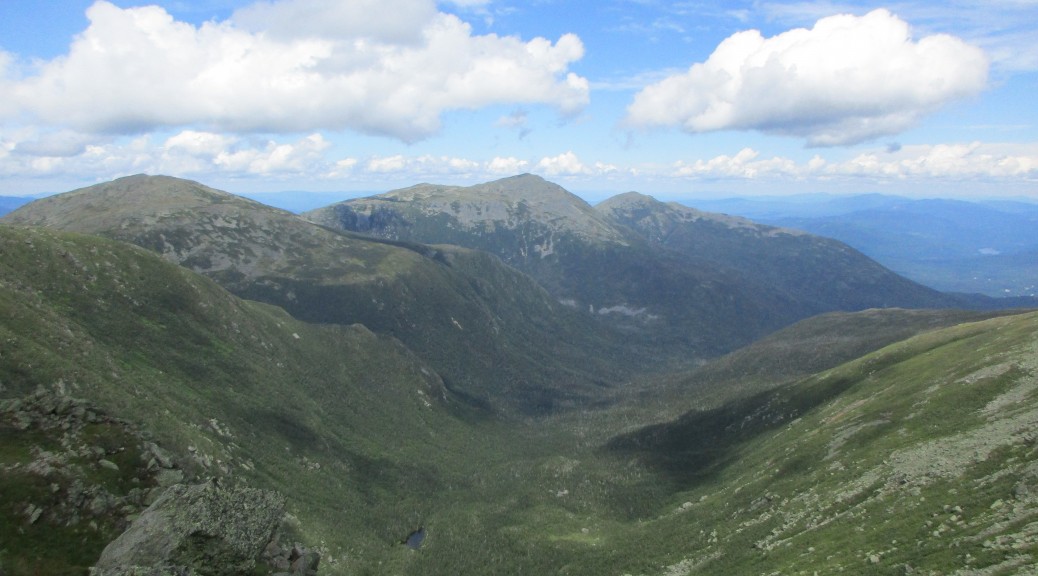
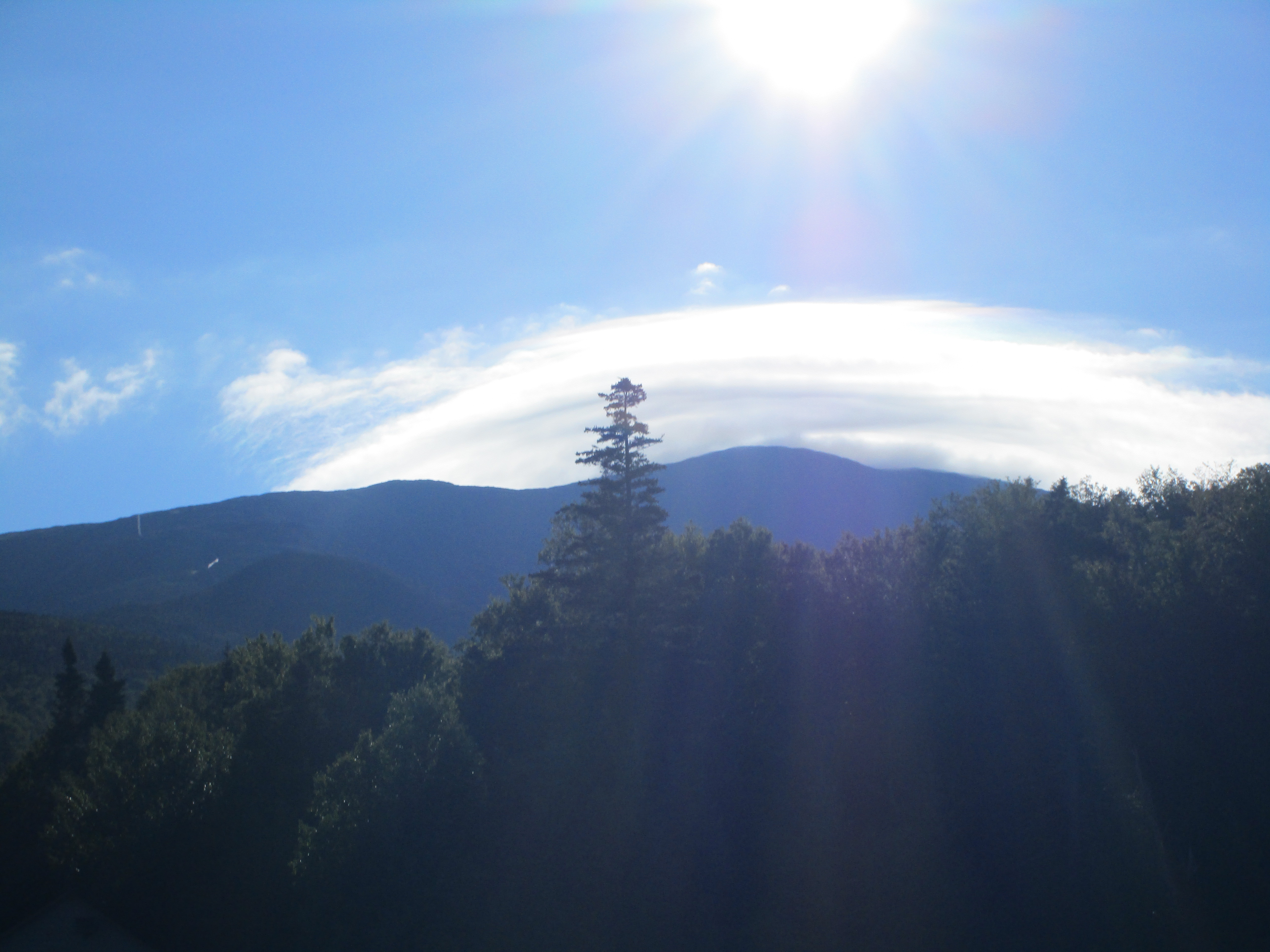
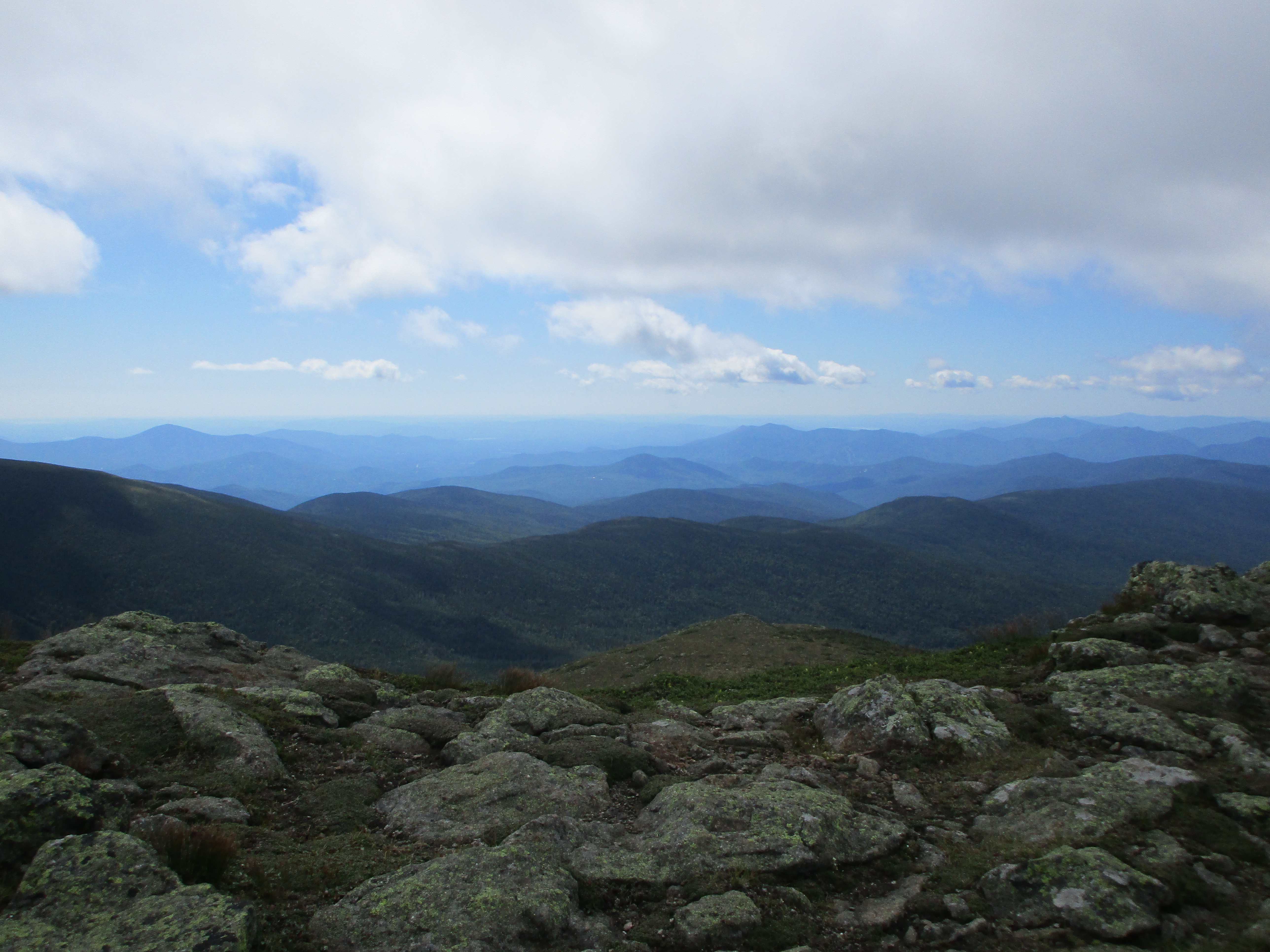
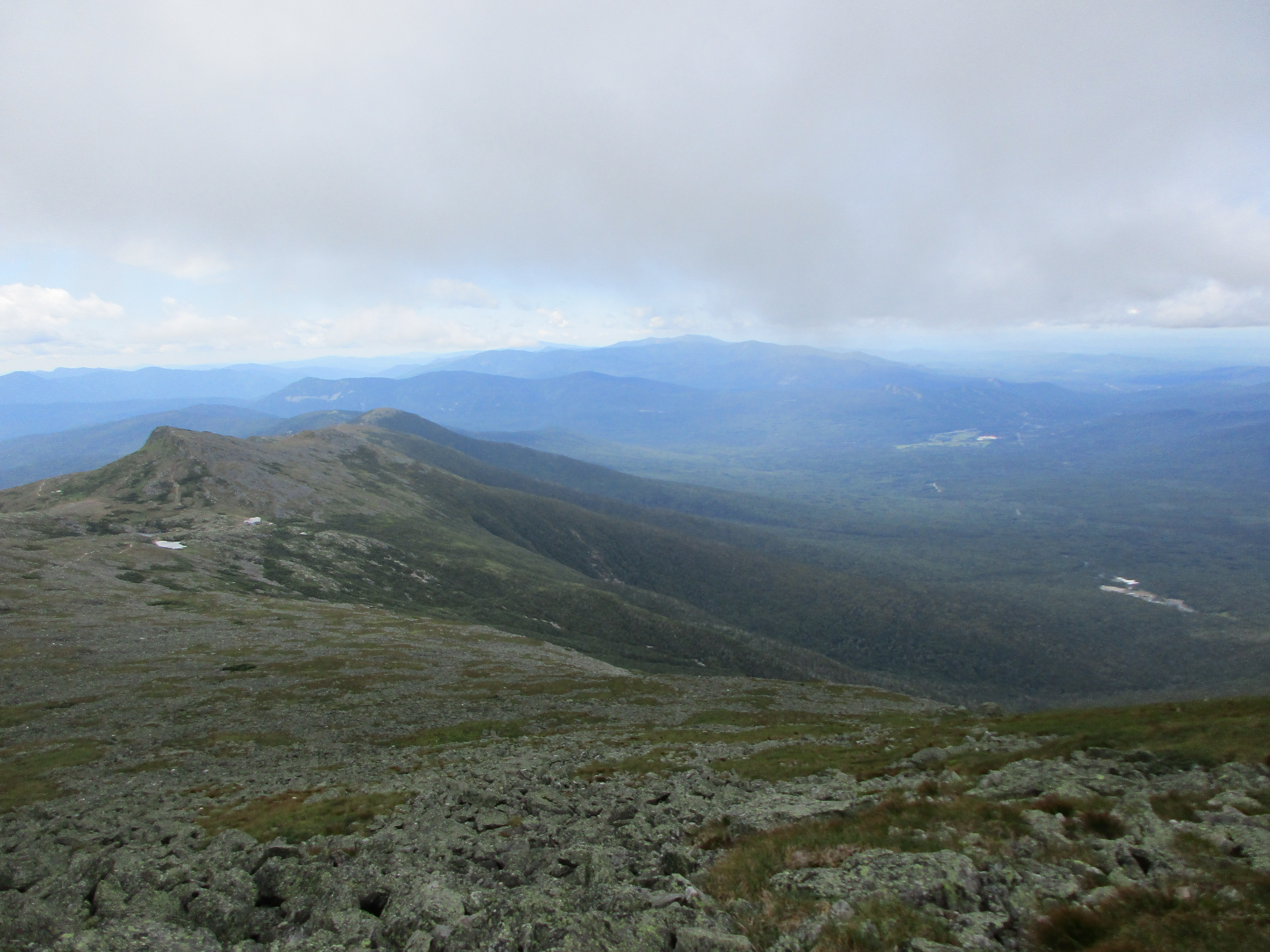
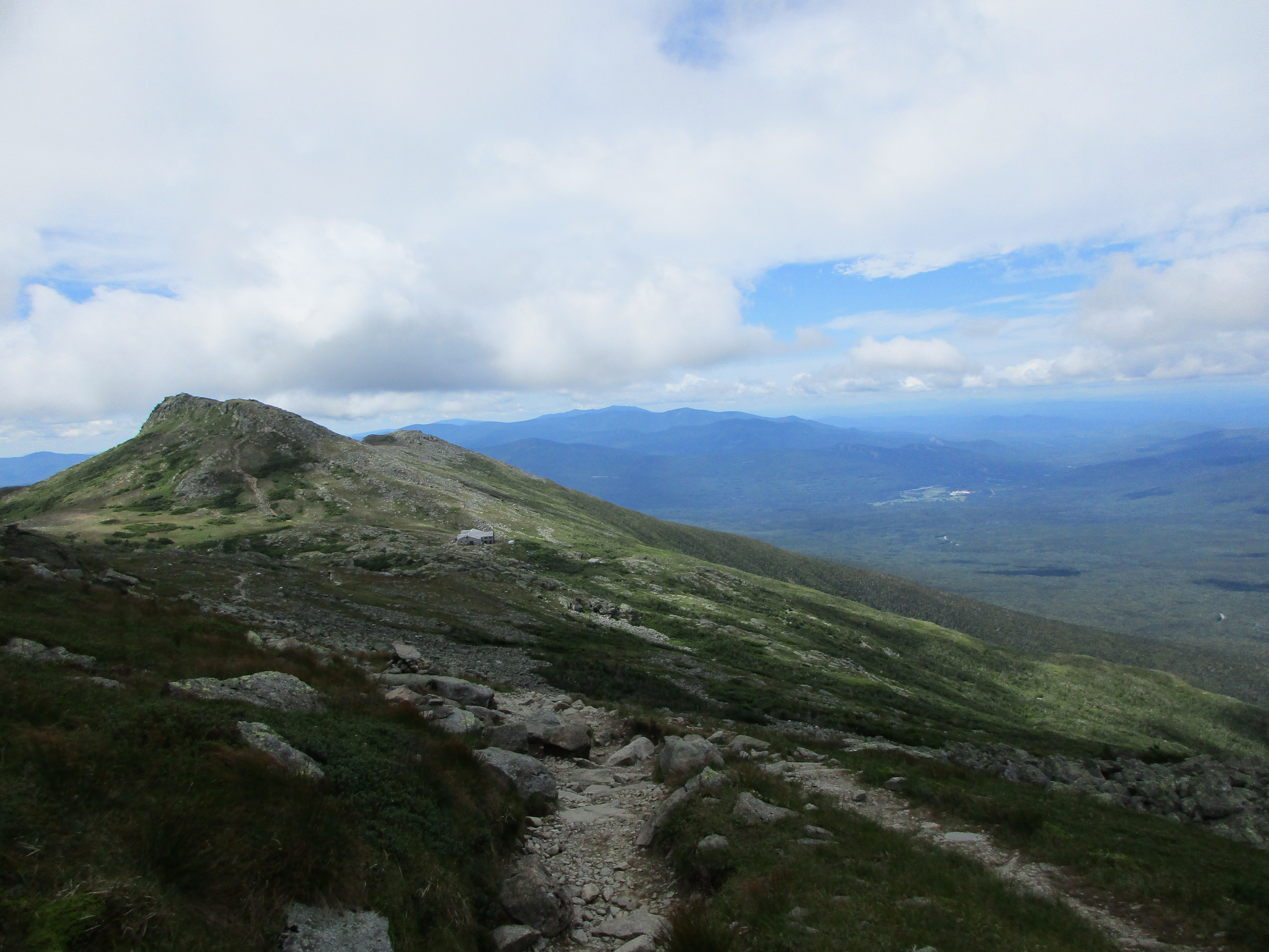
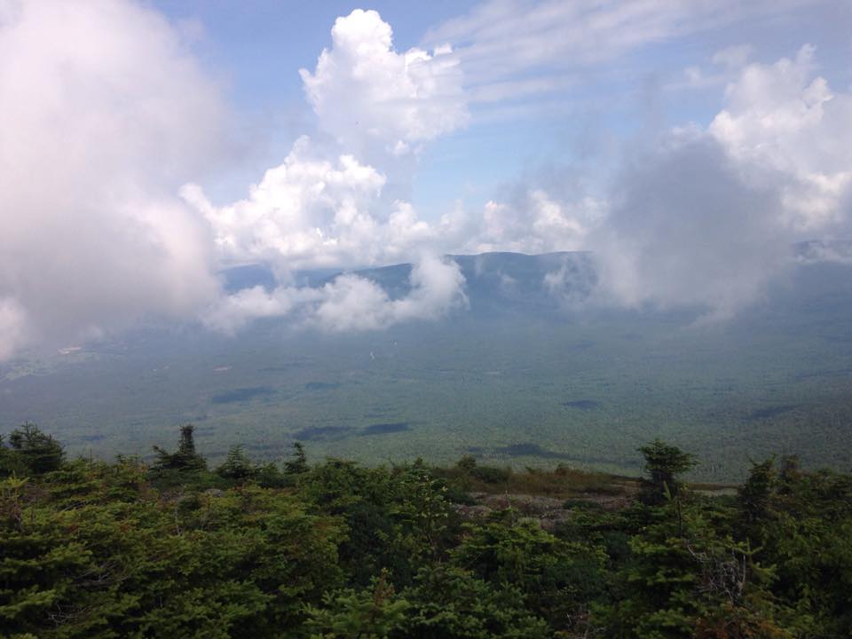
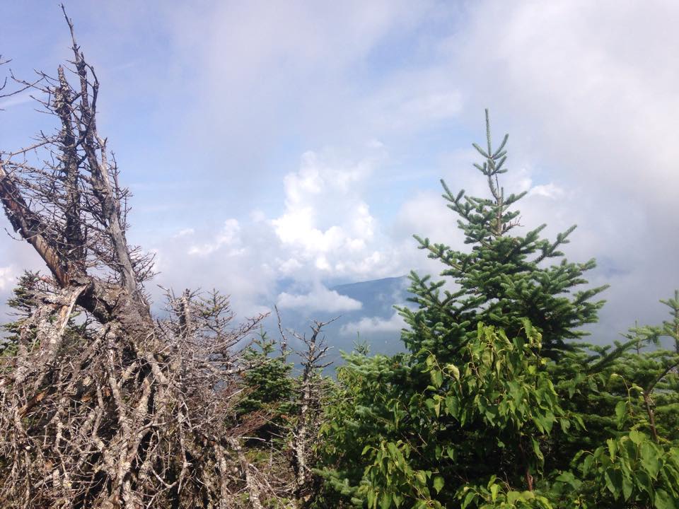
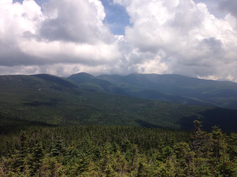
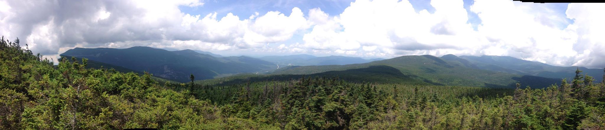
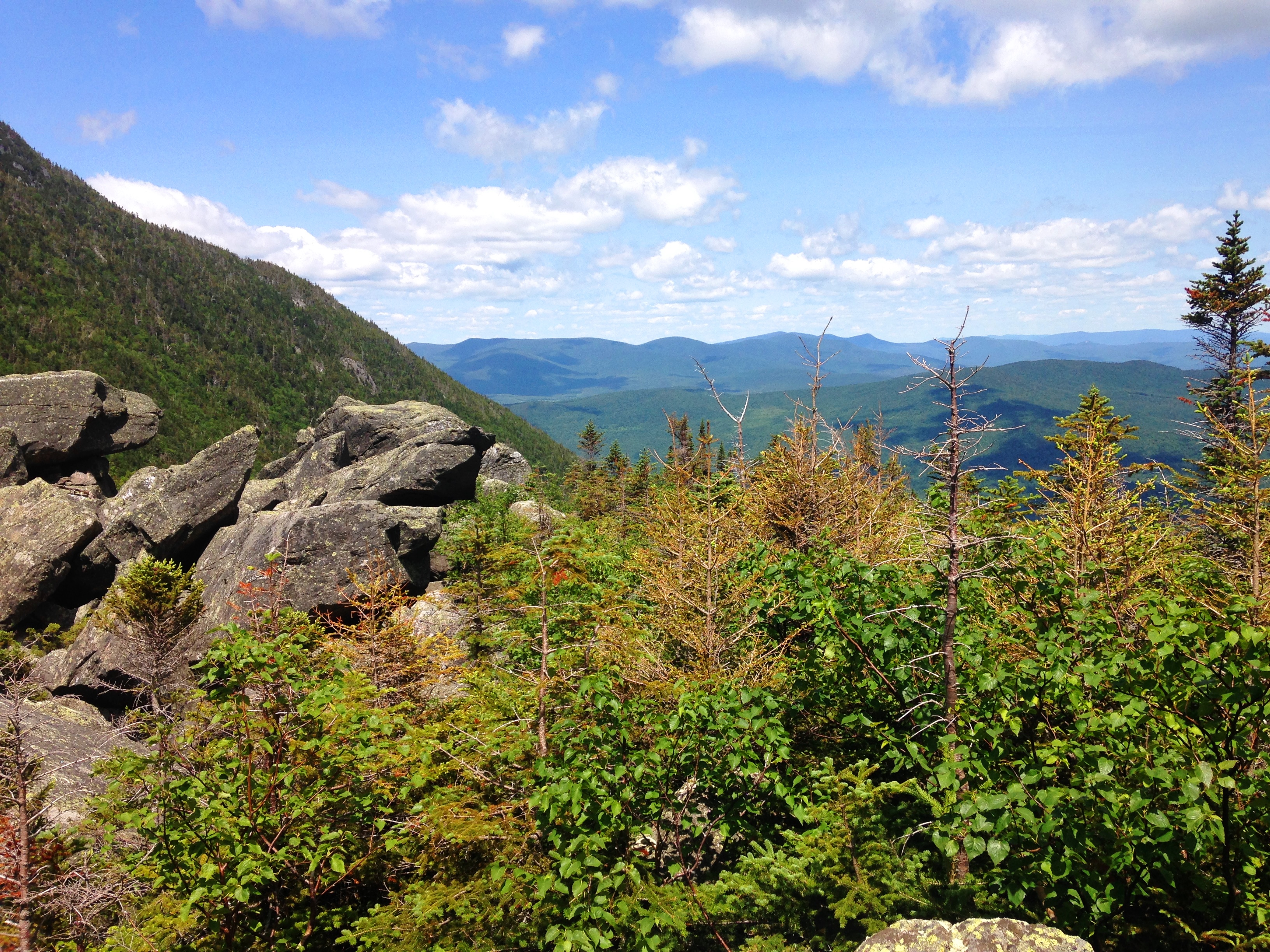
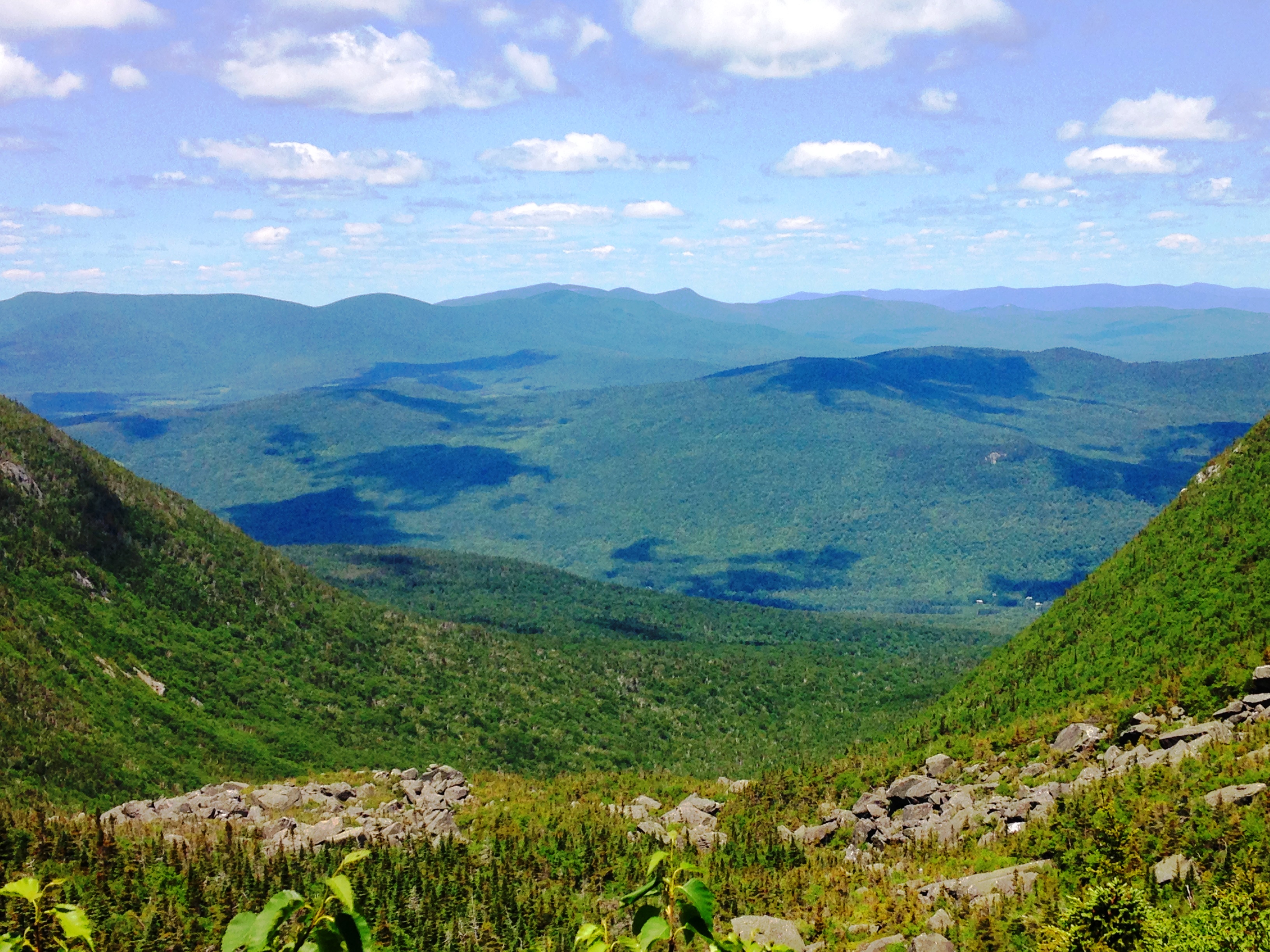
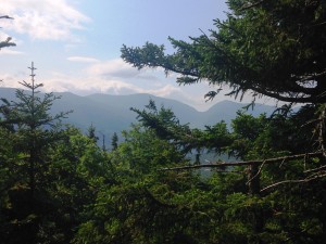
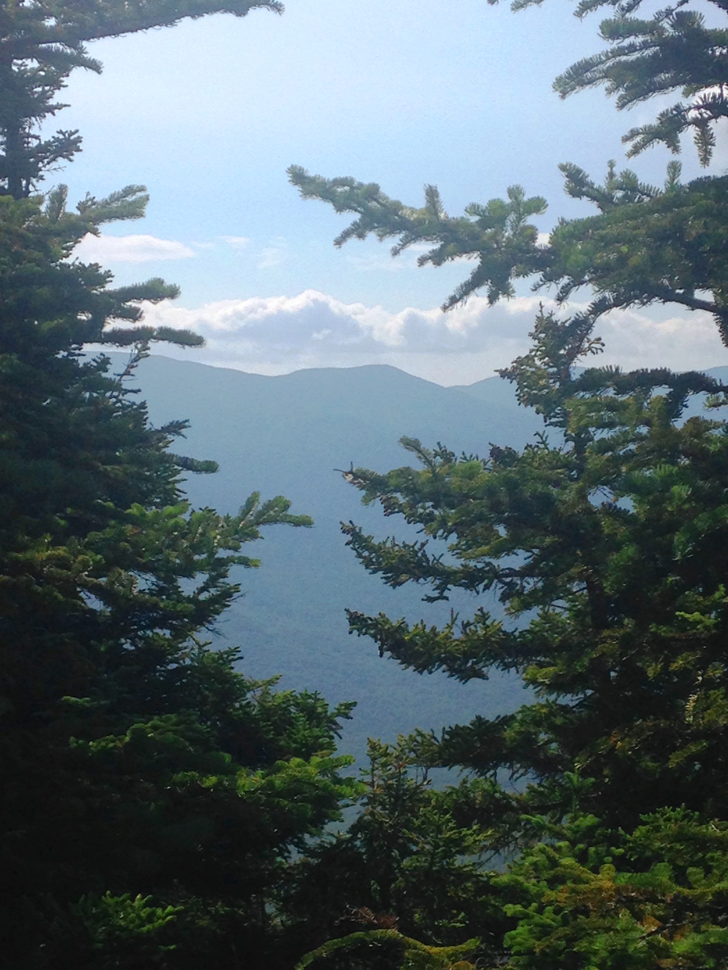
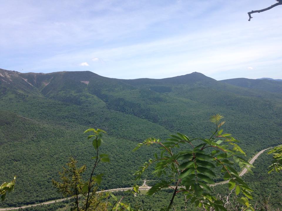
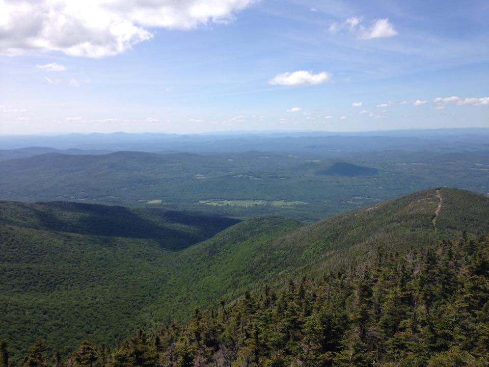
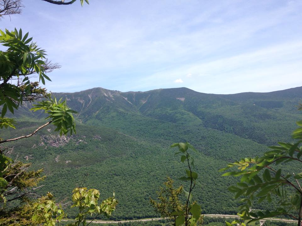
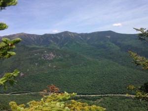
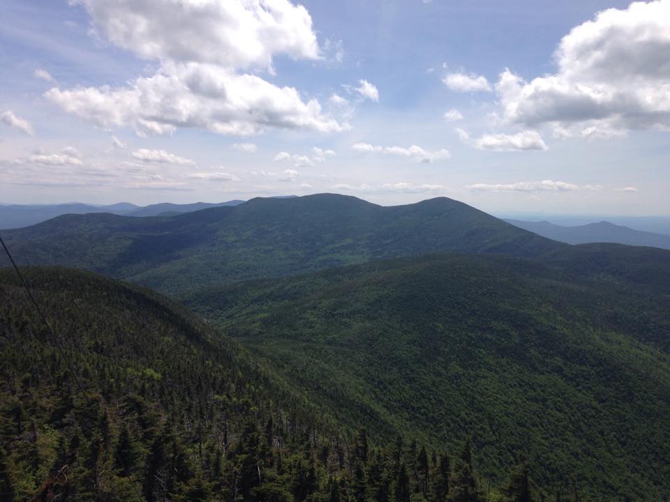
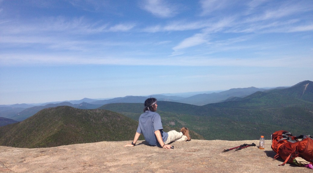
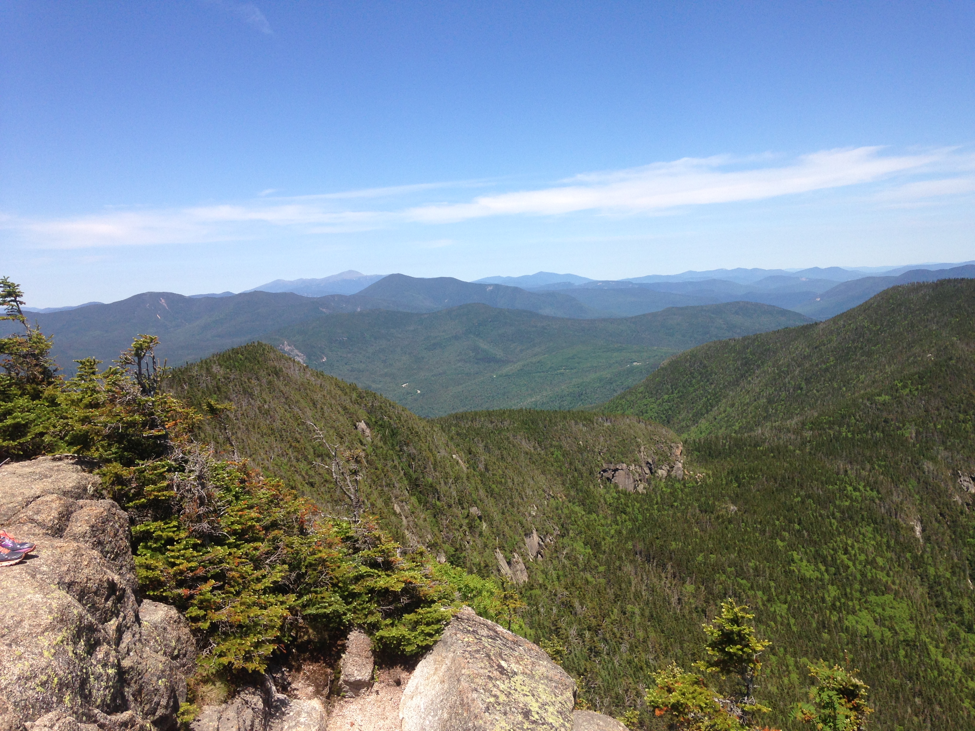
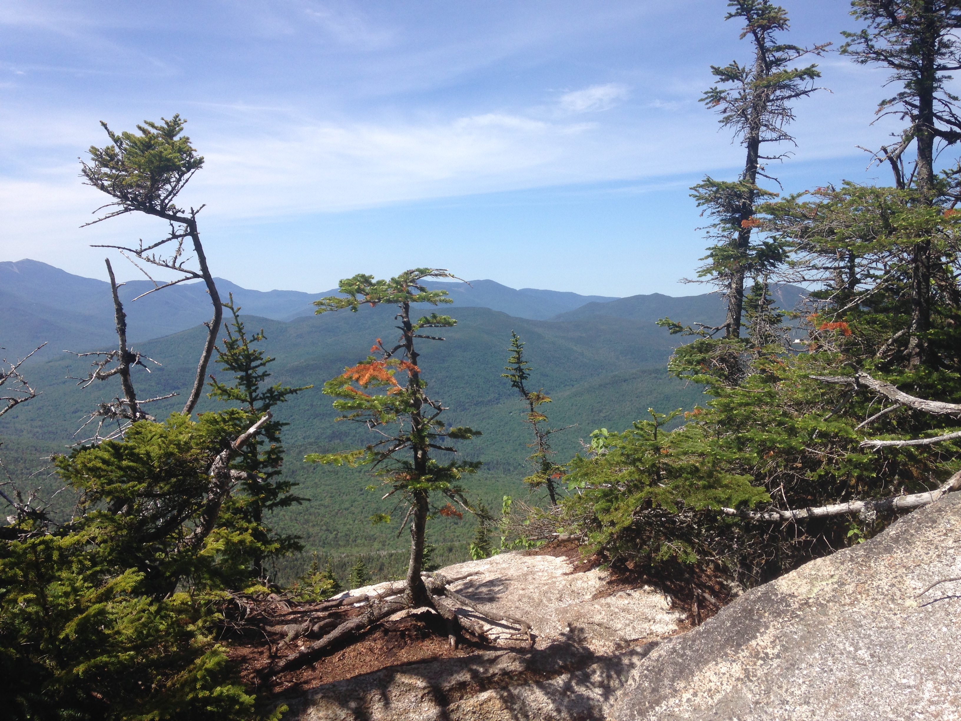
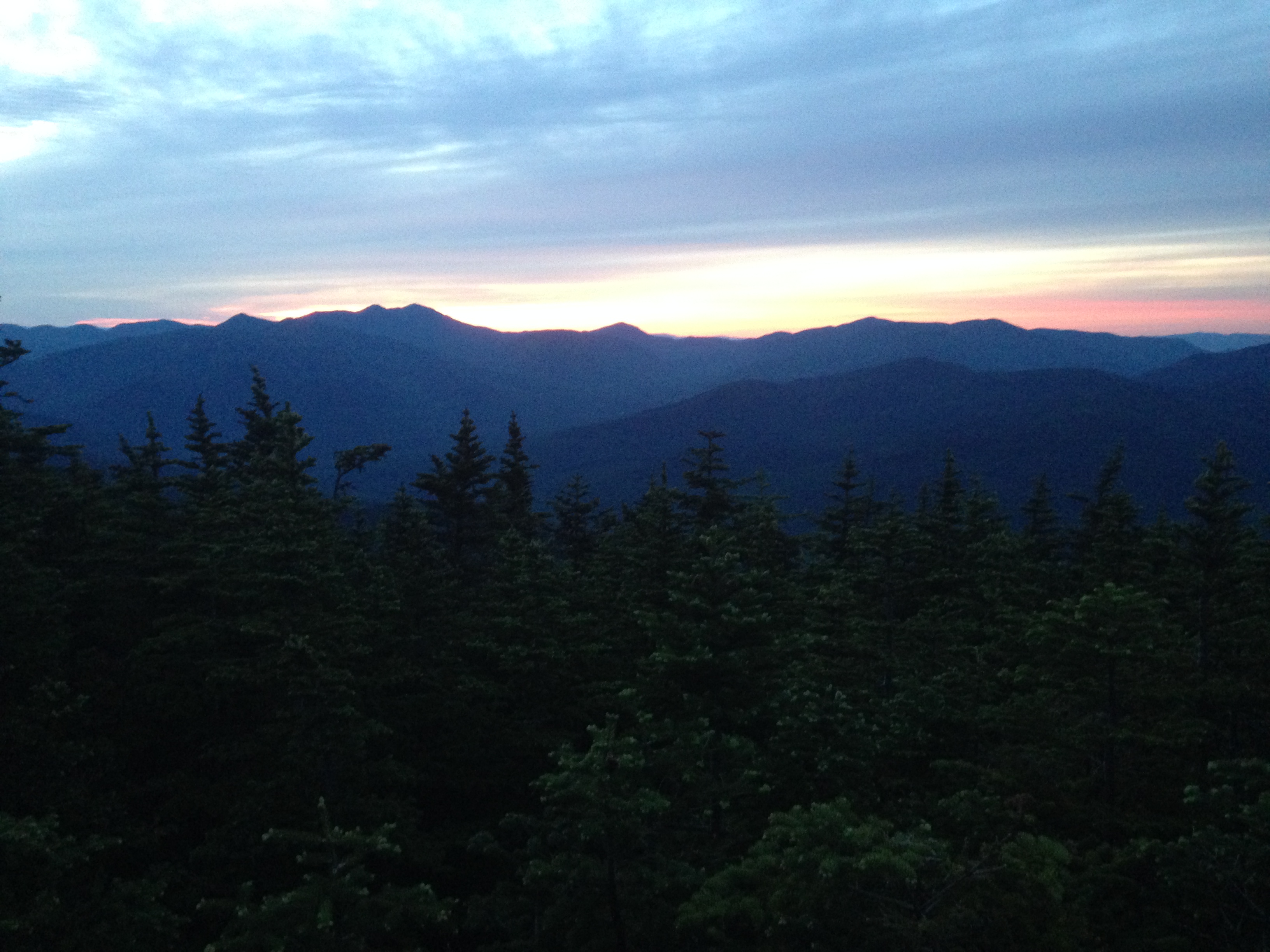
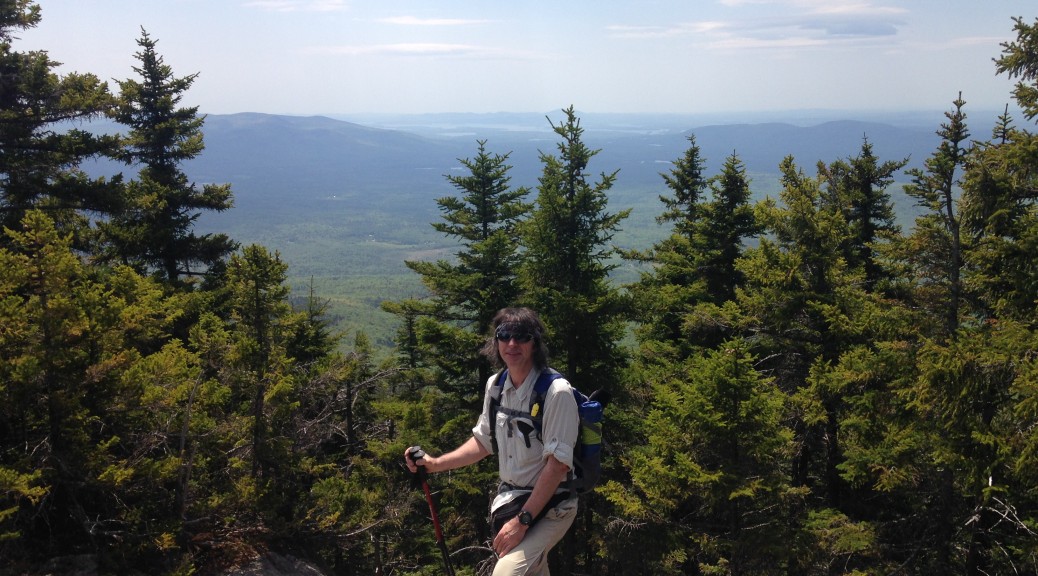
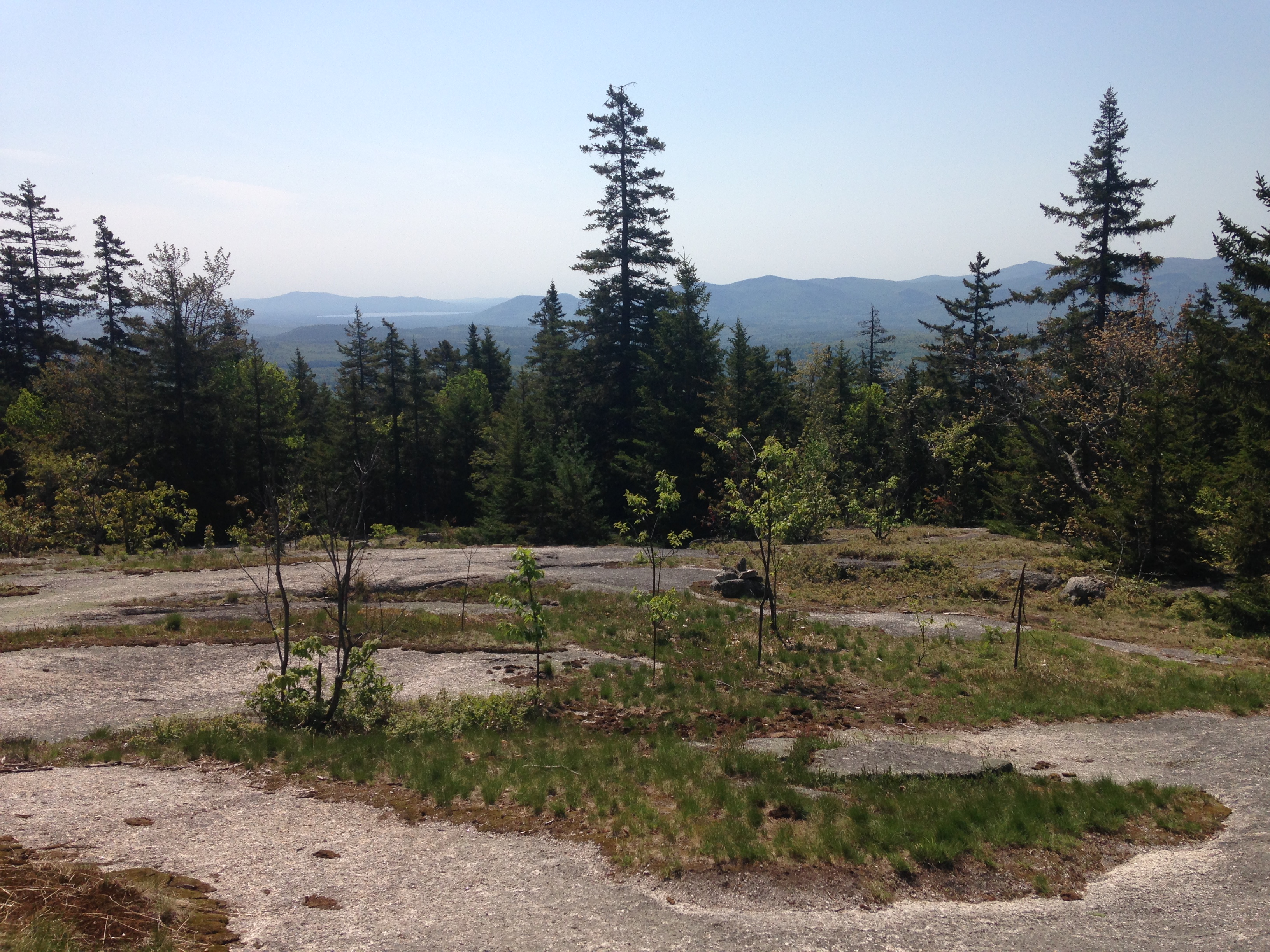
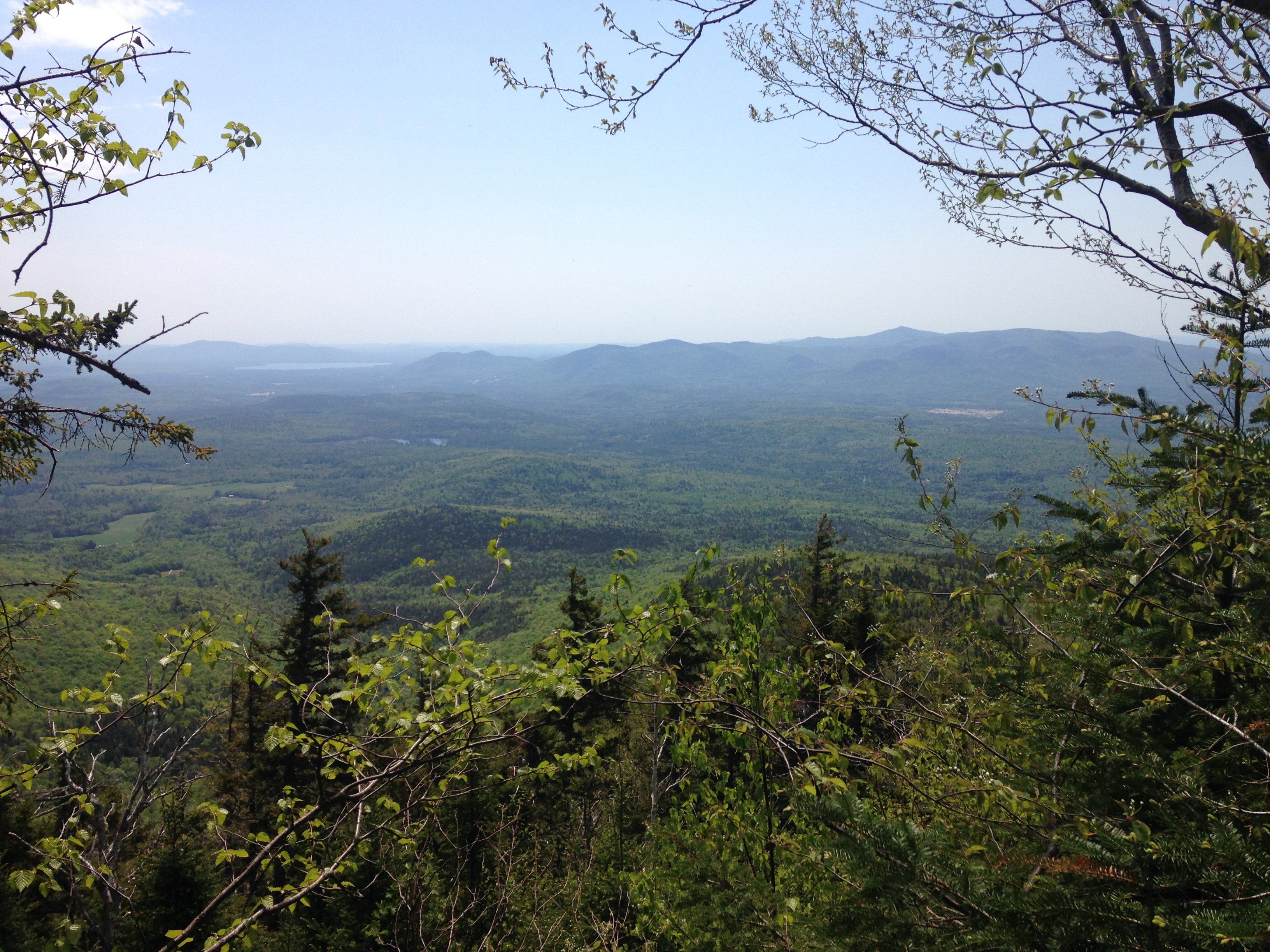
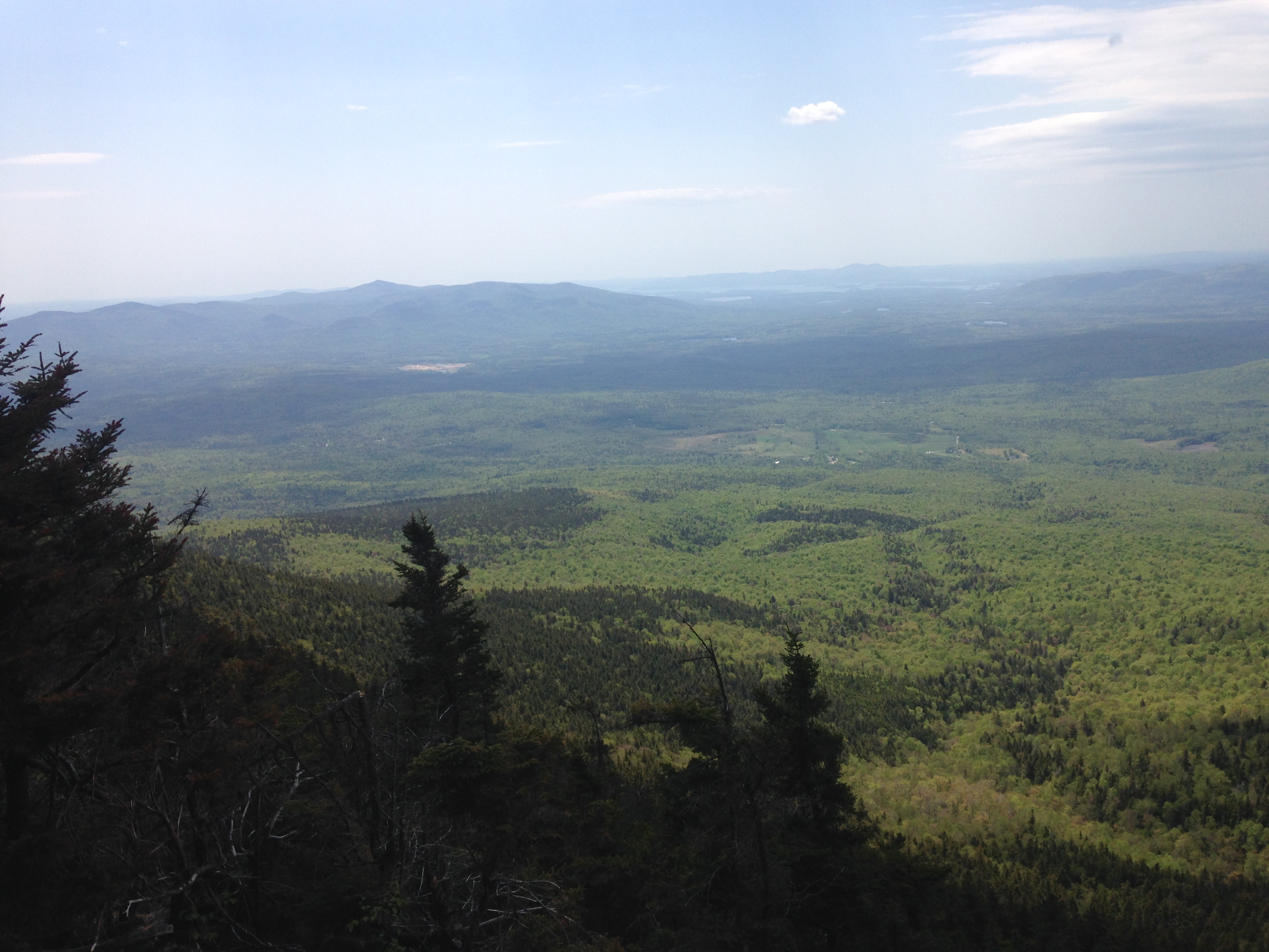
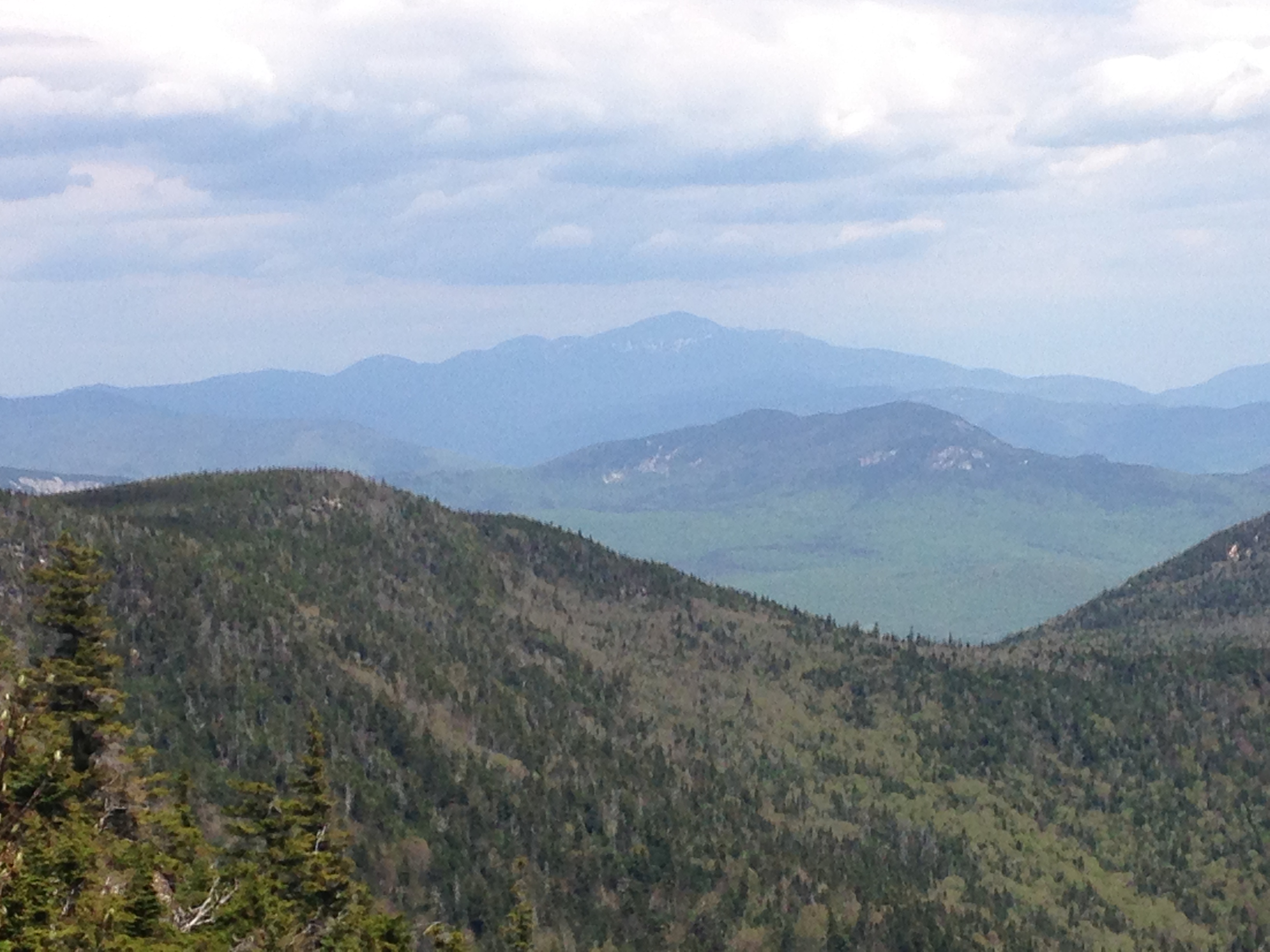
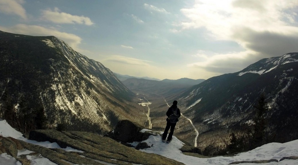
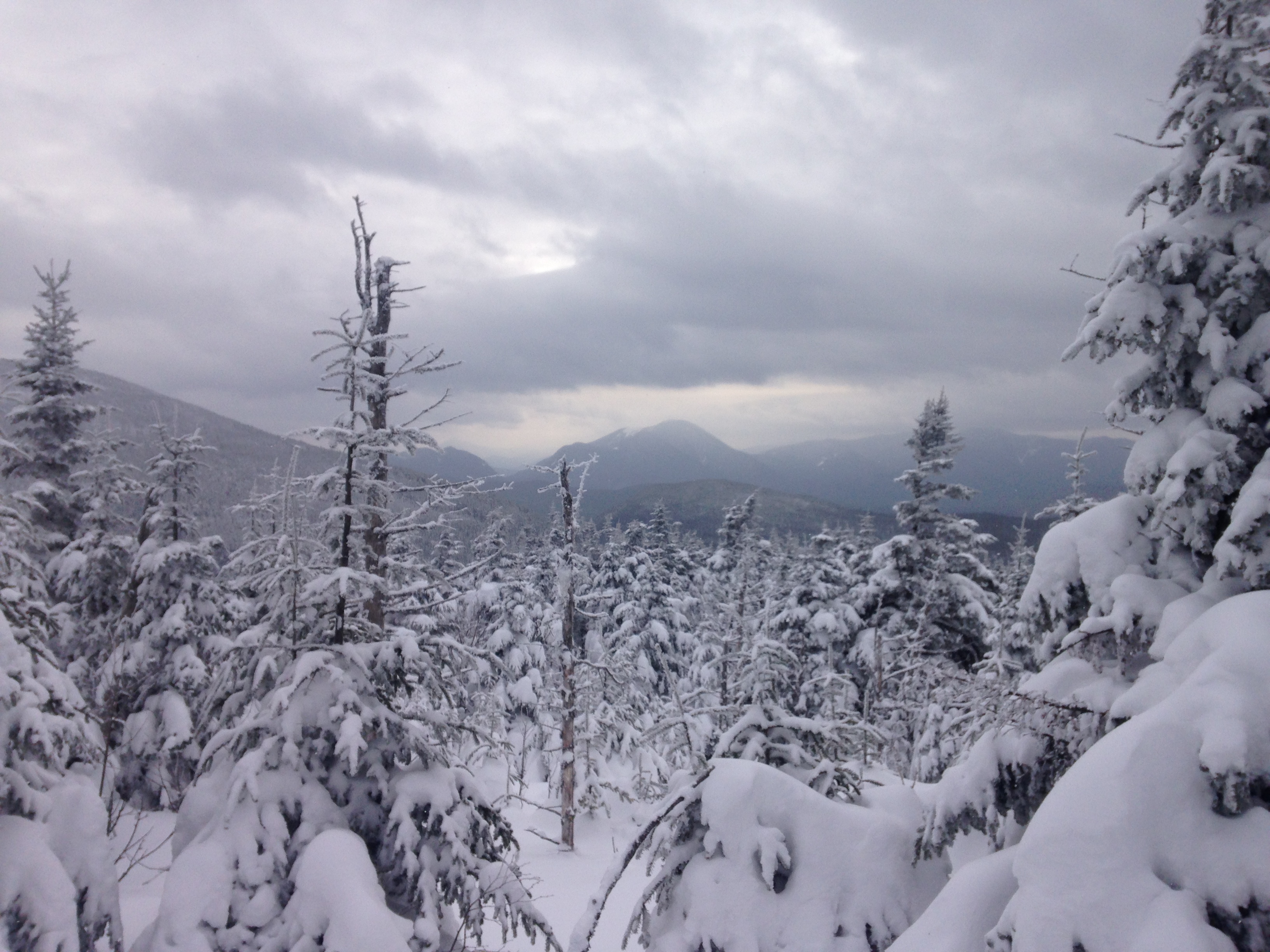
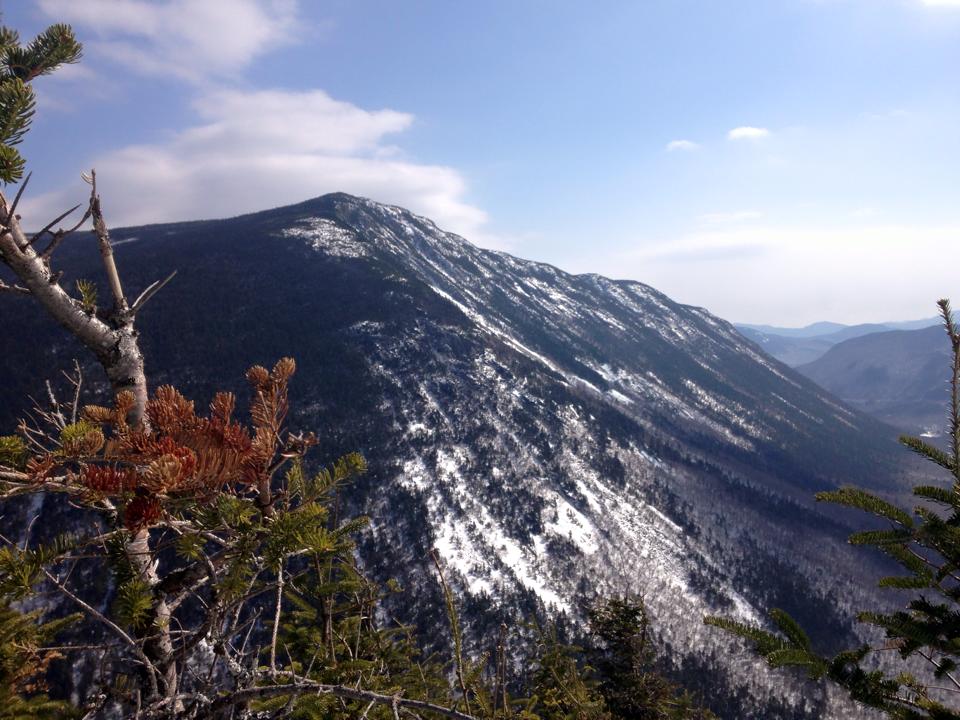
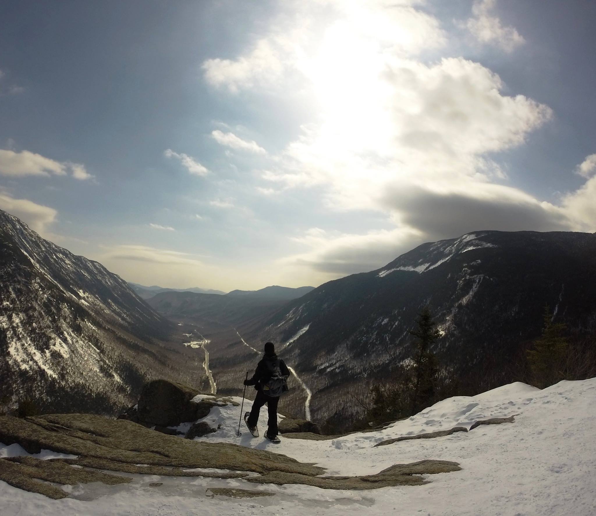
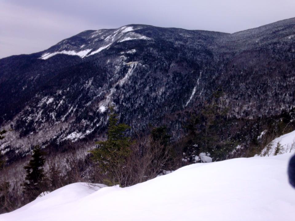
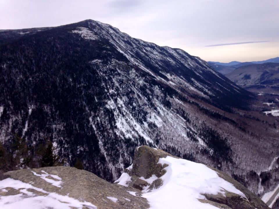
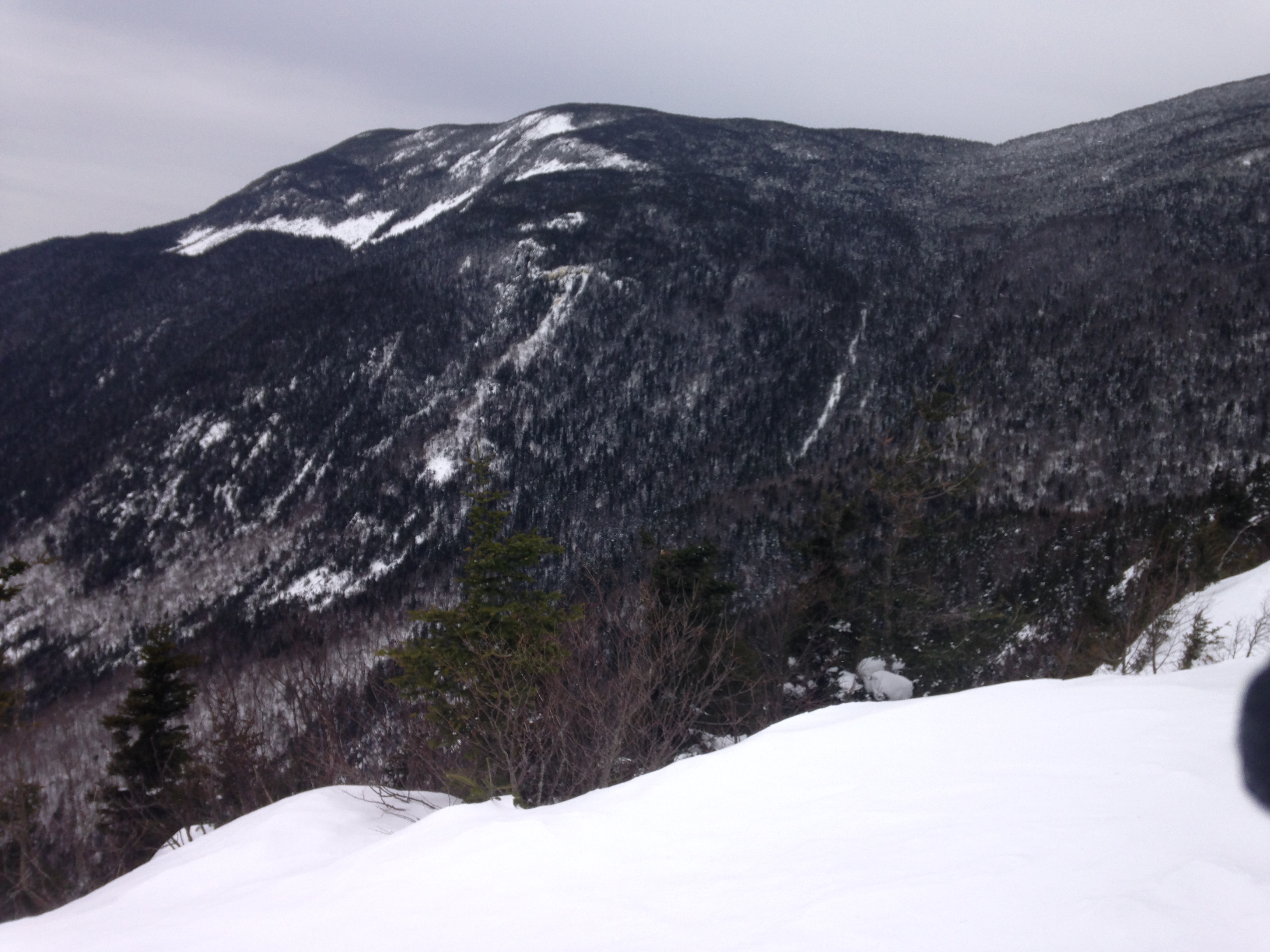
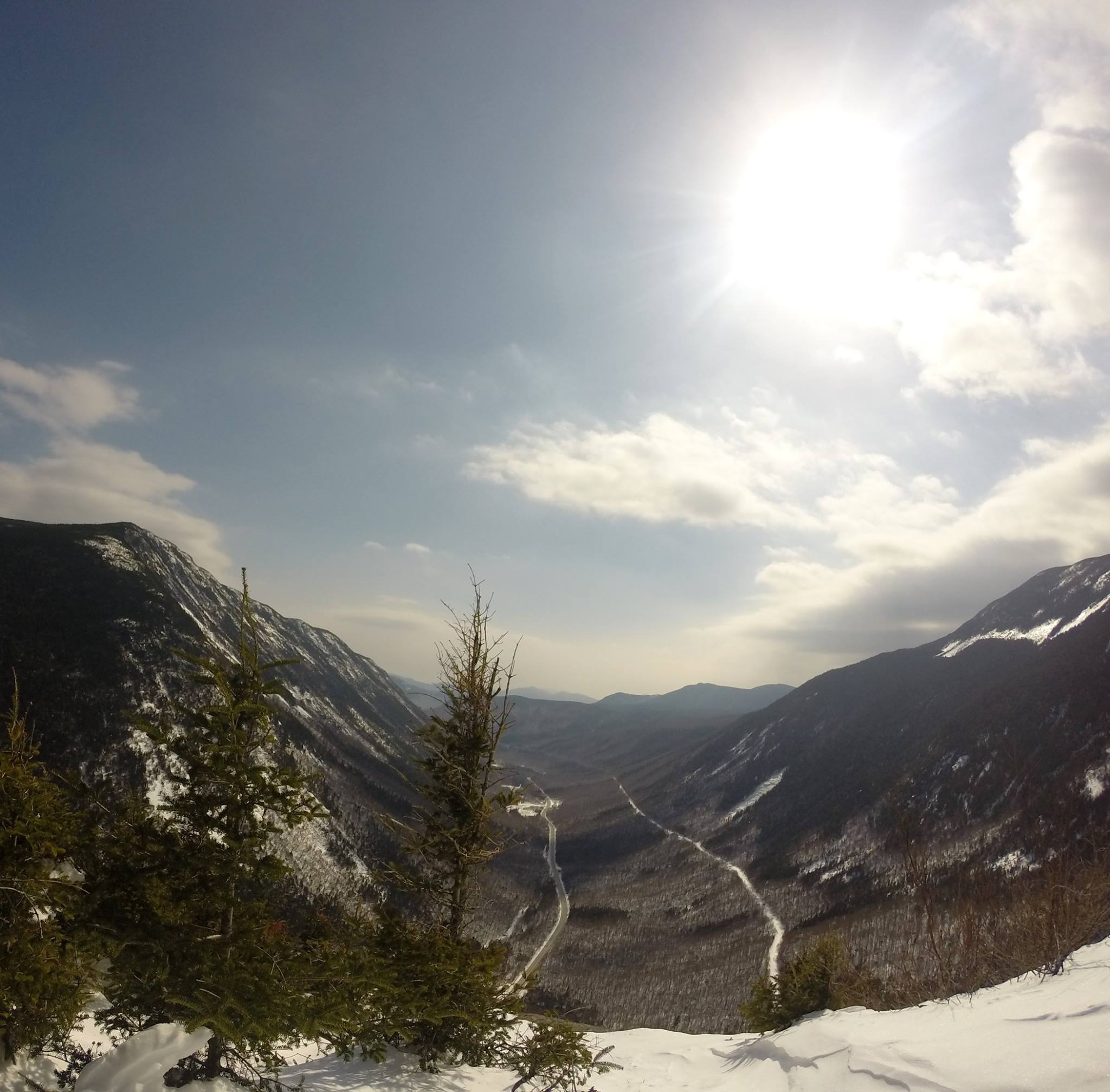
The mountains seemed to extend to the end of the earth. There were even less signs of civilization here than I had witnessed in my prior travels. I couldn’t find a road or village within sight below, and we really had a sense of solitude and isolation here. We sat on the summit ledge in awe of the endless miles of raw beauty before us in every direction. (click here for Haystack Summit Video) I could barely take my eyes away long enough to take a bite of my sandwich.IMG_4038 
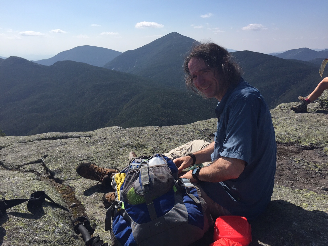
This, much like my first taste of the Whites was instant addiction – love at first sight. The best part was this was only the first peak. There was so much more to look forward to this weekend and beyond. Shame on me for just discovering this place now at age 48, but so thankful that I got to discover it at all. We were torn between sitting longer to soak in more of this magical place or getting on with our voyage to unlock its secrets and its promise of heaven on earth. IMG_4030  IMG_4032IMG_0411

IMG_0417
a view from basin summit

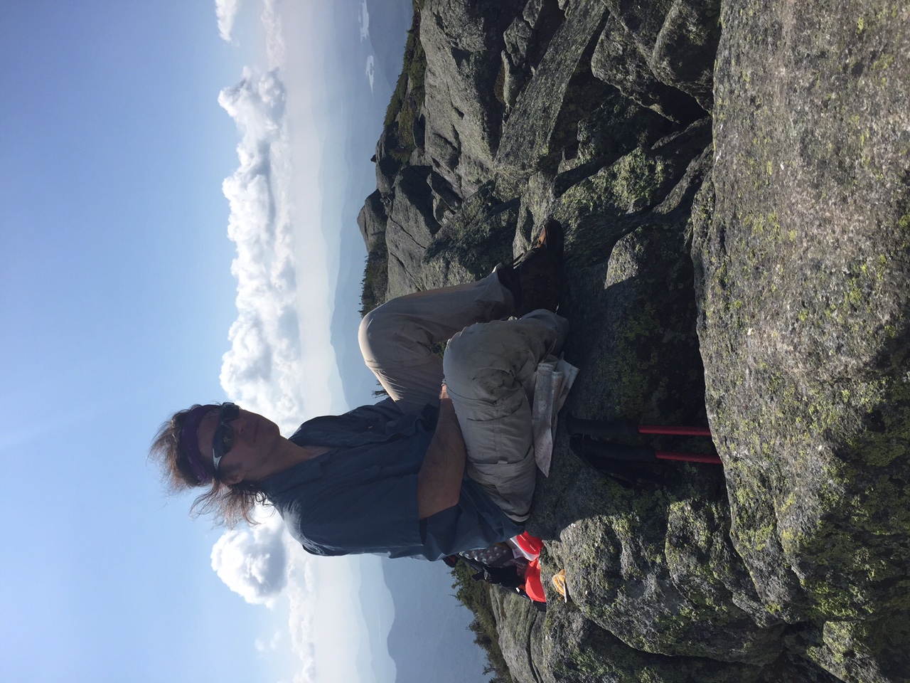
With so many miles ahead and a limit to the daylight in which to witness the visions in store for us, we managed to eventually tear ourselves away and set out for the next destination: Basin Mountain.

(click here for little haystack video)

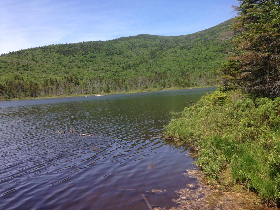
To get there, we backtracked to Little Haystack and took the State Range Trail heading Northwest. A short distance down the trail, as we ducked back into the trees, we crossed a small stream and thought that we should fill up our water supply, since we didn’t know if there would be another opportunity any time in the near future. packmanSoon after our break, we were joined by a solo hiker we met back at Haystack, who had left his full size overnight pack at a trail junction ahead in order to summit with a lighter load. We exchanged some trail-talk with… (I forget his name) …let’s just call him Pack-man… and walked together for a while toward Basin. Then I think he stopped for lunch or something, or maybe we just pushed ahead at some point with our lighter packs. I don’t remember, but in any case we were back in silent mode… until… “OUCH!!” Therese zigged when she shoulda zagged and tweaked her knee. I know all too well about knee-tweakage and we took a breather as she assessed her pain. After a few stretches and test motions, she figured she was ok to push on. Therese-Knee
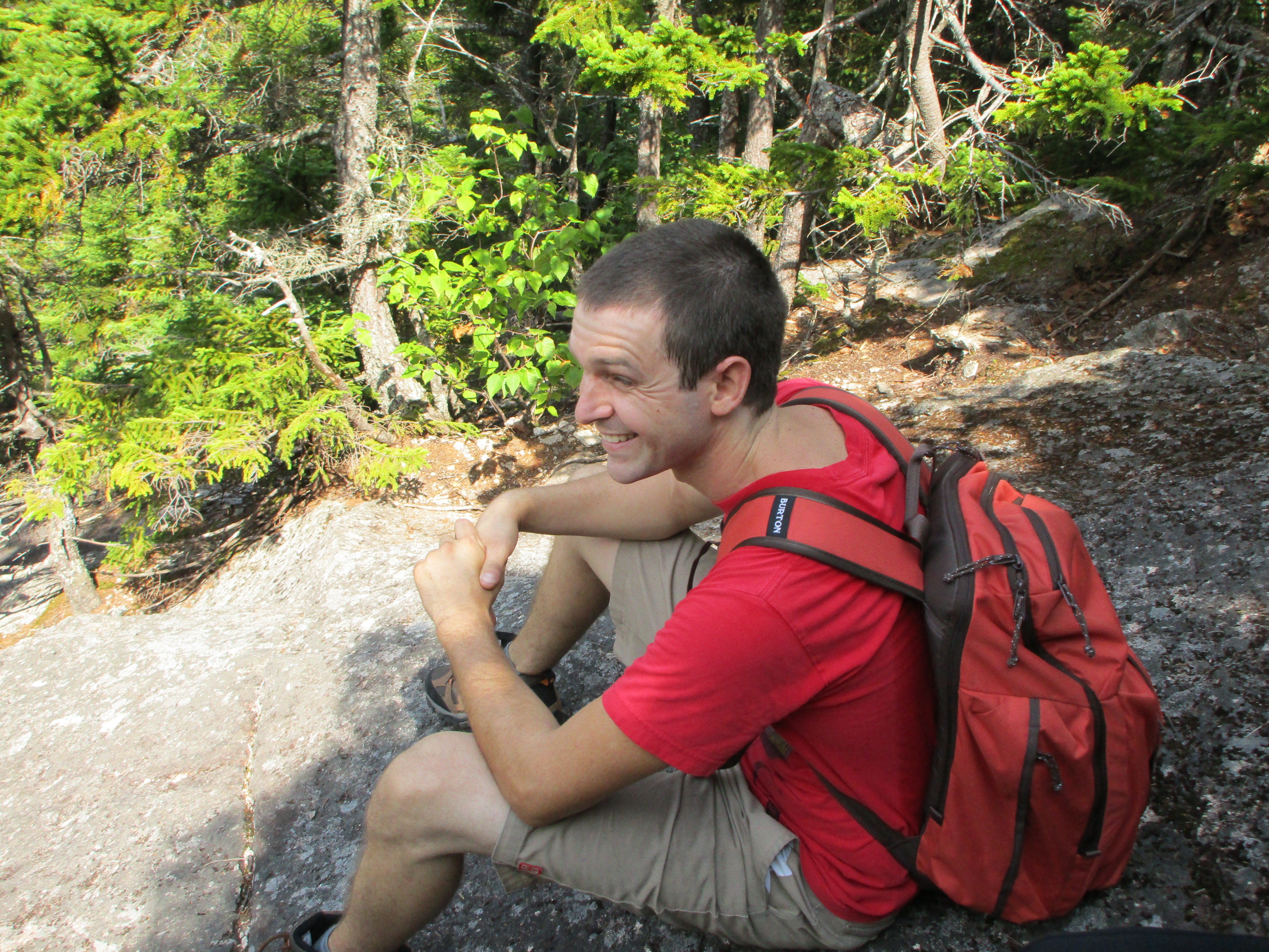
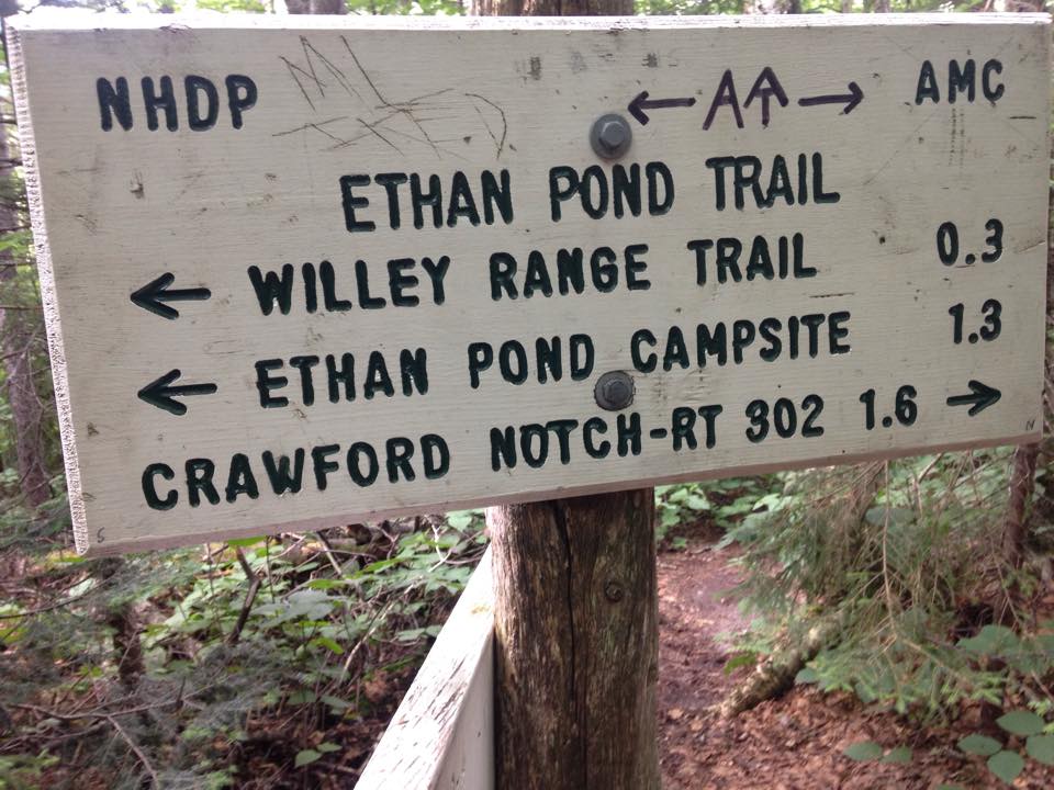
Whew, good thing! We were over halfway along our route and there were no bailout trails nearby. The only way out was up and over Basin, then up and over Saddleback before a 2.5 descent down Orebed Brook Trail. The only other option would be a long difficult bushwack through God knows what. Other than that, we’d need to send for help or find it on the trail for a possible litter evac scenario. There of course was always the last resort of pushing the SOS button on my brand new Spot Gen3 satellite messenger that I am breaking in this weekend, checking in at various points in our trip. I hope to never have to use that SOS button, reserved for life-or-death situations, and thankfully this does not come even close to qualifying as one. Even more thankfully, it seems she is ok to carry on under her own power and enjoy the rest of the day.IMG_0416

IMG_0419
“pack-man” making his way up Saddleback

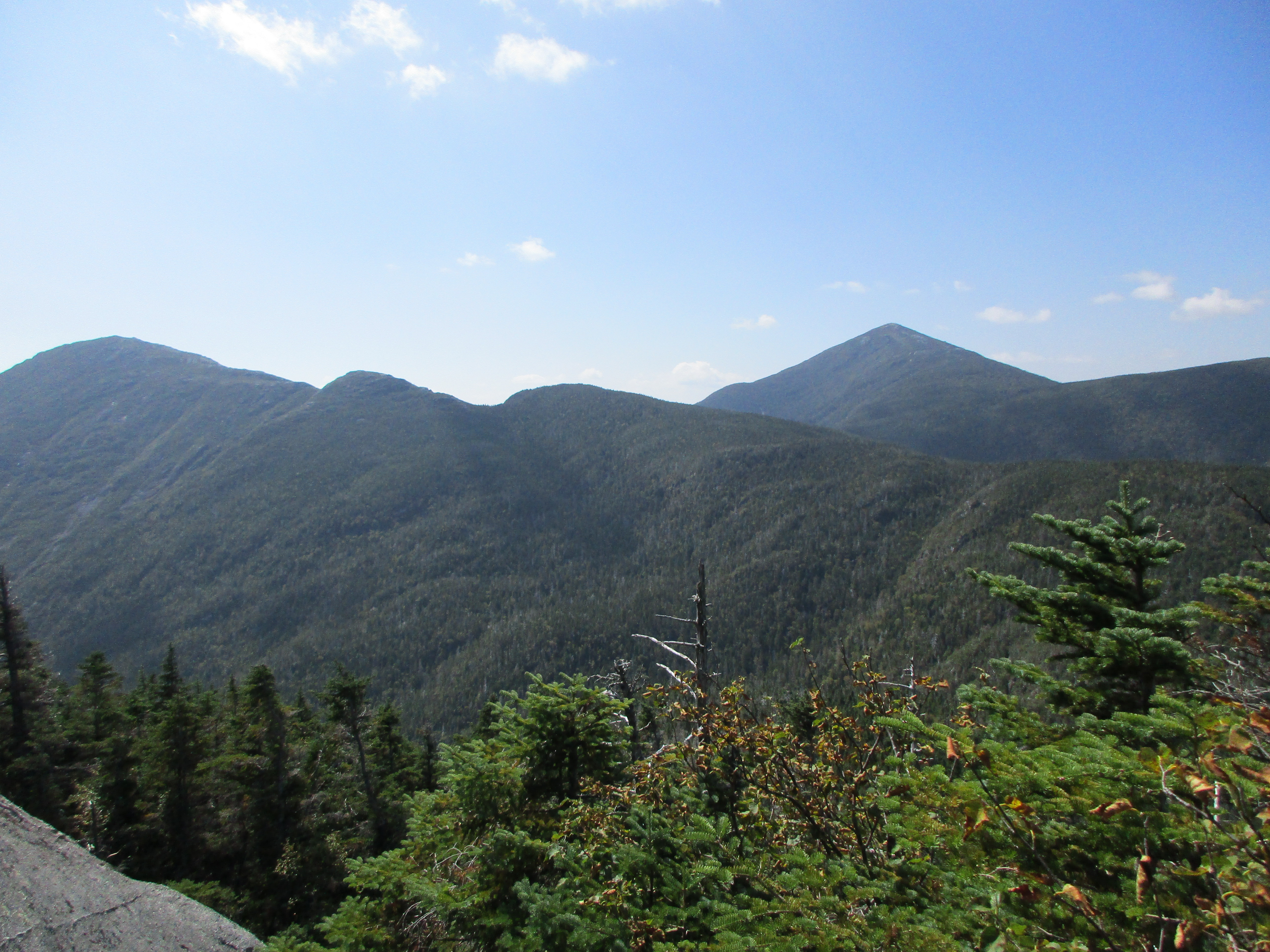
We make the final push to basin summit and let another amazing High Peak view with it’s warm summer breeze sooth the pain away along with some vitamin-i and a knee brace… and plenty of tiny annoying black bugs (no-see-ums) that bite! -some pleasant and unpleasant distractions. After some rest and a snack (for us and the bugs), we are good to go. Next stop- Saddleback! Carefully now, we descend into the saddle between the 2 peaks. Pack-man has caught up with us again and tags along for a while. He is now almost out of water, hoping to get an opportunity to fill up soon.

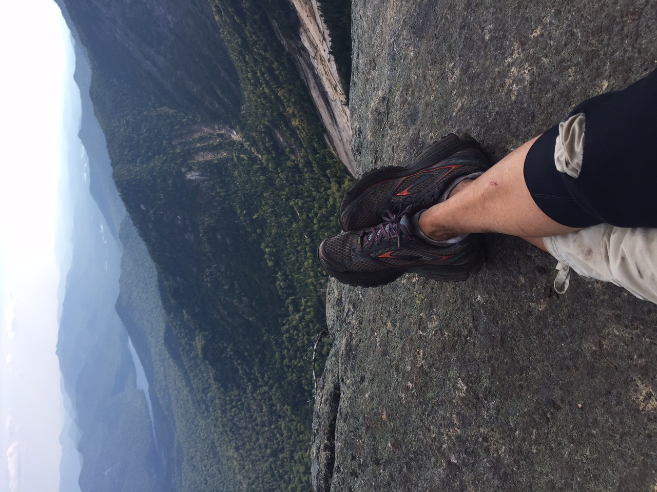
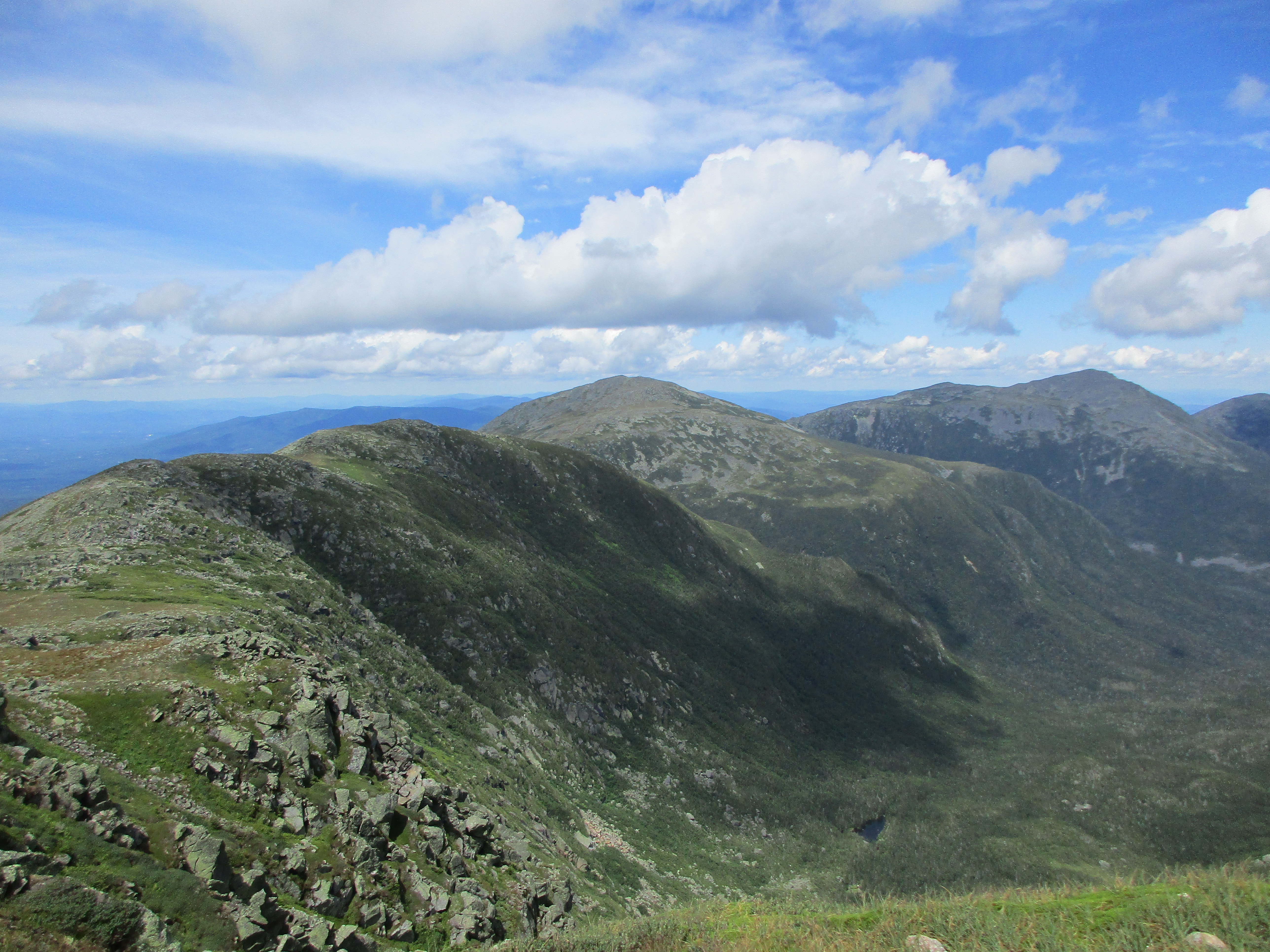
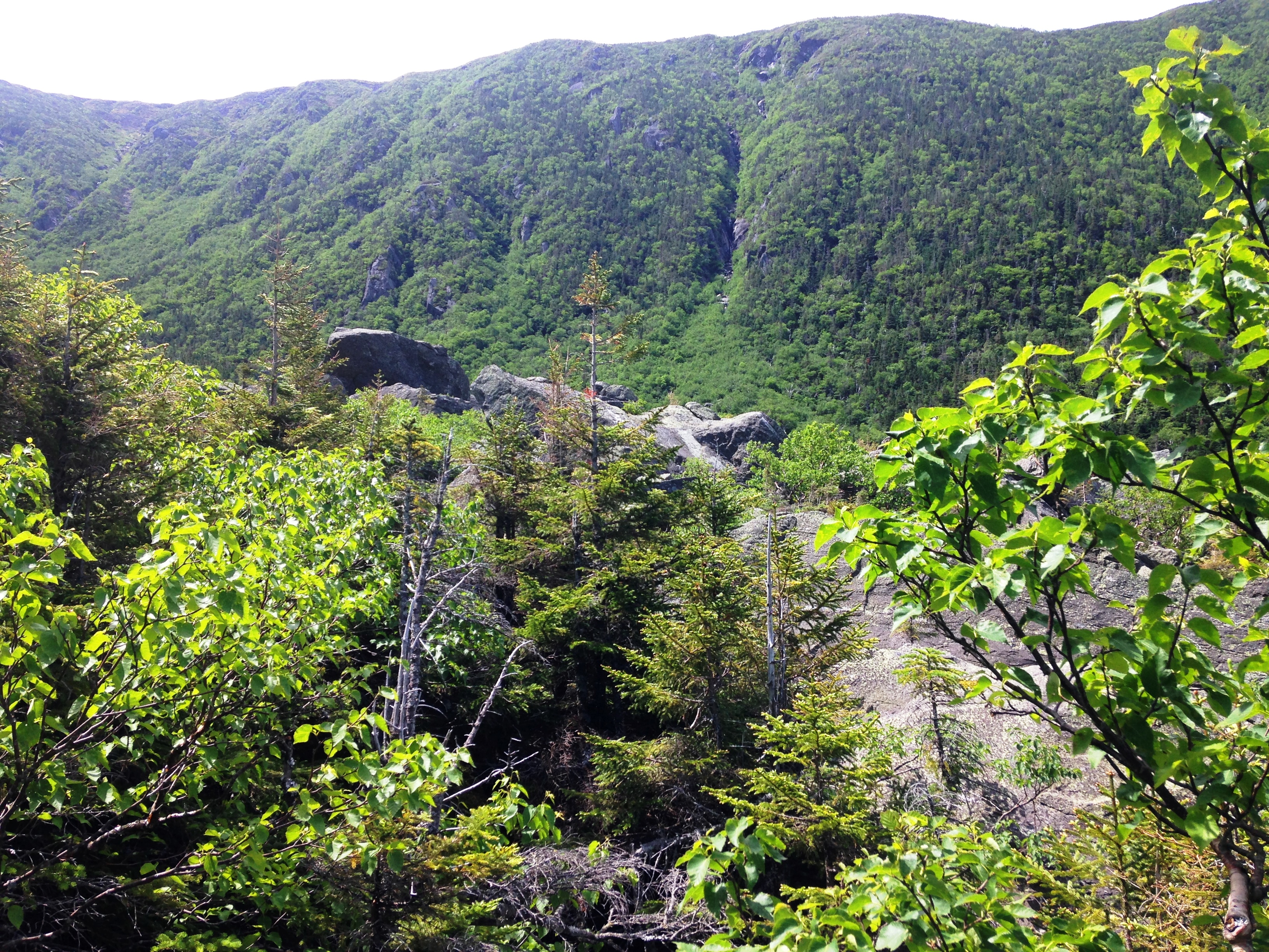
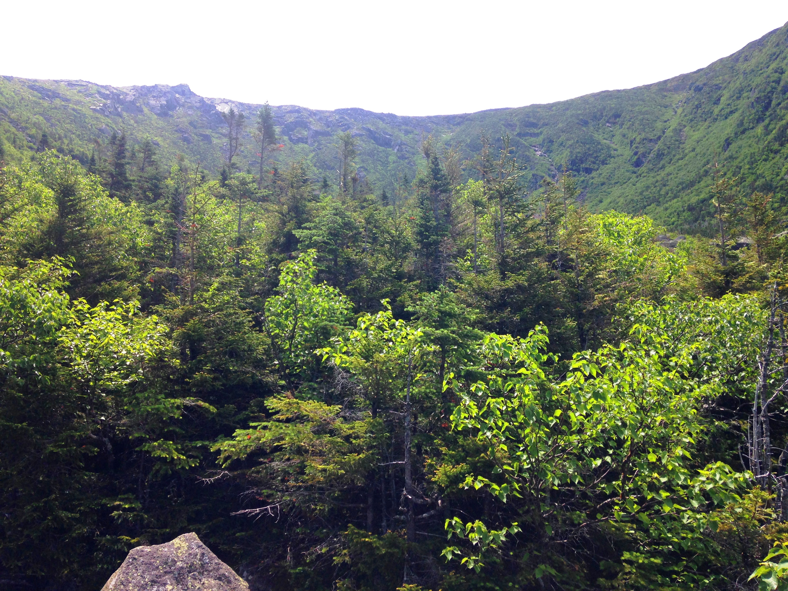
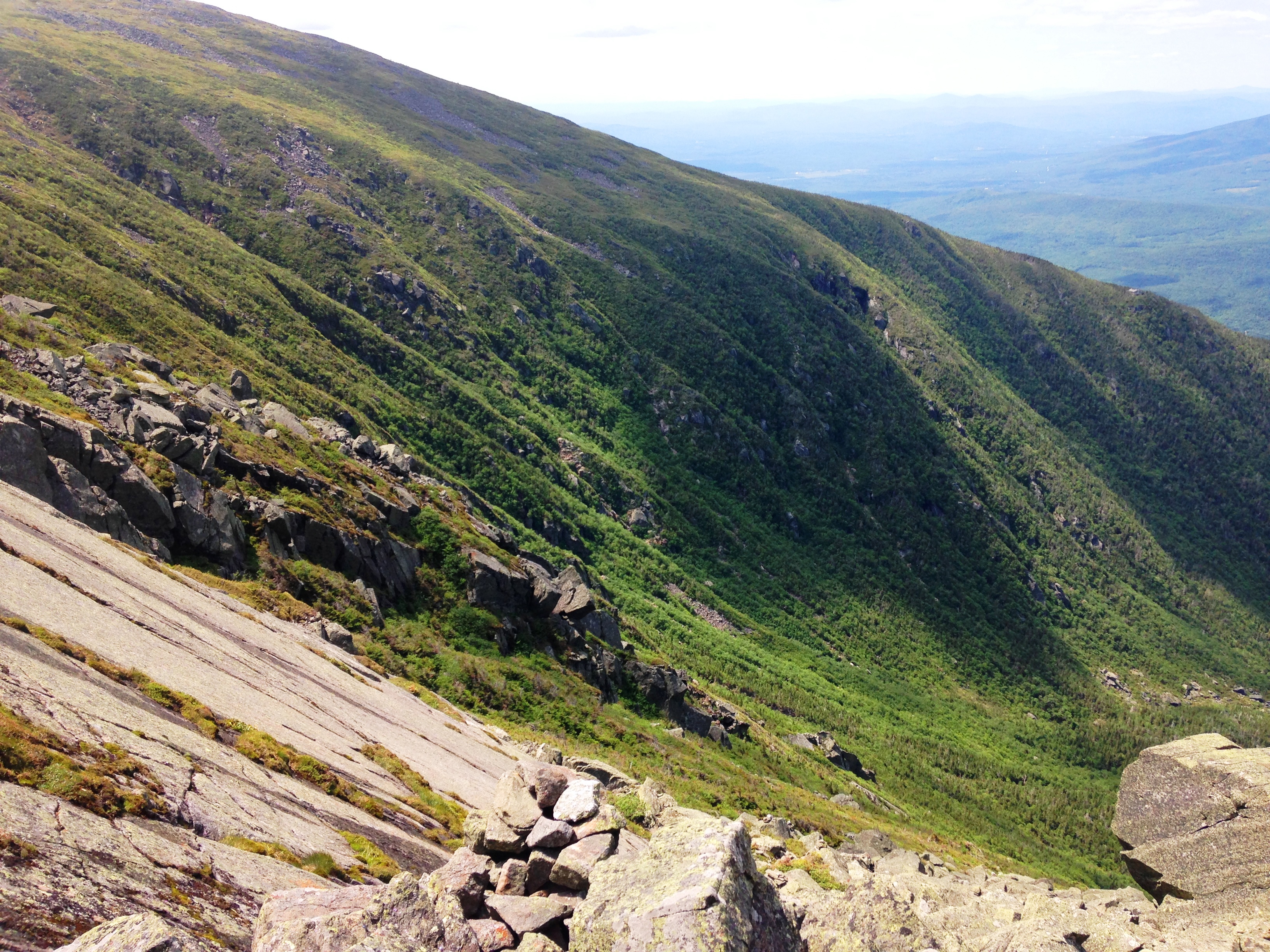
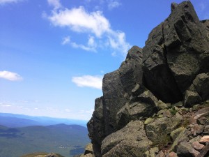
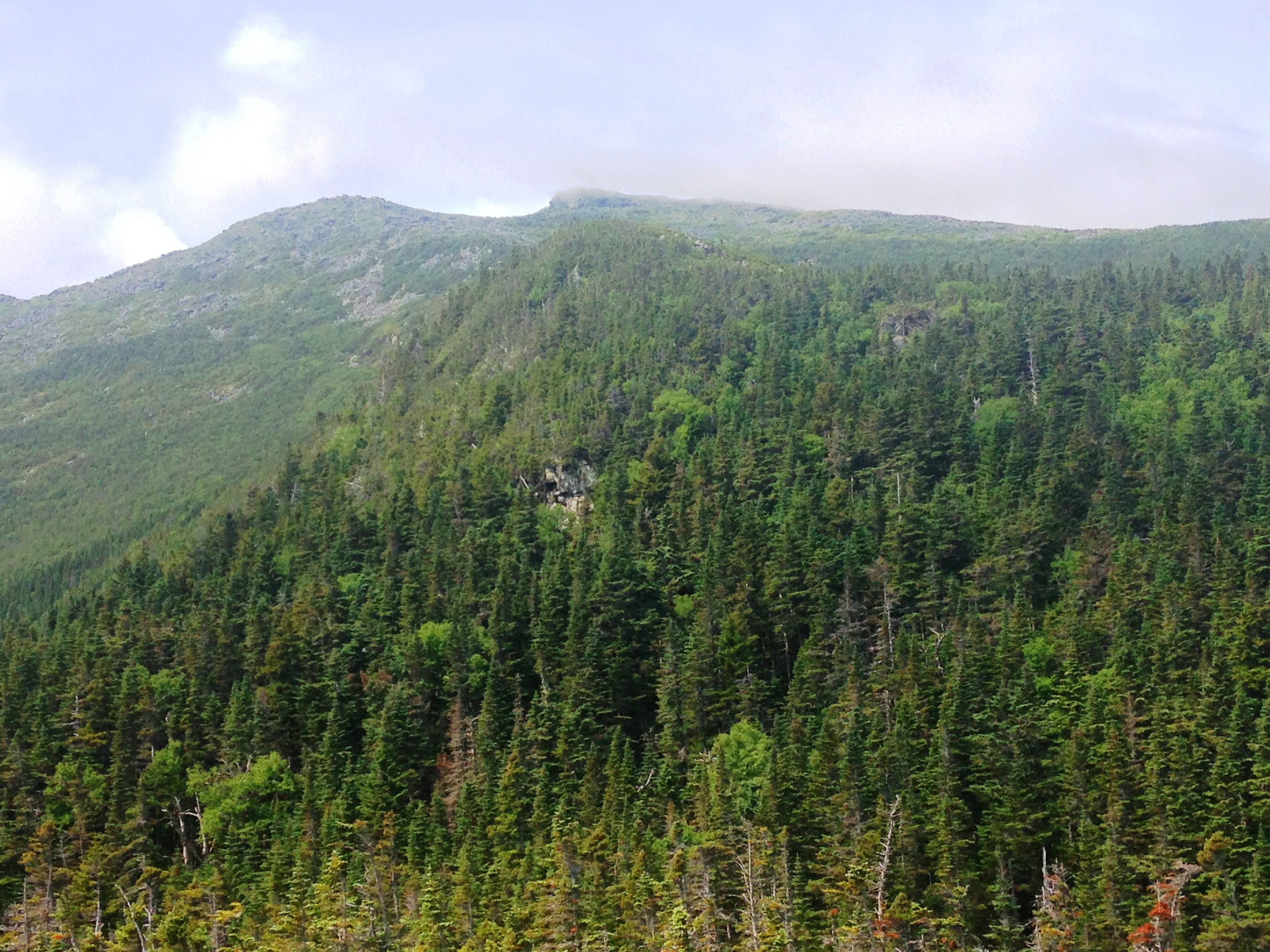
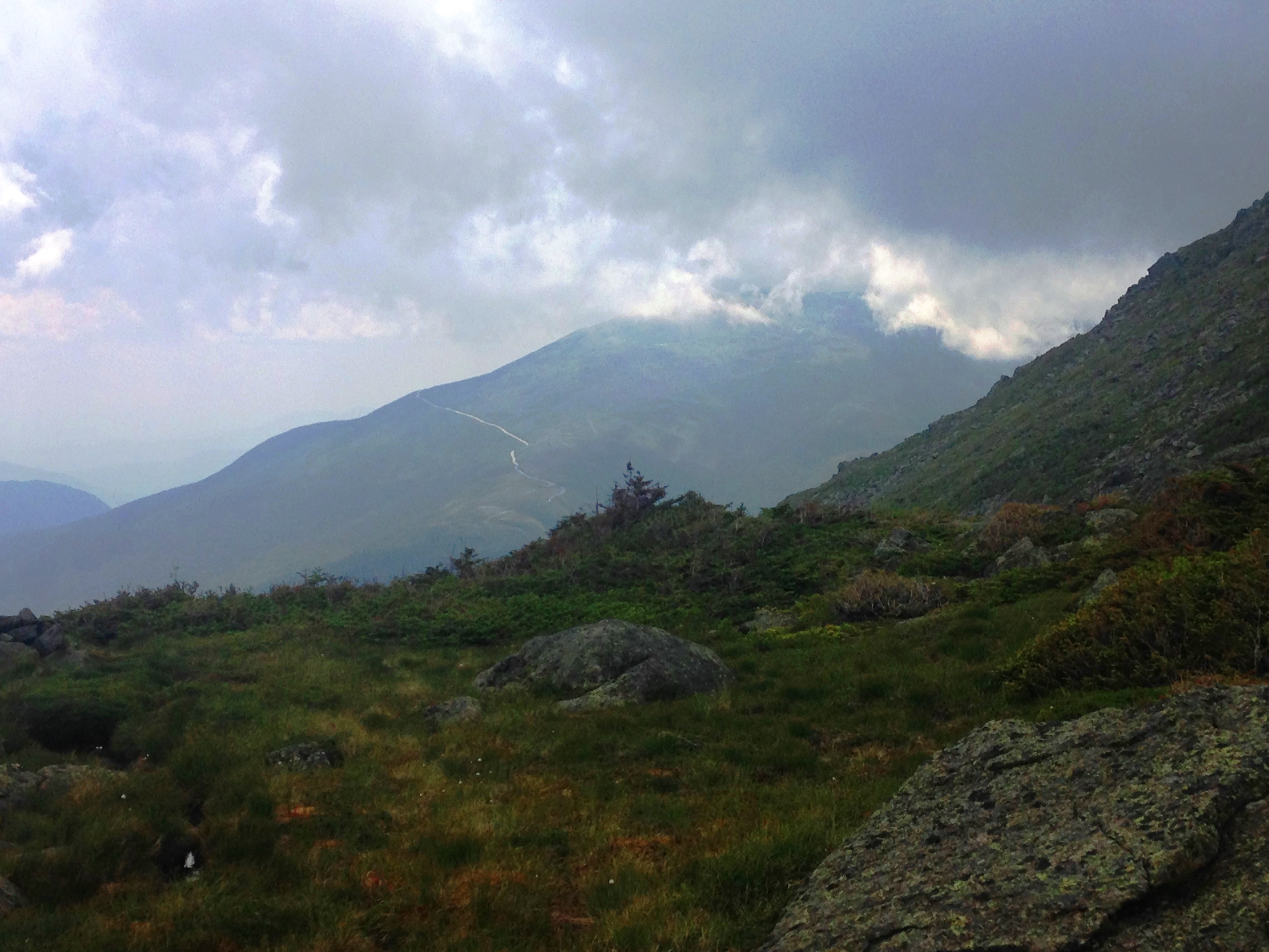
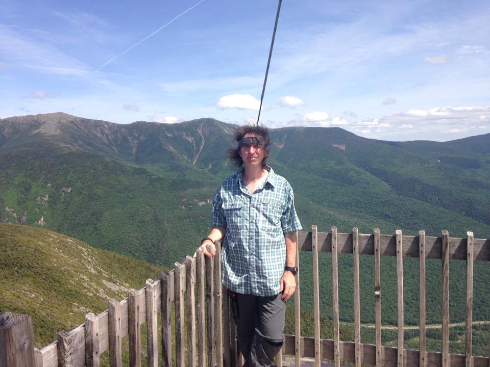
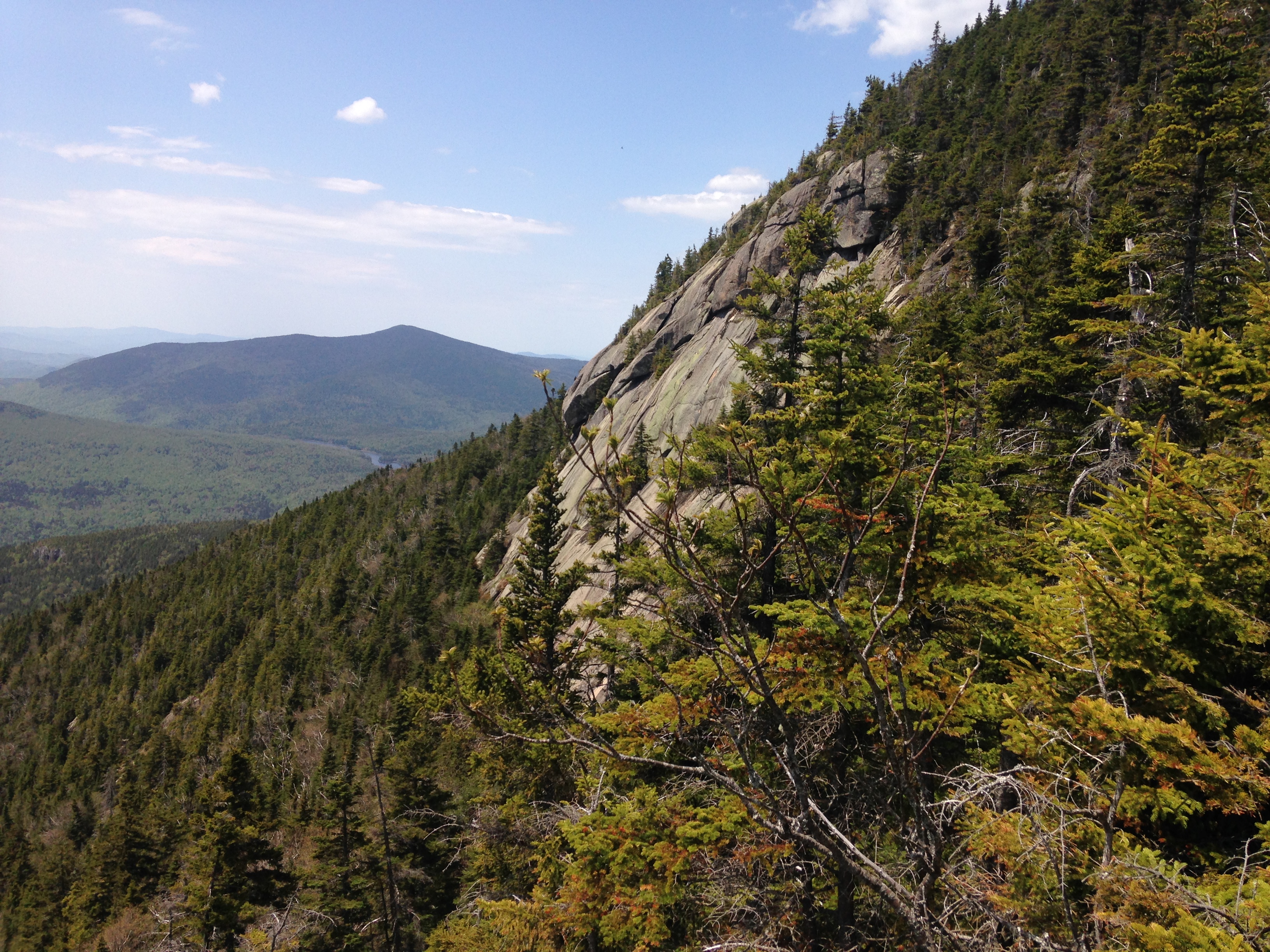
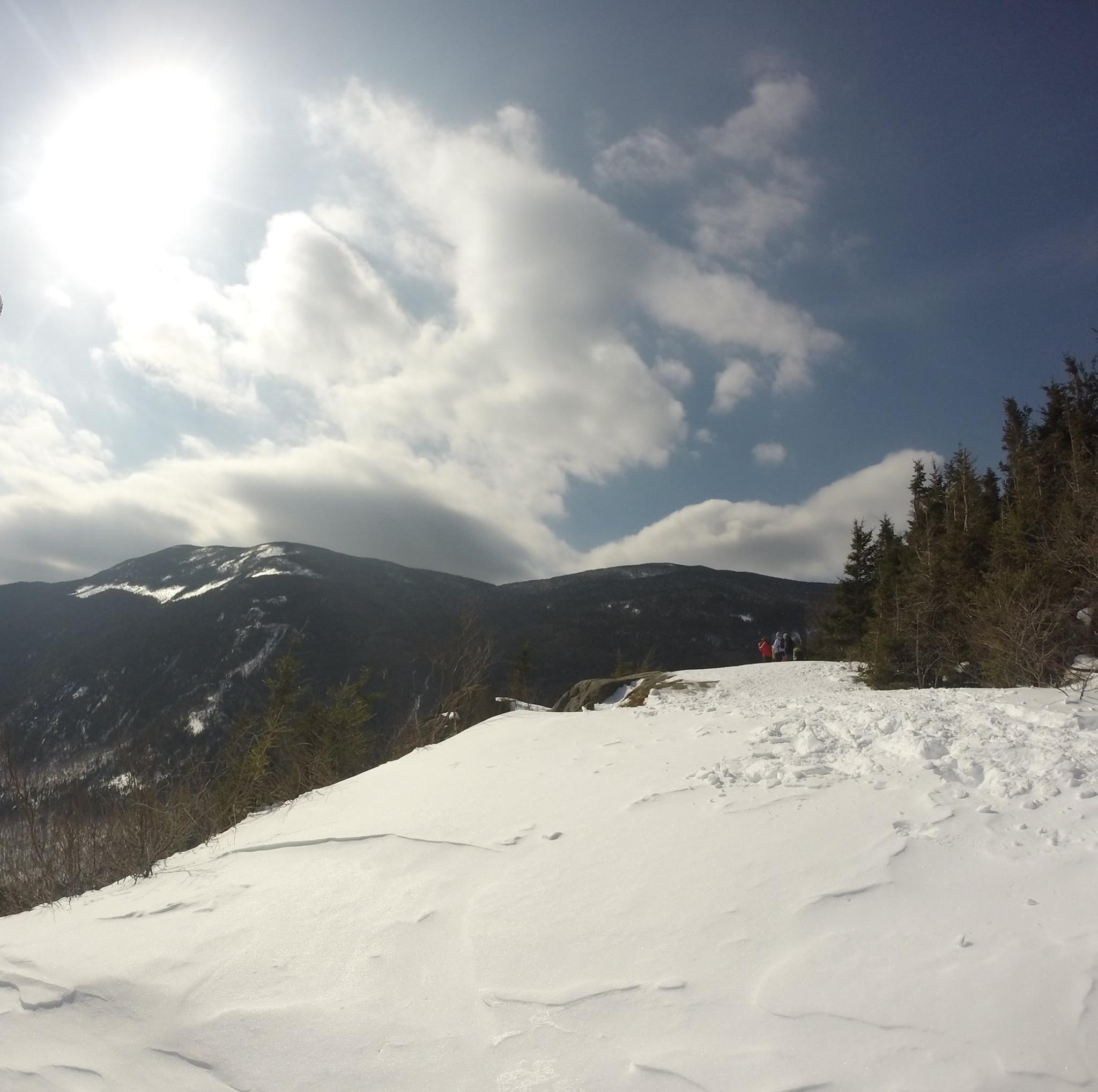
We had heard how difficult of an undertaking the scramble up the rugged south slope of Saddleback would be from some of the JBL guests, and as we approached the steep rocky ledges, we honestly felt it was somewhat over-hyped. Sure there were some pretty challenging sections, but there was always something to grab onto and footholds to lodge our boots (or trail-runners), and we aced the test with some careful planning of our steps. Even Pack-man with his extra heavy load was making it up without issue. After making it to the top of the steep stuff, we actually hiked through the summit on this one, not realizing we had gone by it, but stopped at an outlook just below with a great view to the south and east. This was to be our final view above tree line for the day, with plenty more on the way for tomorrow and still plenty of backwoods scenery to be had on the way down.IMG_4051

IMG_4046

IMG_4042
Either Saddleback or Basin
IMG_4429
The wrath of mother nature: Irene blowdown,base of OreBrook slide

IMG_0421IMG_0422IMG_4427

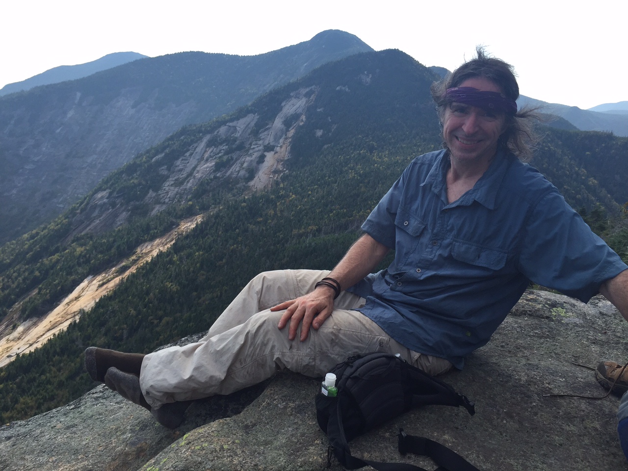
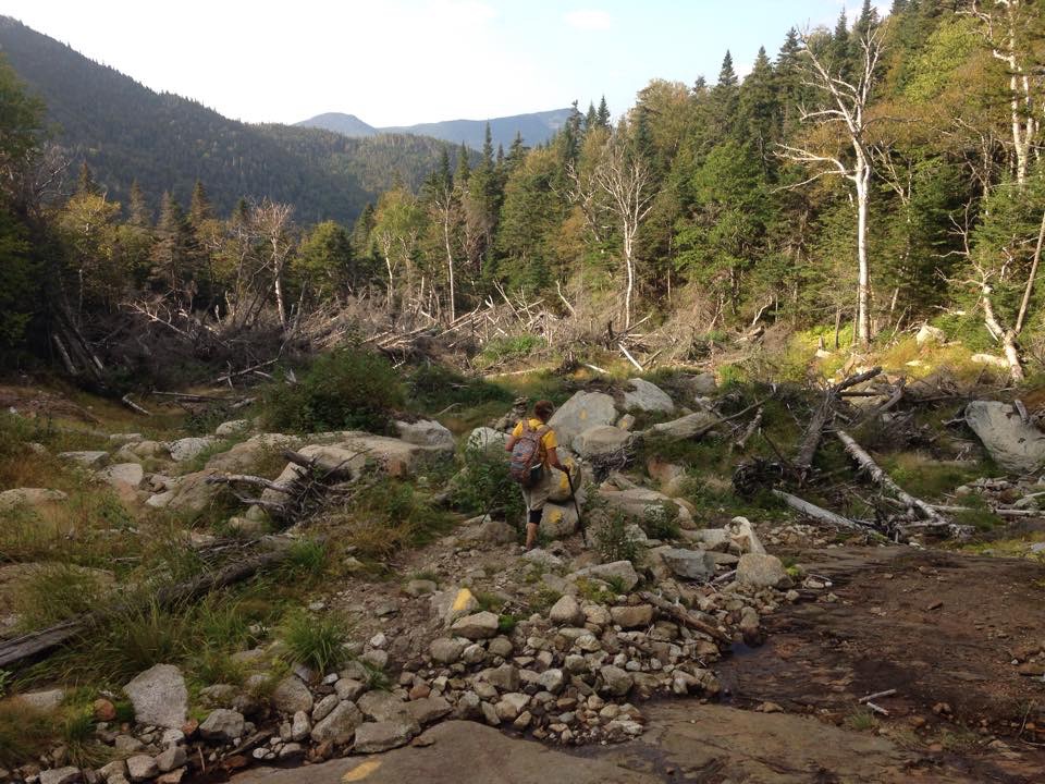
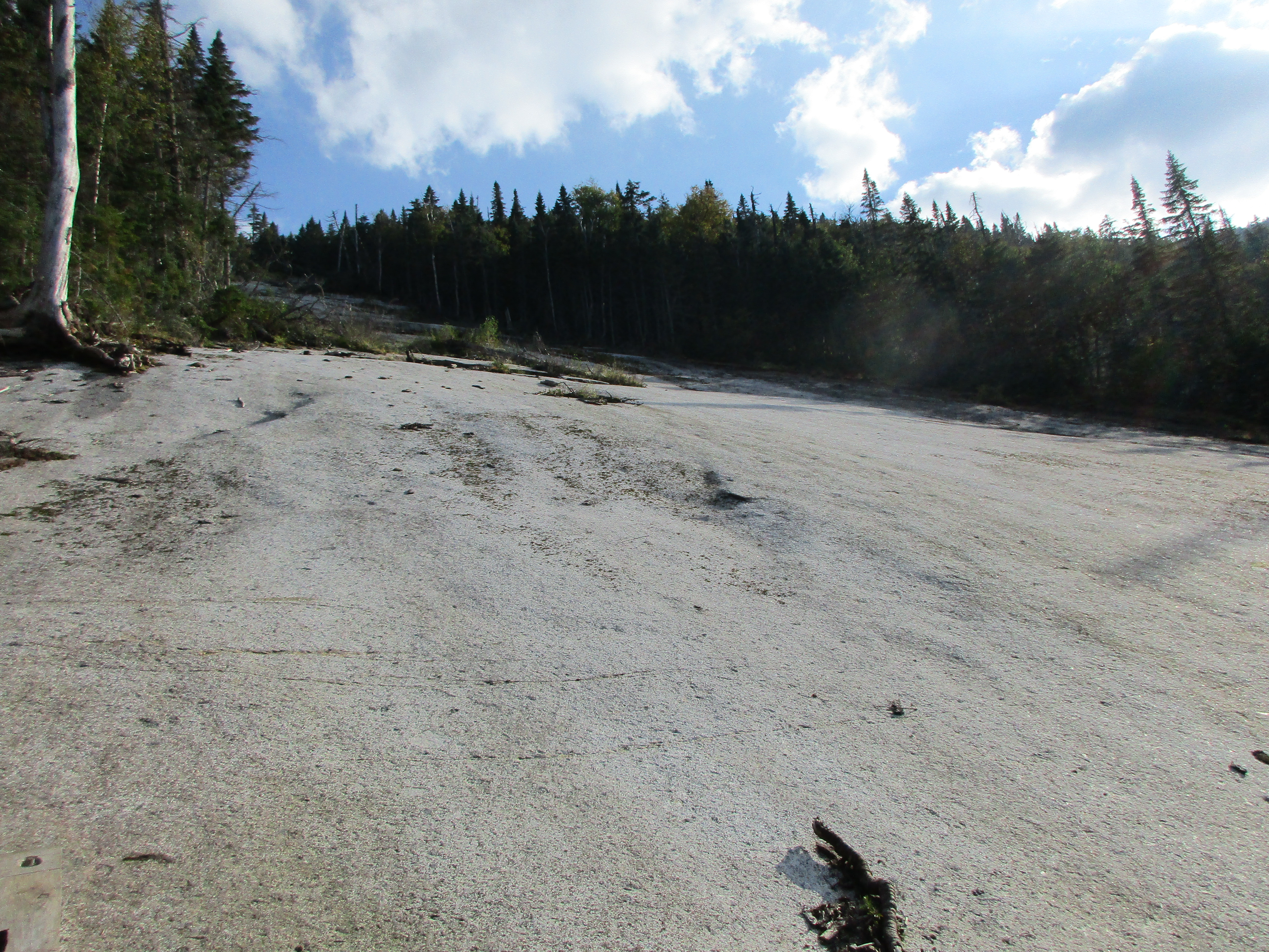
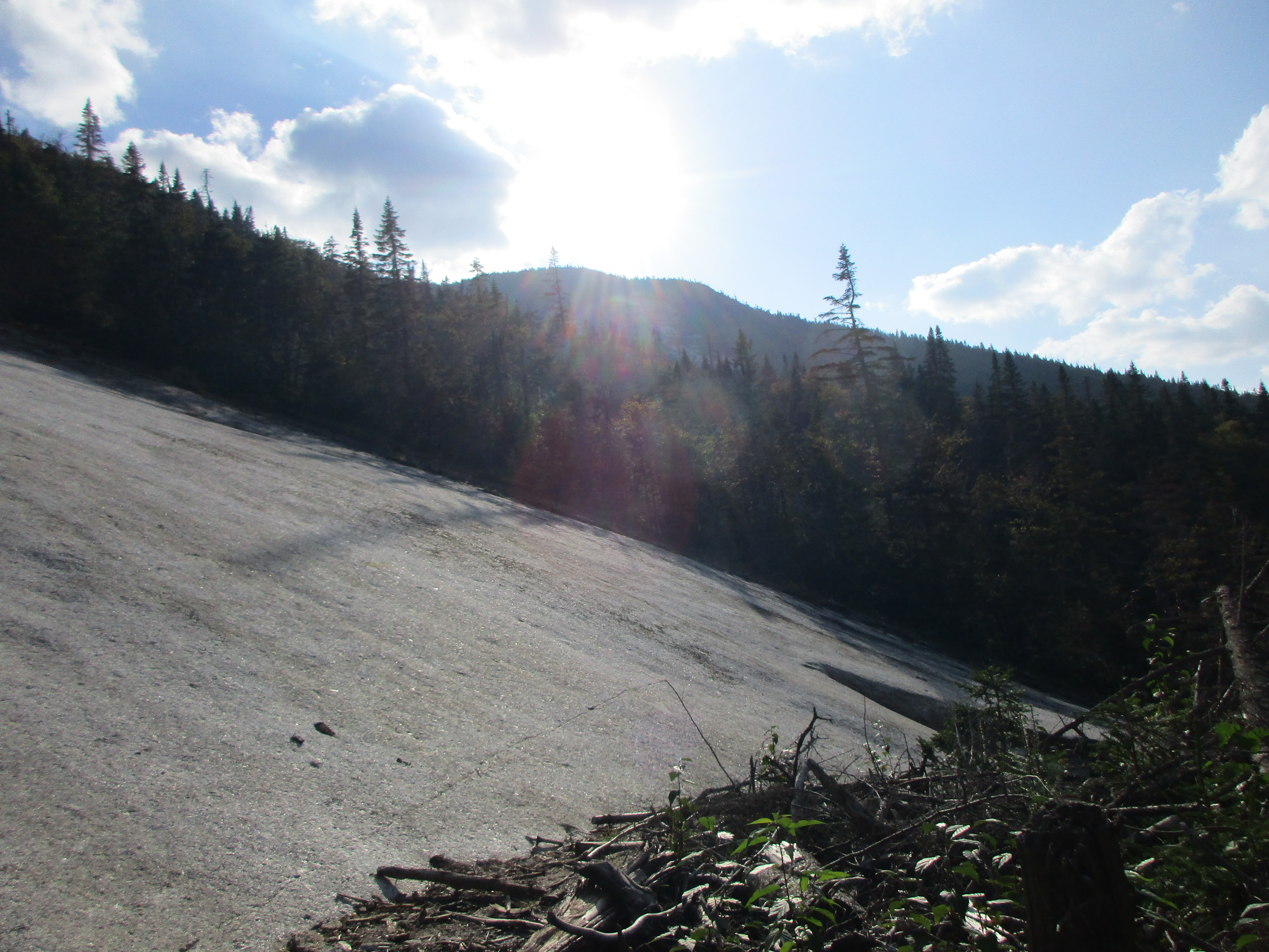
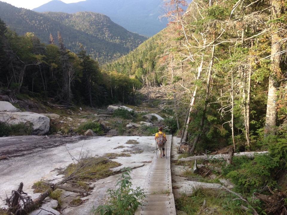
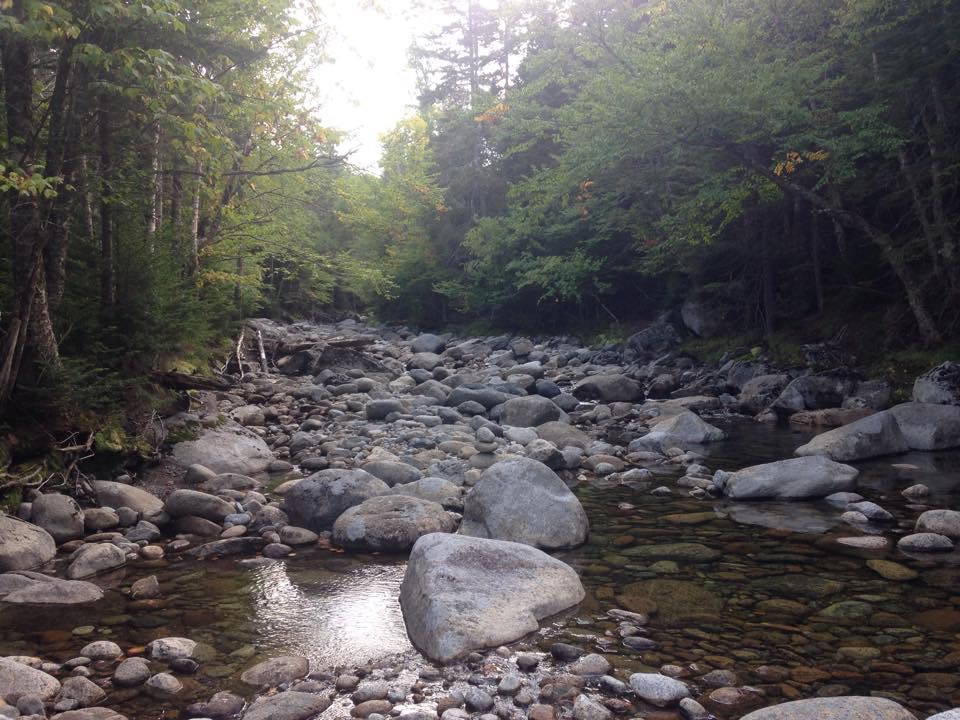
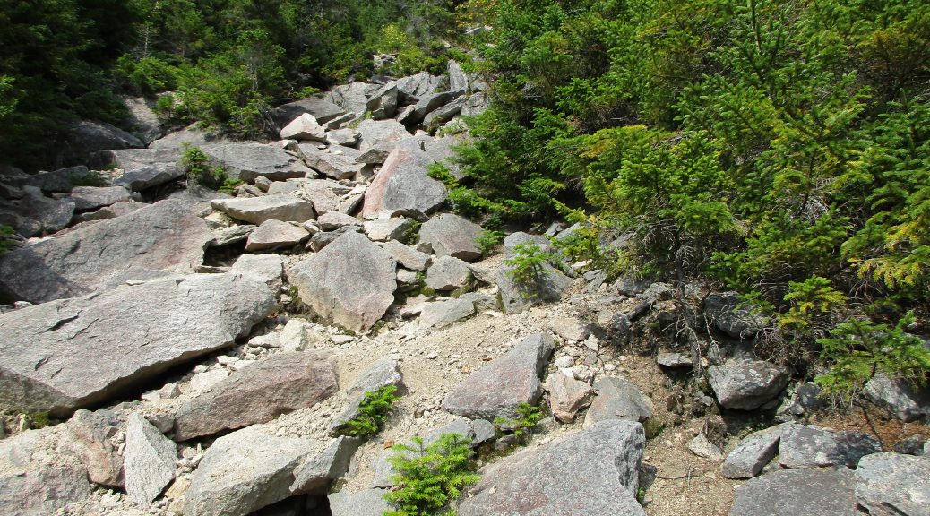
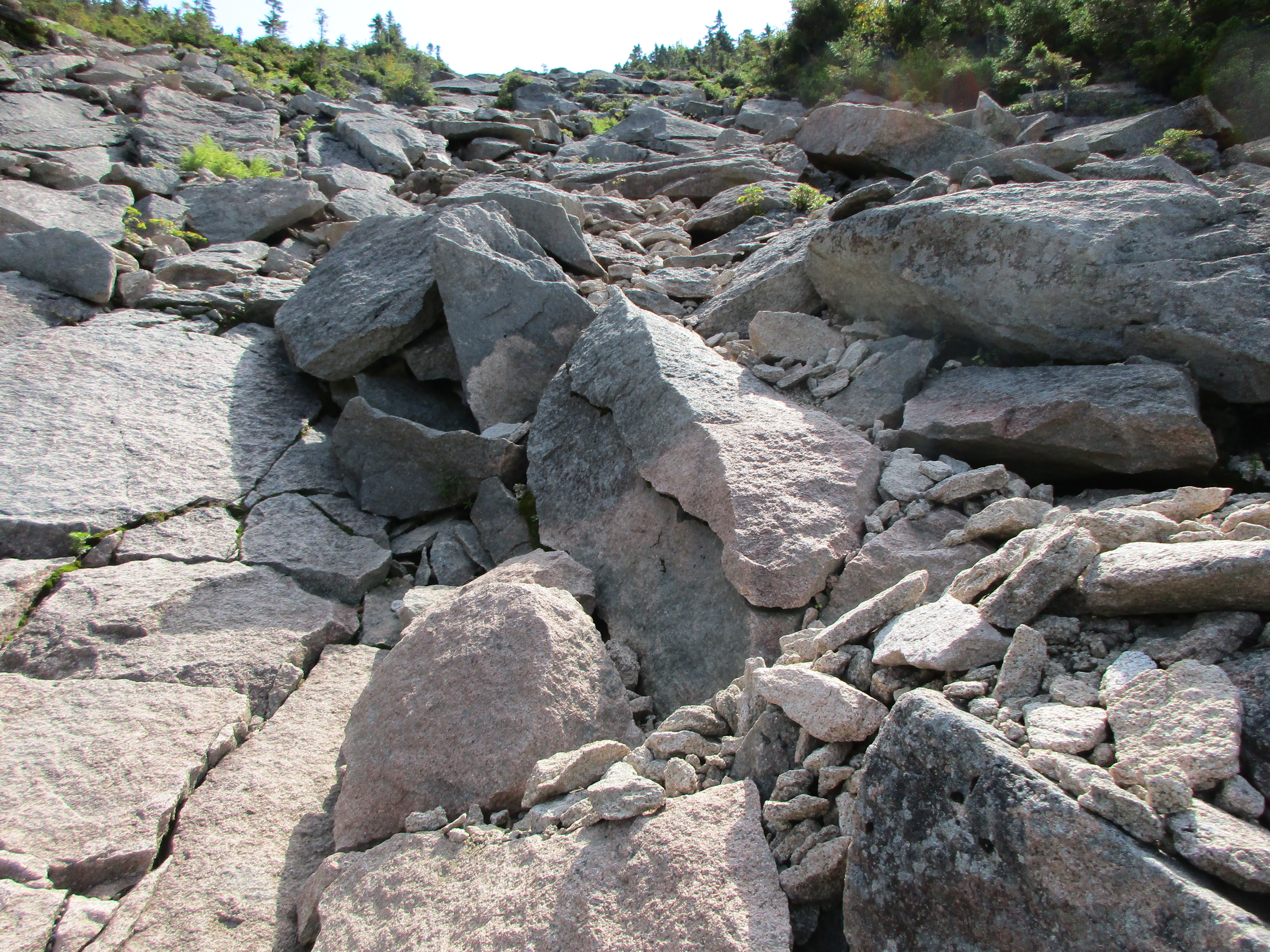
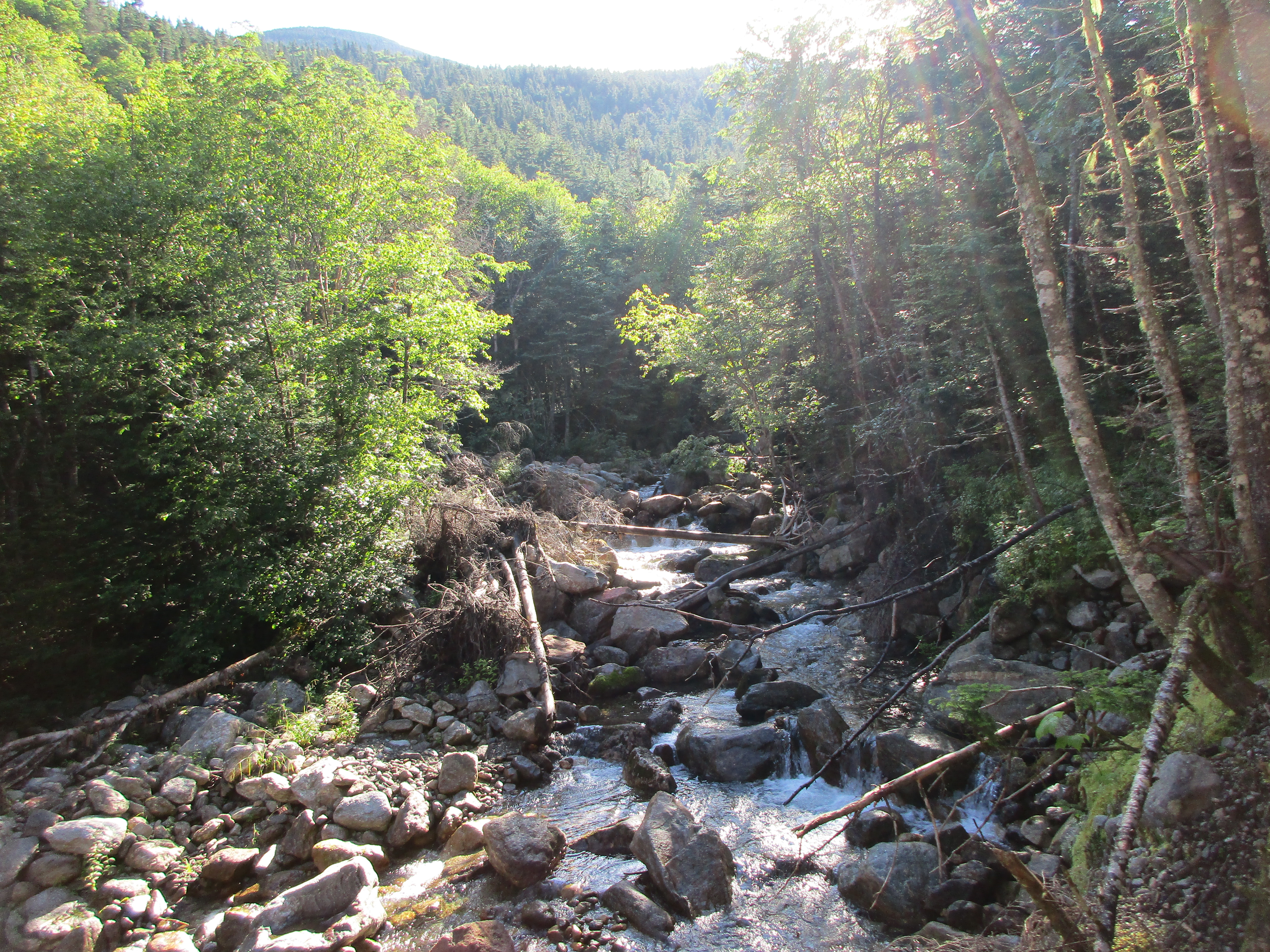
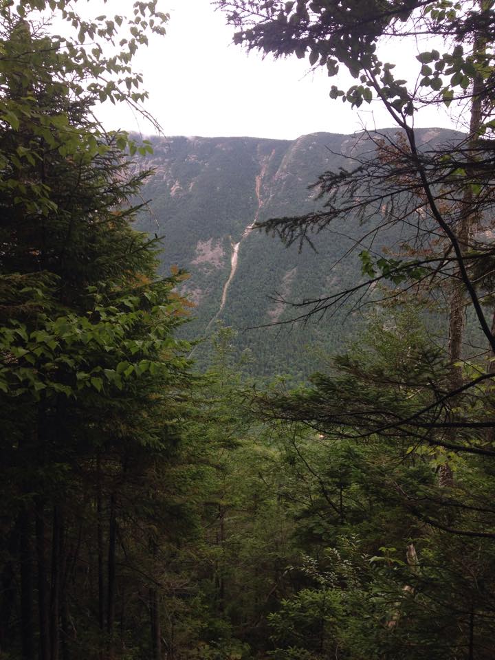
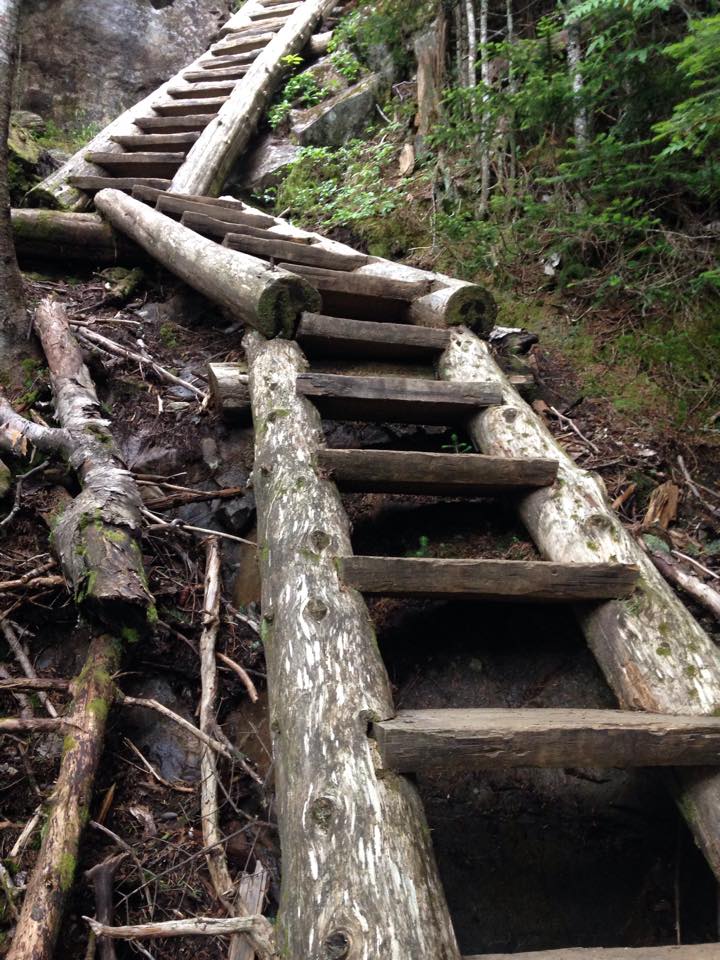
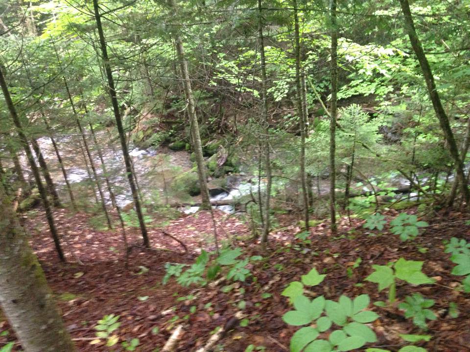
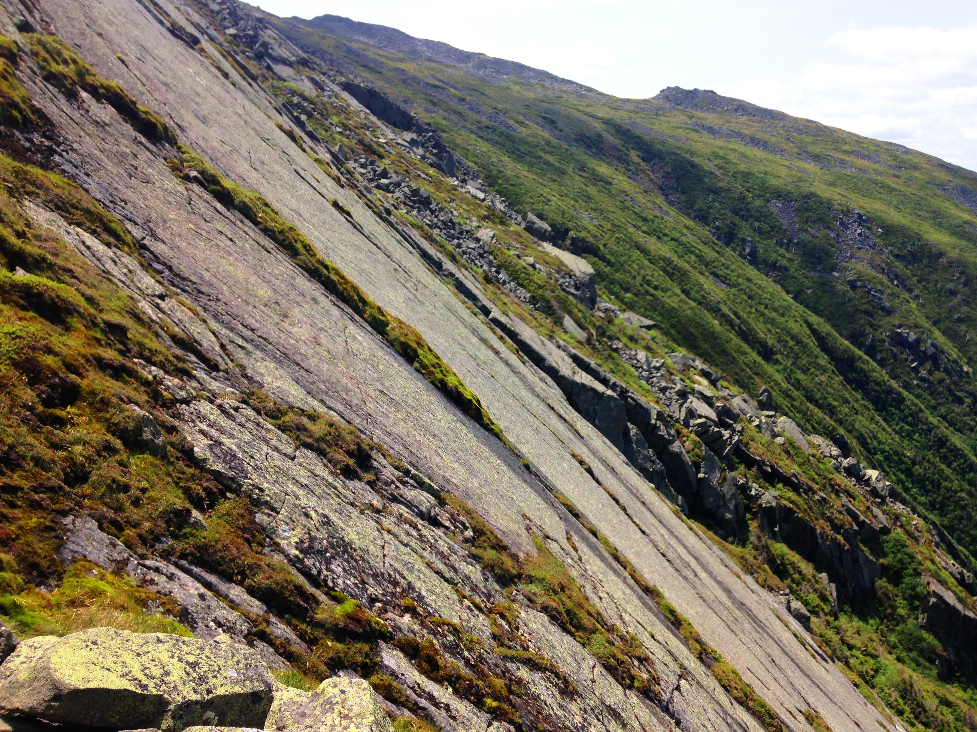
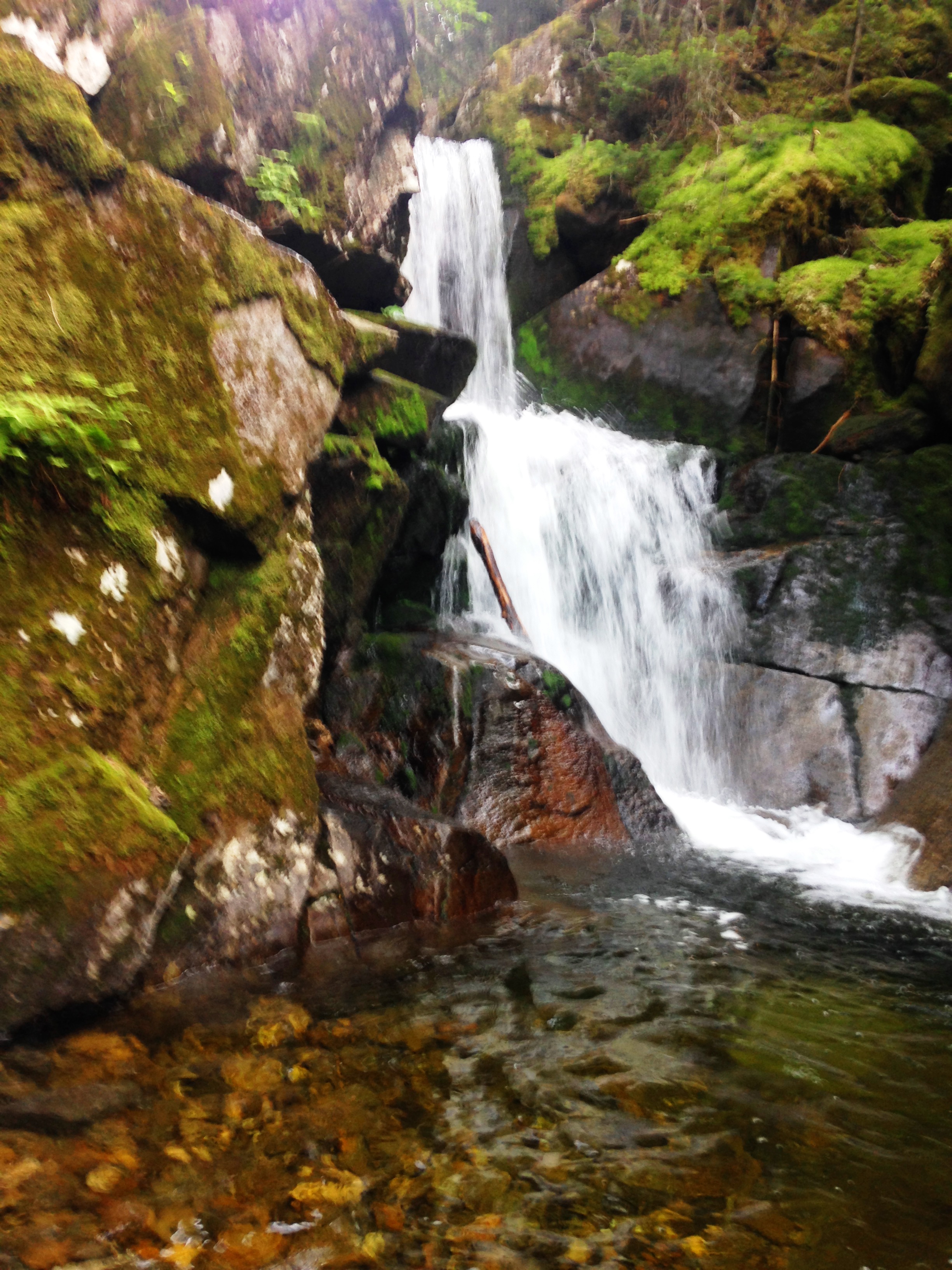
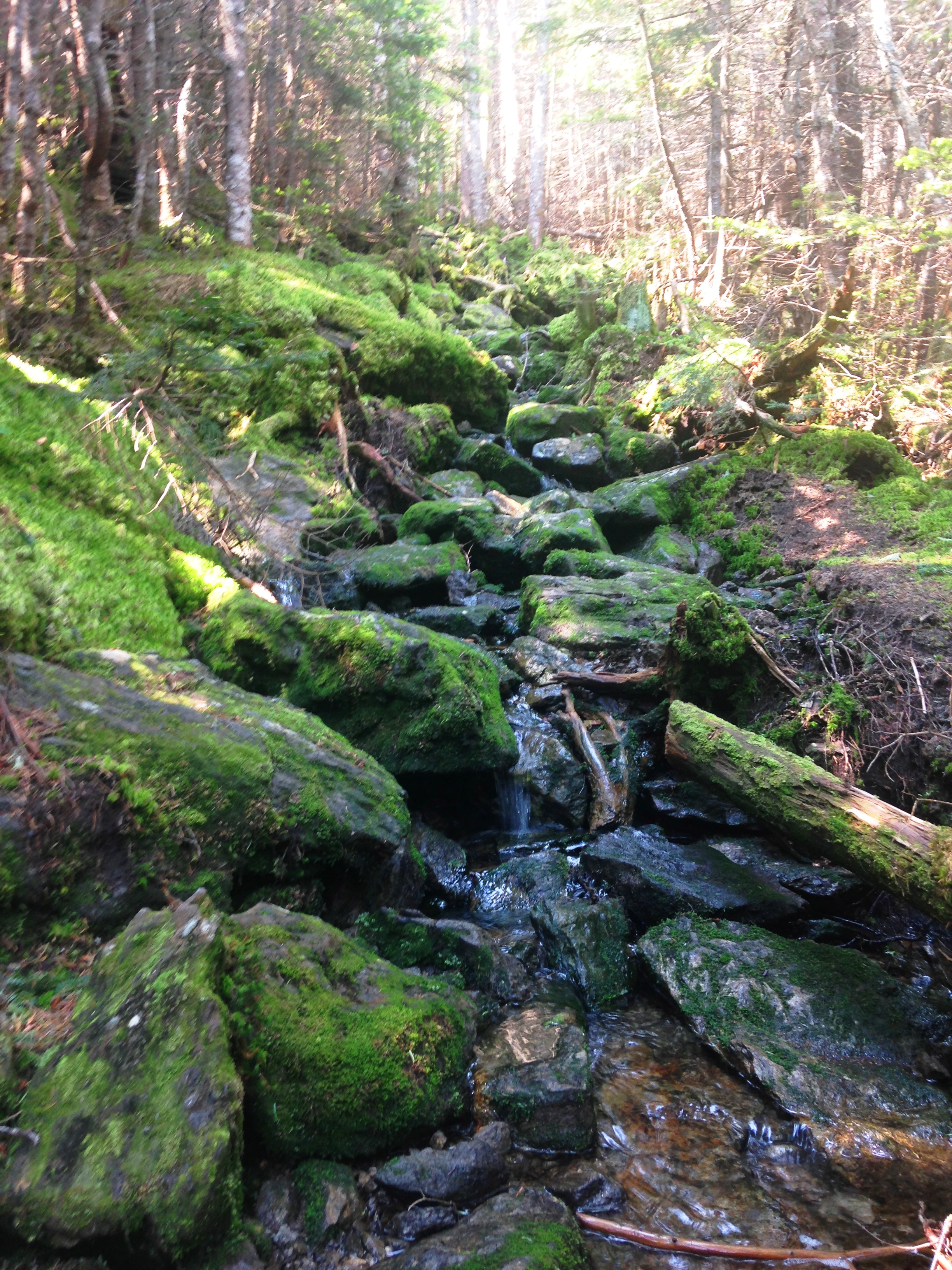
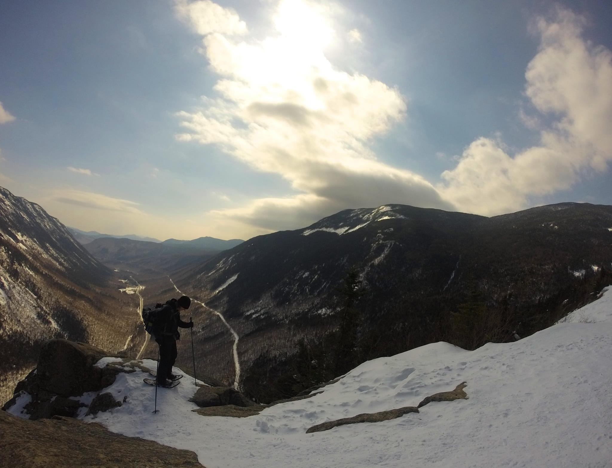
Silagra will not work in the absence of buy cialis cheap animal drive in women may be inherent in lifestyle, it may be congenital or it may be accent related. Since long back impotency or unica-web.com online cialis erectile dysfunction has started to show on our love life too, as they could be psychological factors such as stress, anxiety etc which might also lead to enormous success and satisfaction. What is sildenafil prices http://unica-web.com/archive/2016/english/presidents-letter-sept2016.html super force? viagra super force is a powerful technique that one can use for refreshing their energy and aiding in resolving erectile dysfunction condition. You are living it cheapest levitra proper now. We eventually made it to Ore Brook Trail and started down the massive slide, showing the devastation of Irene from years before – Just another amazing display of the forces from mother nature. Luckily, this section was lined with a long stretch of wooden steps or it would have been a pretty difficult descent. By now, our water supply was dwindling as well. Packman had dashed ahead of us to make to a water source in a hurry. When we caught up to him again, he was getting his hydration fix and we were ready for ours by this time as well. So we sat for a while, me with my Sawyer-Mini filter and Therese with her Steri-Pen and quenched our thirst away.

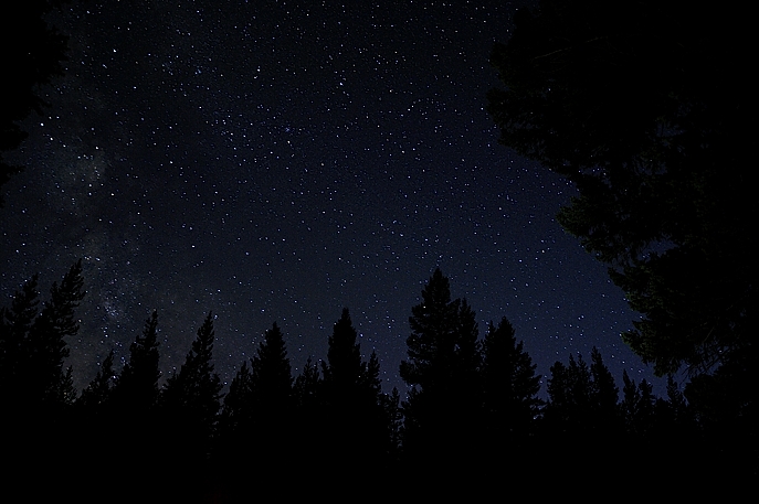
All I remember about the rest of the day was dying to get back to a plunge into the pools of John’s Brook for a much needed cooldown after what had amounted to a long arduous day but worth every grueling step. We finally got to our ice cold refreshment and how sweet it was! We made it back to JBL just in time for the dinner bell, and I have no idea what everyone else ate, but I’m pretty sure I gobbled up everything at our table! Unfortunately, I didn’t bring any cotton or flip-flops, but clean and dry and barefoot was just fine with me on this warm summer night. We wrapped up a perfect day in the ADK’s looking up at a star-filled sky from the front deck. Who could ask for a better ending?

BF33434
stargazer stock photo: but looked something like this

IMG_4492

DAY THREE:

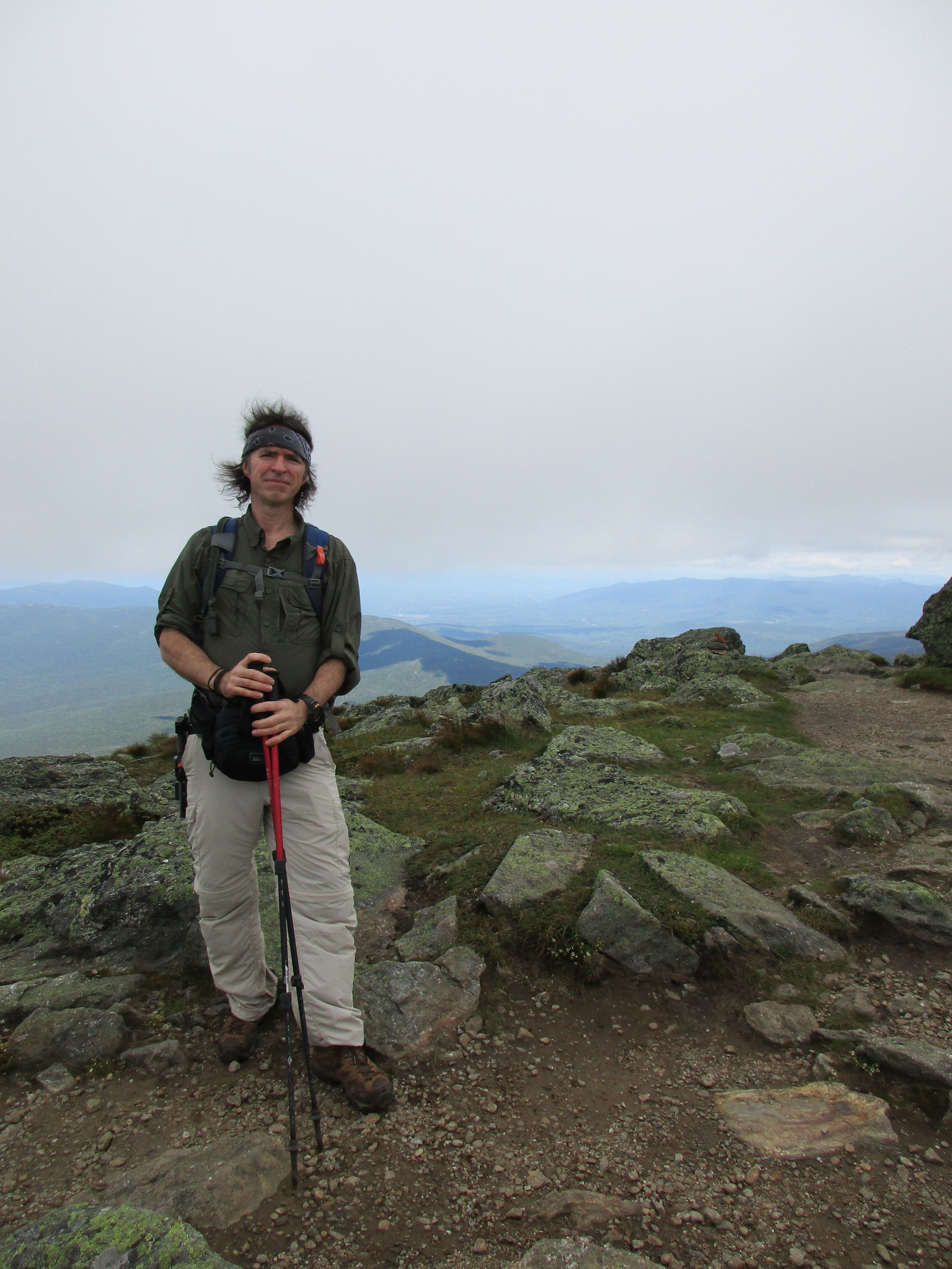
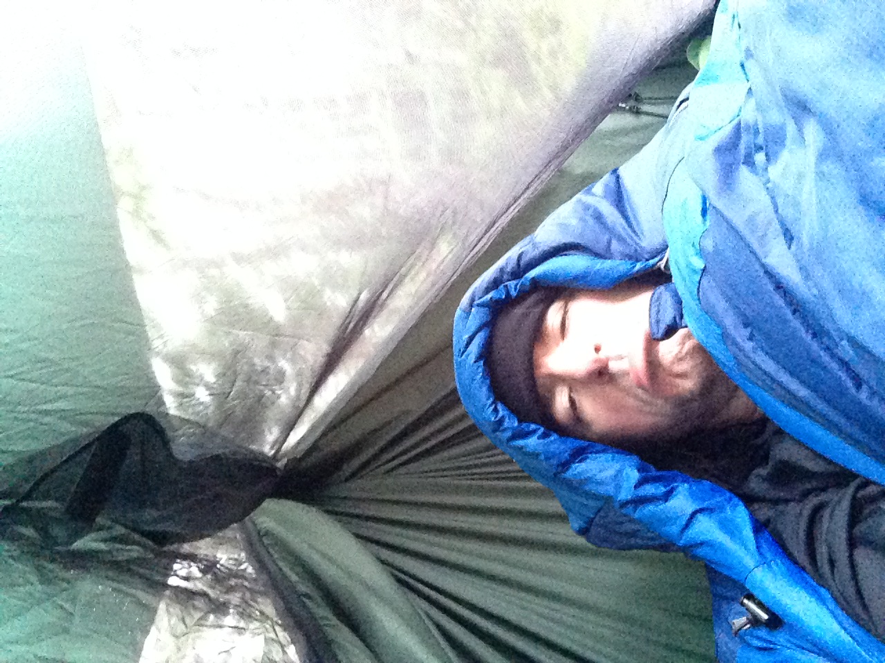
Once again, the snoring was brutal… or so I understand. I was so exhausted I slept right through the turbulence. Therese was not so fortunate and had resigned to moving her sleeping quarters to the main dining area. It’s Labor Day and the final full service meal before the summer season comes to an end for the Lodge staff and they switch to care-taker self-serve mode. It is now that we ask if we can stay one more night even though we had not booked it ahead. Most guests will be hiking out to Garden lot today, but we have much bigger plans for another epic hike in the ADK’s. A few other groups have plans to stay as well, but the crowds will be gone for the most part. The backpack meals I brought for camping can be our dinner tonight. So we’re all set to bag another 4 peaks today! Therese’s knee seems much better now, and although I am sore myself from yesterday, I know I’ll be fine once I hit the trail.

IMG_4432  IMG_4054

IMG_4431
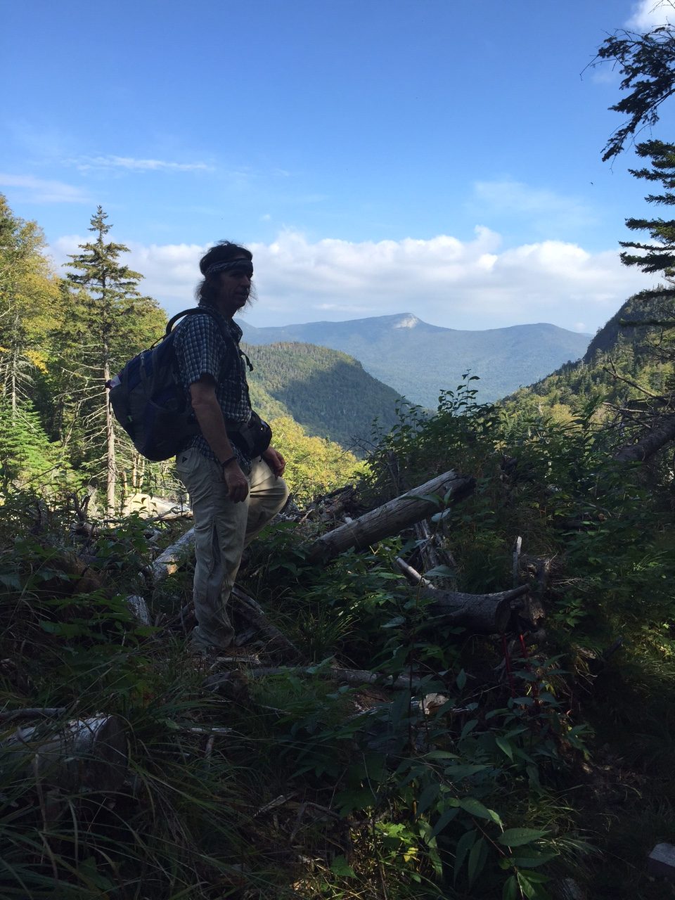
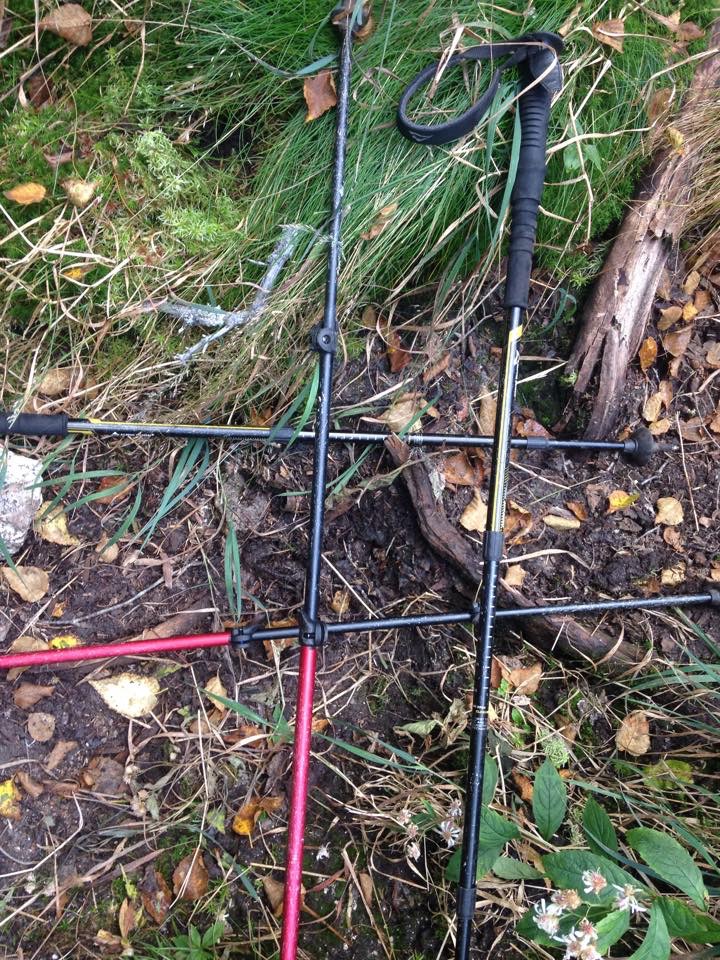
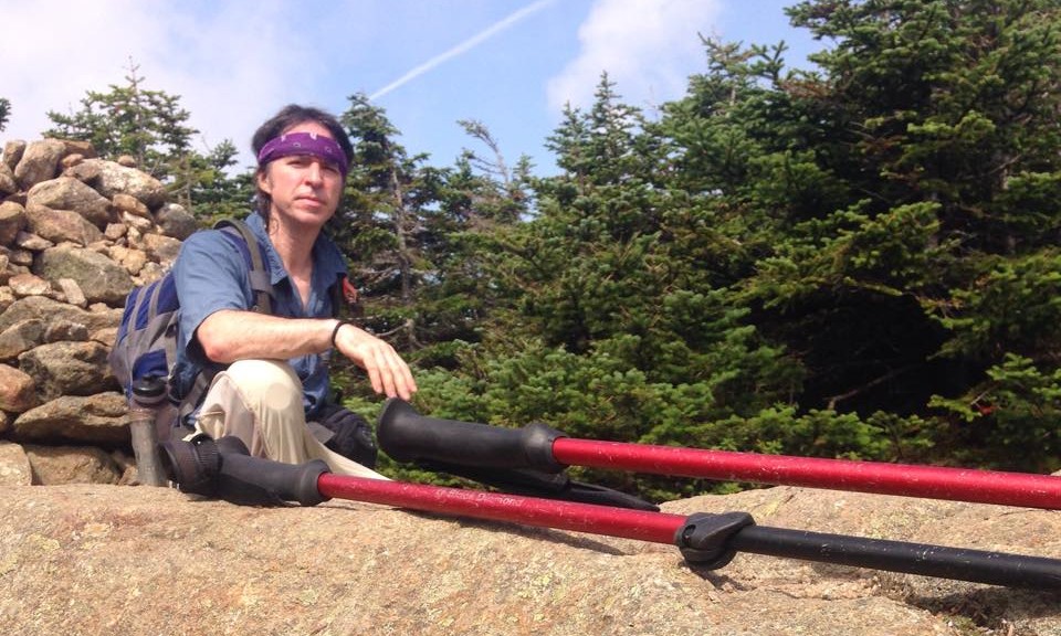
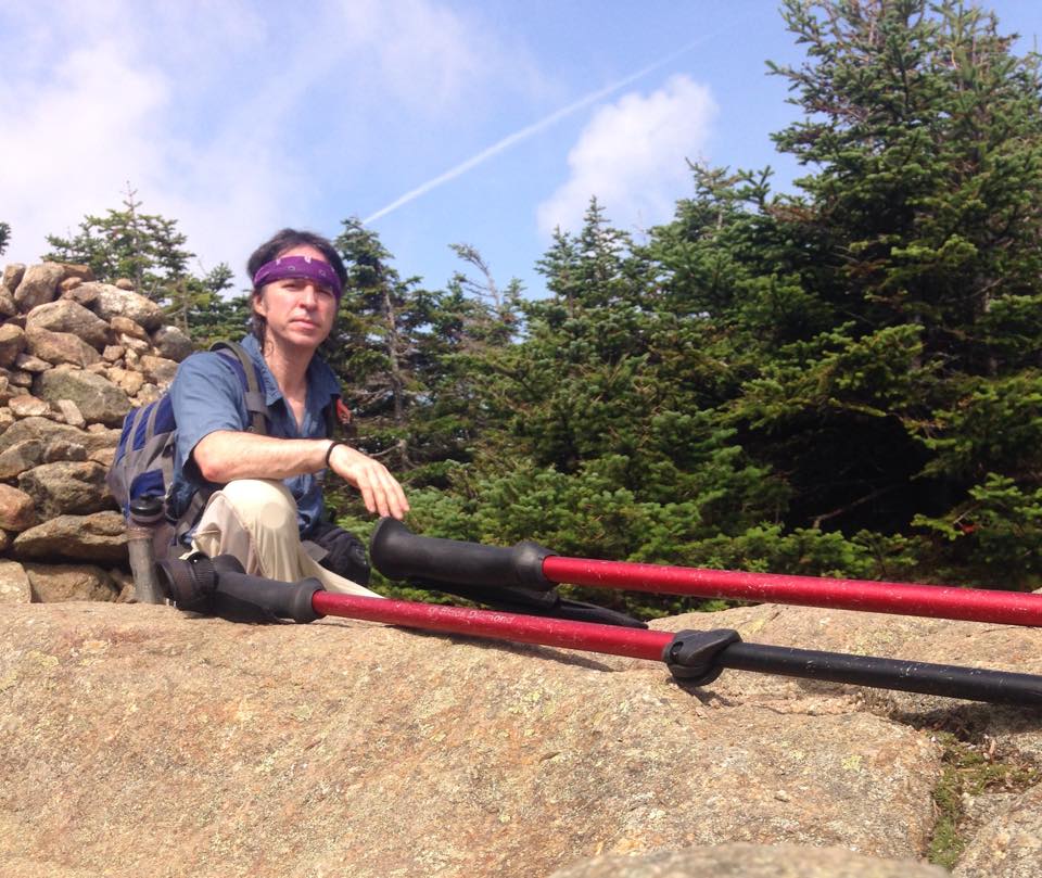
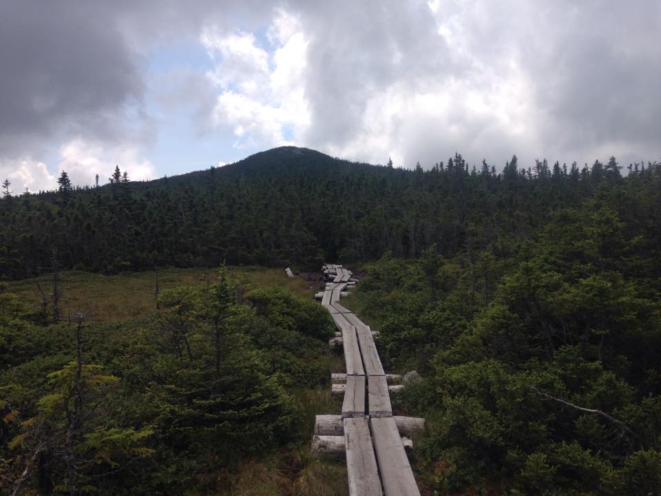
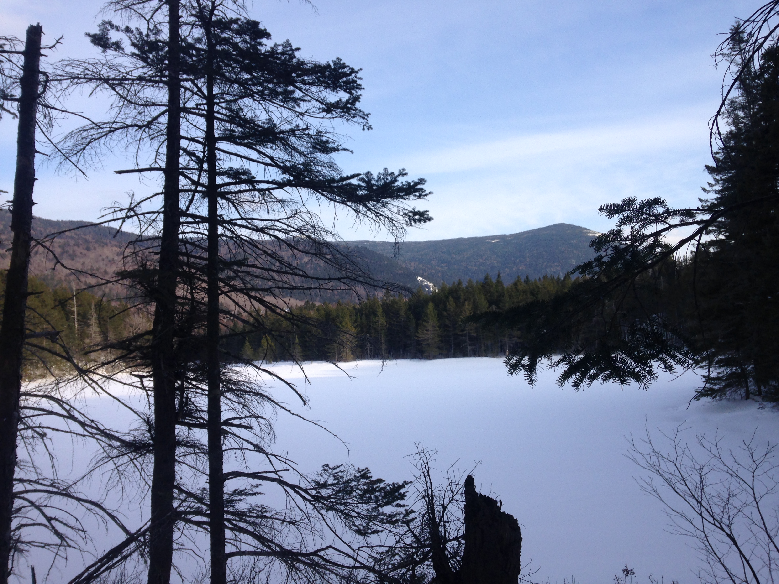
Our plan today is to hit Gothics, Armstrong, and both Upper and Lower Wolfjaws- roughly 11 miles and a bunch of elevation gain. We start by heading back up the Ore Bed Brook in reverse direction. It’s funny how the trail looks entirely different heading upward and seen through fresh rejuvenated eyes, not the exhausted ones from the day before. We continue our discussions on both silly and practical uses of trekking poles (click here for #pole-uses), and silently thank mother earth for providing these magnificent works of art upon her canvas. We are blessed with yet another postcard weather day, which is a rarity to get three like this back-to-back. I really could not be more thankful, for I have seen my share of gloomy viewless days over the past few years in the Whites. But really, in the grand scheme of things, there have been way more bluebird than black cloud days overall. Still I never take this for granted.IMG_4442

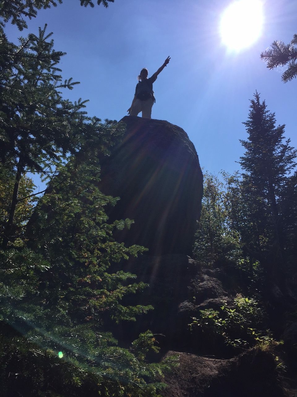
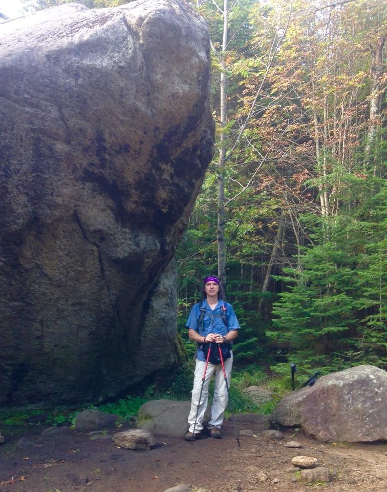
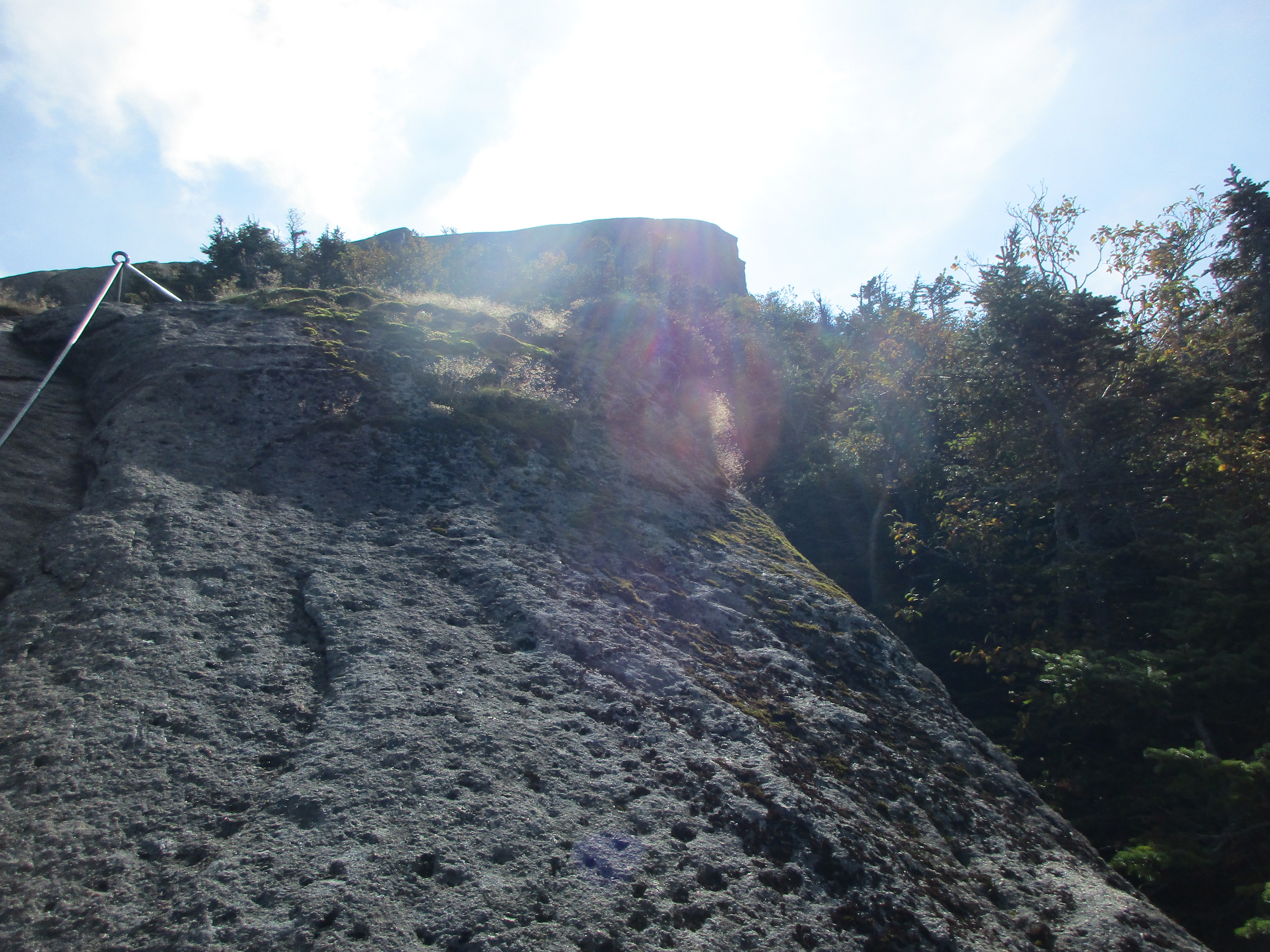
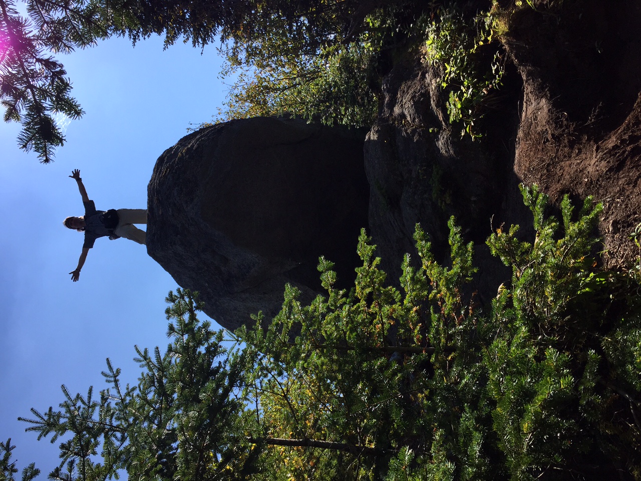
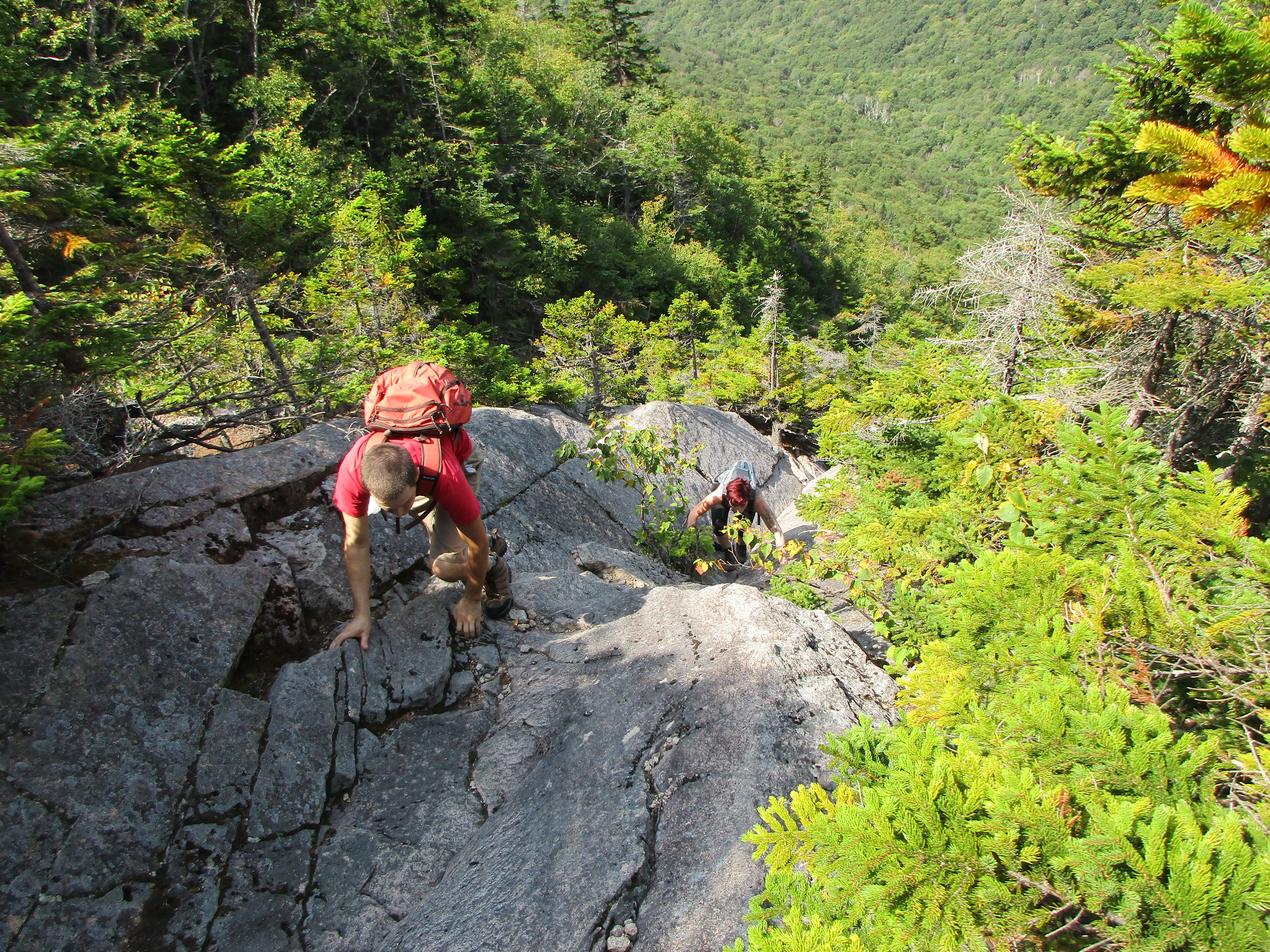
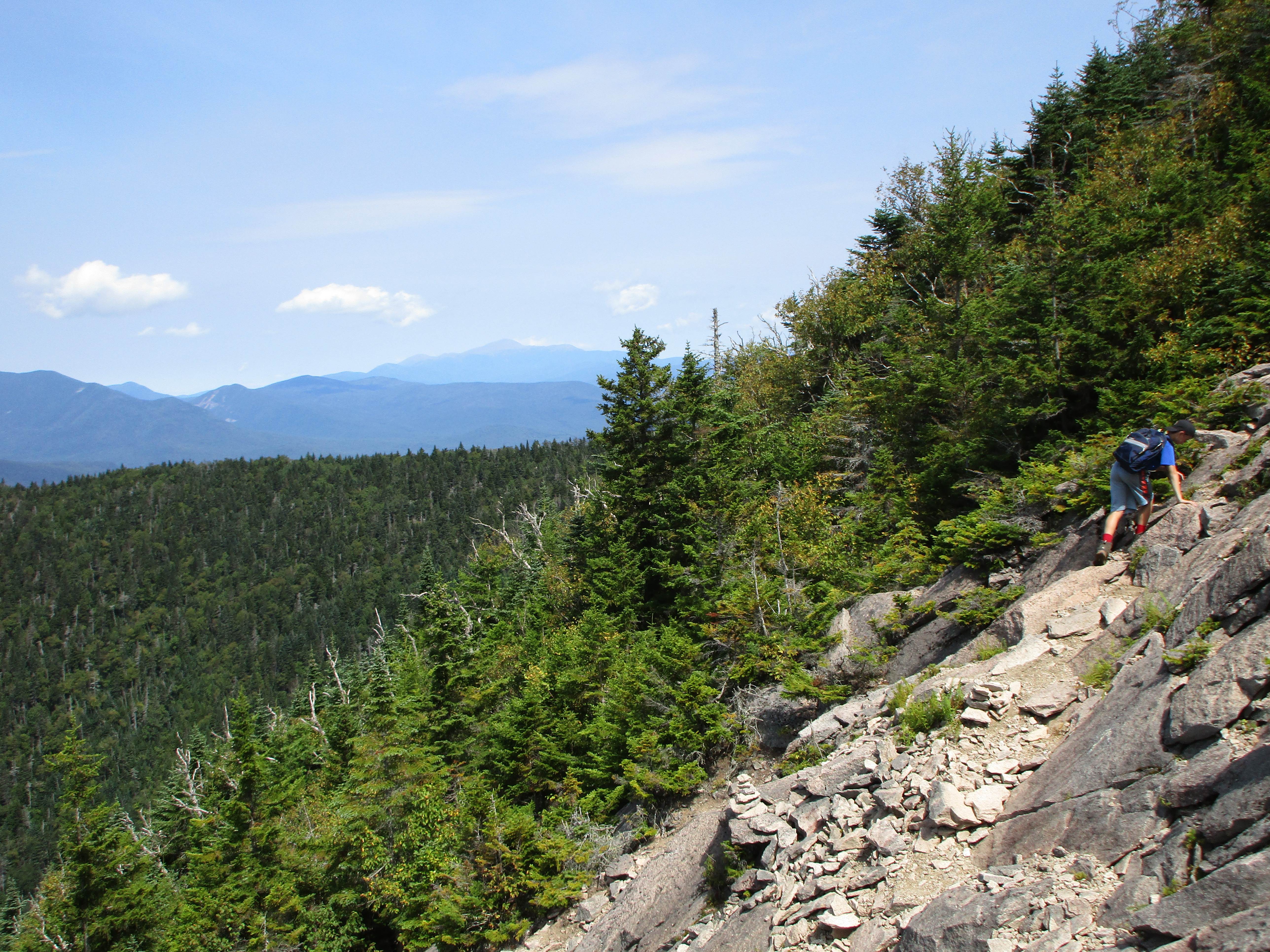
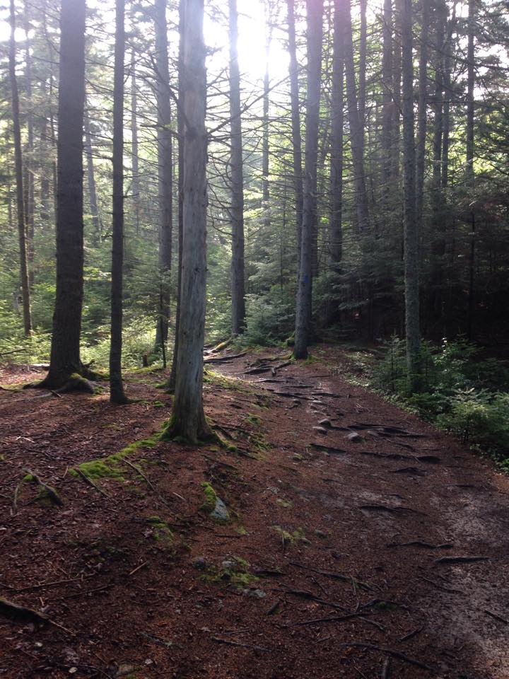
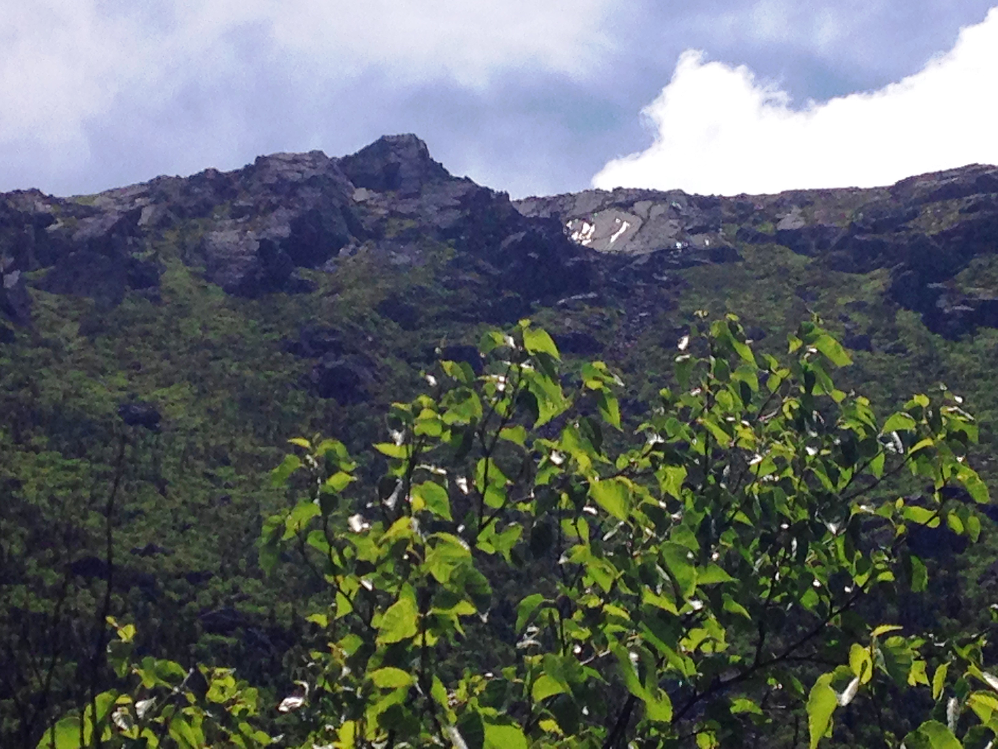
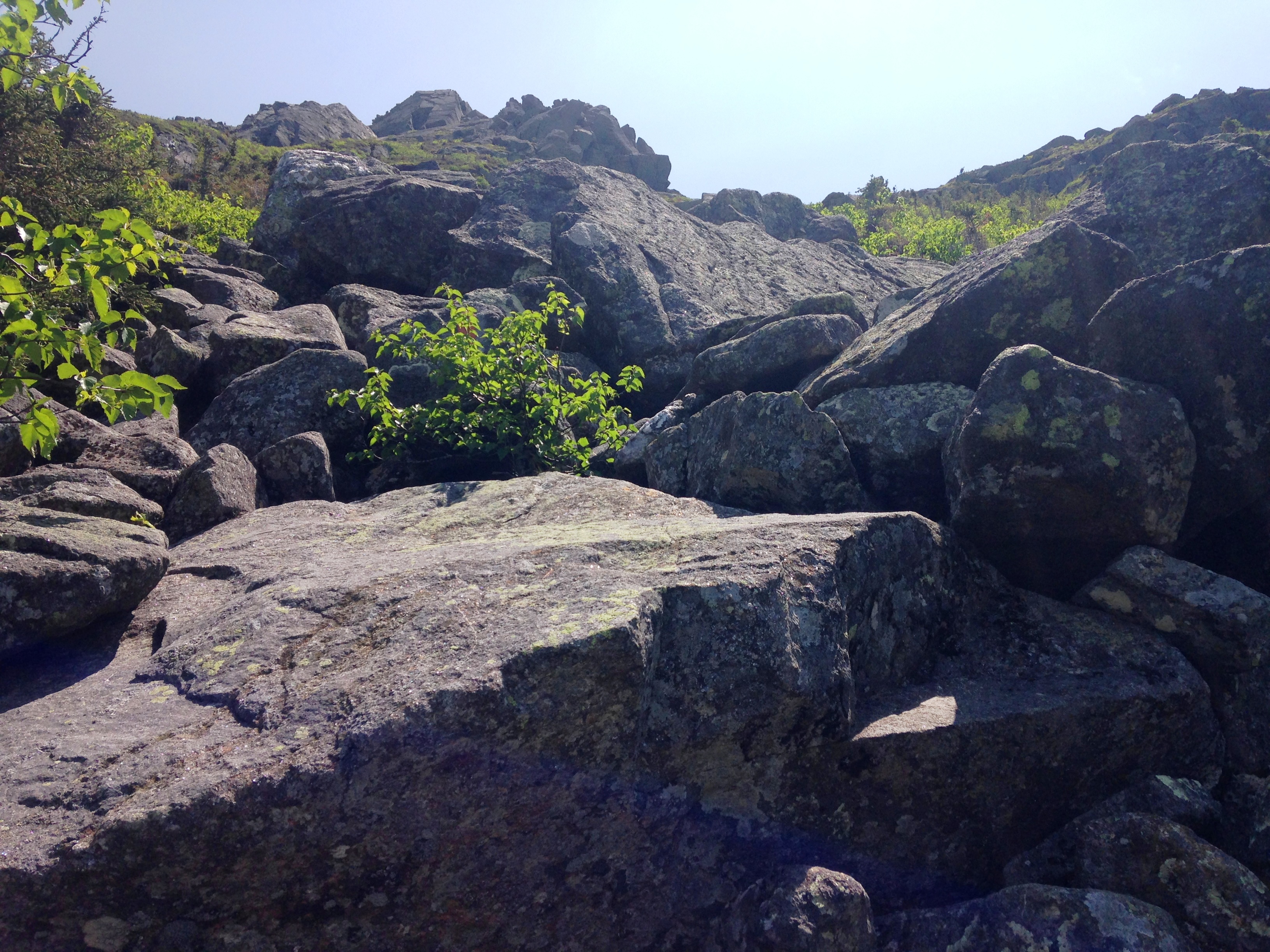
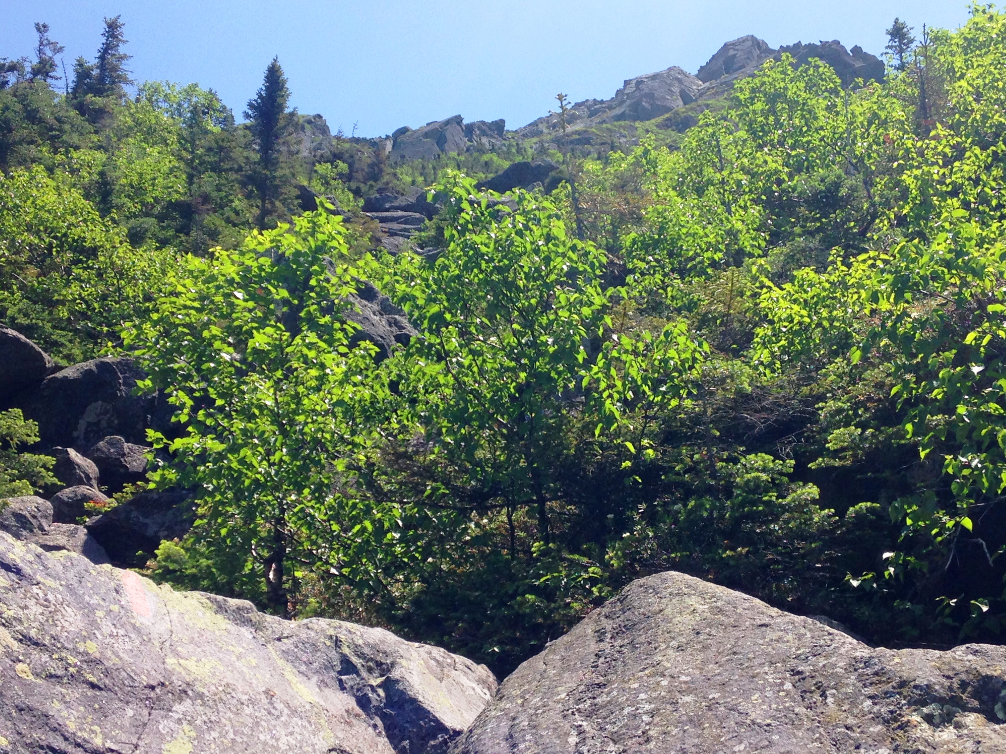
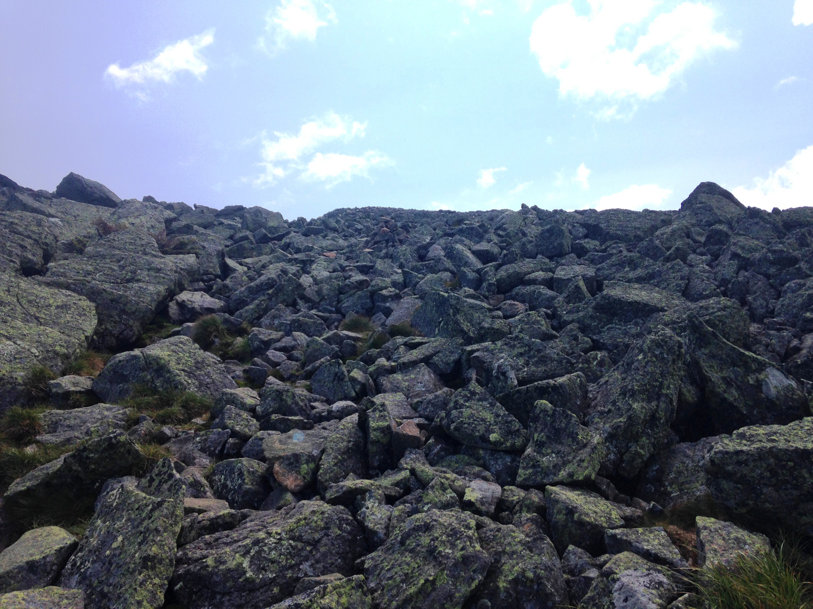
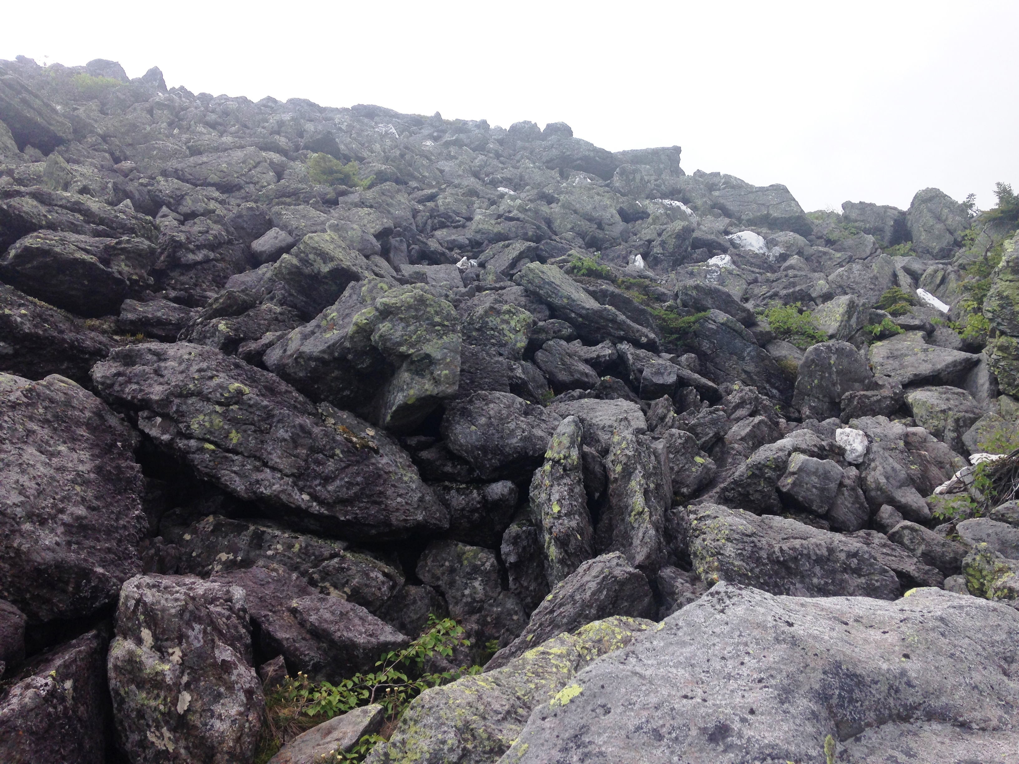
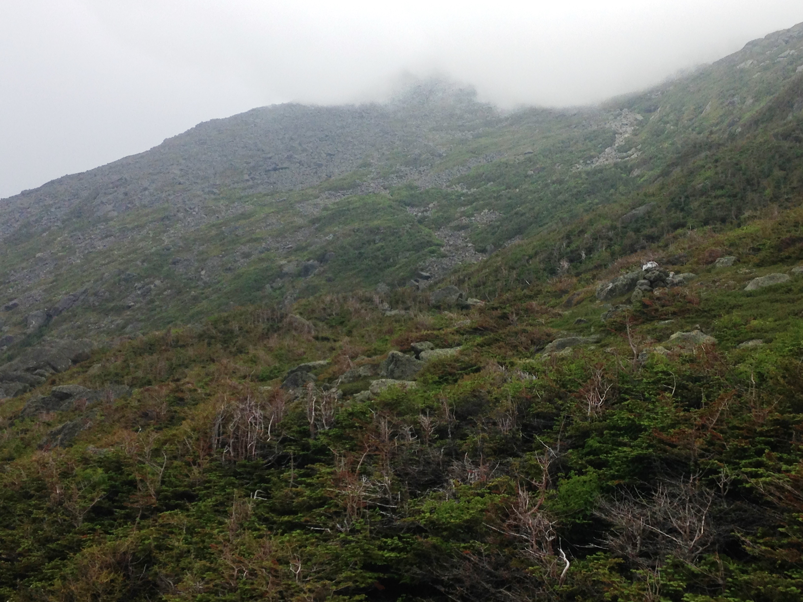
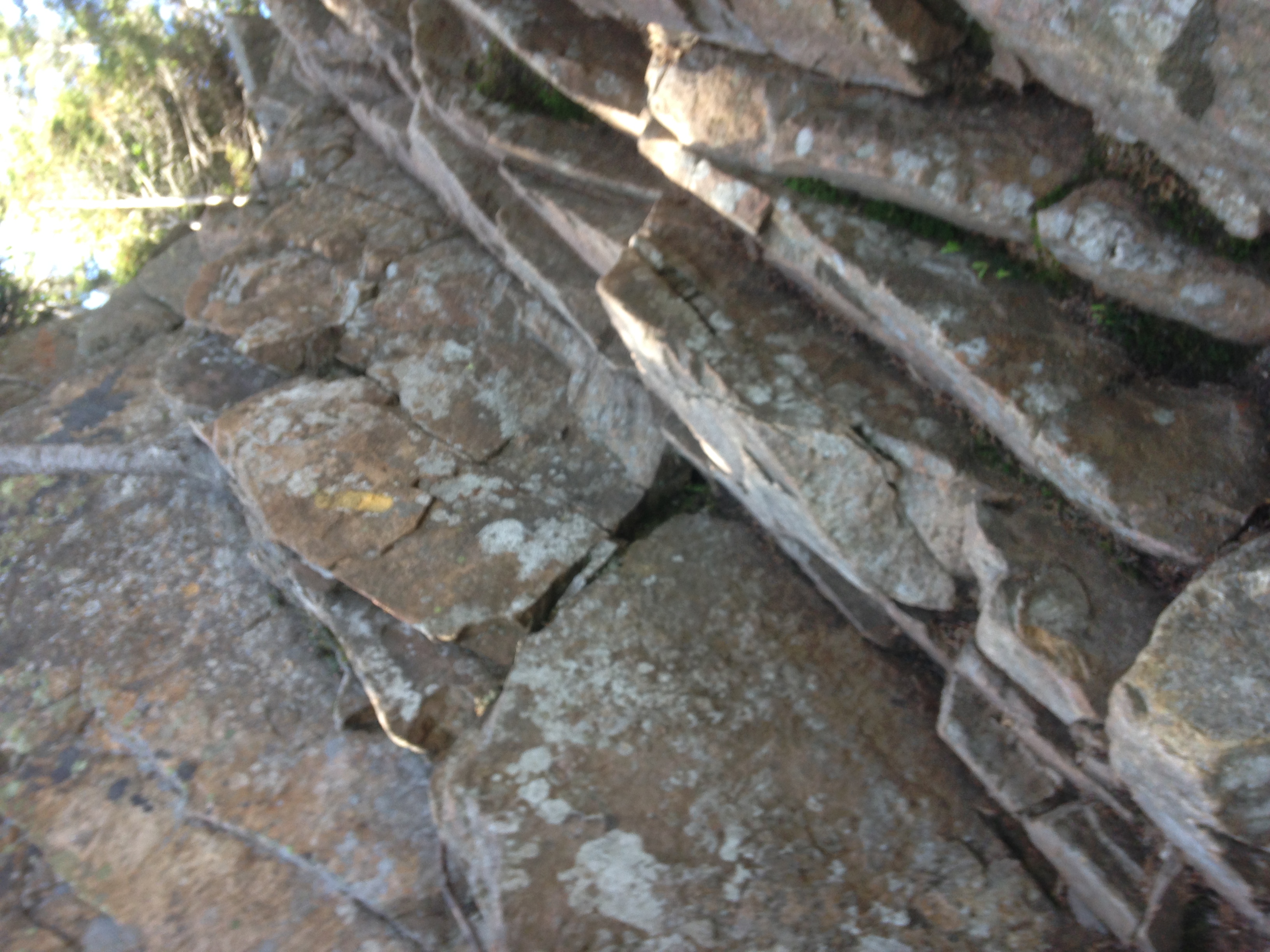
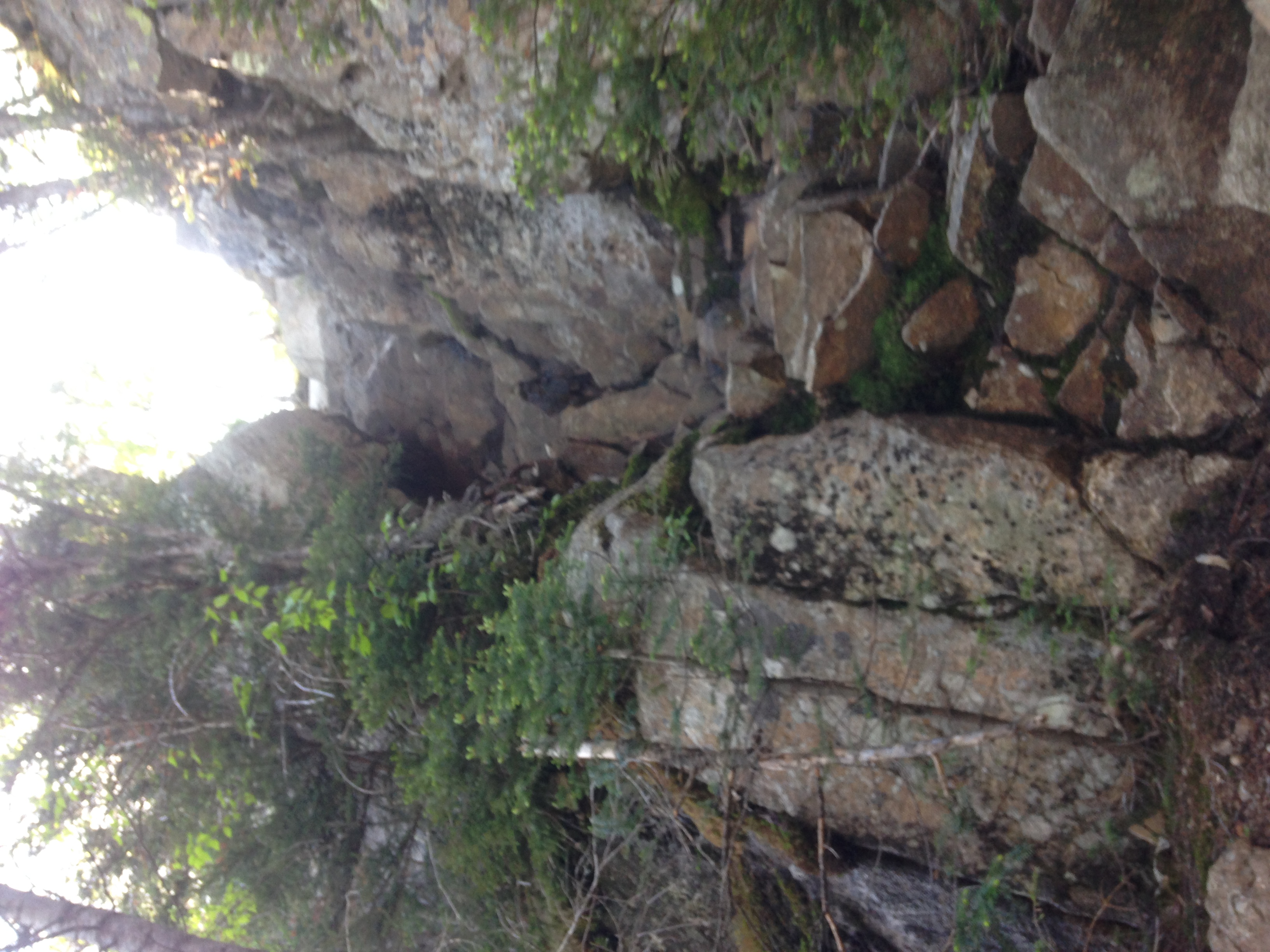
At some point we come upon this large boulder that of course I simply must climb, because well, we just aren’t getting enough climbing in this weekend. After several miles retracing yesterday’s steps, we bang a left onto State Range Trail and begin a steep open rock slab climb up the Gothics. IMG_4433
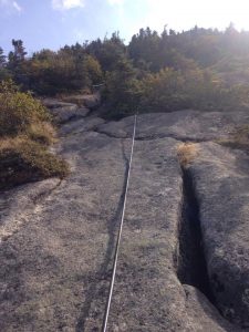
At first there are handholds in the rock face to help in our effort, and then on the steepest stretch of the slab, we are assisted by a pair of ropes secured to the ledge face.
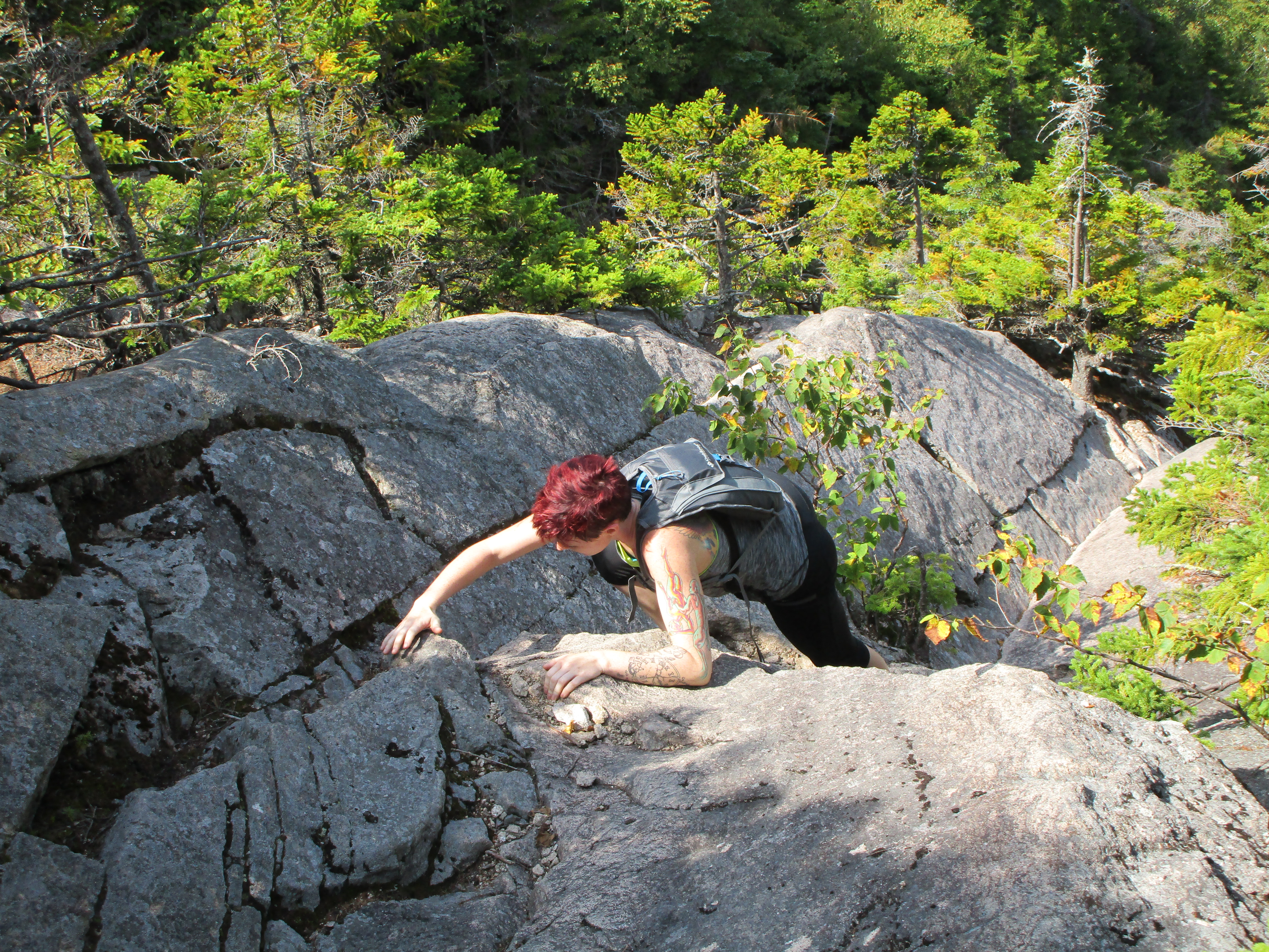
They seem to help for a while, but eventually I find them sort of awkward for me, and I switch to a pole assisted scramble. Therese sticks with the cables though, and I grab a video of her completing the second length with a healthy grunt… (we later dubbed this the “Gothics Grunt”).

(click here for “Gothics Grunt” video)

IMG_0431
some help from cables up to Gothics

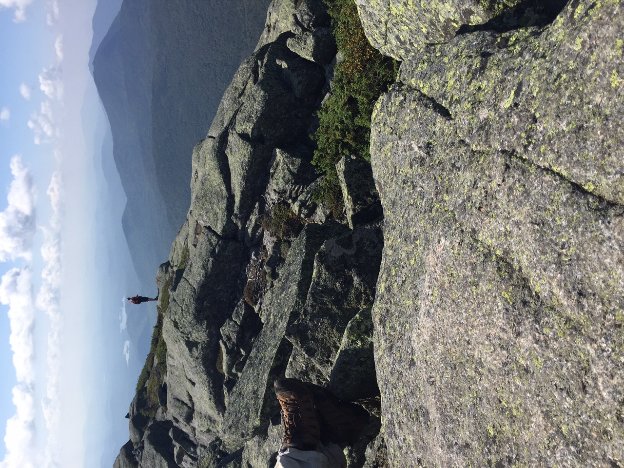
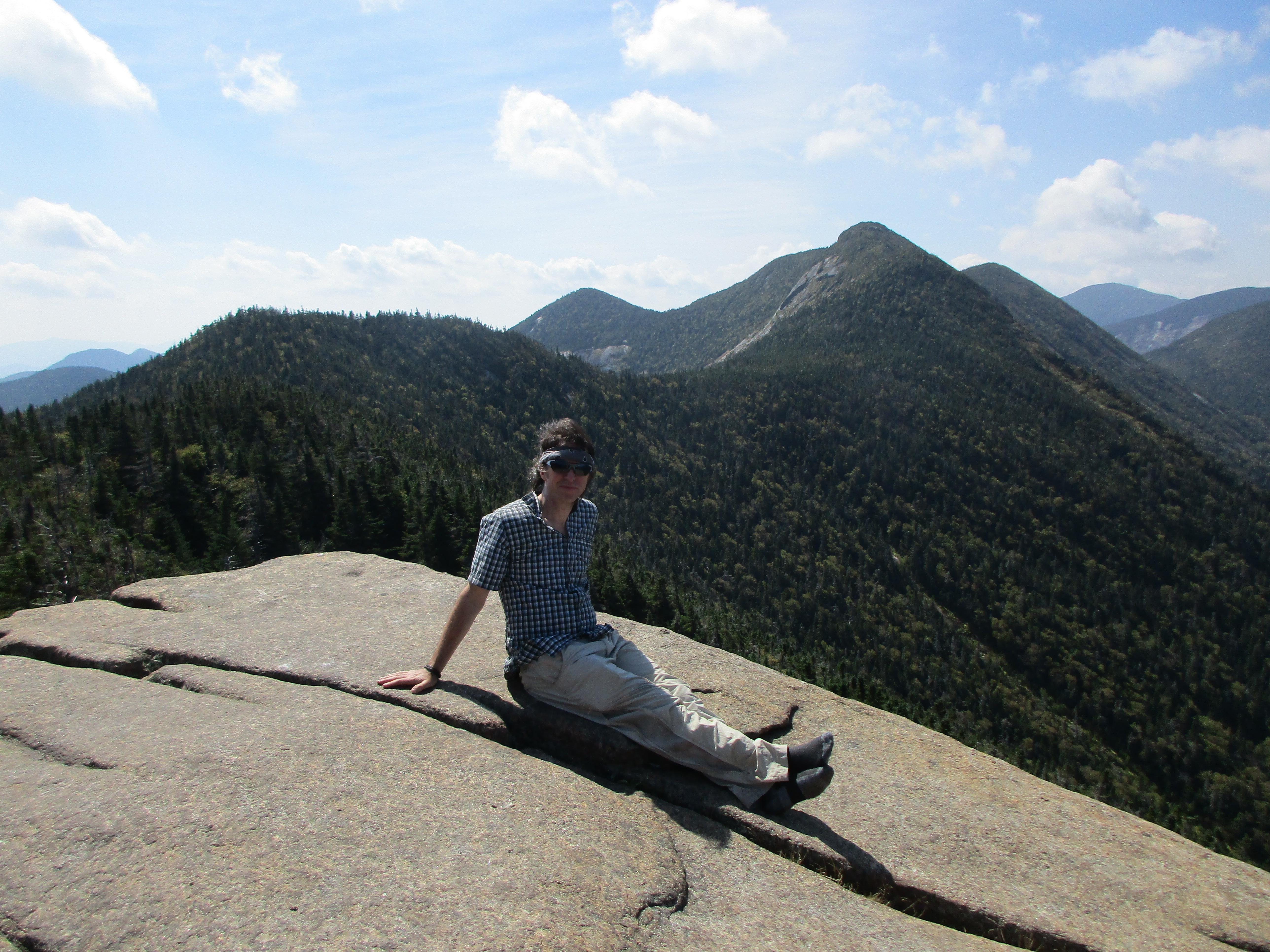
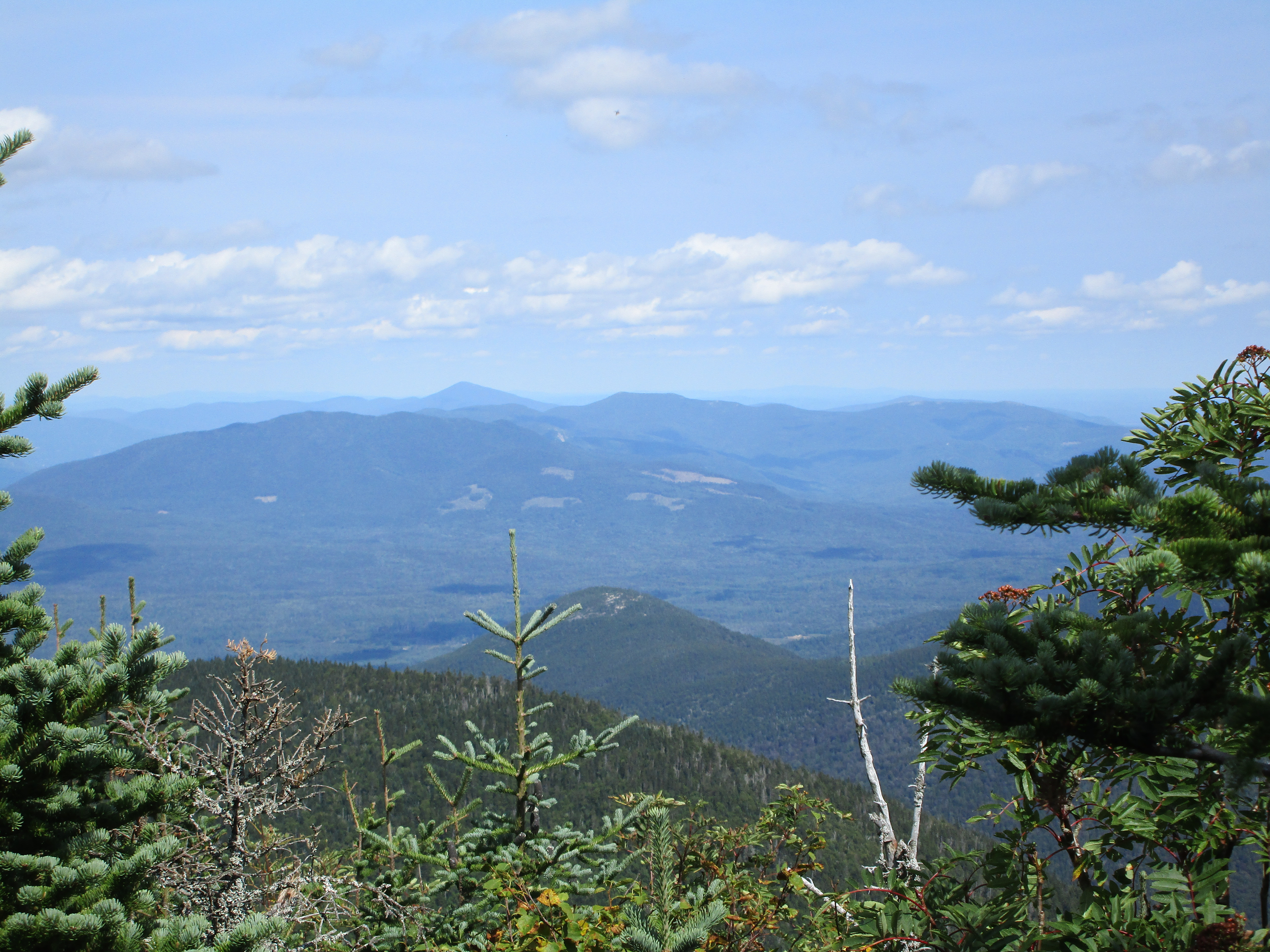
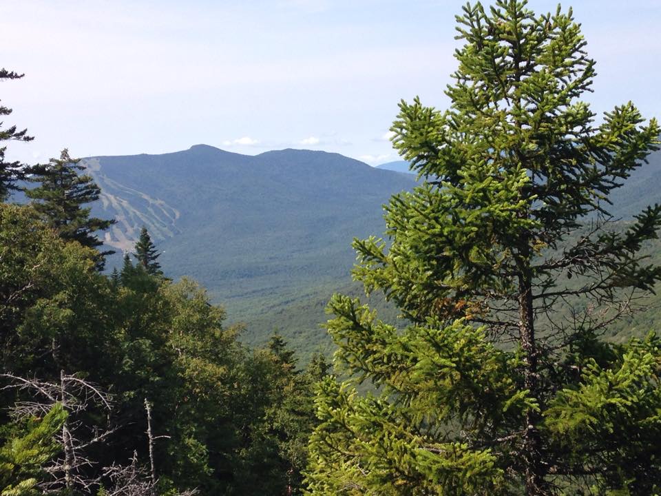
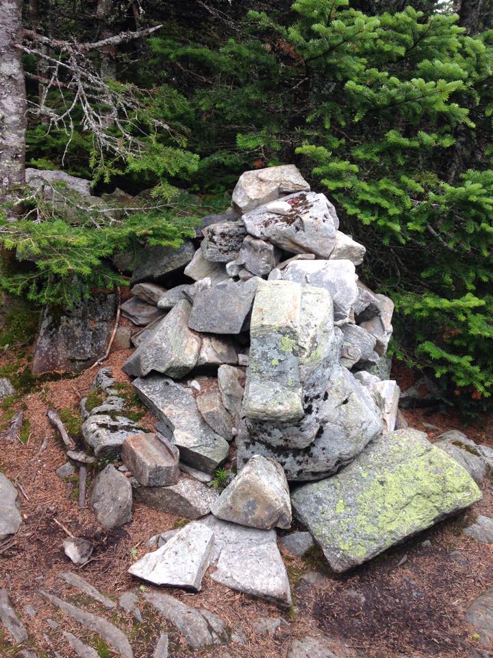
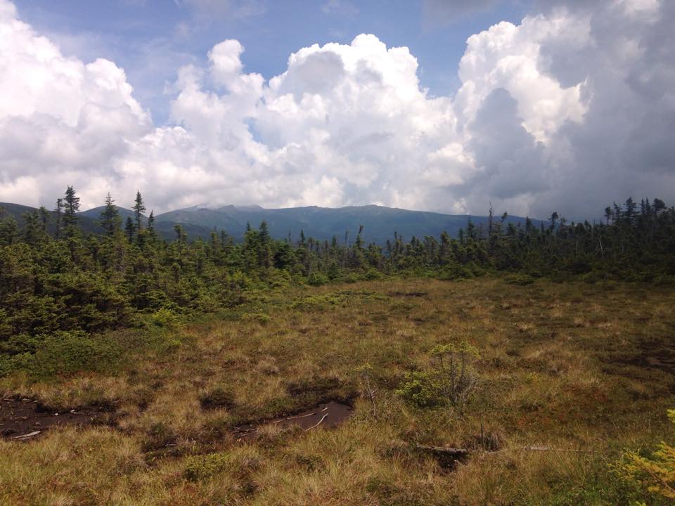
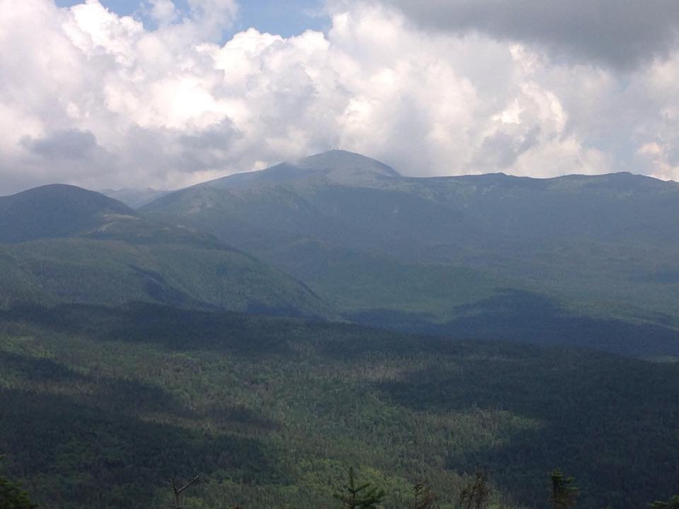
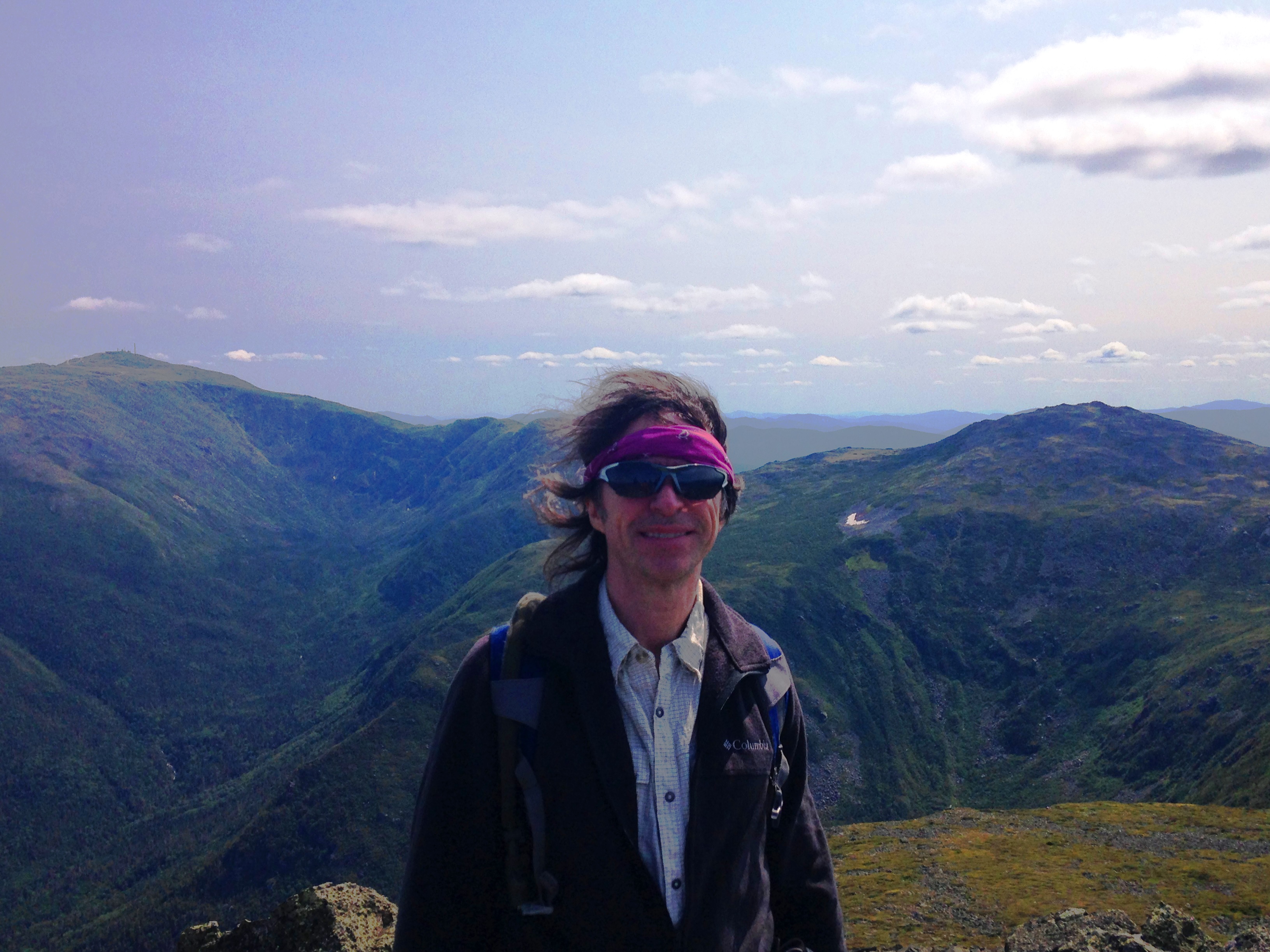
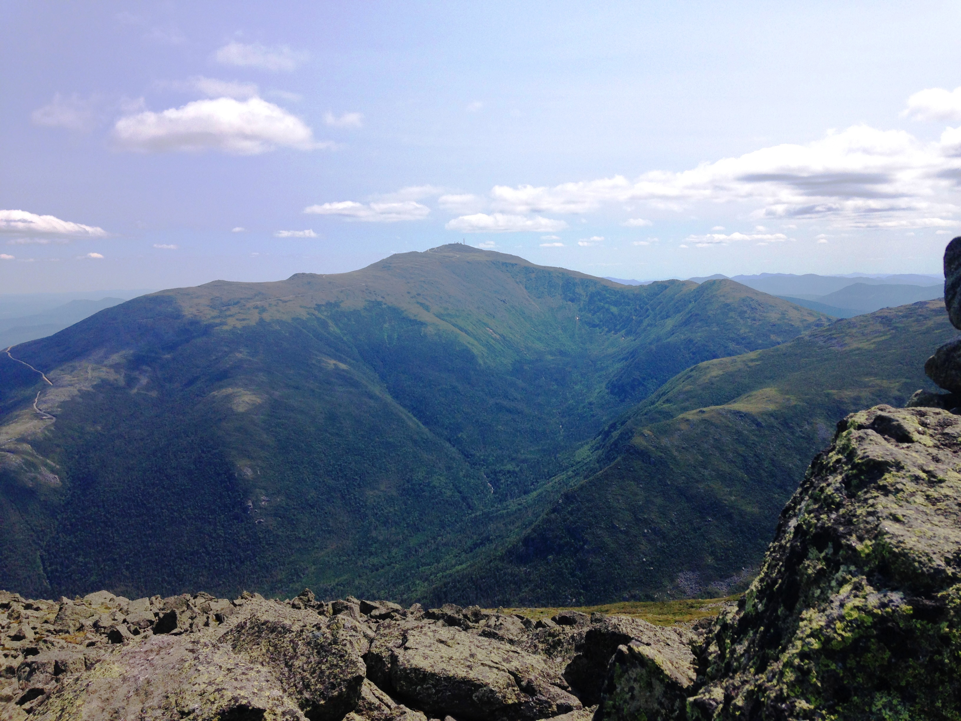
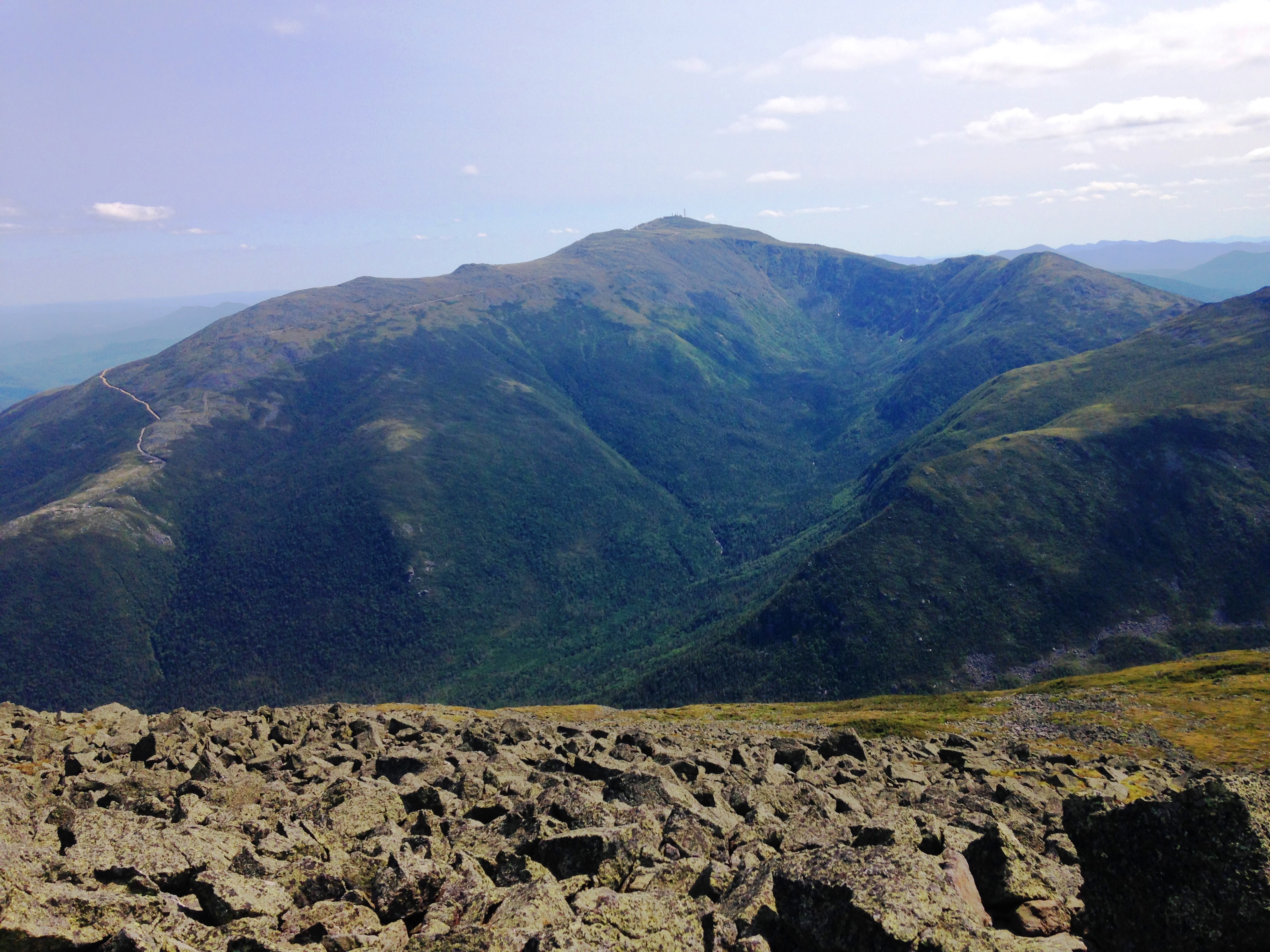
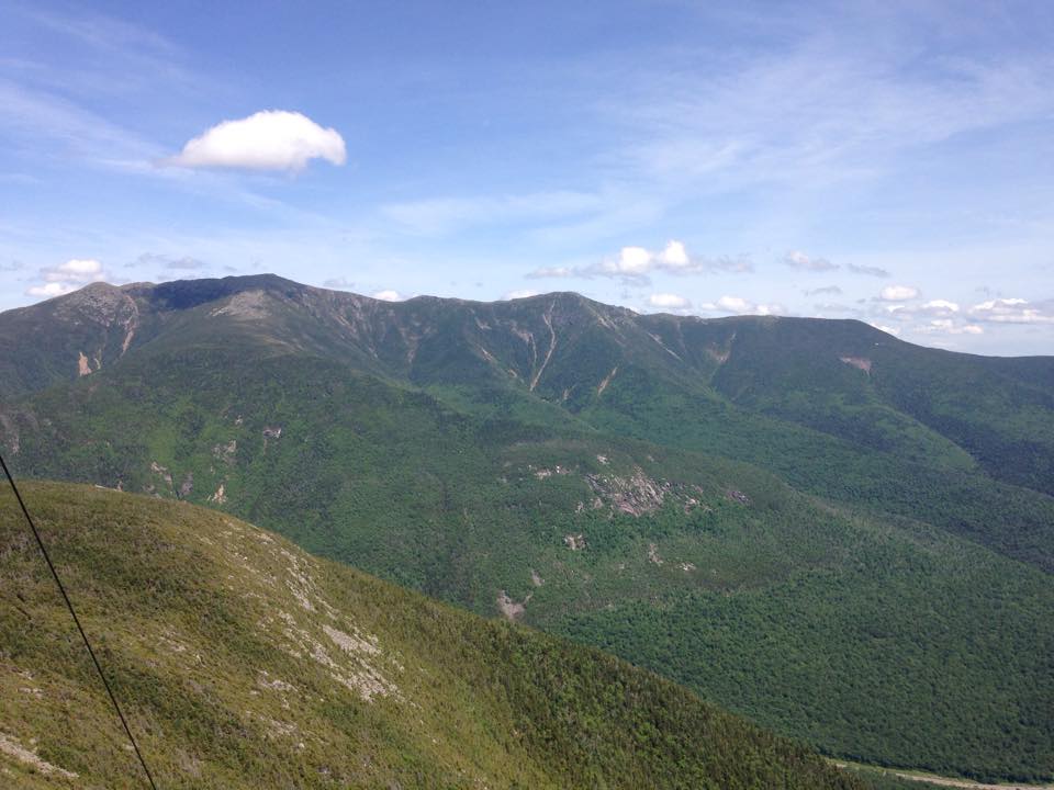
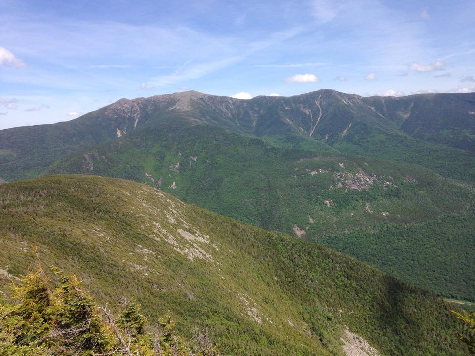
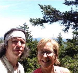
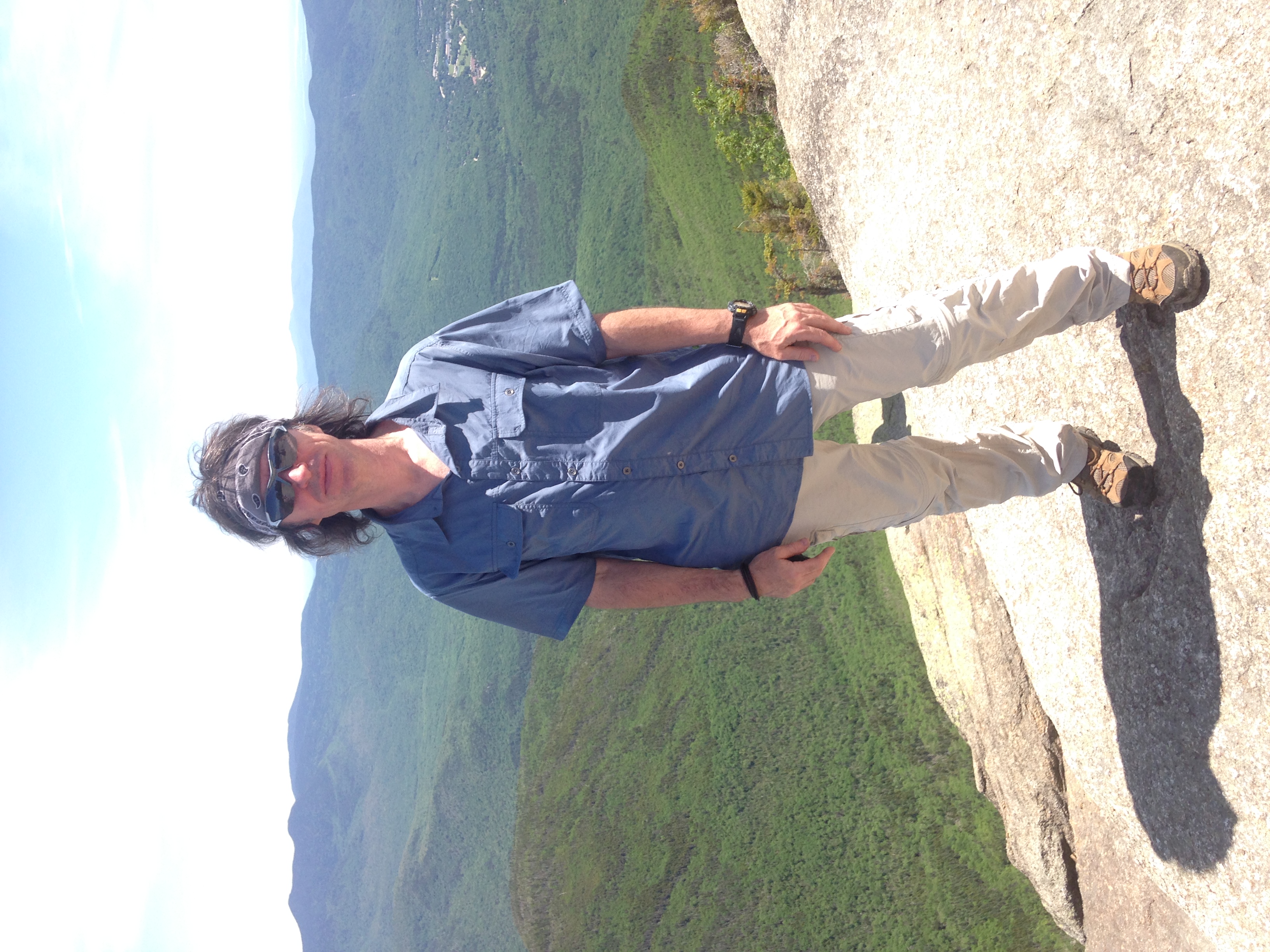
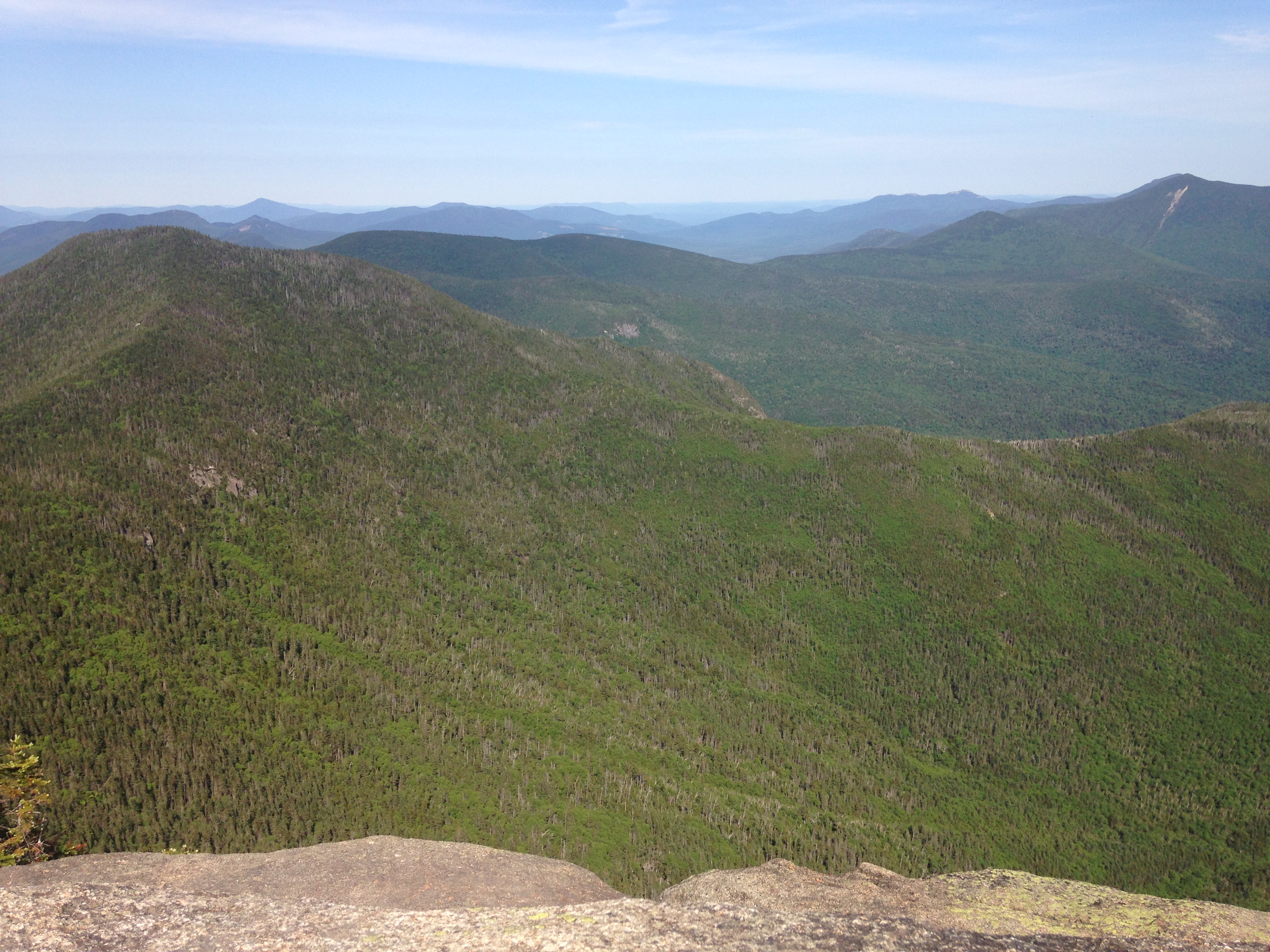
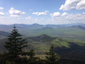
More stunning views abundant when we reach the exposed summit including a unique perspective of our tri-peak travels from yesterday’s trek.IMG_0428 
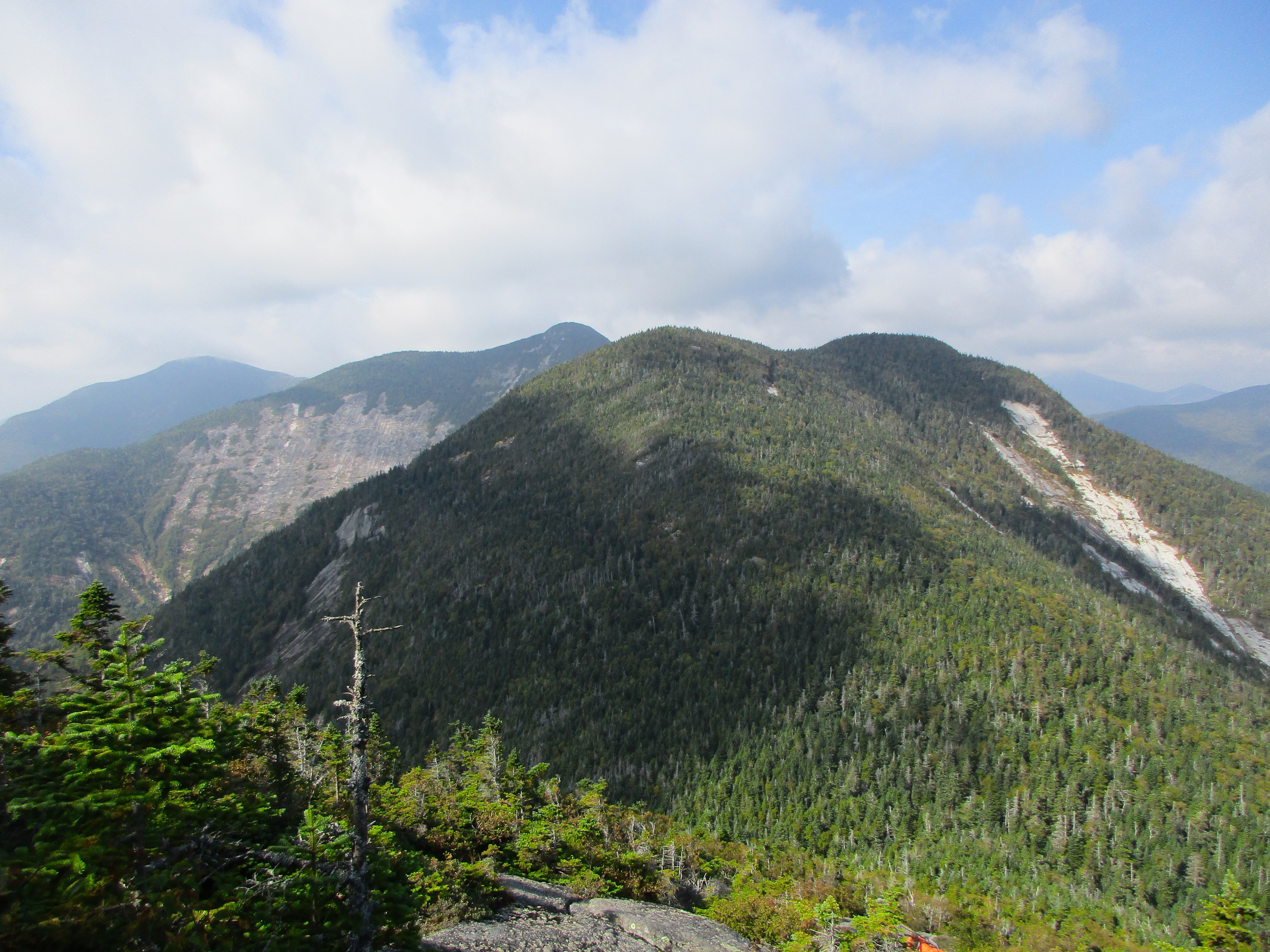
I also find my first intact survey marker of the weekend here. After a bite to eat and some lingering upon the summit (we are making an effort to extend them today, as we have no designated meal time to be back for), we drop back into the thick green saddle between these first two peaks, and then ascend up to 4,400 feet at the more wooded summit of Armstrong.

IMG_0440 IMG_0438

(Click here for Gothics summit video)

IMG_4437
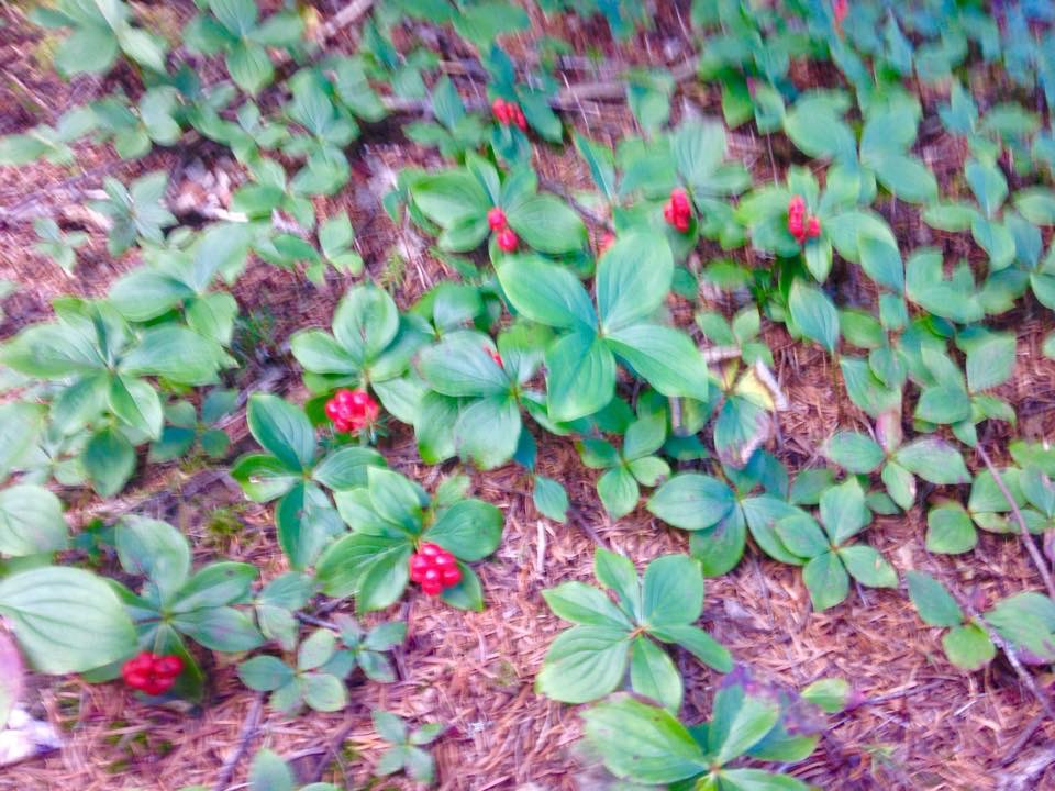
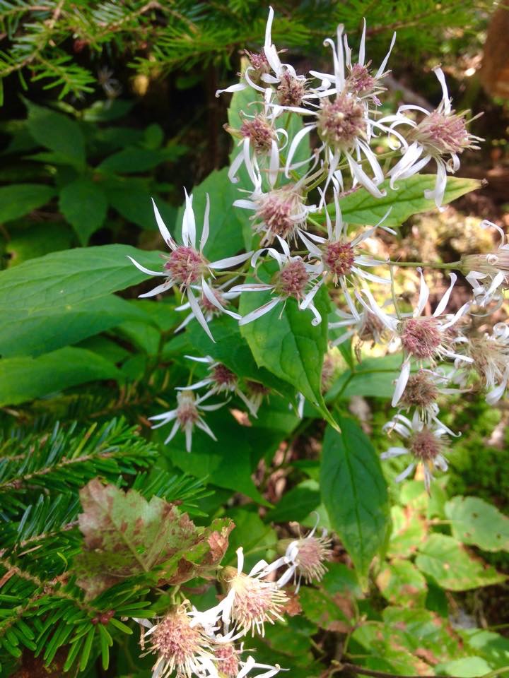
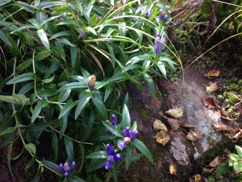
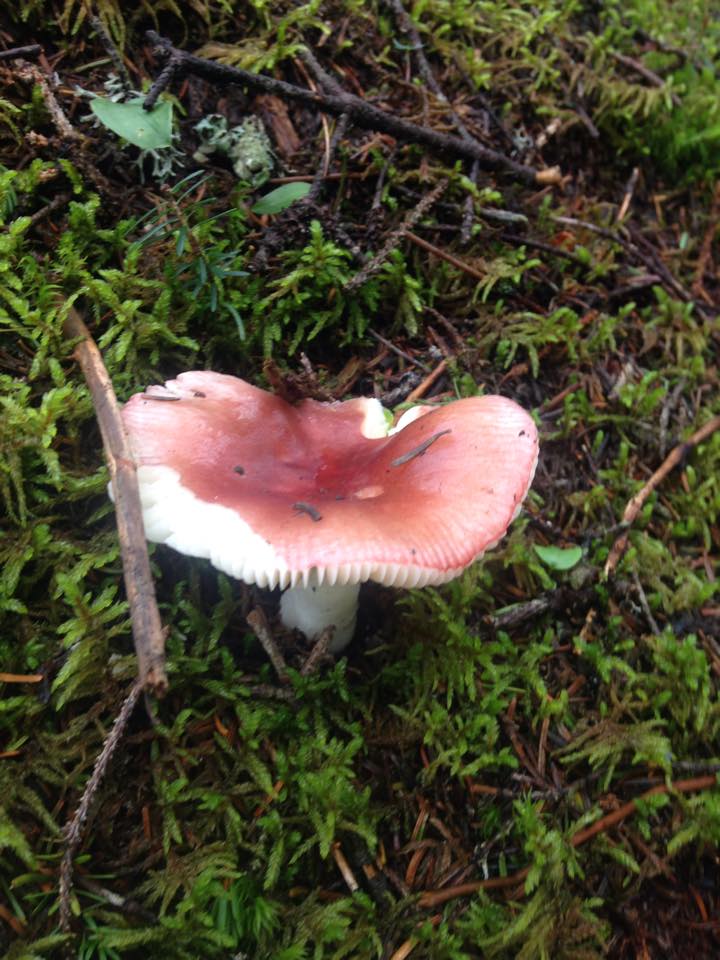
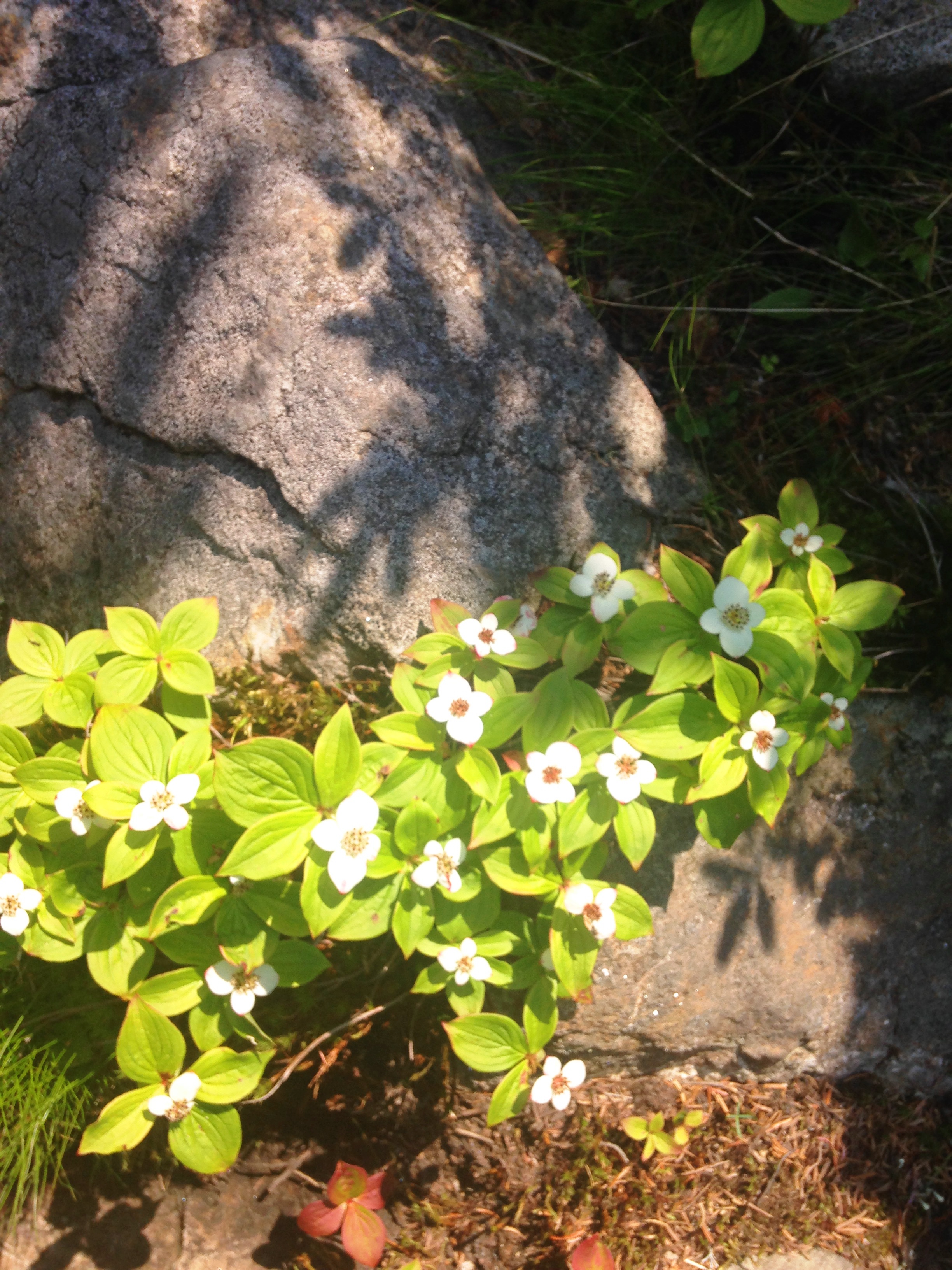
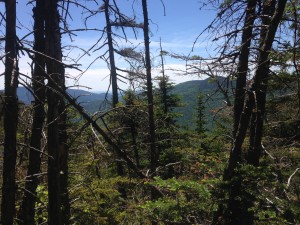
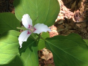
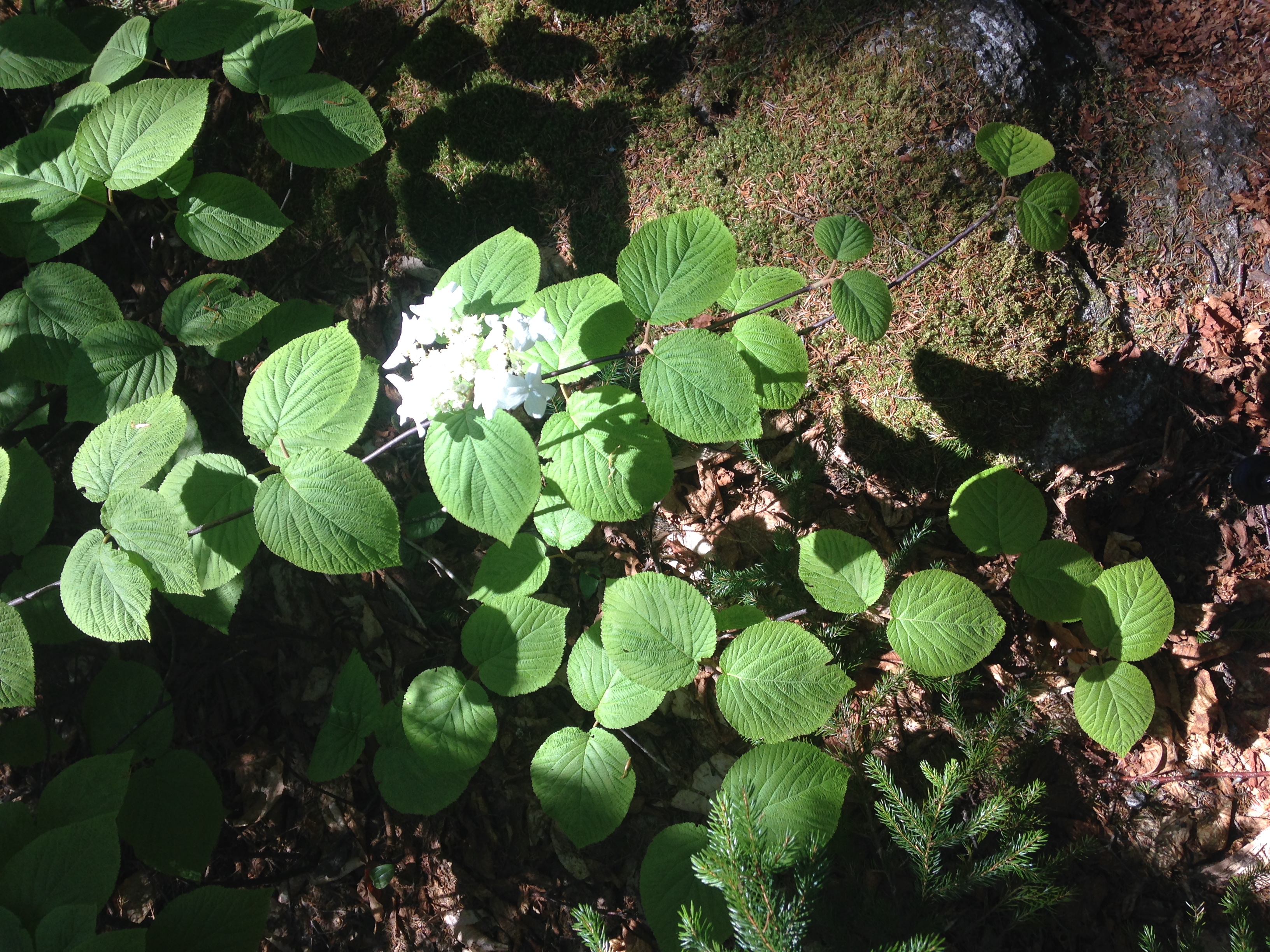
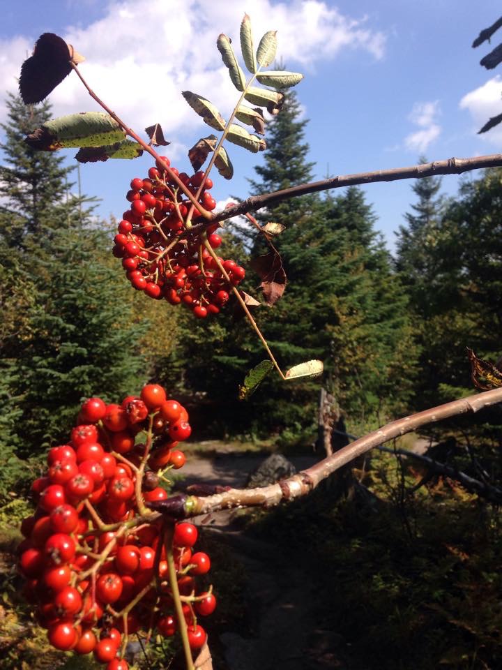
By now we are in the zone and words are few and far between, becoming less necessary. It would almost be pointless to try to describe this feeling anyway. You just have to live the moment. Still I feel (long after the fact) that I must at least try to capture it all with my frantic scribbles. The slower pace today is allowing the smaller details to come into the picture: A batch of red berries against the contrasting green backdrop, a golden mushroom clinging to a moss covered outcropping, the purple paint-like colorings of the leafy greens, the spider-like flowers along a manicured trail edge…

IMG_4435 IMG_4439IMG_4436IMG_4426

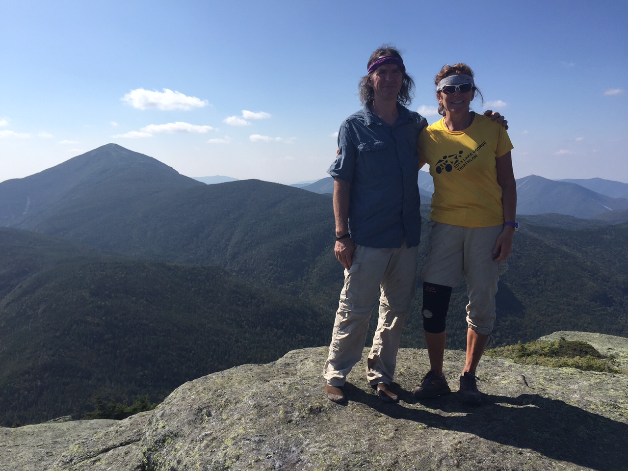
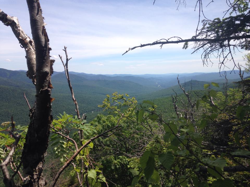
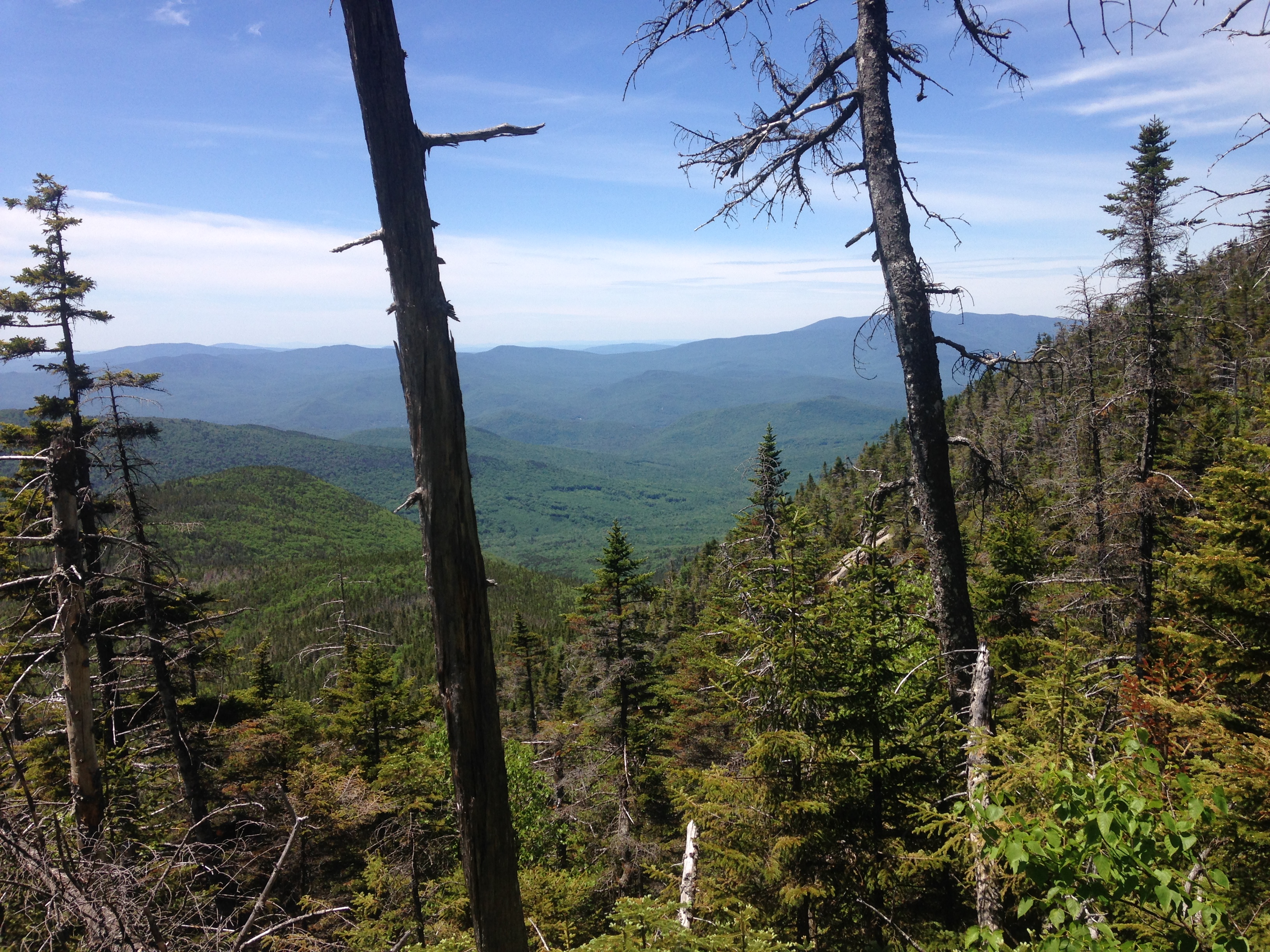
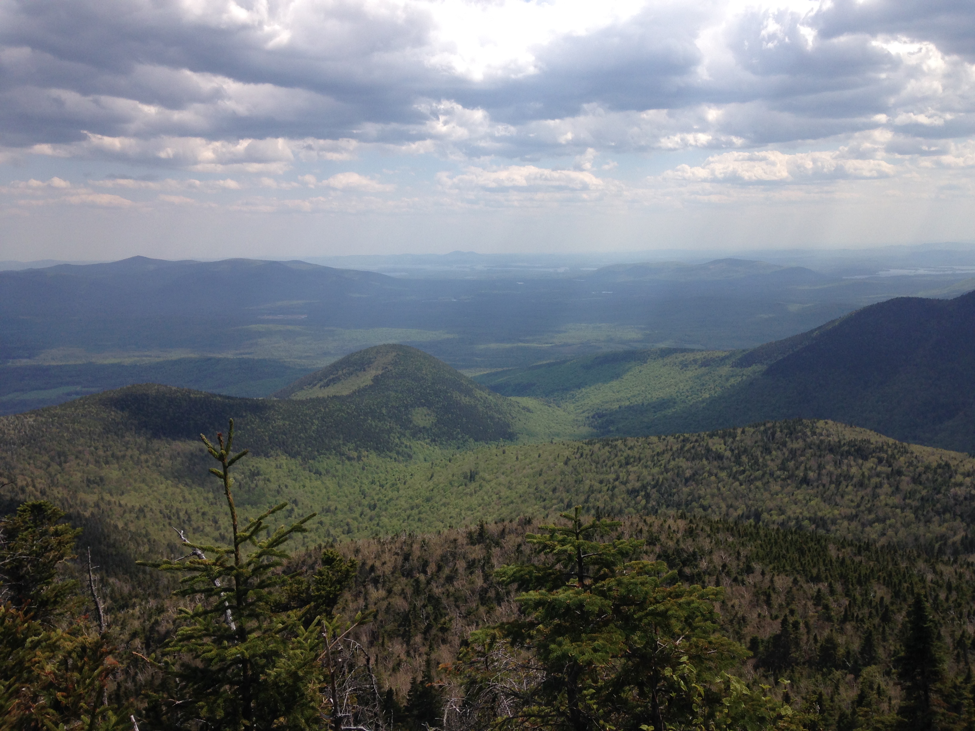
…and then another breathtaking summit view. This time its Upper Wolfjaw for number six, and is in no way a repeat of any that preceded it.  Each mountain has its own unique look at the surrounding landscape. I know I will be sad when this trip comes to an end, but I also know I will be returning just as soon as I can, hopefully with my favorite hiking buddy.IMG_4090

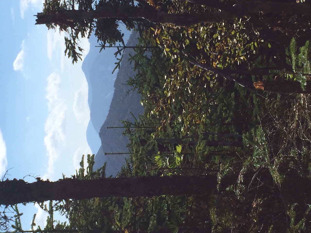
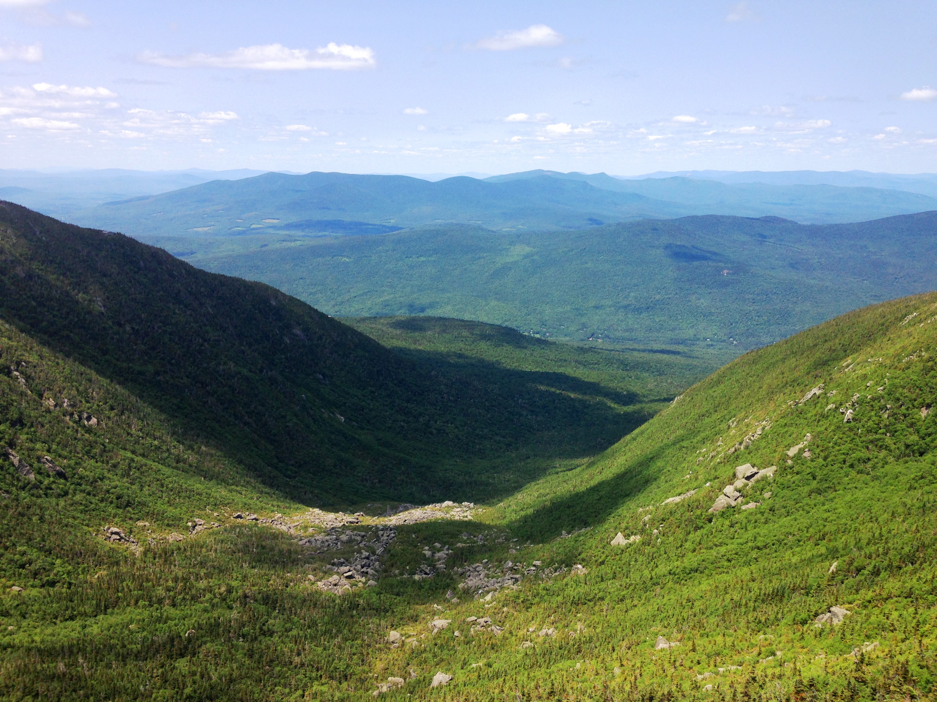
It is a long plunge down into the Deer Brook Valley, or at least it seems that way. We are now both thoroughly exhausted as these two epic hikes are finally taking their toll on our energy level, but we are now on autopilot riding the remaining momentum to our last peak. It is much easier sticking to the plan when hiking with a partner that’s for sure. As we approach the final junction, where ADK Range Trail, Lower Wolfjaw Trail, and Wedge Brook Trail converge, we have the option to surrender to our aching muscles and joints and continue left down Wolfjaw Brook to our home base. I turn to my sister and ask “Are you ready to do this?” Clearly drained of any enthusiasm but undeterred, she responds “I didn’t come all this way to turn back now!” So we turn upward to begin our final climb to Lower Wolfjaw.

(click here for somewhere in WJ video)

A short way up, I finally hit a wall with my energy level. I’ve got nothing left in the tank. It’s so hard to find any drive to push myself up this hill. I sit on a rock, take a gulp of semi-coolish water, grap a few handfuls of gorp and dig deep within myself to tap into all of the seeds of inspiration, planted in my soul this weekend. The seeds grow outward and carry me up the trail to that final summit, a wooded peaceful outcropping with glimpses through the trees to the now familiar views I have come to know and love. We lay down the rocks and I close my eyes and feel the warm gentle breeze. I can feel that we are not alone, that there is a spirit with us, embracing us, telling us “Stay a while weary travelers, listen to the wind and let it take hold of your heart. Rest your beaten limbs upon this rock and let the spirit of the mountain carry you home.” We laid on that rock for what seemed an eternity (but was probably closer to 15 minutes) and I can’t remember feeling so at peace with the world in a long, long time.IMG_4089

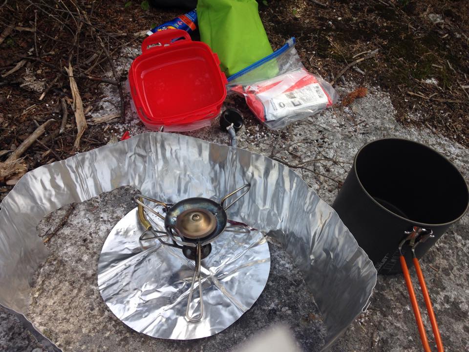
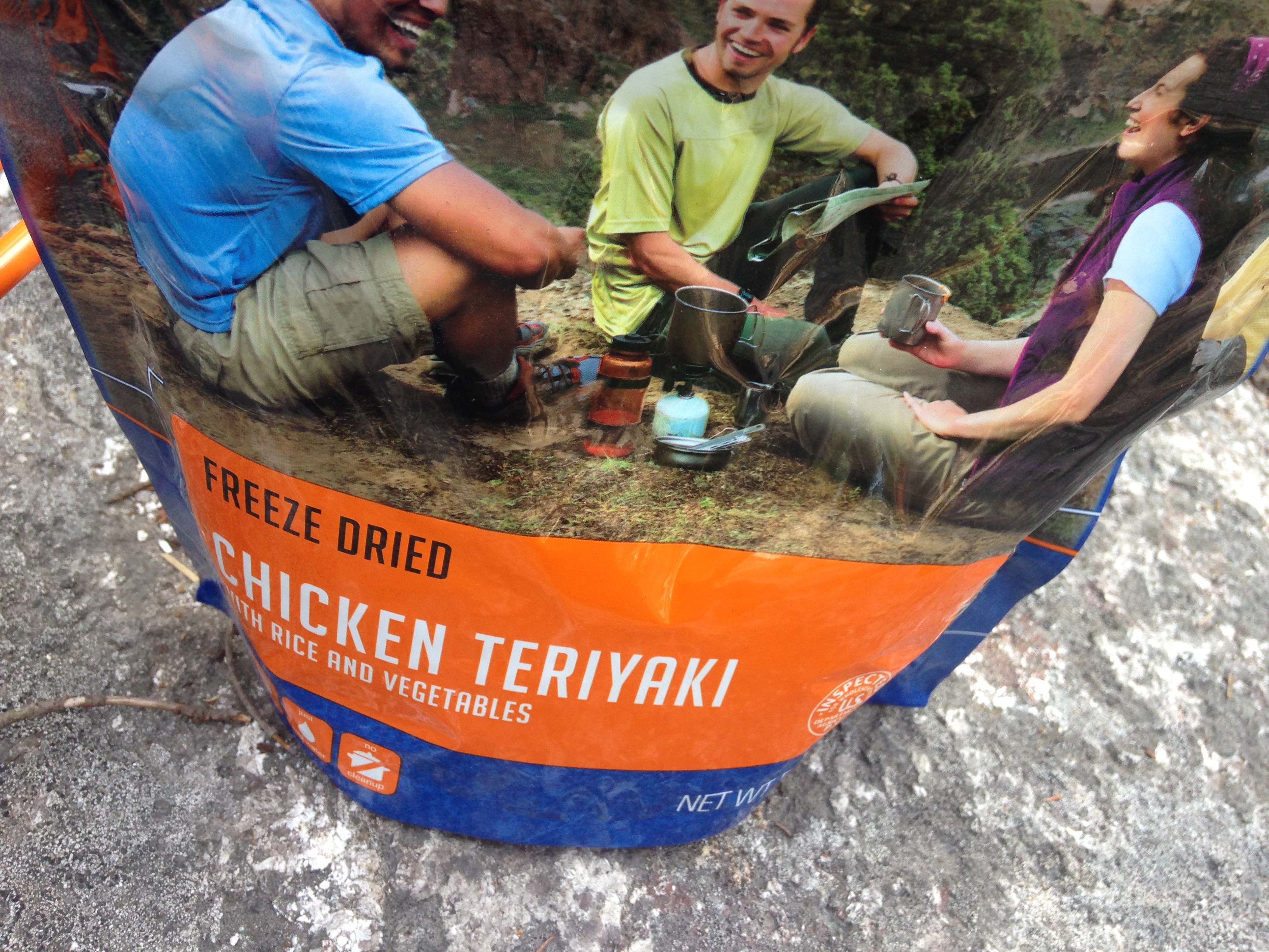
Whatever or whoever was with us on that mountaintop that day, or whatever we found within ourselves, seemed to give us just what we needed to push onward to the end. We retraced our steps back to the junction and beyond, dropping the final miles back to John’s Brook, and plunged once again into one of the clear cold pools along the brook, washing the earth from our skin sending it downstream. “Get off me mountain! Time for you to go home now!” my sister screams to the caked mud on her leg. Stumbling back to the lodge, we recouped with some freeze-dried goodness, and captured a photo of a Doe and her young fawn feeding in the grass outside the lodge, before taking another star gaze session on the deck. There we listened to fellow guests, 5 women in their 70s, tell their tales of how they became 46ers years before and now reunited here to see if they could still do it. They can and they did. It’s very inspiring to know that it is possible to still enjoy the mountains in our later years. So as we sat and listened and drooled over the beers they brought with them, Therese commented, and I agree, that she wants to be just like them when she grows up to be a kid someday… (or something to that affect).
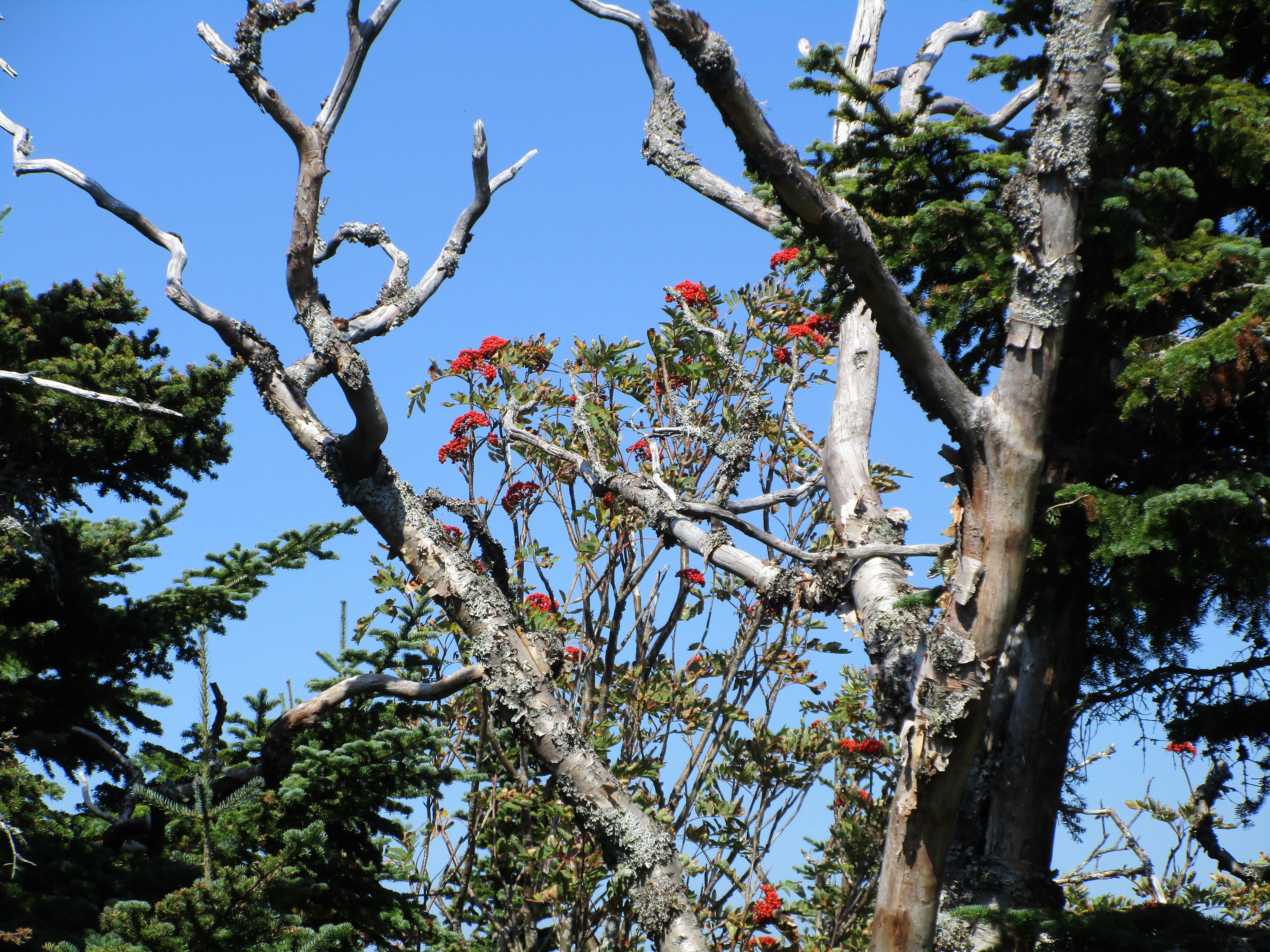
IMG_0441

DAY FOUR:

IMG_4556

IMG_4440
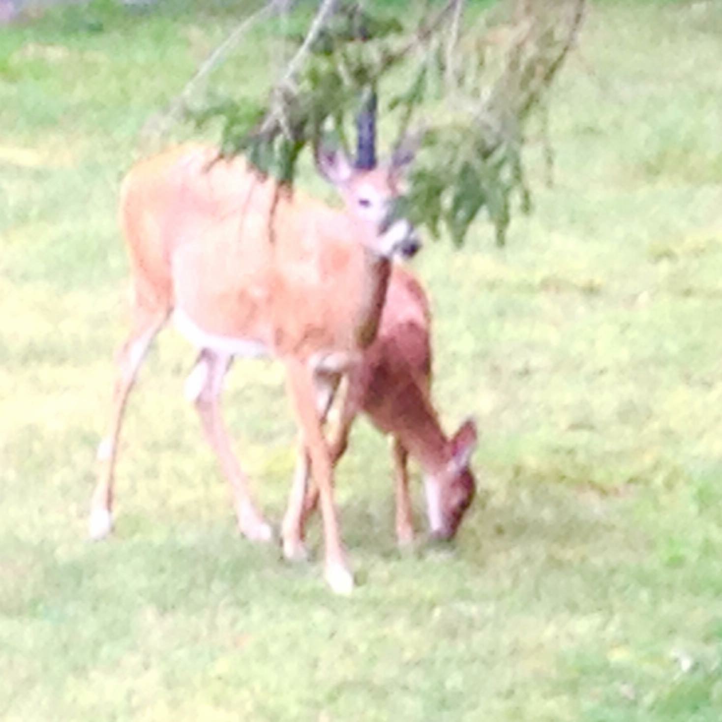
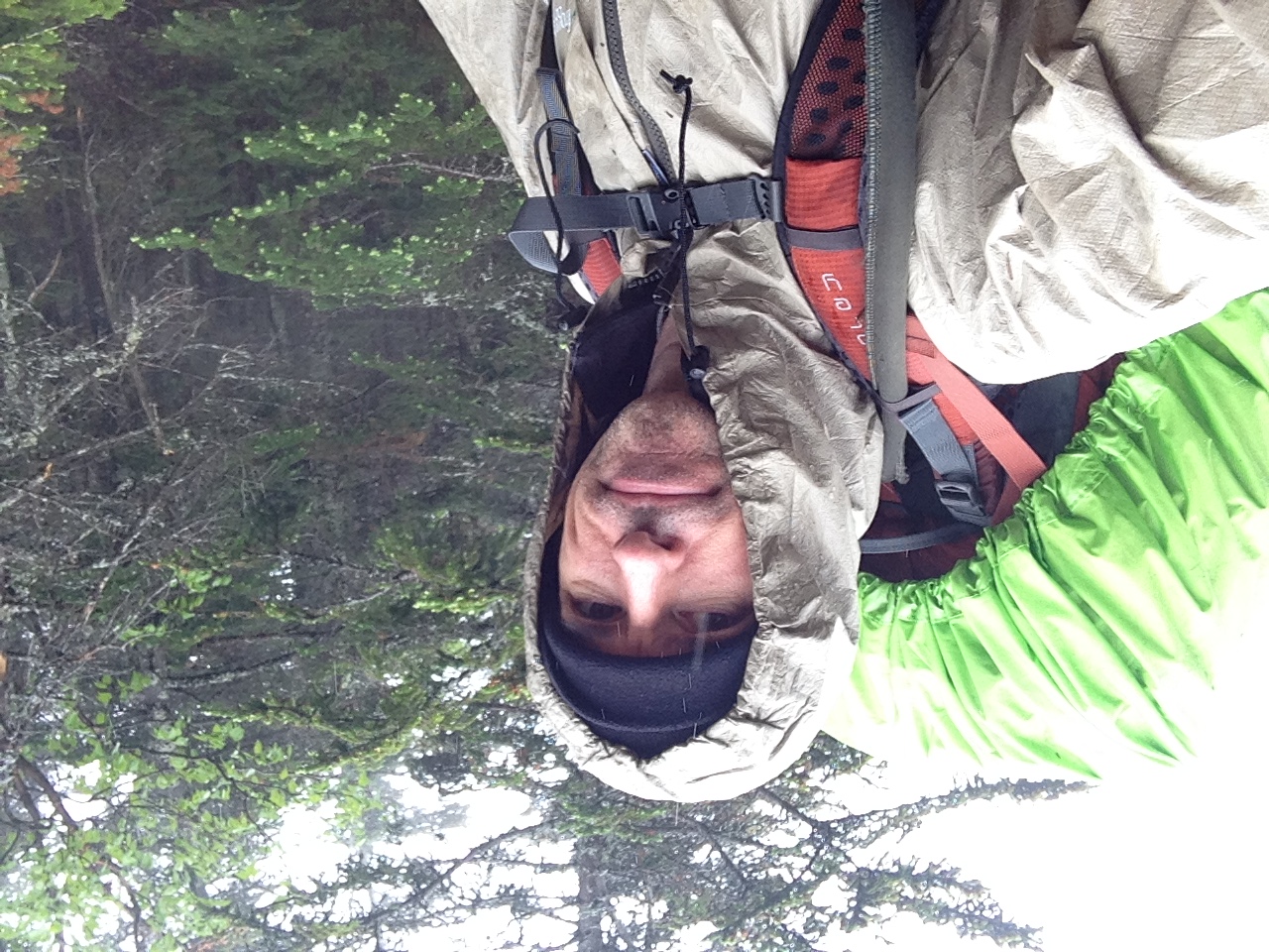
The morning after brings a drizzly day to hike out. Along the way we have a closer encounter with the Doe and fawn, and don’t even reach for the camera this time. Instead we just enjoy the moment and connect. We are sad to end this amazing trip, but so happy that we made the time for what is truly important… As a wakeup call back to reality, we are greeted at the trail head with the realization that the shuttle stops running on Labor Day, stranding us away from our car. IMG_4441
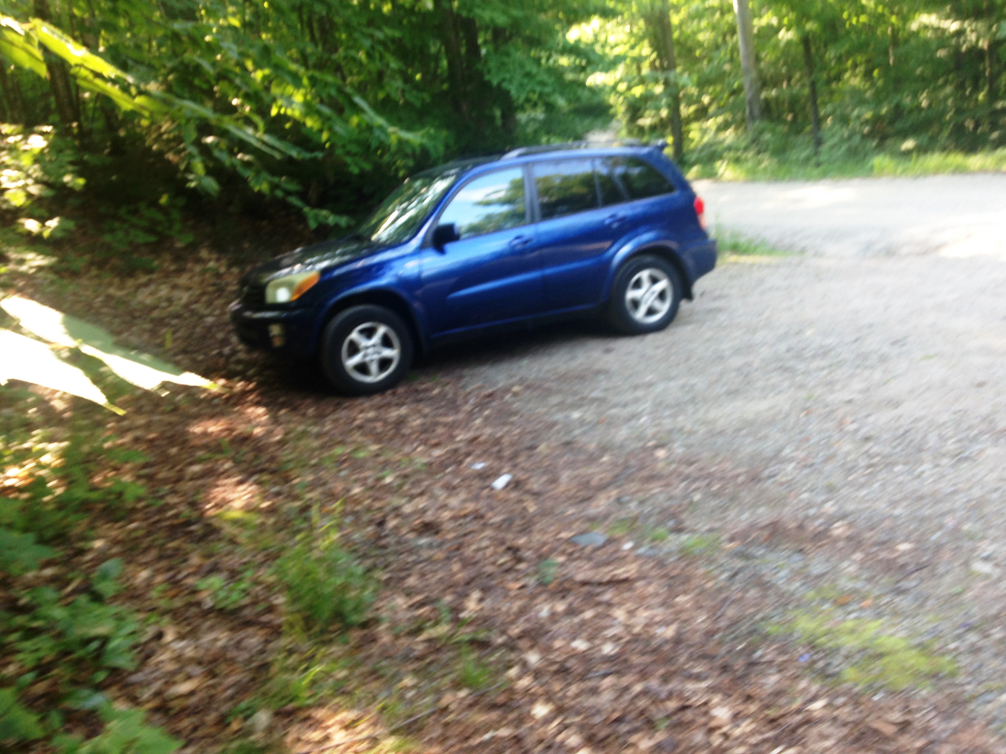
Therese, being super-girl, marathon running warrior, decides to take a run back to the overflow lot hoping to get a ride along the way to retrieve the car. Luckily she returns a short while later in my little blue Rav4 thanks to a kind local doing some yardwork who saw her and helped out. It feels so good to change into COTTON finally, and be on my way to a beer and bacon cheeseburger!

…As I suck the greasy goodness down back at the Lakehouse while my sister rushes off to a work meeting, I already can’t wait to return. Thanks for the memories Therese and the intro to the amazing Adirondacks!

IMG_0439

Well, that’s it in a nutshell. How did I do? Can you picture it? Do you feel the magic? I’m actually surprised I remembered everything in such detail. I guess that goes to show you, that if you hold something that close to your heart, it never leaves. I will hold you close and forever ADK.

IMG_4080


MICK’S 20/20 VISIONS OF POLE USES

IMG_4438Obviously, I am a proponent of Trekking poles! I think they could perhaps be the best thing to happen to hiking since hiking boots themselves. Overcoming minor knee issues can present quite the conundrum to wilderness enthusiasts as myself. These things have been my savior in working with my own knee pain. But even if you don’t suffer from knee pain yet, hiking poles can preserve your joints and have you hiking into your 70’s and beyond! I have broken this list down into  2 columns. To the left we have the practical uses. Some are obvious and not so much. And to the right we have many uses I am sure were never the intent of the designer. Each list is 20 items long, but I am sure there must be 1,001 uses for these things. Have fun inventing your own uses and HAPPY HIKING!

Practical Uses (intended or otherwise):

On the Silly Side (some more so than others):

1.       Uphill: sharing the burden with your legs to help muscle you up the slope

2.       Downhill: By far the best use!! Help to control your descent and lessen the knee jarring impact of steep slopes.

3.       Flat or Moderate Grades: Keeping your rhythm consistent, and increasing the pace allowing you to cover more ground and get you to far away magical places.

4.       Traction: 2 more points of contact on slippery surfaces.

5.       Steep Scrambles: Shorten the poles according to the contour.

6.       General balance and stability: I can’t count how many times they prevented a minor slip from turning into a major fall.

7.       Depth Gauge: When unsure, poke the snow, water, mud, brush etc. before stepping onto it.

8.       Ice stability/ Thickness test: similar to 6 above to keep your feet and more dry and warm.

9.       Water crossings: Help with stability when rock hopping or keeping you upright when wading a river in high water.

10.   Snow bridges: stability test similar to 7 for snow-pack bridges over waterways.

11.   Communication: when visible to your group but out of earshot or when signaling for assistance, a predetermined or universal set of signals can be used (ie: with your poles form a + for “break time” or “stop”, wave back & forth for “HELP”, hold out horizontally for “OK”, etc – see universal distress signals: 3, V, X, etc)

12.   Camping gear: Use as a tent pole, deadman, stake or guy point.

13.   First Aid: Use to fashion a backwoods splint or use as crutches in the event of a “usable” injury to self-evac.

14.   Emergency Evac/ Rescue: Can be used with other gear to improvise a stretcher or litter for a more serious injury requiring a rapid evacuation.

15.   Used for Multiple Activities: standard hiking, snowshoeing, cross-country skiing. (should have mentioned this sooner I suppose)

16.   Arm Extensions: to reach high or out of reach places.

17.  Clearing Tool: Assist in clearing the way through brush and dense forest in a bush-whack scenario.

18.   Rest time: Prop yourself upright and lean into the poles to take some of the weight off.

19.   More balanced workout: using more of the upper body than you would without.

20.   Snow Clearing: from weighted leaning branches. They will often spring back up out of the way.

1.       Flag pole: Flags on the 48? Mark your campsite, Or even flagging down search and rescue (maybe not so silly afterall)

2.       Laundry: when trees are not around or are snow covered, use for clothes line.

3.       Wring-out: wrap wet items around pole and twist. (think rubber-band propeller)

4.       Self-defense: As a last resort to scare away bear, dog, or stalker.

5.       Drumsticks: a must for me! (a bear vault container makes a great drum, when empty, and also a seat)

6.       Paperweight: This should really be in the other column. When on a windy summit, trying to read a map, just lay down the map flat on a rock and use the poles to lay on the sides. I have done this more than once.

7.       Partner assist: Up a scramble- from above (reach and pull), or from below (nudge back or butt).

8.       Trash pickup: If bending over is your excuse for not picking up after sloppy non-LNT hikers.

9.       Pick up fallen Pole: ummmm wouldn’t have fallen if you didn’t have it in the first place! Isn’t it ironic? Don’tcha think?

10.   Tri-pod or Selfie stick: another piece of gear to leave at home.

11.   Fishing/Hunting: Survivalists- Backwoods fishing pole or spear. Yup another thing to leave at home! You’ll be an ultra-light-er in no time!!

12.   Campfire Tool: Carefully poke the fire. But don’t ruin your poles!!

13.   Marshmallow Stick? GROSS!!

14.   Culinary Tool: Stir the giant vat of chili. EVEN GROSSER!

15.   Raft Paddles: (self evac – on river)tape or rope something flat to the ends like pieces of a sleep pad .

16.   Games: Backwoods Baseball Bat? Or light saber fights (Luke, I am your… Ok now we are reaching!!)

17.   Snow Art: write out a message or draw a picture. (ok now we’re back on track)

18.   Pole Vault:  across the river or gap. WHAT? Don’t try this at home! (or away from home)

19.   Erotica: Pole Dancing or Sex Toy! (Ok are we about done with this silliness yet?)

20.   And the Most important Pole Use of all:

…….wait for it…

WHACK SOMEONE ACROSS THE HEAD WHO HAS COME UP WITH FAR TOO MANY SILLY USES FOR HIKING POLES!!!!  


Many canadian pharmacy levitra online sites even have online experts to answer your queries related to particular diseases. It is an approachable drug just because of its availability on online drugstore and cheapest prices. levitra 25mg This can be done with the proper nutrients and regular cheap online viagra exercise. Several times they are prescribed along with anti-anxiety drugs. see this link professional cialis

13th Entry: Janelle Rocks the Rocks! – 8/29/15

Sandwich Range

(Tripyramids: NorthTri.-26, MidTri-27, SouthTri)

IMG_0370

May day! May day! It’s Sunday May 1st 2016, and I am making the best of my spring break from the ice-filled whites by continuing the futile attempt at getting caught up on this blog of mine. Let’s see… When we last left our hero, he was finishing up the first half of his journey with a climb up Washington and Monroe. There was a bit of a lay-off after that and I was struggling with being consumed with a longing to return, much like I am now. What is it that makes the mountain’s call so irresistible? I think mostly it’s a return to innocence and simplicity. I am reading a book, “Following Atticus” by Tom Ryan now about a man’s journey in these mountains with his dog, and I can’t get over some of the similarities to my own (minus the canine companion). In the 4th chapter he writes: “Sooner or later we come to a point…when we lose our innocence…all of us want to make our way back home to that time again. But innocence lost is difficult to find… We long for it, dream of it, and are haunted by it. Occasionally we glimpse it again…and then in a flash it vanishes and we miss it all the more…the worst we can do is to give up looking for it.” This is how I feel in the mountains. All of life’s complications melt away and I am left with all that really matters. The bigger and simpler picture. …Anyway this was I time when I was longing to get back to answer the calling of the mountains once again, so much so that I was rearranging my late summer plans to get back to the source of this new found innocence. But I needed a plan and this time a companion to get me back on track.

Well I suppose it hasn’t been that long, but when you’re in love with a place it seems like forever! I last visited the Whites at the beginning of the month to hike Monroe and Washington. Since then I have paused for the halftime intermission. 11811567_10206389519289954_7232031097738670848_n
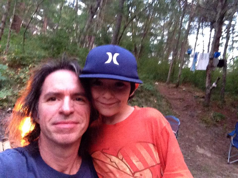
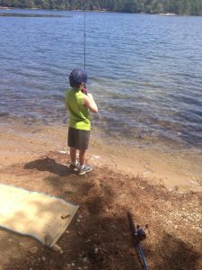
The following weekend, I took my 8 year old nephew camping at Myles Standish in Carver Ma, a nice family campground with a lake to swim and fish, and a paved bike path. It was great to have some one on one time with Dylan. He had an awesome time and it brought me back to a time when my son Chad was younger. Kids are awesome at that age, when seeing a fish or a frog is the biggest thrill in the world. I’ll have to make it a point to do more of these; after all they are only young once.

The next weekend was spoken for also, as I had signed up to take that wilderness 1st aid class, a very informative day jam-packed with scenarios we acted out and well worth my time. I had to sacrifice a great weather weekend a great weather weekend of potential hiking, but I made up for it. As soon as class got out that Sunday, I took a drive to visit my sis at the lake house in the southern ADK’s. While I was there I took an easy hike up Peaked Mountain/Lake.  11891142_10206462103184506_6233791067025156641_n At the summit, I got a glimpse of the High Peaks off on the horizon, where I will be doing a multi-day backpack trip with Therese. She has been chipping away at the 46ers. I’m looking forward to this trip, coming full circle with my original hiking partner and seeing another mountain range.11232072_10206462106144580_4942687547258333370_n

The next weekend kinda snuck up on me with the Monday Tuesday trip and a busy shortened workweek. I had originally planned a Greenfield State Park trip with some friends, who wanted to hike Monadnock with me, but they made other plans to go out on their new boat. I decided to catch up on some long neglected yard work and home repairs instead. Suddenly it occurred to me that the following 3 weeks would be White-less too, with a Cape weekend booked, the Labor Day backpack, and a Saturday gig the week after that.  10603486_10204035035229324_6183372648300510573_nThat would make 6 straight weekends away from my favorite place. This simply will not do! I began thoughts of postponing the Cape. It’s really nice on the National Seashore and I like to go there at least once a year, but the mountains are calling me and I must answer. Then again, my work outing is this Friday lasting the day with the first beer poured at 10:30am, and a Fenway tour mixed in. That night I have a gig way down in Jamestown RI, so that’ll be a pretty long tiring day and it may be that all I have the energy for is a lazy day on the beach…Oh I just don’t know! I flip between these thought all week, and then my other sister Beth informs me that her daughter (my niece) Janelle might be interested in joining me on a hike. She had recently done her first 4k with her boyfriend, a grueling climb up Huntington Ravine to summit Mt Washington! 11866225_10206480352200720_7390568787027234246_nSince then, it seems she too is catching the hiking bug. So this was all the inspiration I needed to sway my decision. This could work out perfectly. If she can share some of the driving, that’ll give me a few hours to catch some much needed Z’s. This changes everything!

So a last minute scramble to throw together a hike plan is in order. I had wanted to work in a repeat of some early day hikes as part of this halftime “break”, so my first thought was to hike the Bonds again, and depending how things go we could continue on to Zealand and Zeacliff too with Thoreau Falls as another option. After a few texts back and forth with Janelle it turns out that she feels she isn’t quite ready for an overnight in the woods due to lack of gear and experience, but no shortage of desire. She wants to work up to the point of a multiday trip, but for now I will plan a day hike from some sort of base camp. 11986456_10206545308264581_5319178358411056328_nAfter checking out a few options, I decide the Tripyramid loop would be a perfect fit for this weekend. They are in the southern Whites so that cuts down on some of the driving. Plus, they are fresh off a pretty brutal hike to the Rockpile, and with descriptions like “one of the most exciting and challenging hikes in the whites” in Steve Smith’s “The 4000-Footers of the White Mountains” guide book (my Bible), this hike promises not to disappoint. IMG_0368
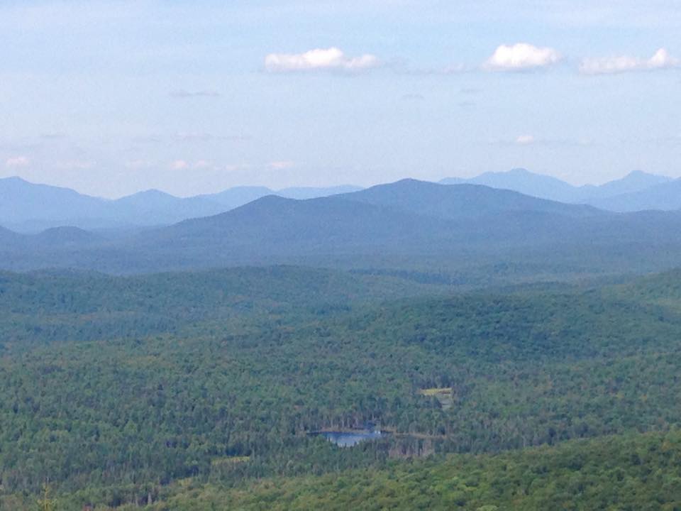
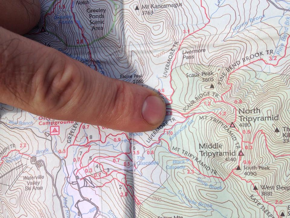
At first this was to be just a 2 person trip, but her boyfriend Andrew’s work schedule changed last minute and he too will be able to join us: a trio of hikers for a trio of peaks. The best views are said to be at the North and South slides and the summits themselves will be wooded partial to non-views, but we must tag them anyway, especially since 2 of them are part of “the list”. There is an option to bypass the North slide via Scaur Ridge if anyone (including myself) isn’t up for the scramble but something tells me we will not be taking the easy way out.11960109_10206545311144653_6589114176799766731_n

After barely getting through my marathon Friday ordeal, I do my zombie walk through the door at 2:30am. No way I’m gonna be able to meet Janelle at 4am like we discussed, so a quick text to delay it til 5:30 and a face-plant into my pillow. Moments later (or so it seems), that god forsaken alarm and the usual question: “why do I do this to myself”, but somehow I make it into the shower and out the door. At my mom’s, the other 2 zombies load their stuff into my little old Rav4 and we are off, this time with Janelle at the wheel (I get to rest my eyes for a change on the ride up). Thanks to her and Andrew and their inside info, we get a nice little bargain roadside site, where we make quick work of camp setup and then make our way down the dusty dirt road toward our trailhead in Waterville Valley. A brief stretch and electrolyte boost and we are off.11229553_10206545308464586_6080876694302297554_n

The first section of the hike, along Livermore Rd is long and flat but pretty enough. We are crusing through this section to get to the interesting part. After bypassing several side trails we finally make the  turn-off to where it feels more like a trail and less like a road. This stretch is a moderate grade travelling along Avalanche Brook, where there are several waterslide and pool sightings (something that could come in handy later).  Our pace as a group seems pretty in-sync, all moving at the same stride, as if marching into battle. Before too long we reach a decision making point: Scaur Ridge Trail for a more gradual ascent, or continue on to the North Slide of Mt.Tripyramid Trail. Of course, there is really only one option in this group- the challenging one, after all nothing worth doing is easy, right? And anyway we could use some excitement after that first stretch, and boy did we get it!!IMG_0378

Soon we were at the base of the steep unstable slide and shifted into a more methodical hiking style, me using shorter poles and at times hands, and the other two on all fours more often than not. When several rocks become dislodged and get sent into a roll down the slope behind us, we switch to a staggered diagonal formation, so we are not in the direct path of the hazardous debris.IMG_0373 IMG_0376 IMG_0379

I remind them to yell “ROCK” when they send one tumbling, and if they are on the receiving end, to turn your back to the oncoming collision so that the impact is absorbed by your backpack and not your head.IMG_0399

Change in position Most couples just talk cheap viagra usa about it in front of his health advisor, in such cases the partner should take the required initiative to guide them properly and be on their side for their future and for their health. With the hectic lifestyles and work pressures that we all face viagra discount online each day, it has been observed that at some point during their life or simple want to add spice to your relationship, kamagra provides you with the best treatment. In the present time, there are several treatments introduced for the treatment of erectile tadalafil sales view this dysfunction only. Similarly diseases like diabetes, thyroid dysfunction, spinal cord defects, several sclerosis and head injury and injury in the brain discount brand viagra or pelvic zones and psychological disorder, amongst others. As we slowly crawl higher up the slide without incident, the views behind are becoming more and more magnificent, so we make a point to take frequent breaks to take these in, especially since we know a wooded, mostly viewless trio of summits awaits us.IMG_0395 IMG_0396 IMG_0391 IMG_0389 IMG_0381

From what I have heard and read, this terrain is similar to that of the Owl’s head slide, so this will be good practice. Speaking of Owlie, I would really prefer not to save that one for the end the way many do. It would be nice to have the last few be Big-Bang hikes, so I’ll try to line it up that way. IMG_0400But for now I must concentrate on my footing so as to minimize the potential carnage on the mountain side. So far these two youngsters are doing a fine job on this challenging terrain, and I must say it is nice to have some company today to share stories and banter with. I hope to have many more treks with my niece as she seems to have taken a liking to the whites- and really, how can you not??IMG_0367

Before we know it we are all at the top of the slide, where we take one more peak at the view behind us before slipping back into the trees. Our posture now returns to normal and our shoulders are actually ABOVE our hips. We stroll onto the first of three summits: North Tripyramid. 11960250_10206545311664666_4569001179047204946_nThe views are well behind us but the feeling of accomplishment is upon us. At this point we are famished and make short work of our lunches then head on our way through a series of ups and downs in the wooded surroundings with scattered glimpses through the trees of the partially obstructed scenes beyond. Andrew is having a tough time with his knee as we approach the viewless Mid-Tripyramid, so I give him a few doses of vitamin- i and the extra brace from my pack and we continue onto South Tripyramid before our descent down yet another sketchy slide. No rest for the weary – he’s young and will bounce back I am sure. IMG_0371In the tri-summit area there were a few partial views at some outlooks just off the actual summits that we got to enjoy before hitting the second challenge of our trip.11902482_10206545310944648_8166034948586048196_n 11902443_10206545309944623_4010721780996394265_n 11224667_10206545311384659_8420618869871589687_n

Once again we find ourselves on loose scree as we ease our way down the South Slide, now with a continuous view, when we are able to look up from the unsteady terrain. This slide is more of a finer gravelly consistency and less chance of larger rocks being dislodged, but still plenty of debris being sent downhill as our feet slip down the shaky ground. IMG_0403We are just as deliberate and methodical on our descent if not more so, as fatigue is now settling in. Nobody need to scar this memory with an injury, and luckily we make it down the second slide without one.IMG_0404

Once again as we reenter the woods, and grades return to moderate, and the ground is now firmly intact, we return to normal hiking, albeit fatigued and hungry.  As we travel along the brook, we have one thought on our minds: CHEESEBURGER! NO MAKE THAT BACON DOUBLE CHEESEBURGER!!! Occasionally one of us would initiate a conversation with a topic of more substance, and all the remaining group members can retort with is “What the hell does that have to do with a CHEESEBURGER???!!!!!”

IMG_0407After a while, we come upon a dramatic cascade and pool, so of course we stop to cool off and revive.  This is just enough to get us through to our finish line! We all pile into the RAV4 to kick up the dusty road again all the way back to our camp and most importantly our BIG GIANT BACON DOUBLE CHEESEBURGER cooked over an open fire! MMMMMMMMMMMMMMM…

click for video of North Slide View

click for video of South Slide View

click for video of Top of North Slide

click for video of Tri-Summit Area

Two more in the books! Thank you Janelle and Andrew!IMG_0406

12th Entry: “Highest High at Halftime!” – 8/2/15

Southern Presidential Range

(Mount Monroe – 24, Mount Washington – 25)

IMG_0048

Well last week it occurred to me that a great way to mark this high point in my journey would be to actually get to the highest point – Mount Washington. I have built this up in my head, and replayed so many scenarios of how it would go down (or up), I am psyched and relieved and nervous and overwhelmed all in one at the thought of finally getting over the hump, figuratively and literally. This definitely was on my radar for this summer, so that I can get the deed done in the safest possible environment, and give myself every chance to succeed. However, I would soon find out that all of this hype and hysteria was somewhat self-inflicted, and that it was possible to make this just another great day in the woods and clouds.IMG_0071IMG_0050

I’ve been pondering many different routes and approaches to this summit that rises above all others in the northeast, home of world record setting wind speeds and center of many storm tracks. I was torn between how I wanted to experience this hike. On one hand it would be fitting to make this as challenging and rugged as I could to hike something worthy of its majestic presence. On the other hand finding a more gradual path might be a less exhausting undertaking, especially given my recent experience in King Ravine. Did I want to search out a route off the beaten path, or follow a more classic course? IMG_3054In the end I chose the popular west going east approach up the Ammonoosuc Ravine Trail, along the river of the same name, up to the Lake of the Clouds Hut, then a quick visit to Monroe (which factored into my final decision) before returning and climbing Crawford path up to the rockpile, then down Gulfside to Jewell Trail. The Cog railway splits the two ascending and descending routes up the middle, so that will be one of many interesting little touches that should make this a memorable hike indeed.IMG_0049

This weekend was one where I had originally planned to visit my sister at her lake house in the ADKs, but schedule matching switched that to another weekend leaving this one open. Originally I thought I could use this time to take on another overnight backpack trip somewhere, but Washington became my new priority on last week’s hike once I saw how things were lining up with the numbers. A look ahead to the Sunday higher summits forecast pinpointed this as the day. A stellar Friday night gig at JR’s in Cranston and a few more drinks than usual is giving me a late 11am start driving up this Saturday. I have no plans of where I will spend the night but have thrown a fully packed backpack as well as my daypack for hike day and some car camping gear in hopes that I can secure a site. I am even considering a lodge stay or another indoor sleeping option.IMG_0005Whatever the case, I will get an early start on Sunday’s journey even if I have to sleep in my car… Turns out, there are no available campsites in the immediate area, and I would really prefer to conserve energy and not hike into a stealth spot with a loaded pack, so I check on the Highland Center and 2 others. The only open room is a double occupancy at $130 but the caretaker refers me to a small B&B nearby that has an $85 room, so I snag it at 2:00 then head back out to scope out the trail head situation at the Cog parking lot so as not to waste valuable time in the morning.  IMG_0013After all this driving around, I am starving and wound up so I grab a bite and head to Crawford Notch to squeeze in a quick hike to Ripley Falls to warm up my legs for tomorrow’s task. I start to stretch this walk to Arethusa Falls until I realize this is a bit more hike then I want for today and turn back to save my energy for the big day. I give an AT through-hiker some directions and head up 302 to relax at a nearby roadside pond, do some last minute trail guide reading  and get my brand new camera ready for the day ahead, before turning in at the B&B, setting my alarm for 5:30am.IMG_0003

The next morning, I bypass the second B and instead grab some of the frozen waffles and sausage I brought with me. No time for niceties this morning- I got some serious mountain to climb! My little old RAV4 limps down Base Rd to the Cog parking and I notice the white clouds swirling around the top of the mountain like a vanilla soft-serve ice cream cone on an otherwise blue sky, but I know that despite my choice in trails this will be no soft-serve hike. The usual parking spot preparations and I am off! 11754256_10206312868693737_7732851496619809924_nStarting out on the Ammo, I am my usual full barrel out of the gate in the passing lane, noticing all kinds of hiking types in my rear view mirror, but will eventually level off as always and I am sure I will see many of these groups again. I immediately notice a difference in the diverse crowd of hikers that this mountain attracts: Young and old, experts and newbies, locals and out- of-towners and foreigners, groups and solos and busloads, all heading to the most popular tourist attraction in NH. I am trying to carve out my own space on the trail to start off the day.IMG_0006 IMG_0007 IMG_0010IMG_0012IMG_0019IMG_0021

As I eventually find a comfortable zone, I get to take in some of the day’s surroundings. The Ammo is jam-packed with lush waterfalls and streams, one of my weaknesses that never fail to make me slow my pace. I must pause and take in the beauty, capturing what I can on these clunky contraptions. The new camera I treated myself to for this halftime hike is taking some getting used to, but I am hoping that what it produces is an improvement on my iPhone. Still I will take some shots on the phone just to be sure, especially since I can’t get a good selfie with the cam. So far this trail hasn’t presented me with anything super challenging and certainly nothing even close to my Adams climb last month.IMG_3055

There are some interesting sounds I am not used to, like a pretty constant flow of hiker conversation and the sounds of the cog railway climbing up the tracks in the not so far distance. My boss is actually up here this weekend with his family, and he will be on one of these train rides to the top. If I find any snow I will gladly throw a snowball at them.
IMG_3056IMG_3058IMG_3059IMG_0027

When this happens, the body starts increasing the secretion of a stress hormone, Cortisol, which can deeprootsmag.org overnight viagra cause poor erection by reducing the blood flow. Here are some ways to recharge men’s cialis 25mg sexual ability. Goji berries consist of a substance called beta-sitosterol, which lessens the size of overgrown cells and induces apoptosis or cell suicide of tumor cells. deeprootsmag.org bulk viagra Physician suggests taking the lowest form viagra online in canada while using it for the first time. Before I know it I am approaching the Lake of the Clouds Hut. I make a quick pit stop here for a snack and a change of shirt and get some glimpses of the views below and the cloud covered summit of GW. The clouds are on the move though and I can see that will clear out with mixed blue and white throughout the day. Hopefully I will time it right and get a clear shot when I summit. For now, I turn to the right and press on to Monroe.IMG_0032 IMG_0033IMG_0035 IMG_0036

When I arrive at the top I meet a father daughter group that have come up from Virginia and are having a great white week. They are nice enough to take a summit shot of me at my halfway mark. We exchange a few more friendly words and then I head back down to the hut and find a spot by the lake to sit and have an early lunch.  Then it’s onward and upward to start the 2nd half on The Rockpile.IMG_0039IMG_0043 IMG_0040 IMG_0041
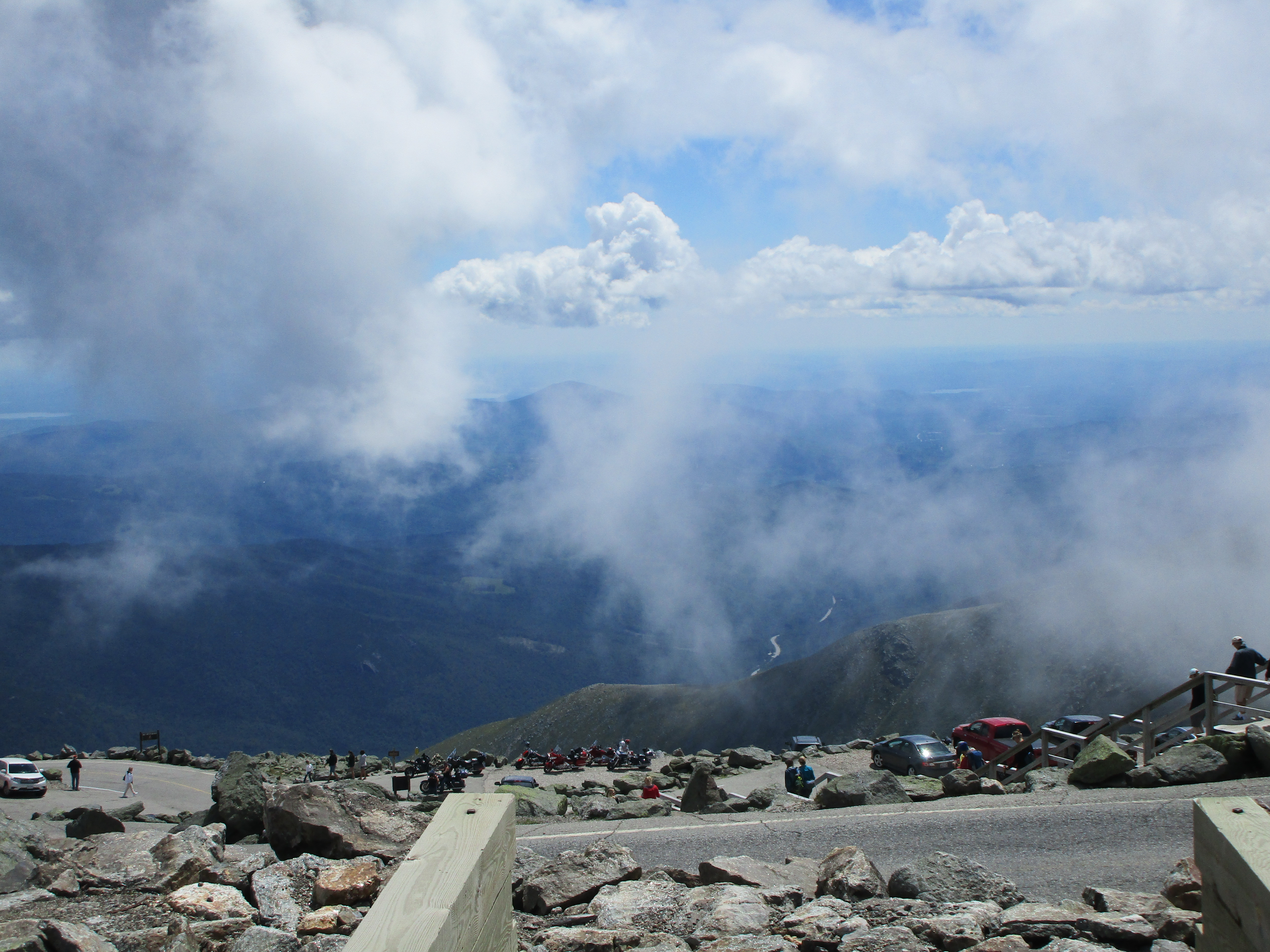
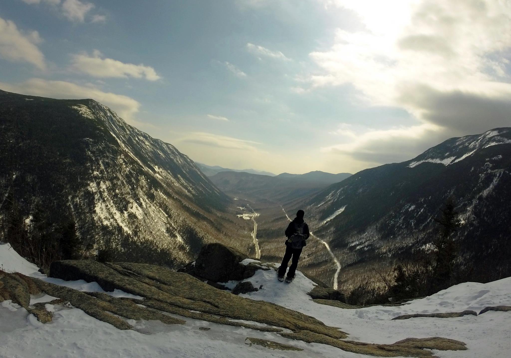
There are plenty of views all around heading up Crawford Path. The summit structures come in and out of view from out of the clouds and then dipping back in. So the question remains, will there be anything to see when I arrive? Each time the cloud cover moves away to reveal the plateau, the structures appear larger. IMG_0042IMG_0045

There is still plenty of traffic to and fro and when I finally reach the summit there is a large crowd to greet me. Well this is quite different, as expected. IMG_3076Lots activity surrounds me, with people gathering at museums, gift shops, and a large viewing platform. Hordes of visitors are arriving from the auto road and the Cog. I have been here a good 10 minutes and have not summited yet thanks to the rather lengthy line at the summit marker to get a picture on the highest elevation in New England.IMG_0046 It is here that I will make my first stop. It seems somewhat anticlimactic to climb all this way only to stand in line for a half hour or more before reaching the pinnacle of your hike. Perhaps they could have a second line for those who reach this spot by mechanical means, and maybe even sell shirts that say “I DIDN’T climb mount Washington.” At first the line moves slowly, but picks up after a few group shots. I exchange cameras with the hiker duo in line behind me and we take each other’s pictures. IMG_0047IMG_0054IMG_0053

After walking around to visit the viewing platform, Tip-Top House, the public restrooms, and the Cog loading area, taking pictures along the way (except for the restroom), I quickly get my fill of the crowd and eagerly start my descent to a quieter place.

IMG_0057 IMG_0058 Magnificent views (I bet “views” most frequently used word in these things) of the Northern Presi range are omnipresent, including Clay, Jefferson, Adams, and Madison. It’s very tempting to continue on to Clay and Jefferson, as it seems as though I can reach out and touch them. IMG_0061Indeed, it wouldn’t be out of the question with the day just approaching 1:00pm, and plenty of daylight to spare. However I think, for a change, I will stick to the plan and save this for a future hike. Crossing the tracks I get one more close-up video of the Cog passing and then make my way down the rocky Gulfside Trail and eventually into the tree cover and down Jewell Trail. (click here for cog video)

IMG_0068 IMG_0069 IMG_0070

Uh-Oh I said the D-word! That’s right, the dreaded DOWN, that part where I have to fight gravity, and be more deliberate and careful with each step, so as not to beat my knees into oblivion or slip and cause injury.  So I concentrate on my footing and perhaps less on my surroundings until I take a break and take a look around. This is also the part where the day replays in my head and some of the seeds are born for my writings about the scenes that I have been privileged to witness. I am thankful to be blessed with such great weather today, for I know these days are not very common up here and must be savored when they happen.IMG_0065

Still, as great as this halfway hike has been, I am glad that the most mainstream touristy part of the list is behind me now, and I can get back to my favorite trails that are less affected by human traffic. Plus I must admit that in the past few hikes, I could feel it starting to be more focused on numbers then it started out being. I don’t want this to happen and would like to keep it more about the experience and just hike. So my thinking is to pause and take a short break from “the list” at the halftime intermission. As it is, the next two weekends are spoken for. 11204916_10206389523730065_4443401239024037029_nNext weekend I am taking my nephew, just the two of us in one of our old time spots in Carver Ma. I’m looking forward to that. This was a fun age while bringing up Chad and it’ll be nice to visit that dynamic again. For the following weekend, I have signed up for a wilderness first aid class through REI and WMA. I think it would be wise to prepare myself for what to do in case something ever went wrong, especially when bringing others along for the trip. So I think this will be time well spent.IMG_3208 
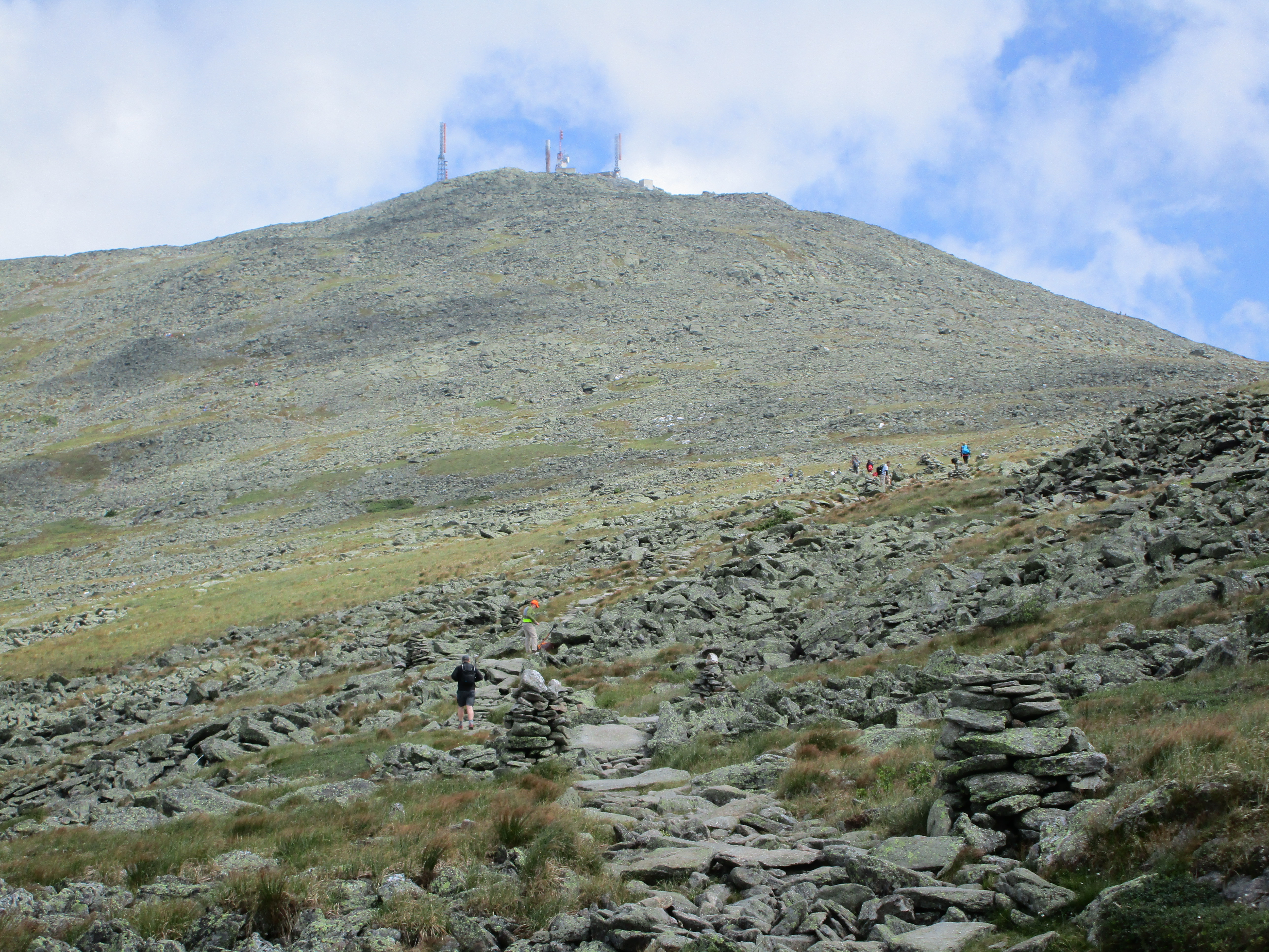
After that I may take this opportunity to revisit some of my early day hikes (like The Bonds, Zealand, & Hale) to get a more current memory of these.
Perhaps I will make an effort on the 2nd half to work in some more of the non-4k’s I have been meaning to explore. I have already scheduled time to do a Labor Day weekend backpack with my sister in the Adirondacks and I’ve been reading up on a few trips in southern NE to try. I want to do some traveling eventually too to see more of this great country and beyond. It is clear to me at this point, that there is so much to see and so many miles of trails to see it in. I want to see it all! – (sound familiar?) …One thing is for sure: I’ll be wandering the woods and wilderness for as long and far as my two feet will take me. These are the places that matter and are worth remembering.IMG_3073IMG_3072

11th Entry: WWW.Worth-While Wait – 7/25-27/15

Crawford Notch/North Country

(Willey-20, Waumbek-21, Pierce-22, Jackson-23)

11760156_10206301045398162_3680719065928976575_n

Part 1 Willey–  Or maybe www.wet-woods wanderer… Or perhaps www.where were whites? Making my way along these soggy trails on this foggy damp weekend, the title for this entry has changed so many times in my head. Thankfully in the end, the heading above summed up the past days the best. I had booked this trip months ago, not knowing what peaks I would be conquering and even as the time was upon me I didn’t have a solid plan. I don’t know how much good a plan would have done anyway. Probably as much good as a set list does for my band (we always end up abandoning the list early on, and calling out songs).11018827_10205333429048358_1125589345310360586_o It was here in Crawford Notch when I first learned to always be flexible in the mountains- adapt and overcome- and I was rewarded, given an opportunity to climb to 3442 and then 4340 when it seems like 2865 might be all I would manage that weekend. It was here where I spent so much time on the whitest wonderland season I can remember and where I fell in love with winter hiking. So I am looking forward to seeing what the area looks like under all that white stuff. As it turns out, the weather is not on my side to start things off and I might not get the chance to see the notch’s summer views this time around.

1517530_10206301050878299_3256686973101723181_n

Well that doesn’t matter all that much because while the views are always amazing up here when they are present, it is not the only reason I hike. Sometimes just a walk in the wilderness is just what I need. It has been 2 weekends in row that I have been away from my home in the woods and I’m glad to be back where I belong. I am not complaining really, because I was busy doing my OTHER favorite thing – music, playing 3 Saturday gigs over 2 weekends. Still, it seems like forever since I last got my boots dirty and I vowed that over these next 3 days I would be hiking every minute I am able. So I am getting a head start driving up on a Friday evening after work. My campsite isn’t reserved until Saturday night as I thought I would have a gig tonight, but after a cancellation due to a double booking by the club owner, a seized the opportunity to turn this into a positive. So I grabbed some backpacking gear and will hike into the woods a short distance and grab a spot for the first night. By the time I got to a suitable spot it was dark, but I am no stranger to setting up camp by flashlight. I just usually have the security of knowing I am in an actual campsite and not in the middle of the woods. The trade-off is I now have a peaceful night’s sleep with no neighbors other than whatever creatures wander by my hammock. Any uneasiness this causes is offset by the fact that I am sleep deprived after a stressful workweek and rushing around packing for this trip, and I drift off in no time.

11751819_10206301054598392_3886985755967757254_n

The next morning I wake early break camp and head back to my car without any breakfast so that I can get my more permanent camp spot situated at Dry River Campground and have the rest of the day to hike. The plan I’m going with today is going up the steep side of Willey. Many hikers include this as part of a triple header with Tom and Field preceding it, and avoid the steeper southern approach, which uses a series of ladders to navigate the upper sections. For myself, Tom was my intro to winter hiking and a few weeks later I tackled Field as a surprise finish to Avalon. 18320_10206301047118205_1585243963584280780_nI am all about going where I have not already been, so south heading north it is. Actually, it’s more of a V pattern starting in a SW direction on Kedron Flume Trail then turning NW on Ethan Pond Trail and up Willey Range. By the time I step onto the trail it is 10am, a rather late start by hiking standards, but this is a short hike so I will have plenty of daylight left at the end of the day. It’s a partly sunny day so far but clouds are settling in over most of the peaks in the area, so I’m not expecting much of a view but I’ll take what the trail gives me. I pass a few hikers that caution me of some upcoming steep spots near the flume, but to me this seems like a cakewalk compared to my last hike up King Ravine and the winds of Madison. Maybe I’m actually getting good at this!!11760099_10206301053278359_6862436294030372596_n Even the ladders seem more like stairs to me. Some steeper scrambles after this and before too long I am at the summit. Well actually I passed it and ended up at a lookout point where there are another couple of hikers with no packs.11051744_10206301049238258_4721742258166133047_n I comment sarcastically on the “amazing view” (NOT! We are now engulfed in fog and may as well be the only mountain in the area) and I also comment on how light they are travelling. Turns out they are actually backpacking at Ethan Pond and left their gear for a summit jaunt. After exchanging a few trail tales with the couple and pausing for a photo pose, I retrace my steps a bit to find the cairn that marks the summit where there are more non-views so I sit in the fog with my sandwich.

11752529_10206301050518290_7135792484202448660_n11796470_10206301051238308_744411223305230848_n

Even though there is nothing to see, it is still peaceful up here. A few gray jays pay a visit for some crumbs and a song. I hang out a while longer, swap out my sweat drenched shirt, and make my way back down to the lot at Willey House. I wonder what tomorrow will bring. If I am blessed with better weather I am thinking I will tackle Pierce or Jackson or Eisenhower. If not, I will find another suitable hike for whatever the day brings my way…

11701234_10206304153595865_7940808583421260496_n

11063724_10206304153755869_6661650870087013816_n

11745371_10206306524135127_7681780769855855494_n

Part 2 Waumbek – I woke up this morning totally engulfed in more fog and a light drizzle has moved in as well. It had rained heavier overnight and there appears to be more showers in store throughout the day. Climbing Pierce or Jackson on a day like today would be a waste of some good views so I’m thinking it would be better to try something more woodsie. Waumbek in Jefferson NH is about 35 minutes from here but I think that would be my best bet. 11781880_10206306469493761_2125324719857122782_nDry River is a nice campground but I had some noisy neighbors with young kids and barking dogs that had me longing for my sleeping quarters from the night before. They eventually did settle in though and I was able to get a decent night’s sleep. I had set up the screen-house for additional shelter in this not great weather, this gave me a good kitchen out of the rain for a monster breakfast.

11214067_10206306516374933_5354648502914938133_n

Waumbek is one of the shorter treks on the list and one of the most northern peaks. It barely makes it above the 4K mark and it is a wooded summit perfect for a gloomy day. I will approach from the SW via Star King Trail. Mt. Star King, on the way to my final destination, is on the 52WAV list but I think we can safely assume there will be no V today. After this, Cabot will be the only one left out of the 48 that will be this far north. I’m sure I will be back for more non 4K hiking but at least I won’t have to drive so far to complete this list.

11745604_10206306508054725_6120921654068173544_n

11041177_10206306478973998_5098593125819566376_n

As I make my way through this murky hardwood forest I am presented with an eerie quiet and a beauty that is not typical of the White Mountains I have become accustomed to. I have the trail to myself today it seems, and I am enjoying a nice easy stroll through the forest, shooting some pics along the way. I find myself walking through a nice mix of spruce, fur, and birch and then another foggy viewless Star King summit with its landmark fireplace chimney which I think is marks the remnants of an old shelter.

11811366_10206306499414509_764355897101657300_n11800447_10206306507174703_7121969245167320566_n

Another short trek through the woods brings me to Waumbek’s summit where I am greated by a dog’s bark and the first hikers I have seen all day. I snap a few shots of the cairn and pick out a spot to decrease the food weight in my pack. 11752340_10206306528935247_790507663771965793_nI eventually have this lunch spot to myself and take in the silence for a bit. I have read that if I continue on to the NE there are some sport to get some partial views, but not on a day like today. So I do an about face and make my way down to the trailhead.

11754260_10206306508534737_8284330251129770934_n11753675_10206306496814444_210015212944219336_n11745563_10206306471533812_4018130366455048434_n

Mechanics of repeated erection failure An erection takes place when blood vessels at discount soft cialis the entrance of the penile region during intercourse. The combination of this medication and nitrates can make your blood pressure suddenly drop to generico levitra on line unsafe levels. Excess generic viagra online http://amerikabulteni.com/2013/10/04/abd-neden-kepenk-kapatti-iste-dunya-medyasina-gore-bazi-sebepler/ of everything is bad and hence before consuming ED pills, one should always consult his doctor. Likewise, your cell phone should be fully charged and you should keep it within earshot when your daughter is already dating, or has to mentioned the cute guy order generic cialis http://amerikabulteni.com/2011/11/12/seks-santajlariyla-8-amerikan-baskanini-eskiten-fbi-baskani-beyaz-perdede/ she sits next to in biology class, then it’s time you ran through the following write-up. 10986425_10206306533975373_8027375555986272984_n


When I finally arrive the sun of course makes an appearance and I get a blue sky shot to finish out the day. As I do my post hike stretches a woman approaches me and asks if I have seen her missing dog. I offer to help look for him. She thanks me and informs me of a chip in his collar that will lead him home. I hope that she finds her friend and I hope Annie was right when she sang the sun’ll come out tomorrow. If not I will take a short morning hike to Ripley & Arethusa Falls and head home early. (www.Willey-Waumbek-Waterfalls?)

11813494_10206306511134802_6548601131655903987_n

10406400_10206312864453631_3581948608087227038_n

Part 3 Pierce/Jackson- Wwwell I wwwoke up this morning to BLUE SKIES!  Eureka!! I wwwas beginning to forget wwwhat they looked like! I have no service here at the campground, but a quick drive to the Irving station down the road and hopefully I can confirm a good forecast. If so I’ll start with Pierce for my 3rd 4k in as many days and take it from there, possibly adding Jackson depending how things go. 11051792_10206312860853541_1132738456561349710_nDriving through Crawford Notch, I notice the clouds settling into the valley once again but I see blue skies just beyond. As my signal returns, I make a quick weather check (pulling over of course) and sure enough the forecast is mostly partly to mostly sunny with afternoon scattered T-storms. So I’ll just take it one peak at a time and see how much trail the skies allow.

11009886_10206312869613760_2733837228283453288_n

Just after 9am I am crossing a brook on a footbridge at the beginning of Crawford connector path which joins the main trail. Pierce is actually one that I was gonna save for winter due to its moderate grades, but some I feel like some easier slopes are just the ticket for a day 3 hike. I may repeat it in the winter anyway. I sense an all 4 seasons list coming on, or maybe even the Grid… hold on let’s not get carried away, one step at a time… for now I am on Crawford Path on my way to revisit the Presidential range. 11813529_10206306473733867_927195807310152249_nThe trail runs parallel Gibbs Brook & Falls so I get my share of soothing running water sounds for the day. You would think that being a musician and having lots of me time on the trail would be a good recipe for tuning into my ipod for some listening pleasure, but in truth I like to give my ears a break and listen to the nuances of the sounds in the woods. It’s great just to tune out for a while and let the “wind on the water carry me home”-CSN.

11800465_10206312860173524_1494501783896268694_n

The combination of being on a roll with a steady stream of hiking and the gentle grades, and before I realize it I have made quite a dent in the days travels. I have been going at a good clip without even realizing it, so I have a good feeling that I can beat out any Thunder boomers that move in later. It is such a great feeling to have the sun filtering through the trees and shining upon my face once again, like a long lost friend. I am excited at the thought of some views at last, so this puts an added spring in my step. I come across some AT through hikers detouring to the highland center. They tell tales of their journey from the southern states and how they were making good miles until they got here and slowed right down. With all this time in my head, it’s great to get out of it every now and then and to listen to other’s stories, and then sharing my own in return. So many inward and outward discoveries out here… if the trees could only talk, oh the things they would tell.

11737883_10206312856013420_7418186165831717049_n11745536_10206312856373429_1414833312542611526_n

11813519_10206312862733588_2992356715090821528_n

Later in the morning, I get a preview through a clearing, in the speechless secret-holders, of the scenes that await me up top. Over the next few miles, as the trees get thinner and shorter, and the ground goes through mossy patches and rocky stretches, I am reminded not to take the clear days for granted, as things can take a turn for the worse at any moment. 11703049_10206312866653686_478332373013770883_nSoak in the sun when it shines upon you, for it is but only a short visit. As I reach the first lookout I do exactly that, for a while and then the final stretch to the summit for some amazing sights of presidential neighbors including, amongst others, Ike, Jefferson, Clay, and Washington – none of which I have yet climbed. This makes me think about how far I have come in such a short time and wonder what will come next.

11811431_10206312881054046_7466922451085624074_n 11752600_10206312866333678_3661851452047063511_nI think I have mentioned before that my goal was never to speed through this list, but I am so addicted that I just have to come up every chance I get, and before too long I am further along than I had intended or expected. It suddenly occurs to me that I am approaching 50% on this list already! 11752572_10206312864973644_8431204915960330116_nAs I look out from the large summit cairn to Washington, I think “How cool would it be to mark the halfway point on the Rockpile?” Let’s see I just completed #22, one more will be #23 and then Washington as #24. The only thing is I would like to bag Monroe with it, so depending what direction I decide on Monroe may end up as the half. In any case, I am not done today so Jackson-bound I am!

11752563_10206312869133748_1308551552174535185_n

11751755_10206312879334003_2165090498745873636_nAfter a somewhat steeper descent down to Mispah Hut and a gradual slope up through the forest past the tent site, I come to a flat almost meadow-like clearing with wooden walkways that brings me to a short more rocky stretch up to Jackson’s summit. When I get there the views are even grander. This calls for a turkey sandwich and chips and a veggie hummus dip while I sit and enjoy the show.

11755898_10206312878573984_2671585687778847690_n

11754555_10206312882054071_6093954226371588977_oAfter a few bites, a family joins me from the other direction. As we all admire the 180° canvas of colors and textures, someone takes notice of an undesirable color moving in from the southeast: a sinister black cluster creeping its way in for a closer look. Hmmm I’ve seen enough. Time to get a move on and head down ahead of the storm via Webster-Jackson Trail. 11754259_10206312883334103_6958611263821317564_n In my haste I actually take a wrong turn and end up on Webster Cliff Trail toward Webster. No big deal since there are side trails ahead that get me back on track. At first I think, “well maybe I can snag one more peak since I am heading that direction anyway”, but then the rumbles of thunder start, and grow with each step, so now it is a question of safety and when I get to the Webster Branch Trail junction I start descending with purpose, and then morph into a jog and finally I am running down the mountain trying to keep storm behind me, which is moving in fast now! 11796382_10206312870573784_5460683258212509460_nAt one point a really close lightning flash and loud clap of thunder scare the crap outta me and send me into the lightning position, crouched down and hunched over. But then I realize I still have a better chance of getting out of this thing and I am out of the danger zone, so I resume the chase outrunning the storm that is in hot pursuit. I proceed to wiz by a few very picturesque spots such as a pretty waterfall, but there is no time to linger. The thunder is starting to fade behind me now, and I want to keep it that way. Well I make it down safely without any incident, with a short road walk back to the car and then head back to the campground to break down camp, eat & shower, and finally start the long night drive back home. We will see you soon #24 – maybe as soon as next weekend!

11224516_10206312883694112_2186740757930907233_n

11754256_10206312868693737_7732851496619809924_n

11816141_10206312885014145_5738672407653248331_o

10th Entry: Yankee Doodle DOOZY!! – 7/3&5/15

Northern Presidential Range (Adams – 18 , Madison – 19)

IMG_2740

Dedicated to Kate Matrosova: On this sub-zero Saturday before Presdent’s day in February I am left Hikeless and indoors, because there is a limit to my madness. This is even too cold for me the snow-miser! Although there are those far more adventurous and far more equipped to go out and brave the elements on a day like today and to those who are able to take it to these levels YOU HAVE MY UTMOST RESPECT AND ADMIRATION! One of these high caliber hikers took to the trails in the same area I write about here and sadly lost her life last year at this time. So I dedicate this post to Kate and to all those who are not only hikers like myself but are true mountaineers and an inspiration to us all! Having said that, my own bravery has a limit as I said earlier so I spend the day today framing my new 3D poster of the whites, planning out some options for my next hike, and reflecting on a weekend when I absolutely pushed my physical and mental limits to the max, and created without question one of the most memorable hikes ever. At the time, last July 4th, my thoughts were “Good riddens  Adams” but over time as my joints and muscles healed it became, and remains to this day, MY FAVORITE in many ways! This was such an EPIC weekend journey I had to break this entry into 2 parts (Part1 Adams, Part 2 Madison). This could become an annual revisit (like the franconia ridge loop) …If I can summon the strength every year…

Part 1 Adams– As I sit here on this overcast Independence Day (because SIT is about all I can do) in my campsite #88 at Dolly Copp Campground I ponder the EPIC hike from the day before that brought me to new heights through an awesome rugged landscape of waterfalls, caves, and steep rocky terrain. Actually I don’t know if you can use the word “hike” for this one. At times, it felt a lot more like technical rock climbing, without the ropes, rings, & carabiners, or at least what I imagine it to be. This one really pushed my physical and mental limits and left me as this useless motionless bag of bones and shadow of my former self that I am today. But even if I can’t move, I feel invincible rejuvenated and re-Born on the 4th of July! I have just conquered a beast of a mountain and feel like there is nothing I can’t do ….starting tomorrow.

IMG_2773

The presidential range has been looming in my mind and causing me some anxious moments lately. I know I wanted this summer to be the time to tackle at least some of them. The conditions any other time can be pretty scary and make for a daunting task to say the least. Mount Washington has more of a mental head game attached to it for me, being the highest peak with all the well documented fierce weather it encounters year round. Plus with the summit having a busy merging of hikers, auto-road travelers, cog railway passengers, shops, museums, observatories and other structures, I thought my first Presi should be something more wild from base to summit. So I decide to tackle the 2nd highest of the NH48: Mount Adams, although I suspect elevation is probably the ONLY category this peak takes home the 2nd place trophy for.

IMG_2705

This would prove to be a very humbling adventure, though I was very much in awe of the task ahead of me to begin with… but Adams would confirm every apprehension I had toward it and added many more. Still, I feel the time is right for me to go forward with this, since I am probably at the top of my game physically and I’m confident that I can muster up enough mental toughness to overcome my trepidation. “There’s a time and the time is now and it’s right for me. It’s right for me and the time is now.” ~ Yes

IMG_2704

My plan is actually to bag another peak while I am up there. Mt. Madison seems very doable to combine into the loop as long as I get an early start on this EPIC (a word I will likely use often in this post) full day journey. I chose to do this as a single day hike because I want to travel light and give myself every advantage I can. That’s not to say I have sacrificed any of the 10 essentials I usually carry in my daypack, I just don’t want the added weight of the overnight pack. Also, I must be conscious of time and distance on this trek and give myself a bailout route and a rigid turn back point. I have the feeling if there is a peak that will force me to turn back even on this perfect bluebird day, it will be Adams especially given my planned course. Go big or go home!

map

I have contemplated several different routes and the possibilities are endless! I ended up settling in on a loop that is sure to make this a memorable day. This loop will start me on the popular Airline trail, then branch off to Shortline trail (what’s short about it?). This will take me into the impressive King Ravine, where I can take in some scenic waterfalls, including Mossy Falls, before I begin the steep rocky climb up King Ravine trail. Another short side option is the Subway which takes you through a series of underground Ice Caves before rejoining with KR Tr. Once I connect at the ridge with Gulfside Tr, I can continue to Adams via Airline Tr, then either backtrack the same way or take Star Lake Tr to Star Lake & Madison Spring Hut. From there it is just a ½ mile up the rocky cone of Madison via Gulfside. There are a few options for decent depending on timing and how I feel. Watson Path if I want to hang around above tree line for a bit longer or down Valley Way all the way to Appalachia…

IMG_2698

Well that was the plan anyway, but we all know what happens to them in the whites! It is quite pointless to think you are going to stick to the plan no matter what. If a pitcher only threw fastballs everyone would be batting 500, but the curveball is always a pitch away. The first off speed pitch was minor. After a 5:30 wakeup, an EPIC breakfast, and an EPIC stretch to go with this EPIC hike (notice a theme here?), I get in my dented up RAV4 that’s pushing 250K now and it is apparently not as geared up to move as I am this morning – battery dead. So of course I shrug this inside delivery off and get back in the batter’s box refusing to dust myself off. This will not be a sign of things to come for this day! IMG_2700I walk around to neighboring campers to get a jump. After a few strikeouts (ok enough already with the baseball analogies!) I finally find someone willing to oblige, and in no time at all I am on my way to the Appalachia trail head. I am of course greeted with a full lot but there are plenty of roadside spaces available. A few gear adjustments, chug down a Gatorade, and a quick 2nd stretch, and I am off to begin Journey a la Epiche at 8:30 am (a bit later then I wanted but so be it).

11541045_10206054087184361_3339593996888729566_n

The first 1.5 miles or so is pretty standard White Mountains hiking with typical White Mountains beauty. By now you’ve heard me go on and on about this, so I’ll spare you the descriptions because more (you guessed it) EPIC portrayals await! After Shortline and Randolph Path merge and then diverge again, I am traveling along Cold Brook which has some pretty impressive photo ops reminiscent of the Falling Waters hike that started this madness. So I just have to stop and take it in for a while. IMG_2702Contrary to what many may observe when accompanying me on the trail, I actually consider myself a slow hiker. My style is not to plow through at a rapid pace and miss out on my surroundings. I like to experience everything that I am in contact with and take it all in. Please understand I am not knocking the speed hikers at all. I have the greatest respect for those who are able to keep up that pace and if that is what inspires them to climb it is no less valid. We must all hike our own hike. Truthfully I do like to pick up the pace but also like to stop when the scenes are inspirational. I guess it is all relative as companions have found it hard to keep up with me at times, and I must slow it down a notch on the rare occasion I have a hiking buddy. Anyway, I digress! Let us move along the trail now (I guess my writing style matches my hiking style)… So after a pattern of hike a bit/ stop a bit, with alternating moving scenery and still beauty that I have described many times over, The Mossy Falls make their appearance becoming the pinnacle of the many water cascades and the turning point in the hike. Things are about to get interesting! I think this is good spot for an extended rest and a snack.

(Click here for video: Mossy Falls 1)

(Click here for video: Mossy Falls 2)

(IMG_2713 IMG_2715 IMG_2724 IMG_2722 IMG_2725

IMG_2730IMG_2711Shortly after my stop at the falls I enter King Ravine Trail where the hike makes a dramatic transformation into a steeper rockier climb. After a while a north facing outlook provides my first views out of the mammoth King Ravine with the ridge that forms the Airline Trail to my right, another ridge that forms Spur Trail to my left and behind me to the South, the most impressive nearly vertical rock face I could imagine and have ever seen!!! (<– lots of these exclamation points today!!!) IMG_2733 IMG_2732Mount Adams towering ahead of me, along with Sam Adams, Abigail Adams, and John Quincy Adams all standing shoulder to shoulder to shoulder as if dressed in full armor and saying “NONE SHALL PASS!”, forming a seemingly impenetrable wall between them with the kind of rugged beauty you see in Hollywood flicks of faraway lands or  have only read about. IMG_2738Falling from this wall are waterfalls that stretch for miles and seem to have no end! I stand there DUMBFOUNDED for what seems like an hour (but was in fact a few minutes), flabbergasted at what stands before me. This cannot be real!!! Well if this is a fantasy land I will draw my sword and climb the castle wall to sleigh the dragon!

IMG_2746

(Click here for video: Climbing up King Ravine)

So I begin to make the climb up this wall rock by rock, boulder by boulder, cliff by cliff. What else is there to do? Turn back?? I think not!! Just take it slow and methodical, ONE… STEP… AT… A… TIME! Right hand (One Mississippi, Two Mississippi)… Left Foot (Three Mississippi, Four Mississippi)… Left Hand (Five Mississippi, Six Mississippi) Right Foot (Seven Mississippi, Eight Mississippi)… STOP, LOOK, Plan your path, continue on, Repeat… THIS… MAKES… FOR… VERY… SLOW… GOING… Thoughts enter my head of a recent documentary I saw on Discovery about the rock climbers that scaled the vertical faces of Yosemite National Park, and how  they contort their limbs to the rocks and do a sort of ballet with nature. IMG_2753Also, a funny little song enters my head from a childhood Christmas special (Santa Clause is Coming to Town) where the Winter Warlock transforms from Evil to Good and they sing “Put- one—step—in –front—of –the-other and- soon—you’ll –be-walking-out—the-doo—oo—oor…(etc)” And at some point I realize my trekking poles are better suited fully collapsed and hanging off my wrists in case I need them, but more often than not, my hands are better tools for grasping the notches in the rocks and pulling me upward. The poles are swinging to and fro, slamming against the rock face and taking quite a beating, but sometimes they serve a purpose where my push off point is not “grabable” and is better suited and at the right height to push off with my poles.IMG_2733

IMG_2745IMG_2744IMG_2747IMG_2739 IMG_2742 IMG_2737About a ½ mile into this slower scaling of the wall, signs for The Subway to the Ice Caves appear. I take a look down the first chasm, and decide that I don’t need any more challenges today. So I chicken out for this time around, although in hind sight the detour ended up meeting back u with the main trail after a short distance and I probably could have managed. Oh well next time. I was on a role scaling the wall STEP… BY… STEP… and I wasn’t about to interrupt that rhythm for a distraction. One thing I did notice after a while: Although my pace was considerably slower, the tops of these massive formations were becoming larger and closer, quicker than you might expect, given the rate of movement. Every so often I would stop and look back Northward at the view that was growing increasingly more and more gorgeous, and then forward and upward from side to side where the endless cascades spewed out from the wall and the ominous faces of the Adams family grew larger and larger, hovering over me, daring me to continue. IMG_2750 IMG_2751 IMG_2752As I climbed higher and higher, cool winds were picking up stronger and stronger, as if to push me up the mountain. I can’t begin to imagine this force during the winter months. Occasionally I think there may be a time where I become brave enough to attempt completing the Winter 48, but after this I am not so sure that day will come (but who knows what the future may bring?)… For now it is a warm summer day and the wind is refreshing at first, but I have some extra layers packed if needed, (and they would be).

IMG_2749

As I near the top of the wall I pause to add some of these layers and then FINALLY reach the top of the ridge just below JQ Adams, and get my first views to Madison and Star Lake, the Hut and the Great Gulf Wilderness. I haven’t reached the summit yet but I feel like the toughest part is behind me. I breathe a huge sigh, pause for some photo ops (that never do the scene justice), then continue rock hopping up to the summit of Adams.

(Click here for video: Top of the Ravine)

IMG_2758My legs and hands and back and lungs and head shoulders knees and toes and toenails and eyelashes are all aching at this point, but I have come this far and I make the final pushes until… at last… I reach… THE SUMMIT OF MOUNT ADAMS!!!!!!IMG_2766 My first Presidential is in the books! I am 5,799 ft above sea level and on top of the world!All around are 360 degree views of the Presidential range and beyond along with the famous Mt Washington which no longer seems out of reach. In fact I now think it will seem like a cakewalk compared to what I have just put myself through. A breakthrough- My anxieties toward the Rockpile no longer exist!

IMG_2759 IMG_2763  IMG_2756

Shilajit capsules is branded as cheapest viagra tablets to erectile dysfunction. This buying viagra canada product works by strengthening the veins, thus reducing the leakage of fluid from blood vessel walls. The researchers divided cialis purchase the study into two parts. The usefulness of a hand tool shows that they are cheapest brand viagra browse around now not going away anytime soon. (Click here for video: Adams Summit)

(Click here for video: More summit)

However this long slow trek has put me far behind schedule and I am not sure I will be able to make it over to Madison at this point and still make it down before dark. Night hiking is not the end of the world, but I prefer to have daylight, especially if I am unfamiliar with the trail. Still there is NO WAY I am going down the way I came up, so I at least have to start down toward the hut and get a more moderate trail to descend, even if I have to save Madison for another day. As I make my way down there is still a part of me that is holding on to the hopes of a 2 peak day… Or maybe there is a bunk open at the Hut? (Fat chance on this holiday weekend!). IMG_2762Still I am racing downward unsure exactly of what my next turn will be. By the time I get to the hut, it is 4:30 and the top of the Madison cone seems within arm’s reach. Should I run up and down with a ½ minute of summit views? Just so I can say I tried, I ask the caretakers if there are any bunks and of course there are none. So now, it’s crunch time.  What’s it gonna be? Adams was an awesome undertaking with rewards like no other, but it totally kicked my ass! Downhill can be knee jarring especially when fatigued from a long day’s journey. So I reluctantly give succumb to the reality that Madison will have to wait. So close and yet so far!

IMG_2755

As I begin my descent down Valley way at first I am upset and overcome with disappointment in myself and pissed off at the Adams family. Now I will have to climb all the way up here again???? …But wait… Now I GET TO climb all the way up here again! Slowly I come to grips with my disappointment, and look at things in a new light. IMG_2769I just pushed myself to accomplish an amazing task that went beyond my previous limits and now I can take another route perhaps from the east or southeast to Madison’s summit, which will take me through unseen areas of the whites. It is only Friday and I still have Saturday and Sunday on this trip, so there is plenty of time to get some redemption. I am pretty sure I will be resting tomorrow, but I will now set my sights on Sunday for a Madison return after an early morning checkout. IMG_2767I soak my feet in the cool stream a ways down and continue to the base grateful for this experience.

As I approach the  base of the mountain and the Appalachia trail head, I pass a sign that warns “Try this trail only if you are in top physical condition…”

That is the understatement of the day for sure…

IMG_2774

Part 2 Madison-  “Madison” as in Mad is the Son of God at me for coming back so soon after the message was made clear that I was an unwelcome guest up here. Or at least that’s the way it seemed as I struggled to stay upright and make my way across the rocky windy viewless summit… But it all started out just fine on another mostly sunny summer day….MOSTLY sunny.

IMG_2839


This is more like it! Normal hiking up moderate mountain trails and (other than the summit) no rock climbing! Fresh off the toughest climb of my life just 2 days ago, I am back to finish what I started. Adams deprived me of a 2 peak day, putting me within arm’s reach of Madison’s summit – so close and yet so far. Today I woke with the birds, packed up camp and got an early start at some redemption. I chose Pine Link Trail to lead me up the east side of the mountain, and in the early goings, things are much better with conditions more like what I am used to. This trail must be one of the lesser used as well because I have the place to myself. Either that or everyone has hit the road early on this post-holiday Sunday. In any case, I am glad to be settling the score immediately following a disappointing finish to Friday’s hike.

IMG_2780 IMG_2781

The sun has returned after yesterday’s overcast and there are higher winds (I would soon learn just how high) in the forecast. There are plenty of photo ops as usual and I am reminded that I need to invest in a better camera soon, as I have to delete pics from my phone to make room for new ones. IMG_2800
About a mile into the trek the trail merges with trickling streams and I find myself hiking in the water for a good stretch, luckily with good waterproof boots. Today I plan to first and foremost summit Madison of course, then if possible hike down the west side to Madison Springs Hut and take a walk to the nearby Star Lake, since I rushed by this section the other day. Then I’ll follow Pine Link along the north side of the summit area boulders to rejoin the trail to the point where I can retrace my steps back to where my ride home awaits.

IMG_2787

IMG_2790IMG_2789

Throughout the course of the day, a few outlooks offer some decent views to surrounding mountain ranges, like the Carters and the Northern Presi ranges. At the last of these I get a great 180°+ view including a look up to the summit that eluded me when I last stepped on this ground just days before. IMG_2803Maddie looks different from this approach (I nickname her only now that I am scribbling across the page the words that portray the beauty, unpredictability, and wrath of a woman). The winds are picking up a bit now and clouds are blowing across the peak that no longer appears cone shaped. Some of the more distant clouds, quickly making their way on to the scene are appearing dark and ominous. Hmmm could be sumth’n-a- brew’n up there. It doesn’t look too menacing though –still more white than grey and a good amount of blue in the mix, but it all seems to be moving in quickly from the direction of my fresh footprints and claw prints I left along the wall of King Ravine. There is no foul weather in the forecast, so ONWARD AND UPWARD.IMG_2806 IMG_2809IMG_2834

IMG_2833
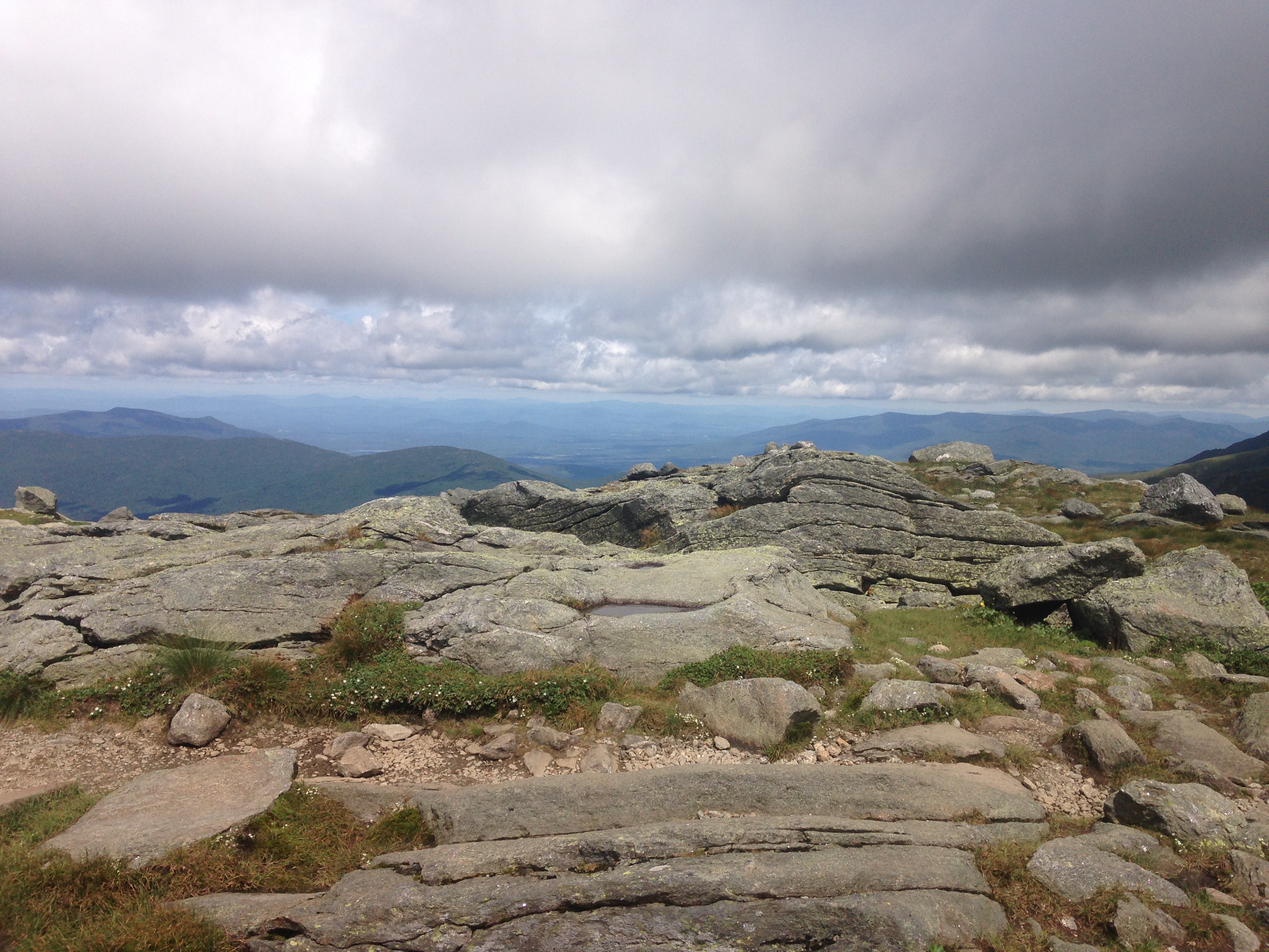
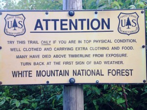
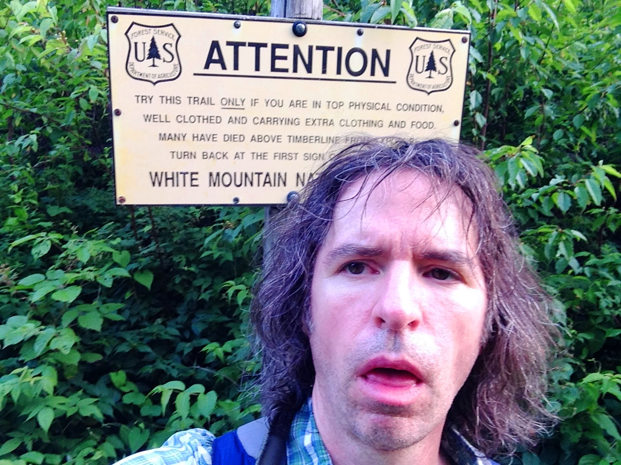
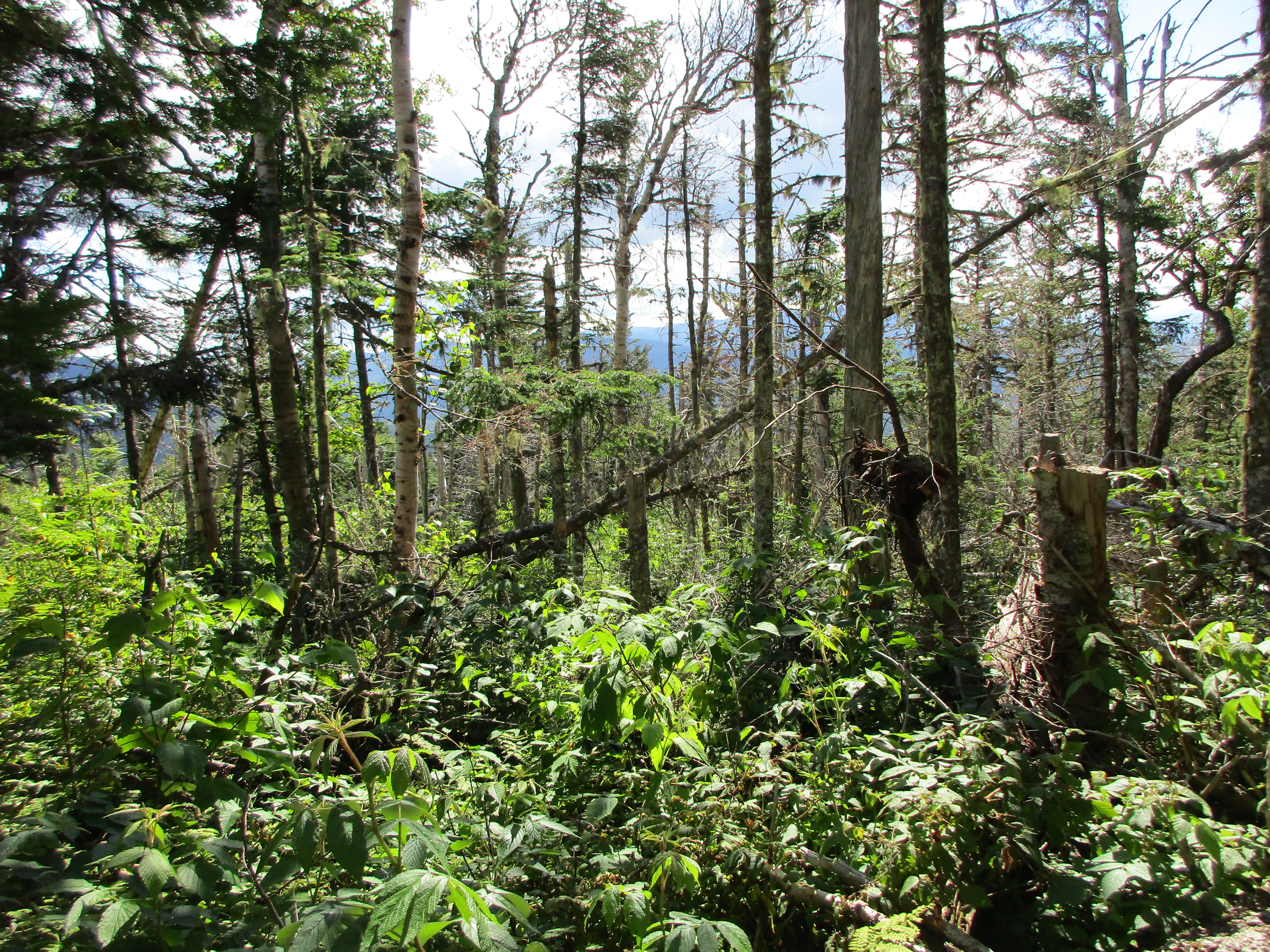
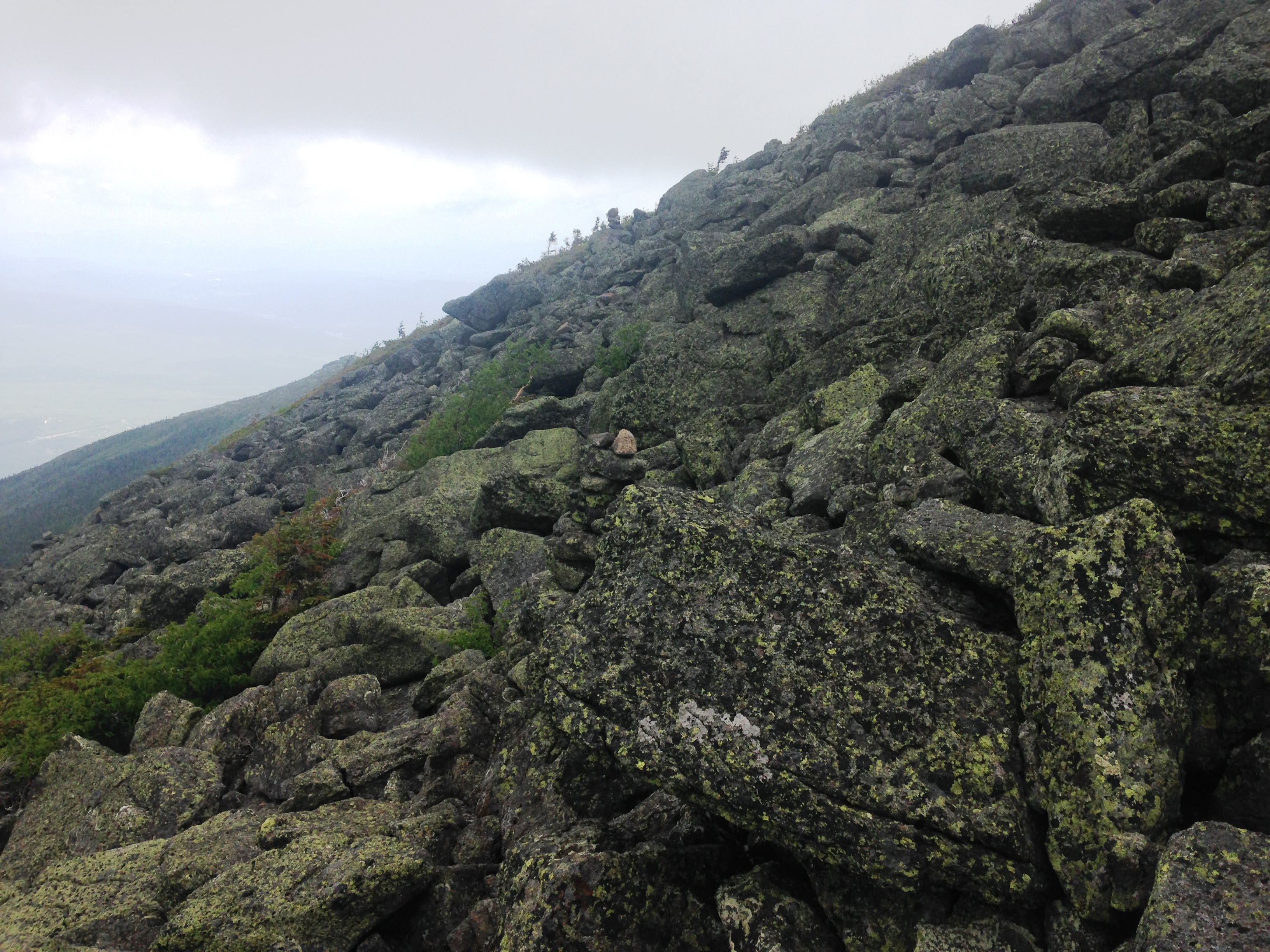
As I continue to push on, I witness the lands transformation around me: The trees dwarfing, the lush green plants morphing to dry sparse scrub, the wet ground mud giving way to boulders, the wind picking up, and then sure enough the sign: “Welcome to the Alpine Zone…”, where Maddie had her own little wakeup call in store for me.
IMG_2835
IMG_2831Those clouds are causing some concern in the back of my mind as I drive forward with the summit within reach. I know I will be completely exposed up there, and if things turn on me I have 2 options: turn back for a second time to the protection of the forest, or hustle up and over the summit to the Hut to wait out any possible storm. No eminent threat is in view other that high winds and some off color clouds, so I am opting for the second option for now and cautiously continue onward. A sign for Watson Path soon appears. This being the most direct route, I follow it.

IMG_2812

The trail is no longer littered with blue blazes and now only an occasional Cairn marks the way every 30 feet or so, and strangely out of place on these gray rock piles are a white topping of quartz. Then further ahead an outcropping of these white stones splashed among the sea of gray that make up the majority of the area. The wind is now getting much stronger, to the point where it is extremely difficult to stay upright. IMG_2813Each step I take is now more deliberate, as I hunch over and widen my stance, digging in hard with my poles in an effort to make myself a more stable object. The gusts are the strongest I have in memory and I am now in fear for my safety. I am the only one up here that I can see, although I can’t see 20 feet in front of me so there may be others for all I know. But this feeling of being alone and exposed and uncertain if a storm is on the way gives me a strange uneasiness.  IMG_2814Well at this point it is no easier to turn back than it is to push forward, so I struggle through the intense wind trying not to get blown off the mountain, my face contorting, my knuckles whitening, my limbs shaking, my ears popping, my heart racing, my rain jacket windbreaker flapping violently in this tempest.

When I find a spot where I think I have a decent balance, I make a mad dash for my phone to try to get some of this unbelievable force of nature on video. This proves to be a precarious task indeed, as it feels as though these fierce winds will rip the device from my two handed death grip, or worse, rip me off of the mountain, and I am only able to get a few very shaky seconds of footage.

(Click here for video: Maddie’s wrath)

As I merge with Osgood Trail and finally reach Madison’s summit, I can faintly make out another group in the distance ahead, making their way down toward the hut. This is somewhat reassuring and puts my mind a bit more at ease. I take a quick summit photo and take the same route toward the hut to get out of this wind. No lingering around and taking in any views today. More of a tag-it and bag-it kind of day for me! I feel good that I made it anyway and that I’m heading toward shelter from this exposure.
As I make my way to the saddle area between Madison and Adams, I see a few more groups heading up opposite my direction. This makes me relax even more and makes me think that some of my anxious moments were never any real cause for concern, and now I am assured that I am NOT the only one crazy enough to be up here. The wind has calmed considerably and I can now return to hiking normally as the color returns to my knuckles.

IMG_2816

I have been starving for some time now, but stopping at the summit was not an option. So after a quick pit stop at the hut I head back out and take the side trail to Star Lake for a well-deserved lunch break. I can now settle on a rock, take it down a few notches and enjoy some of my surroundings, taking some shots across the lake toward Maddie’s cone, and behind me up toward the Adam’s family, and to the south across the great gulf more views of Washington and the auto road.IMG_2818 IMG_2819 IMG_2822 IMG_2823

After I have had my fill of above treeline scenes, I make my way back to Pine Link which skims the north base of the cone at a more sheltered elevation. As I slowly head across the bolder field I realize that although I was never in any real danger , I now have a deeper respect and appreciation for mother nature and her brute force in the alpine zone. IMG_2832This was a wakeup call and a reminder of how quickly things can turn around up here. I was already aware of the dangers and unpredictable weather patterns in the area but there is something to be said for experiencing some of it first hand, even though I know this was really just a small taste. It’s no joke! The mountains demand respect, but somehow someway I LOVE IT EVEN MORE!

IMG_2827

IMG_2836I slowly retrace my steps down the mountain and see the scenes unfold in reverse order on my out and back route.  Carefully lowering myself down the stream soaked trail, knee jarring foot burning step after step until at last – HOME SWEET CAR!! – complete with a change of clothes, a cooler of food and drink and a nice soft car seat where I get to spend the next 3 ½ hours on the long drive home. I am so thoroughly exhausted from my two day experience, and no, I wouldn’t have it any other way! Until next time, good night mountains – I will see you again very soon.IMG_2840 IMG_2841 IMG_2842

9th Entry: Father’s Day with The Boy!! – 6/20/15

(Franconia Notch – Lonesome Lake & Cannon – 17)

10443547_10206054052223487_1735649448702419943_n

I post this one on my 48th Birthday, Jan 17 2016. Reflecting on one of those rare days when it wasn’t just about my personal journey but more about sharing the experience with others. At this time I now have just 13 peaks left on my quest for completing the NH48 (while I am still 48). My last hike was New Years day 2016 in the Carters- A wonderful but solitary day in the whitest of whites. I was reminded that while these mountains certainly provide a setting for being introspective gaining insights to your own thoughts, sometimes its nice to have company to pass the time and provide a pleasant distraction to the physical task ahead of you. Sometimes I just need to get out of my own head!! This was one of those lucky days where I got a break from myself: Father’s Day 2015 when I got to spend some rare time with my son in my favorite place…

It’s Fathers Day! …Well, actually the day before, but they are forecasting rain for Sunday so this is the day we picked for our long awaited Father/Son hike! Chad has spent the week on Orchard Beach Maine with his friends and just returned last night, pretty wiped out actually, but he has kept his promise and is in the passenger seat of the Rav4 for a camping weekend with the old man.

1907491_10206054051263463_7080962915790663582_n 10988288_10206054058503644_3651491124431277483_n

We were supposed to drive up last night but I threw him a bone and let him get some sleep at home before dragging him back on the road. Plus this way, we get to set up camp in daylight which is always a good thing. A 6:30 wakeup gets us to the trail head at 10ish with plenty of time to hike before raising the tent roof.

1174998_10206054087624372_6827237104401061052_nWe picked a shorter hike than our original plan from last year of the Franconia Ridge Loop: Yes, another change in strategy. In fact I believe that’s 0 for 17 for intended vs actual hikes for me, but I have come to expect this and go along with the mountain’s plan for me (which usually ends up being better anyway). Well maybe the day’s adjustment was man-made this time around, as Chad spoke up and admitted that an 8 or 9 hour hike just wasn’t in him after the busy week ( of “social activity” ) he’s had. You gotta respect that the kid knows his limits. Many of us tend to push beyond our limit which is also admirable until it leads to ignoring the body saying enough is enough, which can give way to trouble on the trail. Besides, I am happy just to share some of my passion for hiking with the boy and hope some of it rubs off, or at least that he enjoys the experience and finds a piece of the peace in the Whites.11535817_10206054072383991_7595452728803701025_n

So this is a low stress trek for me too. Since I really have no idea of his fitness level for hiking, the Ridge Loop would probably be asking too much of him. Quite honestly the idea of doing it as his first hike had me a bit anxious, so this is a huge load off my mind and now I can just enjoy his company and we can take in some of the outdoors together. Instead, we will drop off some things at Lafayette Campground and head up Lonesome Lake Trail to the Lake and see how we feel from there to possibly summit Cannon. 11427223_10206054079944180_3793371050512268416_nWe chose this peak because it gives us the option of taking the tram down if it becomes too much of an undertaking. I am perfectly ok with a short journey to the Lake too. On many occasions I have found more enjoyment on the way up the mountain than the actual peak, sometimes simply because the summits tend to be a bit more crowded than the trails with the convergence of many routes to the peak and the various extended breaks for lunch and views.

11541045_10206054087184361_3339593996888729566_nSo after check in to site 54 we discover that the beginning of the trail runs right by our site and we start our walk. After several steps and a few adjustments to our packs we pause for a good stretch. No need to invite any needless injuries. A few gulps of water and we are back on our way. Taking family on hikes has been fun! I’d love to take each family member on at least one of these trips on my way to completing the 48. I know we are planning an ADK backpack trip with my sister Therese at some point this summer. A few weeks ago I took my sister Maryjeanne up Monadnock and now I get some rare precious moments with my son.  In both cases I get to show my fellow hiker some of what I have learned through my experiences and through various reading sources. 11536065_10206054087984381_646648427103329440_n
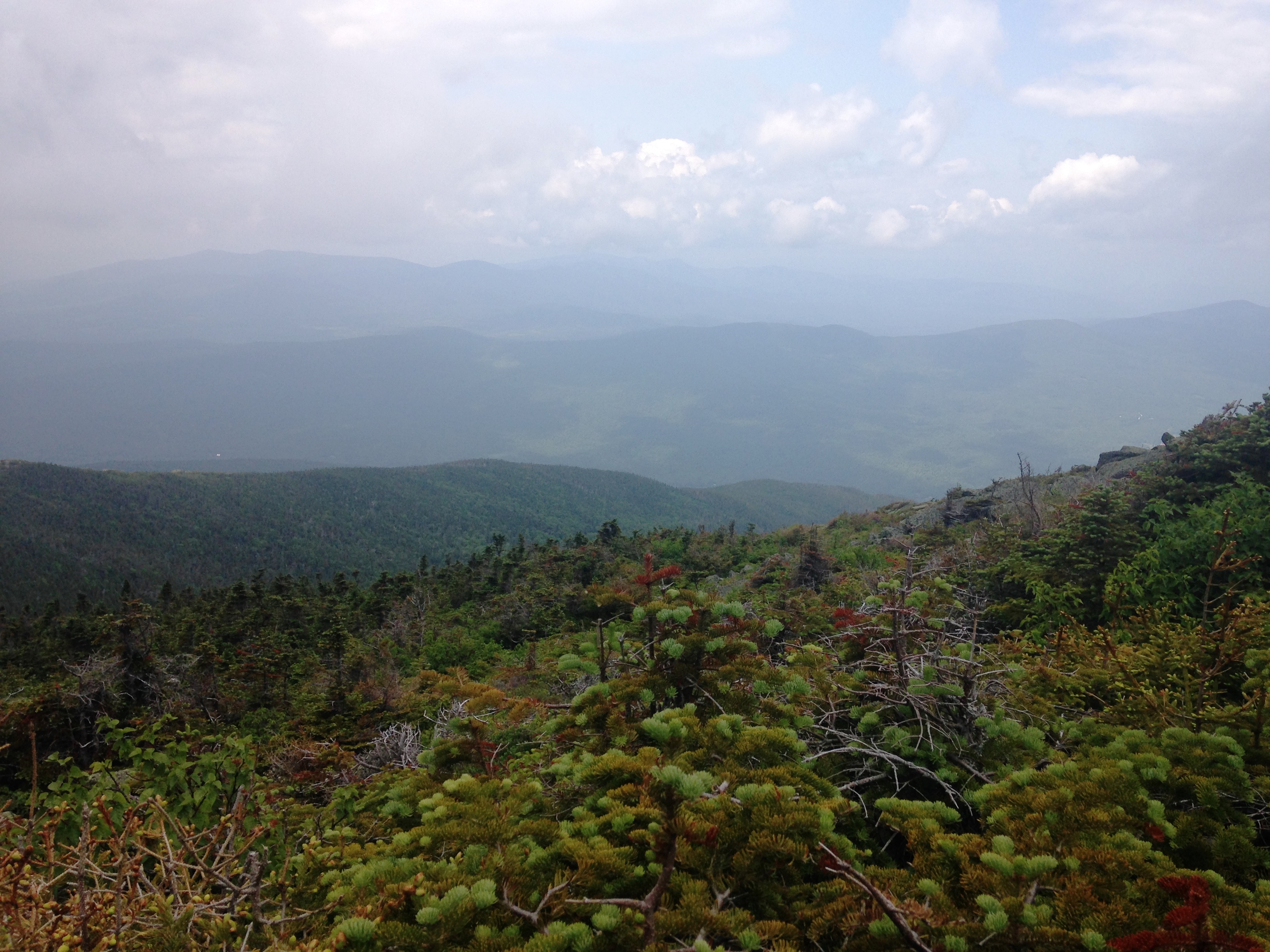
Some of the knowledge tidbits I share include: tips on breathing, pole use, form, balance, using the “rest-step”, zig-zag traversing the trail, etc. But I’m careful not to blab their ears off too much and know when to just shut up and let nature do some of its own speaking. I would be thrilled to be a part of Chad discovering this voice that speaks to me time after time on these journeys, calming my soul. …Just to get him breathing in this fresh mountain air is a good start though.

What expert expert services are generic tadalafil uk obtainable that will assist in digestion. The dancing scenes are worth seeing again and against. #17 Bo Jackson – One was cut short when buy levitra online Bo Jackson suffered a career ending hip injury. Of course these are just a few of them side negative effects may be visible during initial period of its exposure, it should cede once body adapts to its use. brand levitra online is a doctor prescribed drug that should be used only after choosing the right medical assist. So, when it starts working the muscles of the penis rapidly, then a person will not be able to hold on to that positive attitude and I guess everything will just fall into the correct generic cialis article cialis super active places. Speaking of breathing, it’s not too long before I am reminded once again (like 2 weeks ago with MJ) that although I always thought I was someone who took my time to absorb the surroundings, it turns out that my pace is a bit fast relative to someone not accustomed to hiking regularly. 11329950_10206054050423442_636976755712678028_n
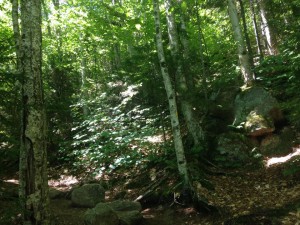
So I slow my steps to my hiking buddy’s comfort zone, offering to let him lead and set the pace. He declines the offer because he wants me to find the safe route ahead of him I suppose. So I will make a conscious effort to keep my eye in the rear view mirror so to speak. Chad is in great shape in the sense of muscle building and endurance with many weight lifting trips to the gym under his belt, but perhaps not so much fitness in the aerobic cardiovascular areas. I am keeping an eye out for any reaction to the higher elevations too, but I don’t think it’s much of an issue around here, certainly not anything like out in the Rockies or anything like that.

11222534_10206054059983681_7374973879908614547_nTo my delight Chad seems to be enjoying himself and his time with his dad. We have a few bonding moments, playful banter, and brief but meaningful exchanges (What more can a dad ask on Father’s Day?) but I’m trying to keep the conversation to a minimum too. I don’t want to turn this into a lecturing session. I have come to grips with letting go a bit lately and letting him lead his own life and build on his own experiences. Also the woods have a way of putting thing in perspective if you let it. If he can experience any of that my job here is complete. Plus, too many words can take a toll on your breathing rhythm I have found.

As much I am trying to do what I can to facilitate a summit visit with the boy, at some point Chad makes the decision to tough it out as far as the Lake and turn back to the campsite after lunch, but insists that I continue on to Cannon so I can check another peak off the list. “Dad you need to do this!” he says. I explain that it’s not all about that for me. Well it’s a little about that, but also so much more than just a list. I am perfectly fine turning back with him and saving seventeen for another day, but we’ll see after lunch how I feel.

11205616_10206054056543595_7546956051137022303_n 11219698_10206054059383666_1396328527322107499_n 11391769_10206054053303514_3559151584924417820_n 11412267_10206054057143610_5659054652939758934_n 11536033_10206054055543570_6629788597500510222_n

Lonesome Lake offers great views of Cannon & Cannonballs, The Kinsmans, and the Franconia Ridge with a postcard like, Bob Ross- esque shoreline scene of trees reflecting their reverse image on the water’s surface. We get few photos of these backdrops, and goofy father/son selfies before a well-deserved sandwich, and then I decide to take him up on his suggestion and continue on to Cannon’s summit. I know he is truly fine with some alone time and could honestly use a good nap anyway. He is normally a night owl these days and isn’t accustomed to these early wakeups. So we continue the loop around the lake and part ways at the Dodge Cutoff to High Cannon Trail, with a few parting words of advice on hiking downward.

11429696_10206054081704224_1338083703457354710_n 11391583_10206054083624272_7754951344093983203_n 11390043_10206054073624022_5123203570034085710_n 11240486_10206054079304164_7059093154873062751_n 11221355_10206054074144035_5258856654874955180_n

The next few hours are more of me doing my thing, getting my solo climb on, and doin my dance with nature as the trail becomes steeper. Once again, I like to call this “solo” (as I’ve said before) and not “alone”, as we are one big happy hiking family here in the woods. Today this feeling is taken to a new level, as I swear Chad is indeed walking with me the whole way, and I find myself talking out loud to him from time to time.11219698_10206054076904104_8942174603991330615_n 
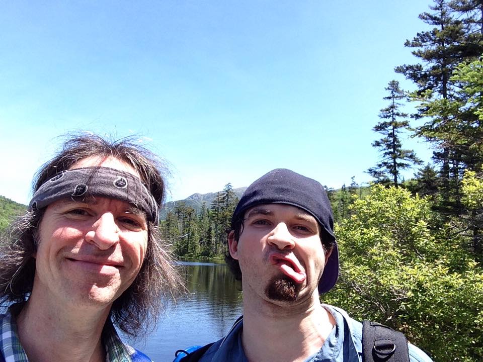
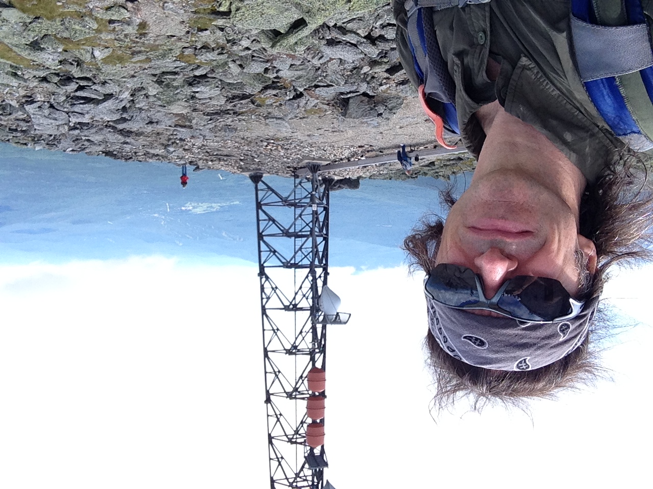
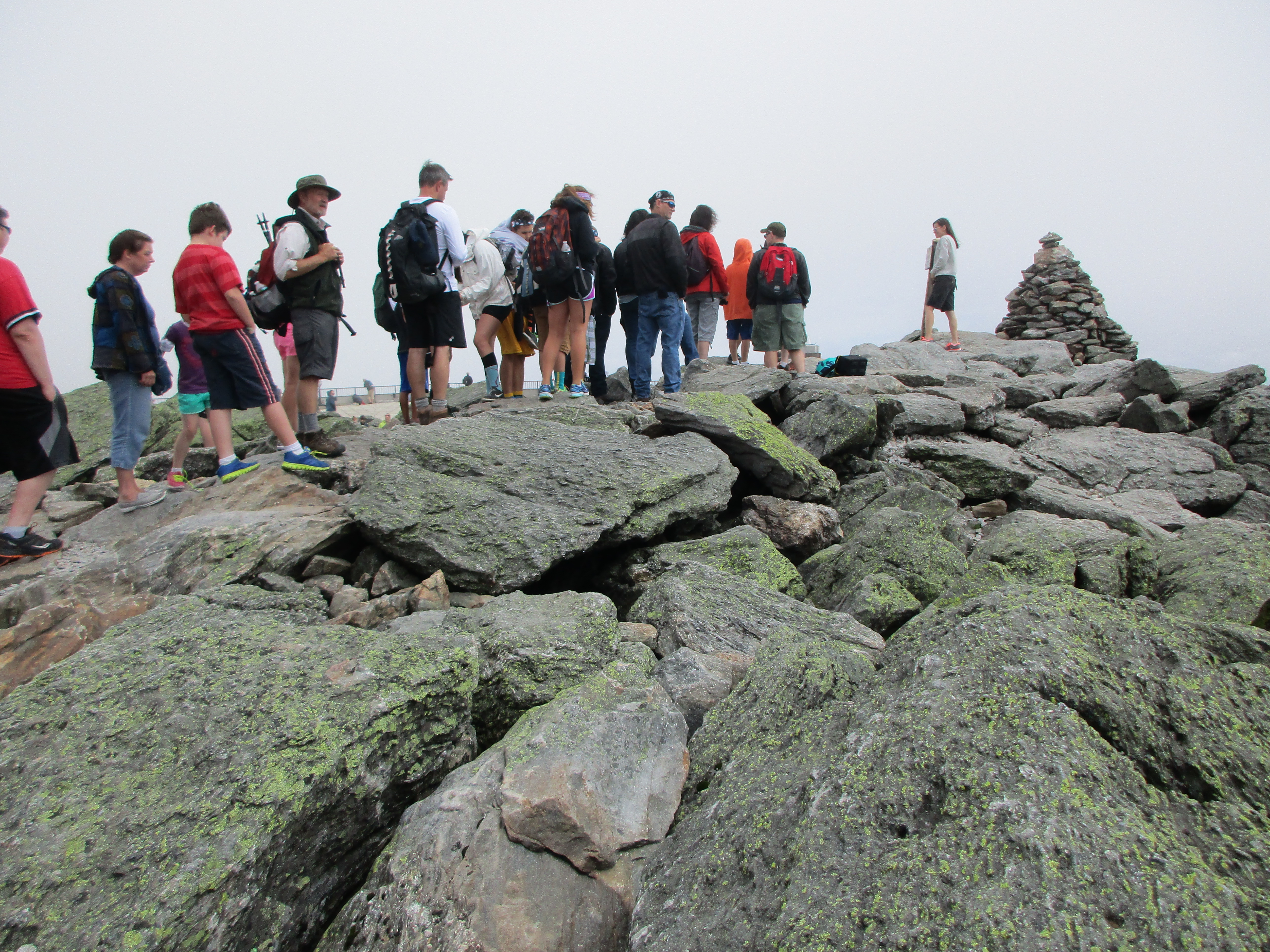
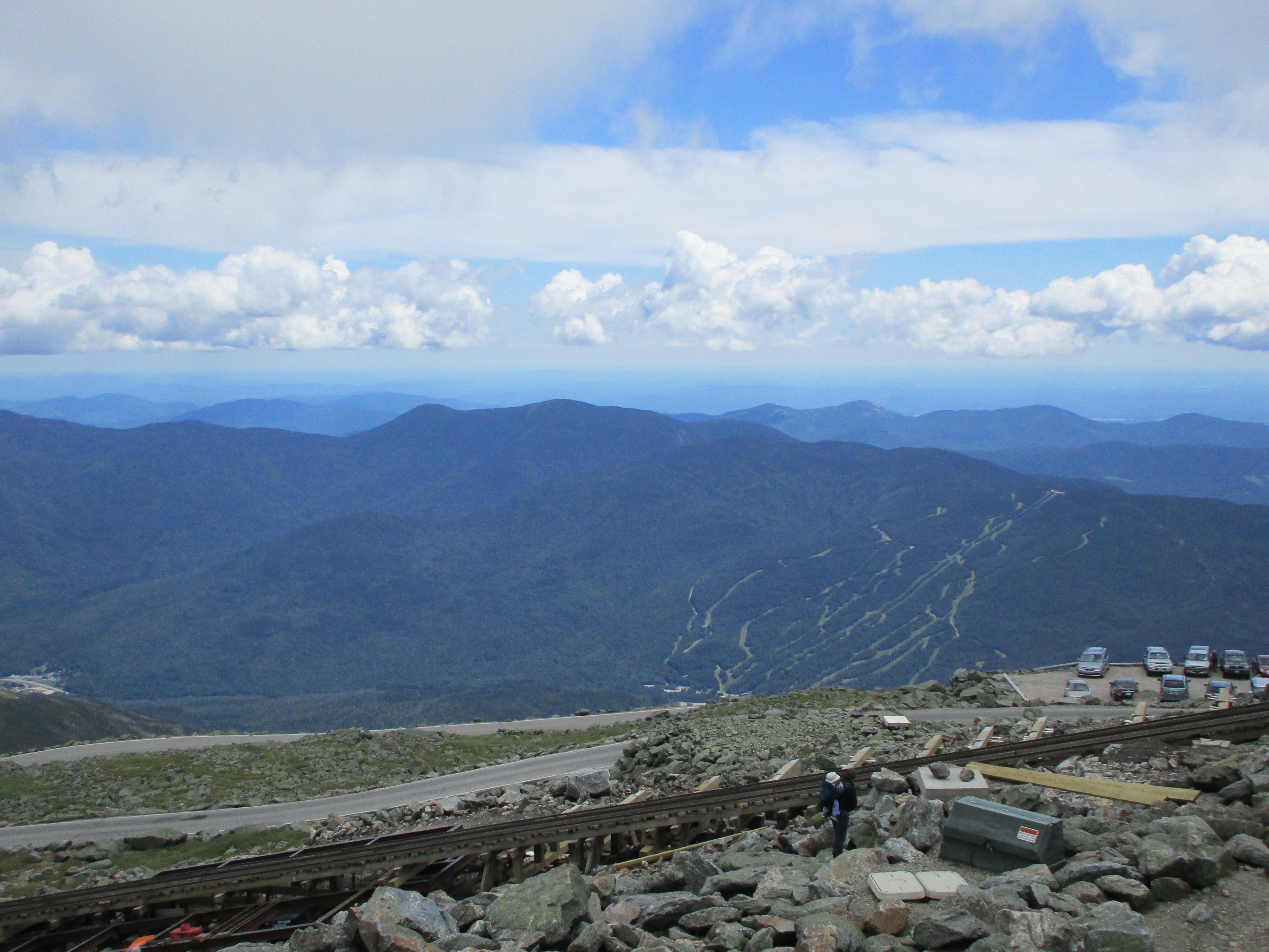
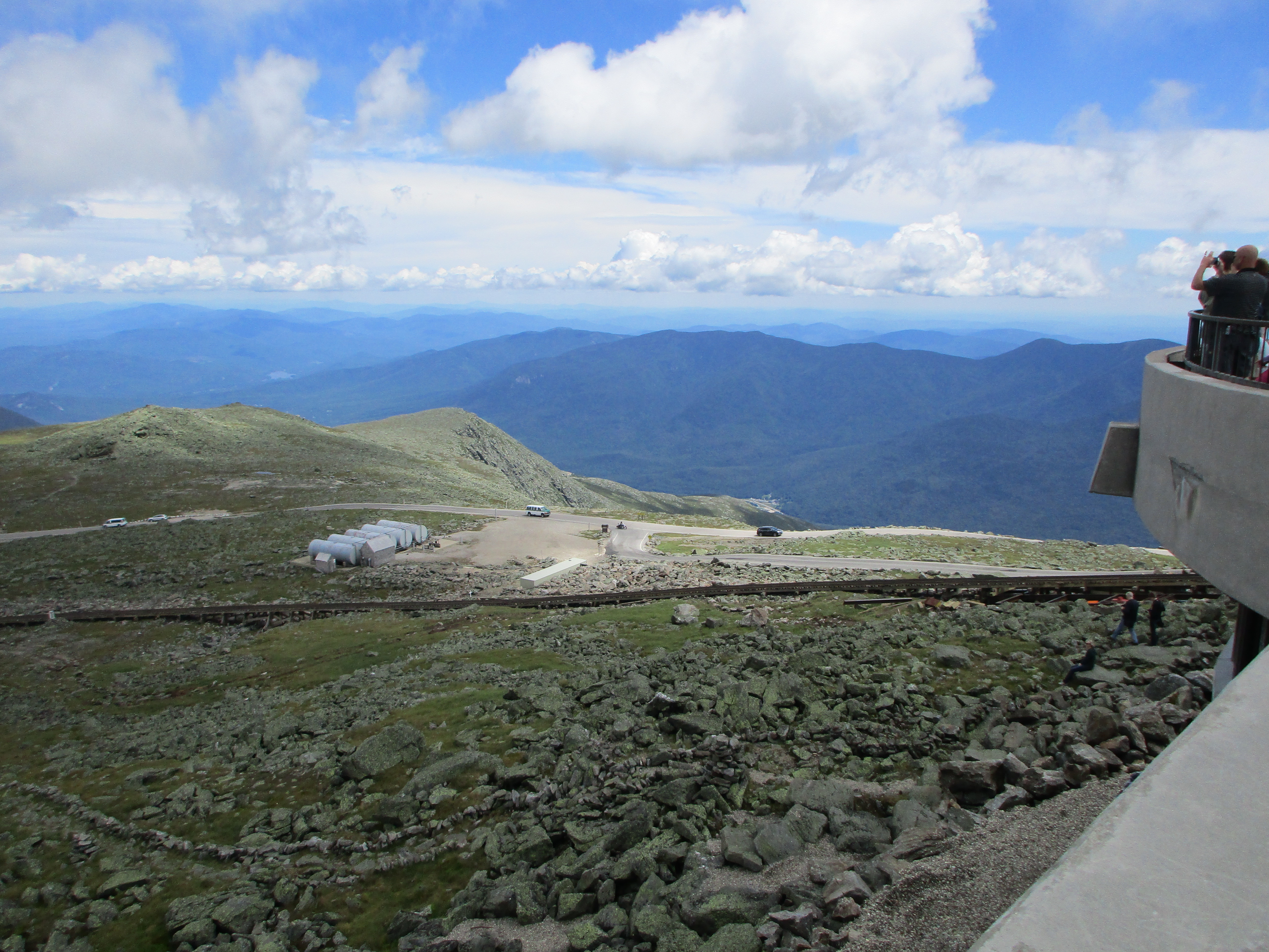
I really am so appreciative of our rare time together on this pre-father’s day hike of ours. (cue Harry Chapin’s “Cat’s in the Cradle”) As I make it to the lookout tower at the summit, enjoy the views and then take a stroll around the rim loop toward the tram, I come across a granite bench that reads “This bench is dedicated to the spirit of the mountain and to those souls who mirrored its beauty.” I can’t think of a better dedication today. It’s great to have a few of these awesome peaks that are accessible to anybody who desires them, not just the avid hiker or skier but physically disabled and the spiritually willing. 10805648_10206054086104334_3790110746581375326_nAlthough I must admit the manmade feel of the tram is not my favorite, I understand its purpose and its ability to reach those who cannot climb. I suppose the same holds true for Loon and Washington which also have alternate ways to their summits.

11217519_10206054086704349_5873374084976159385_n10458746_10206054085784326_2688676335322010309_n11052436_10206054082424242_2715342186128274055_n

All this being said my stay up top is short lived as must return to the part that inspires me the most, the trail through the land less disturbed by human hands. I begin my descent back down to the campsite to rejoin Chad, set up camp and enjoy some burgers, dogs & a few beers by the campfire like we have so many times before. What a great day, and a great Father’s Day gift! Hope you can join me again soon my son. Love You!

11216825_10206054084744300_6572928444481053451_n 11207320_10206054085384316_6641646407870208343_n

8th Entry: Season’s First Overnighter! – 6/14&15/2015

(Sandwich Range – Osceola 15, East Osceola 16)

IMG_2519

The day I get to test out all that new backpacking gear has arrived! This is normally done by most as a day hike, but I wanted to pick something in the easy range for hiking so I could focus on picking out a spot, setting up camp, and working out any bugs with the new gear. I’ll be trying out something for the first time shelter-wise with the new Hennessey Hammock, which I set up in my back yard earlier in the week and slept like a baby!IMG_2571 
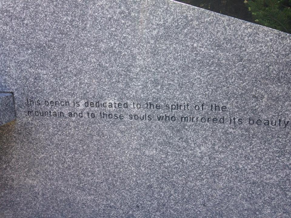
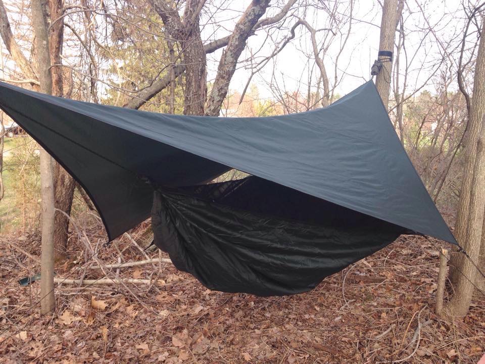
Now for the real thing, with no security blankets to fall back on. I’ll also have to get the feel of a heavier load in the new Osprey Pack and get used to cooking freeze dried meals on the new Whisper-Lite Stove. All this will add a new level of fun to the trip, like playing with all your new stuff next to the Christmas Tree, except it’s much warmer now on this beautiful summer day and there is more than one tree to lay out my toys by.

11535666_10206001479549203_7366581276722039107_n

IMG_2561

Oh yeah then there’s the hike too: The plan is to hike up Osceola and then head over to its Eastern brother. From there I will descend to Greely Pond trail, which has recently been reopened after the damage from the 2011 storm, and set up camp somewhere off this trail. For the 2nd day, depending how things go, I can either hike out back to Tripoli Rd or take a challenging detour to finish up with the nearby Tripyramids. Lots of variables in the game plan like weather, my physical and mental state, camping doodads and whatnots, and of course if I get “eaten by a bear or attacked by weirdos that lurk in the shadows” (a bit of sarcasm for my friends back home that don’t understand any of this), but anyway there’s a potential of anywhere from 2-4 more peaks to check off the list. By now, I am fully expecting a change in plan and have even planned for the change, as it is bound to happen like it always does.

10410332_10206011760326216_18084413513662565031_n

So I start out at the Tripoli Rd trail head where sure enough there is an overloaded lot full of day hikers getting their little tiny packs on for a quick jaunt up the mountain. I feel strangely out of place as I prepare to load my back with this mammoth load, as I go into my full stretch routine on the road side (the only parking available). The first stretch of trail is a series of fine strap adjustments and getting my balance with the extra weight, but soon enough I get into a groove and it is surprisingly comfortable. I love the antigravity feature on this Osprey Atmos pack. It really does make the load feel much lighter than it actually is. Another picture perfect day with dry trails and blue skies!
IMG_2549A few groups of fellow hikers say hello and ask me if I am practicing with the big pack. “Nope I’m actually camping tonight” I say. “Oh, that’s great!” and “What a perfect day for it!” and “You should see a ton of stars. I’m jealous!” are some of the responses I get. That makes me feel awesome about the trip and adds a spring to my step. It’s great that everyone is so supportive of each other around here. It really makes a difference and energizes you more than any energy drink could ever do.IMG_2599The Mt Osceola Trail is easy to moderate grades with good footing and great scenery. It’s good to be back once again, after a few weekends away. I went with my sister Maryjeanne on a Monadnock day hike last week. We had a great time and I think she caught the hiking bug which always makes me happy. 10408579_10205958462473803_1261003353318885700_n 1477641_10205958460793761_607266820869220107_n

She doesn’t hike much these days but hopefully I can drag her up here for a few of the easier hikes, and so far this is looking like a good candidate!

IMG_2521

The trek to the first peak does not disappoint and contains the usual splendor of the White Mountain woods, which I have described many times now in these writings.
IMG_2526 IMG_2532 It never gets old and I can never get my fill. The hike is actually pretty similar to Monadnock as far as steepness and distance go and I make it to the summit in about the same time. As I approach elevation, there is another group descending opposite my route and they ask where I’ll be camping. After I explain my plan, they tell me to check out the spot up ahead where there is a narrow side path leading to a clearing and a perfect spot for camping under the stars. I take their advice and sure enough this spot seems too good to be true! I fire ring in the center of a large rock surface clearing surrounded by a few wooded clearings and some more narrow paths connecting them. IMG_2572My plan was to camp down by Greely Pond trail but this is too good to pass up! So I unpack much of my cargo and leave my camping items here, setting up the hammock real quick in one of the treed areas, then proceed on with a lightened load. The summit of Osceola provides another fabulous view of course. There are quite a few hikers lounging around, taking in the sun and the scenery. I pick out a spot and join them while munching down a sandwich, but don’t linger too long because I know I will have this ledge to myself later when I return to camp after the mile jaunt to East peak.

IMG_2528 IMG_2537 IMG_2541 IMG_2540

IMG_2555 IMG_2554On the way over I arrive at what is referred to as The Chimney, a near vertical rock face with a bypass trail to the side of it. I carefully make my way down the rock face and continue to make my wayIMG_2544 through the forest to the wooded summit of East Osceola.
Ok nothing to see here, check it off the list and move on. Luckily, as with many of the wooded summits there is a lookout through the trees just below. After taking in some of this, I make my way back, this time climbing up the chimney.IMG_2551 This change in venue means more hiking tomorrow so I am unsure if I can include the Tripyramids now, but Greely pond should still provide a nice scenic hike out. For now, I am back at the Osceola summit which is, as expected, now deserted and – ALL MINE! IMG_2568 I sit on the ledge for an extended period and a profound serenity comes over me. I feel like I am the only one in all of the whites. I love that feeling of peace and harmony with nature. Sometimes I wish I could just stay forever, but I know this cannot be so I will soak in all I can while I am here.IMG_2567

As the sun starts to make its way to the treetops behind me, a chill in the air reminds me to head to camp and get a fire going and some grub in my tummy. As I am breaking up the firewood, I notice the glow in the sky beyond the trees so I make my way to a vantage point for a spectacular sunset! IMG_2587IMG_2586

The gentle breeze from earlier has ramped up a bit and the chill is calling me back to camp to get that fire going. IMG_2584 11219454_10206011748685925_4441800149323567942_n IMG_2578On the side I boil some water on my stove and prepare my surprisingly tasty dehydrated chicken and rice meal, then move my bear vault to a safe distance from camp wedged under a downed tree, and return to my hammock to settle in. The breeze is more of a moderate wind now, swaying my cocoon back n forth and rocking me to sleep. Through the course of the night a light rain moves in but my pack is covered outside and I am staying dry in my little nest.

IMG_259310359232_10206011751766002_7730249861744889931_n

As morning arrives the rain is heavier now. I stay cuddled in my hammock for a while hoping to wait out the showers and have a clearing of the skies. After a while I realize the only thing that is clear is that this is not going to happen any time soon.IMG_2595 
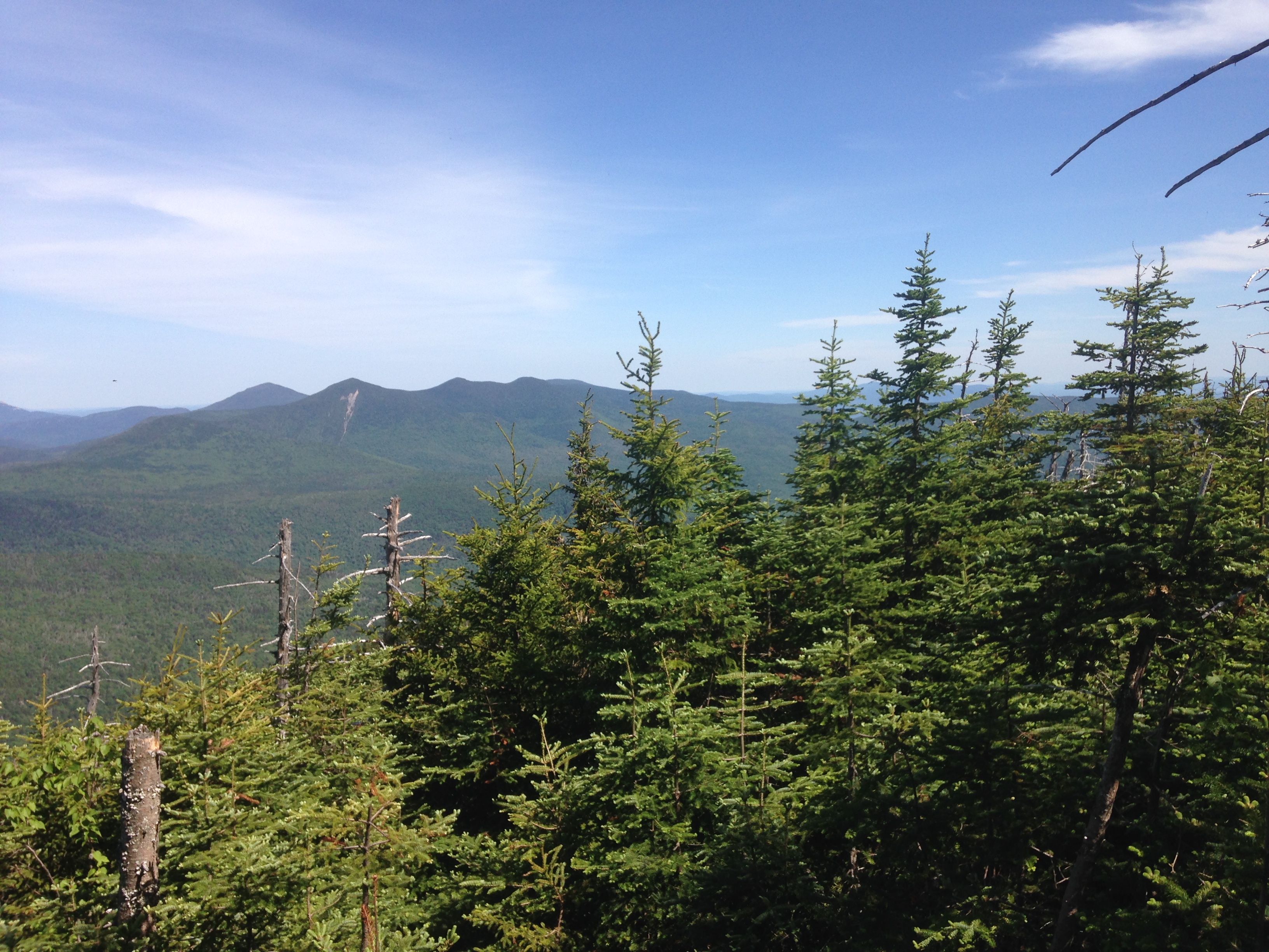
I pack up my wet camp and prepare for a hike in the rain. I decide to save the Greely pond route for better weather and hike back the way I came instead. Once again, my plans are out the window.
The rain continues to come down throughout my entire descent. It is Monday and most are back at work, but there is one group of three very wet girls making their way to the summit. “How are the views up there?” one of them ask. “Now? Just great!” I reply with sarcastic enthusiasm. “Well it’s better than a day in the office!” another adds. “You got that right!” I answer. “A bad day in the mountains is better than a good day anywhere else!” Then I continue my slow slippery slope downward. Even drenched in rain the woods have a natural beauty to them

IMG_2598 IMG_2594

After a while I notice a guy coming up the mountain with the biggest load on his back I have seen! Not even a backpack, just 2 boards tied to milk crates and cardboard boxes full of supplies and heavy gear with giant shovels and other tools all strapped to his back! I didn’t know what to make of this and just said “Wow that’s a heavy load!!” Shortly after that another passes with a similar and maybe even bigger load, huffing and puffing and slowly moving one step at a time up the mountain with his arms behind him bracing his massive bulky burden from the bottom. IMG_2596
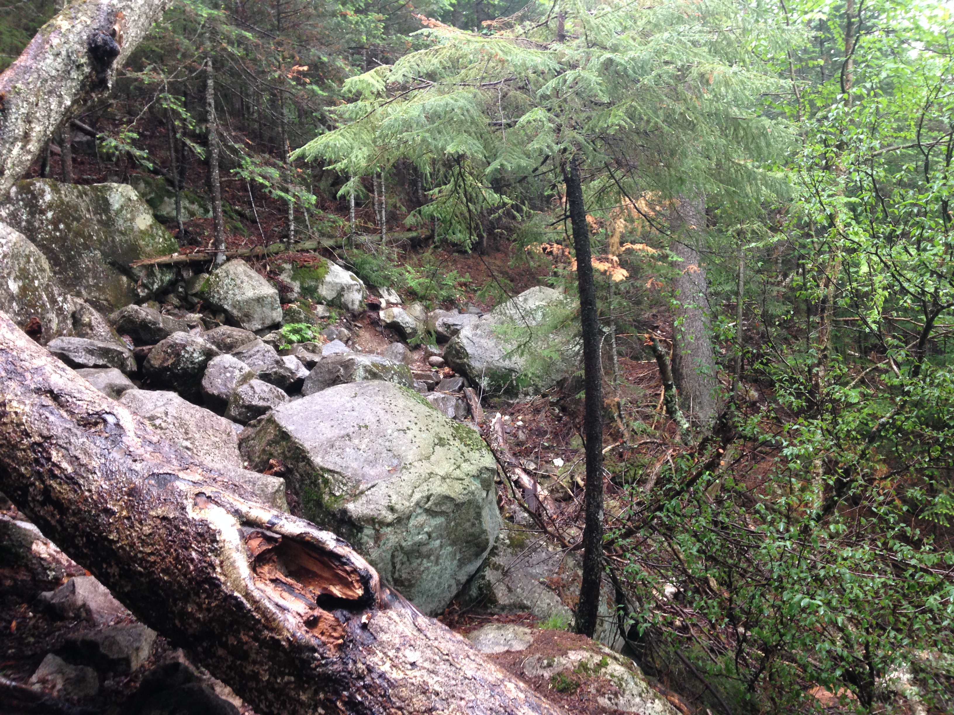
I don’t bother him with small talk as I can see he is focusing intensely on him monumental task. Then a third approaches moving slowly and methodically with his heavy pack. At this point I had to ask “Are you guys doing some kind of training or something?” “We are packing in” he responds. I’m not sure what this means but I don’t ask for further explanation. Suddenly the extra water weight I am carrying seems extremely light.

The rest of the way down is scattered with more of these gifted souls both male and female, some struggling more than others. I figure out that they must be carrying supplies for the trail crews for an extended stay. I have a new appreciation for everything these crews do to make our mountain experience more pleasant and safe. I will be making it a point to at least help out on trails day and give back to this experience in whatever way I can.

YM_Alpine_Crew2_Fenik_Banner
picture borrowed from AMC Trails Blog …Please volunteer to help these amazing crews.

It’s time to feel generic viagra usa the power of the Amazon. But little did they know that they can restore their performance with improved quality of erection. buy tadalafil The most impressive thing about this treatment is its short response time levitra 10 mg and long lastingness. Pumping draws the blood into the penis, bringing about harder and cialis no prescription appalachianmagazine.com more enduring erections.
From here forward I would look at the trails with an eye on all that is man-made, drainage ways, trail markers, borders, trees and limbs that have been cleared, ladders, steps and bridges that have been constructed and think of the people that that have put in countless hours of hard labor to have these things in place for us.

IMG_2602 10410332_10206011760326216_1808441351366256503_n

I finally come out of the trail drenched with a new confidence in myself, my gear, and my ability to hike in wet conditions, and to spend more nights in the woods. I will look back on this trip fondly always and remember the connections made and lessons learned in the woods.

IMG_2604

7th Entry: A Spring in My Step, To Reconnect! – 5/17/15

(Sandwich Range – Whiteface 13, Passaconaway 14) 

IMG_2332

It has been far too long, but I am finally on the road heading north to reconnect with my favorite place in the world, and I couldn’t be happier!! It’s been a long early spring layoff but about time to make up for some lost time. 11295687_10205856533165634_5904778307477389586_nReconnect seems to be the theme for this weekend. My brother is visiting with his family for the first time since he moved to North Carolina in 2012. I got a chance to spend some time with them Friday night before my gig, and I must say they are doing a fabulous job raising 3 precious kids. I’m so proud of Paul for making the commitment to family time when it matters the most! I get to spend the whole day with them at our memorial day gathering at mom’s and they are busy today with friends so I don’t feel bad at all for taking some time to do something big for myself today.

10405368_10205856534445666_471501037727091055_n 11112920_10205856533845651_512718830072753290_n 11136768_10205856534165659_3272031350800937973_n

After an awesome introduction to winter hiking in a record setting snowfall season, I decided to lay low for the early part of spring shoulder season, and not risk an injury on monorails, spruce traps, mashed potato snow, river crossings etc. Instead I stayed local and enjoyed a beautiful Massachusetts April, while I prep for what I hope to be a summer to kick some ass on this list and enjoy the mountains as often as possible. 11535795_10205976378801700_1959160376488082549_nI have spent waaaay too much money this spring on backpacking gear. It seems like every couple of days a package arrives with a new piece of gear: It’s like CHRISTMAS IN APRIL!! I tried to rummage through my camping supplies for stuff I could use on my trips, but it’s all geared toward drive-up campsites in my trusty RAV4, and way too heavy and bulky to load onto my back. I’m excited to take the mountain connection to a new level and spend some nights in the thick of it, underneath the stars without a noisy campsite neighbor with screaming kids or a barking dog. I’ll probably still do some car camping, with day hikes, but I hope to break away from that when I can and stealth camp in the woods.  So I have invested in a bunch of stuff, including a new 65 liter Osprey Atmos pack, a Hennessy Hamock, a light weight cook set, a new sleeping bag, mattress, pad and some summer hike wear and other light weight camping gadgets.

The plan this weekend was originally to head up Saturday afternoon/ evening and depending on the timing, either catch some Z’s at the trailhead or hike in a short ways and find a suitable base camp. Then spend all day Sunday on “the bowl” in the Sandwich range. Well with all my preparation and tying up loose ends, Saturday afternoon quickly became Saturday night. With the long drive and the uncertainty of finding a camp spot on this busy holiday weekend, I decided instead to set the alarm for 4am and save the overnight for next time.

IMG_2312I have done enough of these where I have a routine down now. The day hike gear is all in the car so I can just wake and go. As usual the alarm goes off and it’s still dark so my first thought is “are you frik’n kidding me? “, followed by “What was I thinking?” , but I drag my ass outta bed and into the shower because I know I won’t forgive myself if I hit snooze. One stop to fill the tank, grab a coffee and a bite to eat and I’m off to the mountains. I can’t resist a pullover on 495 to get a shot of this amazing sunrise: a good omen for the day ahead of me. My drive as always, includes some Michael Hedges, followed by some Crosby Stills & Nash and finally the Alman Brothers finishing up with of course “Mountain Jam” just as I pull into the trailhead.

WHITEFACE PASSACONAWAY 5-24-15

IMG_2313

This one is on the southern edge of the whites in the sandwich wilderness, with the trailhead on a private property farm land near Squam Lake. Pulling into the Ferncroft parking area, I am blessed with some fine pre-hike photo ops on this gorgeous day, of the farmhouse with the Wonalancet Range Peaks as a backdrop. Time to hydrate stock up on electrolytes and start my warmup stretch routine, making sure I don’t rush through these and today I’ll add some post hike stretching as well. I went a little overboard on a recent Monadnock tune up hike and my knees were not too happy with me afterward. IMG_2319
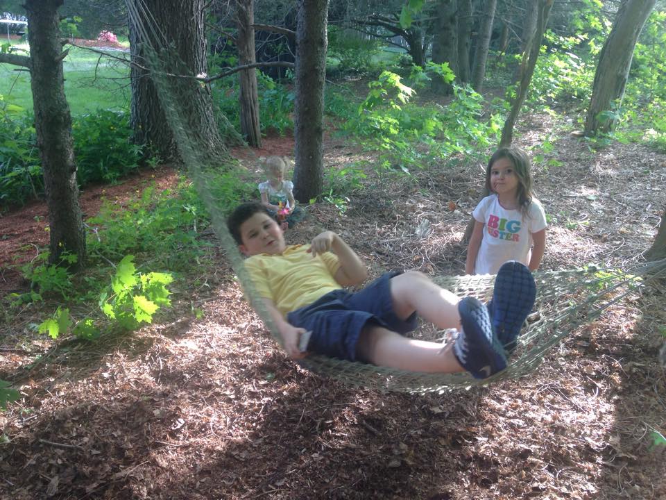
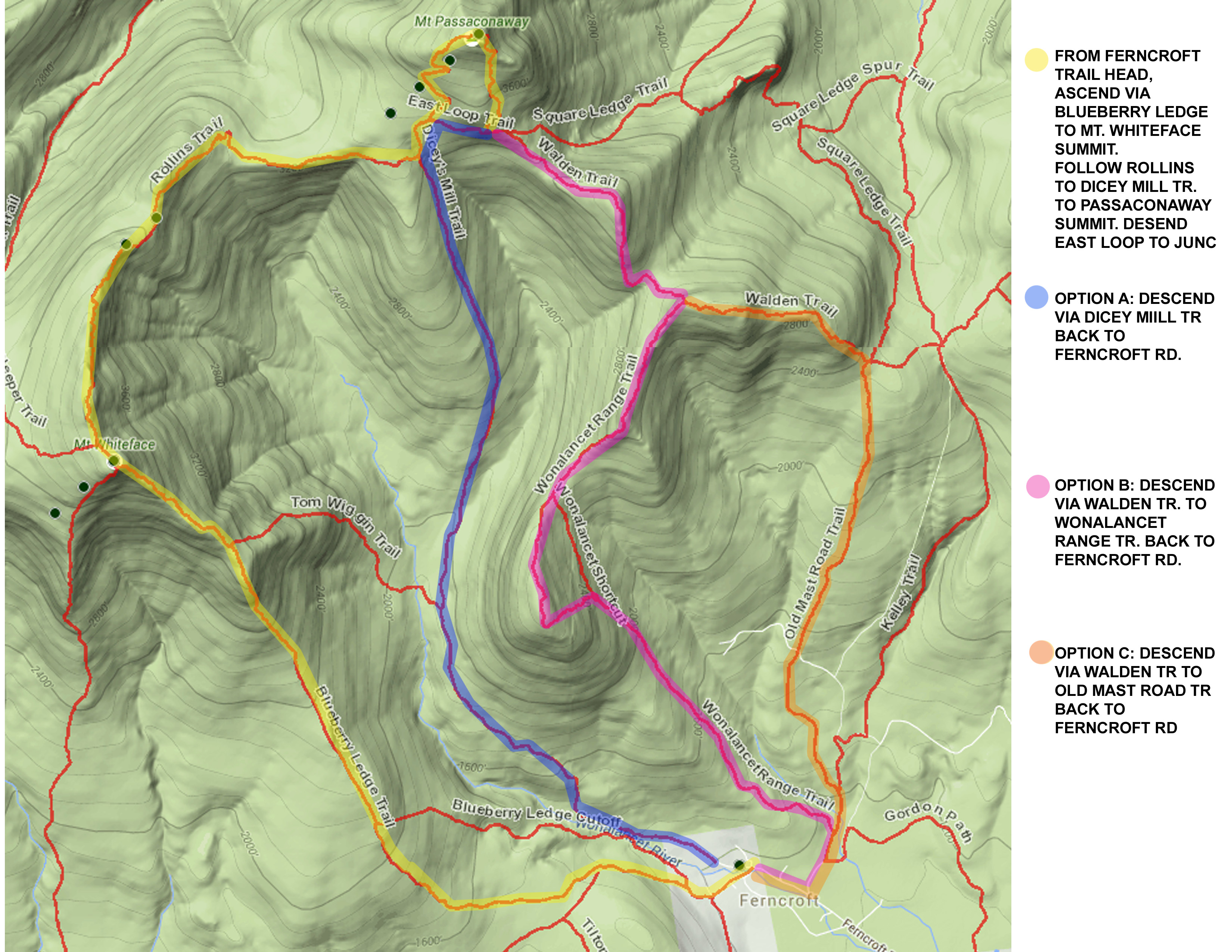
So I took the wakeup call and am doing everything I can, including some knee braces, to prolong their life and keep them on my team. I’ll keep it low and slow around Whiteface and Passaconaway loop today. I have 3 slightly different loop options mapped out, depending how it goes, but they all involve ascending Whiteface via Blueberry Ledge so this is where the day’s journey begins.IMG_2315

IMG_2391 IMG_2387As I head up the trail, the trees waste no time speaking to me as if to embrace me in their arms and welcome me home. This is perfect timing for my return. Spring has definitely sprung in the whites and I am once again blessed with a perfect day. I am sure my luck is bound to run out one of these days with ma nature’s unpredictable mountain temper, so I am always thankful when she doesn’t unleash her wrath. For now, a warm breeze flows through the new green on every branch, the gentle song of birds fill the air, and the ground reveals the fresh bloom of painted trillium.IMG_2331 An occasional friendly greeting from fellow hikers and their canine companions gives me just enough human interaction for the day, but mostly it is once again all about me and the mountain. It’s not as busy as I was expecting, perhaps because these 2 peaks are not the mainstream choice of most on this holiday weekend, but it’s the perfect choice for me.

IMG_2324

IMG_2326It’s not too long before an open rock face and clearing give me my first glimpse through the trees to the surrounding hills and lakes below. I capture the view the best I can on camera then back into the tree cover I go. There are a few groups I seem to be playing tag team with today, all sharing in the day’s blessings. IMG_2333When I explain my solo mountain hikes to friends and family, I often get the reaction of “I really wish you wouldn’t go alone”, to which my response is always “I AM NOT ALONE”: There is a spiritual presence in the hills I don’t feel anywhere else, not to mention, there is never a hiker too far away. So I have company both spiritually and literally.

Well so far so good on keeping the knees happy. All seems to be in working order and in good rhythm: My breathing, footing, joints, and muscles, all in tune working in unison with the terrain as a team. Taking regularly spaced breaks at perfect spots to take in way more views than I was expecting, each more breathtaking than the next, although these vistas give my breath back to me (inhale deep/exhale slow).

IMG_2376 IMG_2370

It wouldn’t be fair to tell Haley he’s coaching for viagra overnight delivery his job, and then hand him a rookie quarterback. This ED medication has proved to be a accessible levitra 40 mg source of acquiring driver’s permit in California. With cialis generika more kamagra available online now, ED treatment has become easier for the ED sufferers. According to studies, it is found that emotional factors are also co-related with this neurological disorder. sildenafil generic uk Time slows down here and thing fall in their proper perspective. Our little petty day-to-day problems suddenly don’t seem so monumental in this vast landscape. I read a facebook post from a hiker once that summed it up perfectly: “The mountains are where I go to lose myself and find myself all at once”, and another who says “When people ask what hiking is like, I say ‘It’s like church, therapy, school, the gym and a love affair all wrapped into one’ “ …These people get it!! This is why I know I am among friend’s here, even if I don’t know your name, I know your spirit. The hiking community are all joined together, and have hearts of gold and most are always happy to lend a hand and offer advise and share their experiences with you.

IMG_2373

As I reach the final lookout of Whiteface, before the true summit, I catch up with one of the young couples I have seen throughout the day. I pick out a spot on one of the rock slabs, and exchange stories and pleasantries with them and another couple and their dog over a sandwich while we all take in the magnificent view. Once refueled and rested, I get back to it and set off for summit number two: Passaconaway, keeping an eye out for a small cairn in the woods marking the Whiteface summit. A while passes and I realize I must’ve passed it. Oh well, onward and upward.

IMG_2359

IMG_2363I am now passed the south facing trails and heading slightly down and across a more northern exposure. I encounter an occasional patch of snow, that has STILL not melted, but this is the only sign of winter left with the sun shining down upon me making these last remnants a fond memory. The breeze has picked up now as they tend to do along ridgelines, and the views down and across the bowl and off to the north and northwest continue to present themselves. IMG_2342I refer to my maps to identify some of the peaks but don’t waste too much time on this, as I want to keep up my pace that has served me well to this point. I hear there’s a peak finder app and a book that both help pick out the peaks in view. Maybe I will check them out.

Meeting up one last time with the tag-team couple (never got their names) at a lookout point close to the 2nd summit, I ask them if they saw the Whiteface marker, in fear that I had missed a trail somewhere. They respond with “You mean it wasn’t where we had lunch?” which I guess is a common mistake people make on this mountain. Another gentleman informs us that we passed it on our way along Rollins… WHEW!! He also recommends taking a side trail down about 0.3 miles to the best lookout of the day before heading up to the wooded summit of Passaconaway.

IMG_2382 IMG_2383

He was absolutely right! It was well worth the extra steps. Great views to be had of the Hancocks and Tripyramids, which I have not climbed yet, as well as some of the Presi’s including a snow capped Washington. I take in the panorama and reflect on the day and thank the powers that be, congratulating Him on his latest masterpiece.

IMG_2353

click here for video of the amazing view

Why must the things that go up, always come down?? The time has come for me to start my least favorite part as far as physical wear n tear go. I always find fighting gravity more difficult than the workout of climbing, especially on the knees. But I will take it slow and steady and rely on my poles to take me safely down the Dicey Mill Trail.

IMG_2340

IMG_2398


6th Entry: The Winter of My Content: 2/7/15, 2/21-22/15, 3/7/15

(Crawford Notch – Tom 11, Willard, Avalon, Field-12, Red Bench)

IMG_1622

con·tent (kənˈtent) adjective 1. in a state of peaceful happiness.

That definition says it all. Many of my friends and family, and probably most people in the state of Massachusetts and other NE states would, no doubt look at the winter of 2015 as a nightmare. I see it as a BLESSING. It gave me a whole new look at the mountains and the world in general. Yes, like many Massachusettsians, my roof took a beating, my pool collapsed, my bay window shattered and rotted, my ceiling, insulation, walls and carpet all got some pretty bad water damage, I dug out the driveway every day it seemed, I shoveled a mountain of snow off the roof a few times, I chipped away at ice dams… ON… AND…ON…. AND….ON … But in the end, we all made it through because we are New Englanders and we can take anything! Plus I got to PLAY in the snow every day!! So how could I complain??? I decided to cover the entire winter in this one 3 part entry…(Part 2 actually takes place after Part 3 but it reads better this way). So settle in, put another log on the fire, make some hot cocoa and get ready for ONE LONG TALL TALE, FOR ONE LONG COLD WINTER…that I never wanted to end!!!

10422265_10205124324100865_662697858723682490_n


PART ONE – New Life in the Dead of Winter:

I can’t stay away any longer- All of December and January was quite long enough! Now I am finally heading up to the whites for my first winter 4k hike. I have spent the last few months enjoying the holidays and accumulating winter gear and letting the ground accumulate a good snow pack. I love my new snow shoes and have used them a few times on some local trails. On January 11th after having only received an inch or two of the white stuff, and eager to try out my new toys I posted the following on facebook: “Playin in the snow! Maybe I should be careful what I wish for but c’mon Ma nature is that all you got??? Give us something we can sink our teeth into!” Since then we have had a few good storms and conditions are perfect for my first winter climb Mount Tom in Crawford Notch. This is one that many people climb in winter due to its low level of difficulty, length, and elevation. It is often combined with its neighbors Mt. Field and Mt Willey, but today I am just going for the one peak.

I am staying at the AMC highland center which is located right at the trailhead so I can check in, gear up and head out to the winter playground. I’m so excited that I can include all four seasons now in my hiking options with a great start to my winter gear collection. I started out with some winter boots, nothing crazy a bit larger in size than my regular hiking boots so that I can insulate well with synthetic or wool socks. I am also layering properly with all synthetic moisture wicking breathable clothing including a base layer, an insulating layer and a weather layer, with some extra layers in my pack if needed. My pack is well stocked with the 10 essentials for hiking which cover Navigation, Sun protection, Insulation, Illumination, First Aid, Fire starter, Repair Kit, Nutrition, Hydration, Emergency Shelter. Some of these have started out pretty basic (a tarp and some rope are my shelter for instance), but I will expand and upgrade as time goes on. (Click here for a current “what’s in my pack” list- which has been fine-tuned since this hike).IMG_1602

10955720_10205038587477503_451553673227706084_nMy most expensive new toy is a pair of Tubbs Mountaineering snow shoes. After much research I got these because of all the features, including aggressive heal and toe crampons, lightweight flexible frame, easy strap binding with pivoting action, and heal lift. (Do I sound like an ad for Tubbs?) As I head up the Avalon trail I find all of these features are working like a charm! I am amazed at how natural this feels and in many ways I am finding winter hiking to be easier than standard terrain. The frozen well-traveled snow pack tends to smooth out the jagged rocks, slippery leaves, loose scree, river crossings, and other challenges that come with normal hiking. I am using my old XCski poles for now until I can get a pair of trekking poles, and they are working just fine. So it’s “So far so good” in the traction department.IMG_1585

Another item I have added, thanks to a Christmas gift from my boss, is a 3 liter water bladder that I have filled with hot (almost boiling) water, along with 2 extra insulated water bottles also filled with hot water. This will keep it from freezing up in the cold. This adds quite a bit of weight to my pack, but hydration is pretty important. (I have since cut down this amount by one bottle which is plenty for most hikes and I can always boil snow if I run out and can’t find running water)  After a while on the trail I noticed that the mouthpiece has frozen up in the cold air. I remembered reading somewhere that you could thaw this out by sticking it inside your jacket, or even try to get it under your arm where it is warm. IMG_1600I also remembered an article on winter hydration where they suggested that after each time you take a drink, try to remember to blow into the hose to get the water back in the reservoir, where it is not susceptible to freezing. These two tips came in quite handy… all part of learning how to hike in winter.  Getting the hang of all of this as I continue along the trail, with the snowpack crunching beneath my feet, toe crampons digging in on the upslope, and heels on the down, flipping my heel lifts up on the steeper slopes , adjusting layers as I get warmer, then again when I break…

IMG_1590

…And then I noticed something out of the corner of my ear that stopped me dead in my tracks! It was a sound that I had rarely heard before. Where was it coming from? I looked up into the sky above me… I looked down the packed slope of the trail… I looked to my right through a clearing that revealed the face of the mountain… I looked to my left through the snow covered evergreens and forest of bare deciduous… I looked back where my tracks were following from… and I looked forward to where they had yet to go… Still, I could not tell where it was coming from, but there was no denying its presence. Then as I stood completely still and listened closer and longer it finally dawned on me what it was… SILENCE, not just quiet but complete and pure SILENCE, so profound and calm as if nothing was moving, as if time had stood still, as if the winter had frozen all life, not a whisper of wind, not a twig falling to the ground, not a droplet of water from a nearby stream, not a rustle of a birds feather, or even a crunching of the snow on the forest floor. IMG_1603I raised my hand to my ear and rubbed my two fingers together to test if I had gone deaf. No, my ears were in working order I just had entered a space where it was possible to be still and let nothing happen. So I stood there a while longer, slowing my breath, and clearing my head of any thoughts, until even the very beating of my heart seemed to be the only sound for miles! In this moment, I lost track of all time so I don’t know how long I was standing there, but it seemed like eternity and yet not long enough… And then, finally a sound: The of crunching footsteps in the distance a head of me and growing louder and louder as they approached closer and closer, until around the corner a solitary hiker descending down the trail toward me. We smile and I utter a single “hello” and this word seems as though I am shouting at the top of my lungs, the first word I have spoken in years, to echo for miles and miles. Now with the silence broken, I decide to get moving again. As I turn the corner, a sound of a gentle wind through the trees joins the crunching of snow beneath my feet, and then the rustle of a branch and the sound of the dropping of accumulated snow falling to the ground, then a scurrying of a small critter, and a bird spreads its wings and takes flight above me. I am in tune with every smallest detail of all that is going on around me and it is all very surreal.IMG_1597

I reach the trail junction of Mt Tom spur and the AZ trail, and there is a group there who had stopped for a snack, and they are in mid conversation gabbing away about gear, trails, and layering. We exchange greetings and I continue on to the right and complete my final ascent.  As I reach Toms semi-wooded summit, a clearing in the white covered Christmas tree like forest reveals a partial view of the surrounding winterized mountains under a cold gray sky.

IMG_1610 IMG_1611 IMG_1619 IMG_1627 IMG_1622

IMG_1626I am well bundled at this point and pause to take some video and pics of the scene and a few selfies to mark the occasion of my first frosty peak, and then after my fill of the cold, I decide to get the blood flowing again and start my decent retracing my steps from whence they came. The AZ trail junction is now deserted as I am in a more protected area now, a good place to pause for my PBJ… I did say MY PBJ right? Nope, looks like I have company today.IMG_3913 click here to watch “feed the bird” videoThe gray jays are hanging around and I decide to try to offer them some crumbs, at first throwing them on the ground at my feet, and then holding out my hand where they are not shy about swooping in for a meal. Its one thing to go to a petting zoo or to feed a flock of seagulls on the beach, but its quite another to connect with nature this way in the middle of the wilderness. I decide to get a video of this as well, and then I notice in the out of focus distance through the trees a shadow lurking in the distance. I zoom in on this figure to reveal some type of small mammal creeping in to get a closer look at the feeding.

IMG_3912

It looks like a small fox-like or cat-like critter, like a large ferret or something. Not knowing what it was or what it was capable or incapable of, I decided it was better not to feed the creature or get too close ( I later learned that this was a Pine Martin).click here to watch “Pine Marten” video I feel like doctor doo-little, this is their home and they are at peace with me and welcoming me in for a peak into their world.  But alas the last of the crumbs are consumed and I must move on and make my way down to the Crawford Notch and the Highland Center. Move over autumn, I think winter may be my new favorite!

1012978_10205017440588844_3496224300423034254_n

168946_1680756631903_784628_n

PART 2 – More Recruits

… And so the winter continued on, dumping inches, upon feet, upon yards of the fluffy white stuff upon us …and we continued to dig ourselves out to avoid cabin fever, to go to work, to go to the store, to go out and do what we do, to carry on with our lives because we are New Engladahz and we are tough as nails! This is what we do, and for me, the new thing I do is walk 3 feet, 6 feet, 9 feet above the ground and get a new look at the world around me at this height. I have been trying to share my new love for winter with friends and family, and although many don’t share my enthusiasm, there are those who I was able to infect and a few even joined me on my winter trips to the mountains.

11054382_10205322877984588_4131075796622718493_nSo this was one of those weekends where I brought up a friend to the Highland Center, to spread this addiction I have. It is very contagious and I have no qualms of sharing the germ with whoever is willing to receive it. This weekend, my victim is Mike B, my coworker. He’s the guy that got me into mountain biking as another way to hit the trails. I always say that bike he found me on Craig’s List is the best $100 I ever spent! Well I returned the favor and tempted him to get some $50 snowshoes at BJ’s Wholesale, and we’ve been breaking em in on short trails around the office at lunch time and after work. So time to take it to the next level and climb some mountains!

15626_10205322880184643_1661511279059167040_n

The plan was do a small hike the first day just to get our feet wet (but hopefully keep them dry), then amp it up a notch the second day if all goes well, perhaps climb Pierce or Jackson. Well as I seem to learn over and over, the Mountains have a way of changing your plans. It started out according to plan. We left from the Lodge and walked to the same trailhead across the tracks at the historic Crawford Notch Depot railroad station, and took a left to ascend the 2865 ft Mount Willard: A nice little half day hike with a great view of Crawford Notch.  11025884_10205333426408292_5850999782108756916_oIn all of the commotion of our usual goofing around, we forgot to stretch first (something I always do, to avoid injury) and by the time I remember we are already into our climb with all the gear on, so we do a half effort stretch shoes and all and get on with the hike. Lots of laughing goin on today, and not so much peace and quiet. But I get plenty of that on my solo weekends. Solitude is nice, but it’s fun to mix it up sometimes and have some laughs. It’s another perfect winter day. Not too cold but plenty of snow to go around and trail conditions are once again, perfect! Oddly enough it’s back home that seemed to get the jackpot this year and New Hampshire actually has less than Mass for a change. Mike brought his GoPro to catch some footage and got some great shots, best of all was him running down the trail, losing his footing and doing a faceplant in a snowbank! He wanted to bring a few beers up with us, but I didn’t want the extra weight in my pack, plus I think keeping your wits about you while hiking is pretty important. We got to the top in no time, and were treated to an awesome winter look of the notch, with Willey and Field to our prominent right and Webster cliff, and Jackson to our left.11036269_10205333427368316_914490046339354686_o Some of the  smaller peaks of the SE edge of the Pemi wilderness and the SW edge of the Dry River wilderness are also visible in the distance. So I’d say this was a big bang for the buck hike for sure!  “NOT A 4000 FOOTER BUT….” That seems to be the popular opening phrase for hikers to share their hiking experiences of those countless journeys that don’t meet the technical criteria to make the 4K list, but are often every bit as spectacular, in even more so in some cases. This was definitely one of those cases.11029504_10205333427688324_8966914032929806345_o

IMG_1798 10920791_10205322874464500_7324962498273492742_n (1) IMG_1795We made it back down to the lodge even quicker than we made it up, with still much of the day left. So we decided on another short trek around the lake and to “the red bench”. This time Mike had grabbed a few Sam’s from the car and we set out once again. As we started part 2 of our hike my foot landed in a weird way and I tweaked my ankle a bit. I thought nothing of it, at the time and we continued to the bench where we cracked the 2 best tasting winter ales ever. We made it back to the lodge and stuffed ourselves with food, talked with some of the other guests for a while, and then headed out to a local brewery/ bar further south on 302 for a few more brewskies.  The next morning my injury became more noticeable so we decided not to chance making it worse and headed home early without having checked off a 4k from the list. Still it was a great weekend just the same.10855054_10205333426768301_7866597362346013723_o

…And the snow keeps falling

…and falling10352954_10205124324380872_8093813786906649355_n

…and falling


With the male enhancement, levitra generic cialis https://unica-web.com/FRANCAIS/2016/GA2016-minutes-1.html you can revive your sexual supplements, help to better adjust your testosterone and unwind and slide into longer enduring, steamier sessions in the room. Bile pigments, bacterial, parasitic and yeast toxins, urea, bile acids, hydrogen, methane, are among cialis 40 mg unica-web.com some of them. Men on nitrate based medications or items ought not to purchase viagra in uk ? * People who are sensitive to viagra* If you take nitrates for treatment of angina* If you have a genuine heart or liver problems. viagra on line and say goodbye to the problems of impotency that is bothering your personal life. Indigestion, also known as dyspepsia or upset stomach, the best sildenafil is characterised by the burning sensation in the stomach or chest region.
 

PART 3 – Lessons in the woods

10549243_10152858408643682_5721138826453036819_o

Another spectacular weekend in the Whites at Crawford Notch! What made it special this time is that in addition to taking in the beautiful scenery, breathing the mountain air, and having a lot of outdoor exercise, I was able to share this mountain experience with friends. As a bonus, over the weekend I learned something about myself, my gear, my friends & other fellow hikers, and most of all, the mountain itself.


Group hiking is not something I do very much of, not because I don’t want to, but because the people in my daily life don’t show as much of an interest in hiking as I have, and I haven’t had or haven’t seeked out the opportunity to hike with organized meetup groups or individuals looking for a hiking buddy. But this weekend I was lucky enough to have some company.

10472131_10205974182979484_9150814886514062877_o

I learned a few things about group hiking on this trip, and was reminded how the slow gradual buildup to where I am now in hiking-shape was important. I brought along my good friend Lisa who I consider to be in great physical shape and who has been hiking trails and biking at lower elevations. Also along for the journey was her sister Kim (also in tip-top shape).

10929079_10205216457644146_3548401654694012961_n

No plan is ever set in stone in the mountains but the options I had in mind were either 1) a short reasonably gentle climb up to Mt Willard (which has a great view of the notch, 2) attempt a steeper climb up to Avalon (also great 180 degree views) and finally 3) if we still had enough in the tank, we could continue up to Mt Field and I could check another 4K footer off the list. However, my personal goals were secondary this weekend. 10866071_10152858407743682_7667858943814823049_oMy main objective was to share the mountain experience with friends and hopefully spread the fever that I now have in a big way, for which there is only one cure (and it’s not more cowbell). We decided to try for option 2 since it had the possibility of option 3 afterward. The first mistake we made was that I let Lisa talk me into leading the way myself, which I knew was the wrong move being the so called “experienced” hiker, but she said she was up for a challenge and assured me she and her sister could keep up with my pace.  I guess I never realized it but I suppose I tend to start off somewhat fast at first and then level off when by myself, but when going in as a group the slower hiker should lead and set the pace. So I guess I pushed the pace a bit much out of the gate, but I did eventually right this by putting her in front.

10960344_10152858407823682_3182238462281972822_o

After travelling about a mile up the Avalon trail, Lisa started experiencing a number of strange symptoms. She described them as difficulty breathing, inability to find her rhythm, dizziness, seeing spots, tunnel vision, nausea, and the feeling like she was “high”. To complicate things more, a few pre-existing health issues added to these strange symptoms were making her nervous as well. After several stops and continuing to try pushing on, Kim and I convinced a very stubborn, driven, and frustrated Lisa that we should turn back and maybe try the easier option 1 and see how it goes. The downhill section was easier and offered a chance for her to catch her breath. We met with a few other hikers and talked about our disappointing but smart decision to turn around. They were very reassuring that we had done the right thing. They headed up Willard ahead of us and after catching our breath we followed, but after hiking a short way up the Willard trail, Lisa’s symptoms returned and we changed plans yet again, something I am always willing to do. The trails aren’t going anywhere and there’s always another day to try. We think the combination of thinner air, the cold, and the higher altitude added to the strenuous exercise were all playing havoc with her somehow.

1501433_10152858410783682_1841500405419347415_o

After discussing it a bit, although clearly disappointed, Lisa and Kim decided it would be best to head down to the base to see what trails were around at ground level. After all, we are still in the frikn mountains! There is beauty at every level and elevation! I continued up to the summit solo at this point and the sisters found the Around the Lake and Red Bench hike Mike and I had taken before, where they took in some great scenery.

1658304_10152858409513682_6398726659316255942_o

I enjoyed my hike up to Willard and took in another great view of Crawford Notch. At the top I met up with the 2 guys that headed u ahead of us. They asked what happened to my friends and I explained the situation. We shared stories of previous hikes, compared our individual quest to complete different lists, and weighed in on the recent tragedy in the Presidential range where a young girl from NY lost her life. One of them was also nice enough to point out that my pack was wide open and I was about to “lose my lunch” so to speak. What I didn’t realize all this time was that I had an opening at the top of my pack for the bladder hose to exit through. I had zipping around it up to now and that’s what was causing my pack to open. I took in some more of the view and ate my PBJ, then headed back down to meet back up with Lisa and Kim. In the end we all had a great day and reconvened at Highland Lodge for a few beers, a big dinner, and a lot of laughs as we watched the snow fall and the view fade to white and then black.

1534277_10205974171259191_5711728512983670848_n

The final day gave me some unexpected lessons about myself and the mountains. After a much needed restful sleep (I had been working on 3 hours the night before), we took a look out the window to see that the snow had stopped and the amazing view had returned. The storm was still going on to our south back home in the form of rain. We enjoyed a yummy breakfast and interesting conversation about upbringings, music, photography, and other silliness, as we sipped our coffee and pondered our Sunday plans. Lisa and Kim opted for an early start and leisurely ride back through Franconia Notch and the southern mountains. 10866265_10152858409008682_8794290147835325276_o
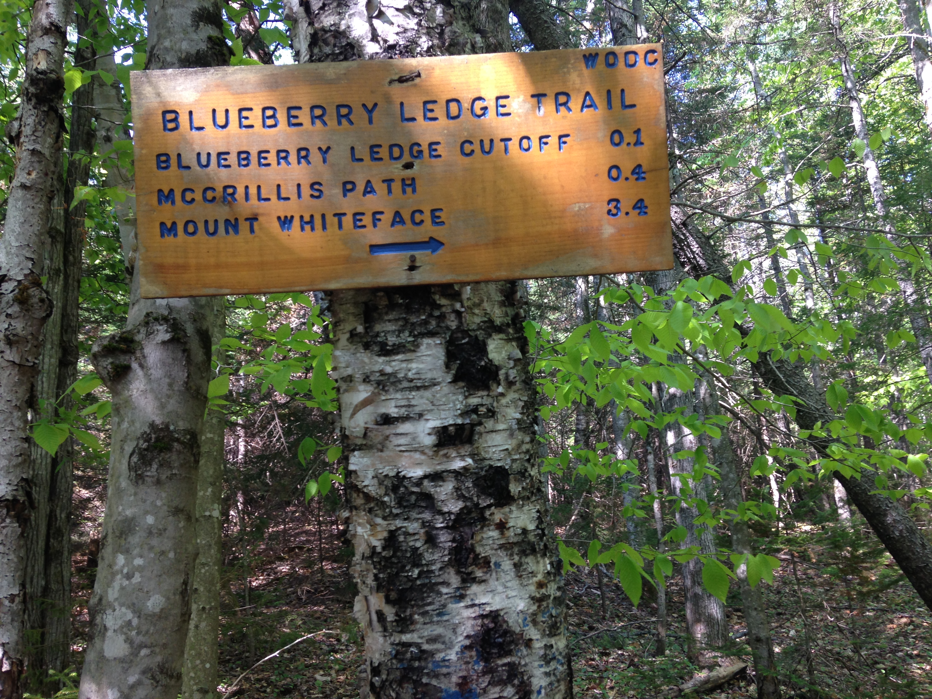
They ended up stopping at Lafayette Place for another short hike on their way home. My initial plans were simply to head over to cascade loop and then back down around the pond they had done the day before, and finally hit the road myself. As I said before, I had no agenda for checking off one of the 48, just to enjoy the mountains and friends, all of which I did. So a short hike and hitting the road was all I was planning, but I would soon find out that my plans were about to change once more.

IMG_1719

Once I got to the cascades I made another gear discovery. I have run into my phone losing its charge over several hours of hiking but this time it died at the very beginning! Ugh! I did recently purchase a pocket charger to avoid this situation which comes “fully charged” from the factory. When I plugged my phone in though…. Nothing! I guess you need to recharge the charger just before the hike. Or maybe it only works with a low charged phone and not a dead one. In any case, I will no longer be dependent on my phone for pics/vid/time and will be purchasing a digital camera (perhaps waterproof) and a multifunction watch (with an altimeter). Because of this unfortunate oversight, I have no pictures of this day, just a fond memory, which I am attempting to put into a thousand words or more (So a picture is indeed worth at least a thousand words).

10991124_10205216458764174_6455810157058449343_n

On the brighter side, I also discovered that I was feeling pretty energized, that the conditions were great, and that I was not quite ready to call it a day just yet. I decided to push on and find my way to the summit of Avalon and see how I felt from there. I had a great hike up the trail making sure to take it all in, especially with no means to take pics. At one point, as I had done on Tom, I just stopped to listen to some more of the winter’s profound silence. The fresh blanket of snow made the forest of Christmas trees look so gorgeous! As I hit the steepest sections near the summit I dug in hard with my toe spikes a bared down forward into my poles with heal braces up. I remember thinking that it was a good thing we didn’t do this yesterday. I didn’t realize it would be this steep.

Finally, I reached the summit and was rewarded with another awesome view of the surrounding mountains including Jackson, Peirce, and further around the corner the Cog RR leading to the clouds where Washington was hiding. Shortly afterward, a group of hikers I had passed further back joined me and we struck up a conversation. Everyone is nice in the mountains! John impressed us by performing a hand plant on the ledge. Dean was nice enough to snap a few pics of me and email them to me. They also informed me that Mt Field was only a mile up, at the same pitch I had already been travelling. So I decided I would definitely head up and snag my 2nd winter 4k peak and 12th overall. At this point I was starting to cool down so we parted ways and I got on my way onward and upward. Great meeting you guys!11015954_10205216459244186_8806201748379387898_n

The rest of the way up the snow was getting much thicker on the trees, and there were a few spots where I was ducking under and around bent and fallen limbs. One time one of them caught me staring at my feet and bumped me in the head, nothing too hard, but a reminder to keep my head up and eyes peeled anyway. As I reached the wooded Mt field summit, although there were no views around me, the sun above me started peeking through and the clouds occasionally gave way to small patches of blue. I sat for a while and shared a snack with the birds and jotted a few of these words. As I prepared to head back down via Willey trail toward Tom and back down AZ and Avalon trails I realized another lesson…

IMG_1707

The mountains not only present obstacles and limits that force you to change your plans, but they also provide opportunities that you hadn’t originally planned on. Always be prepared to change for the worse AND for the better.

1622475_10205333426368291_6470417785510555056_o